
Watershed
Guadalupe
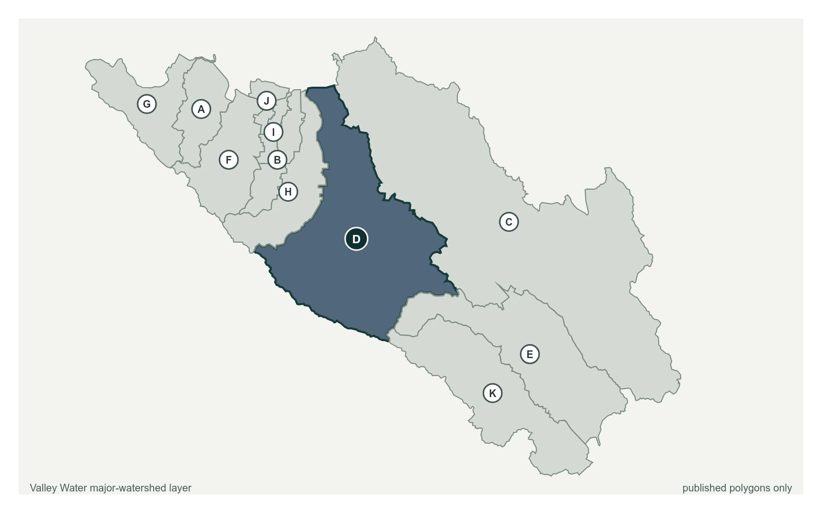
The Guadalupe River gathers Los Gatos, Guadalupe, Alamitos and Calero creeks out of the Santa Cruz Mountains and carries them straight through downtown San Jose to the Bay.
35 stream gauges · 11 rain gauges · 5 reservoirs · drains to San Francisco Bay
- Stream gauge
- Rain gauge
- Reservoir
- San Francisquito
- Adobe
- Permanente
- Sunnyvale West
- Sunnyvale East
- Calabazas
- San Tomas
- Guadalupe River
- Coyote
- Uvas
- Llagas
Reservoirs Above This Watershed
Water released or spilled from these reservoirs arrives at the gauges below.
| Reservoir | Storage | Elevation | Spills at |
|---|---|---|---|
| Almaden Reservoir | 1,093 acre-feet | 599.5 ft | 608.6 ft |
| Calero Reservoir | 3,974 acre-feet | 461.9 ft | 483.5 ft |
| Guadalupe Reservoir | 1,296 acre-feet | 582.3 ft | 617.3 ft |
| Lexington Reservoir | 11,408 acre-feet | 630.2 ft | 649.9 ft |
| Vasona Reservoir | 440 acre-feet | 294.4 ft | 294.8 ft |
Stream Gauges, Upstream to Bay
Each creek is drawn top to bottom in the order the water runs. The bar beside each gauge is filled to its captured stage on that gauge's own local scale; the dashed rules across it are the flood thresholds Valley Water publishes for that location.
Los Gatos Creek
8 gauges, ordered south to north down the creek
Los Gatos Creek above Ryland Dam
5.33 ft · 2.17 cfs · no published thresholdLos Gatos Creek above Lexington Reservoir
0.00 ft · 0 cfs · no published thresholdLos Gatos Creek below Lexington Reservoir (Low Flow)
2.18 ft · 0 cfs · no published threshold- 2.54 ft · 20 cfs · 4.96 ft below threshold 1
- 1.51 ft · 20.77 cfs · 2.49 ft below threshold 1
Los Gatos Creek at Kirk Dam Pond (Stage Only)
9.32 ft · 0 cfs · no published thresholdLos Gatos Creek below Kirk Dam
1.19 ft · 6.65 cfs · no published thresholdLos Gatos Creek at Lincoln Ave
4.95 ft · 4.02 cfs · 5.05 ft below threshold 1
Guadalupe River
6 gauges, ordered south to north down the creek
Guadalupe River at Alamitos Fish Ladder
1.60 ft · 5.8 cfs · no published thresholdGuadalupe River above Almaden Expwy
2.34 ft · 1.86 cfs · 6.66 ft below threshold 1Guadalupe River at Alma Ave (Stage Only)
3.12 ft · 0 cfs · 11.38 ft below threshold 1Guadalupe River at US-101 (USGS)
5.12 ft · 27.5 cfs · 11.88 ft below threshold 1Guadalupe River at Montague Expwy (Stage Only)
10.44 ft · 0 cfs · no published thresholdGuadalupe River at Gold St (Stage Only)
4.76 ft · 0 cfs · no published threshold
Alamitos Creek
2 gauges, ordered south to north down the creek
Alamitos Creek below Almaden Reservoir
1.97 ft · 3.5 cfs · no published thresholdAlamitos Creek at Graystone Ln
1.56 ft · 2.18 cfs · no published threshold
Almaden-Calero Canal
2 gauges, ordered south to north down the creek
Almaden-Calero Canal at Almaden Reservoir
0.53 ft · 0 cfs · no published thresholdAlmaden-Calero Canal at Calero Reservoir
-0.07 ft · 0 cfs · no published threshold
Calero Creek
2 gauges, too close together to order along the creek
Calero Creek above Calero Reservoir
3.67 ft · 0 cfs · no published thresholdCalero Creek below Calero Reservoir
1.39 ft · 0.8 cfs · 2.41 ft below threshold 1
Canoas Creek
2 gauges, too close together to order along the creek
- 1.47 ft · 0.67 cfs · no published threshold
Canoas Creek at Almaden Expwy (Stage Only)
1.28 ft · 0 cfs · 8.22 ft below threshold 1
Guadalupe Creek
2 gauges, ordered south to north down the creek
Guadalupe Creek above Guadalupe Reservoir
2.35 ft · 0.48 cfs · no published thresholdGuadalupe Creek below Guadalupe Reservoir
1.48 ft · 2.12 cfs · no published threshold
Kirk Ditch
2 gauges, too close together to order along the creek
- 2.45 ft · 12.48 cfs · no published threshold
Kirk Ditch at CA-17 (Not Real-Time)
0.00 ft · 0 cfs · no published threshold
Ross Creek
2 gauges, ordered south to north down the creek
- 1.08 ft · 0.04 cfs · no published threshold
- 2.53 ft · 0 cfs · 4.97 ft below threshold 1
Other Gauges Here
- Almaden Inflow 2.93 ft
- Alviso Slough 4.90 ft
- Golf Creek near McAbee Rd 0.28 ft
- Guadalupe Creek off Hicks Rd 1.64 ft
- Masson Fish Ladder 3.56 ft
- Pond A8 Stage 5.11 ft
- Upper Page Ditch at Headwaters 2.27 ft
Rain Gauges Here
| Gauge | Last hour | Last 24 hours | Season |
|---|---|---|---|
| Alamitos | 0.00 in | 0.00 in | 15.91 in |
| Almaden Watershed | 0.00 in | 0.00 in | 33.39 in |
| Guadalupe Slough | 0.00 in | 0.00 in | 12.05 in |
| Johnson Ranch | 0.00 in | 0.00 in | 24.88 in |
| Mt Umunhum | 0.00 in | 0.00 in | 49.53 in |
| Rinconada WTP | 0.00 in | 0.00 in | 21.69 in |
| Guadalupe Watershed | 0.00 in | 0.00 in | 38.11 in |
| Vasona Pump Station | 0.00 in | 0.00 in | 19.02 in |
| Calero Watershed | 0.00 in | 0.00 in | 20.08 in |
| Church Ave Perc Ponds | 0.00 in | 0.00 in | 16.54 in |
| Lexington Reservoir (Banjo Point) | 0.00 in | 0.00 in | 34.92 in |