Reading 4.95 ft and 4.02 cfs. That is 5.05 feet below the first flood threshold.
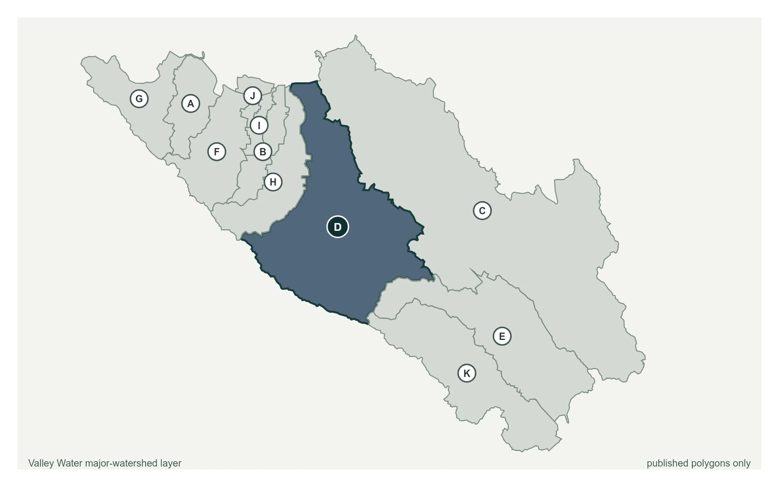
Los Gatos Creek at Lincoln Ave at 37.3124, -121.9050, exactly as positioned in Valley Water's sensor feed. Valley Water publishes Guadalupe River as a major watershed here. The eleven published boundaries do not line up exactly with the five watershed groupings used here, and not every named creek has one.
Stream gauge
4.95 ft
Captured July 28, 2026 at 4:30 PM PT
Sensor ID 5050
37.3124, -121.9050
Included in Valley Water's flood watch
Reporting
What Floods at Each Level
These descriptions are Valley Water's own, quoted exactly as published for this gauge.
Threshold 1 · 10 ft(1,368 cfs)
5.05 ft above the current reading
Los Gatos Creek Trail becomes inundated at various locations downstream of Vasona Dam. Barack Obama Blvd / Park Ave culvert at risk of overtopping if severe obstructions and vegetation exist.
Valley Water, threshold 1 description for Los Gatos Creek at Lincoln Ave
Threshold 2 · 17.5 ft(5,500 cfs)
12.55 ft above the current reading
Area between Park Avenue and West San Fernando Street overtops on both sides of the creek. Creek begins to overtop near Auzerais Avenue, flooding properties on the east side.
Valley Water, threshold 2 description for Los Gatos Creek at Lincoln Ave
Threshold 3 · 20 ft(7,000 cfs)
15.05 ft above the current reading
Widespread overbanking between West San Carlos Street and I-280, as well as between West San Fernando Street and Park Avenue.
Valley Water, threshold 3 description for Los Gatos Creek at Lincoln Ave
Threshold 4 · 20.5 ft(7,500 cfs)
15.55 ft above the current reading
Entire creek reach from I-280 to the confluence with Guadalupe River is spilling at multiple locations. Overland flow generally moves along streets to the northeast, pooling along CA-87 and I-280. On the west side, spills flow north toward SAP Center, bounded by the Caltrain tracks and the creek.
Valley Water, threshold 4 description for Los Gatos Creek at Lincoln Ave
Places This Gauge Covers
Streets and landmarks named in the threshold descriptions above.