Threshold 1 · 17 ft (7,362 cfs)
11.88 ft above the current reading
Flood watch stage.
Valley Water, threshold 1 description for Guadalupe River at US-101 (USGS)
 Surface Water Data Portal
Readings as of July 28, 2026 at 4:53 PM PT · not current conditions
Reading 5.12 ft and 27.5 cfs. That is 11.88 feet below the first flood threshold.
5.12 ft
Captured July 28, 2026 at 4:30 PM PT
These descriptions are Valley Water's own, quoted exactly as published for this gauge.
11.88 ft above the current reading
Flood watch stage.
Valley Water, threshold 1 description for Guadalupe River at US-101 (USGS)
13.88 ft above the current reading
High flows with heavy debris might cause localized blockages to cause overtopping of levees.
Valley Water, threshold 2 description for Guadalupe River at US-101 (USGS)
14.88 ft above the current reading
Levee overtopping imminent. Highest risk areas are between US-101 and Trimble.
Valley Water, threshold 3 description for Guadalupe River at US-101 (USGS)
15.88 ft above the current reading
Levee overtopping, with failures likely along both sides of the river between US-101 and Trimble flowing in a northerly direction.
Valley Water, threshold 4 description for Guadalupe River at US-101 (USGS)
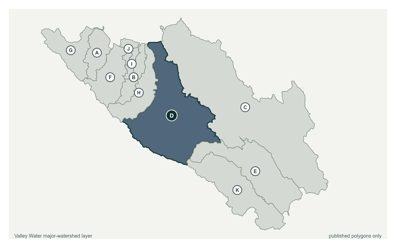
Where this gauge sits on Guadalupe River.
Guadalupe River at Alamitos Fish Ladder
1.60 ft · 5.8 cfs · no published thresholdGuadalupe River above Almaden Expwy
2.34 ft · 1.86 cfs · 6.66 ft below threshold 1Guadalupe River at Alma Ave (Stage Only)
3.12 ft · 0 cfs · 11.38 ft below threshold 1Guadalupe River at US-101 (USGS)
5.12 ft · 27.5 cfs · 11.88 ft below threshold 1Guadalupe River at Montague Expwy (Stage Only)
10.44 ft · 0 cfs · no published thresholdGuadalupe River at Gold St (Stage Only)
4.76 ft · 0 cfs · no published thresholdThis sensor is operated by the USGS. Previously, this sensor was located near St John Street in San Jose under USGS sensor ID 11169000. The captured contributing watershed is approximately the same.
Valley Water, sensor notes for Guadalupe River at US-101 (USGS)