Reading 2.34 ft and 1.86 cfs. That is 6.66 feet below the first flood threshold.
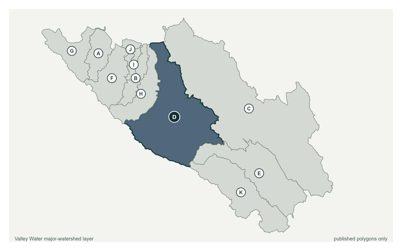
Guadalupe River above Almaden Expwy at 37.2808, -121.8800, exactly as positioned in Valley Water's sensor feed. Valley Water publishes Guadalupe River as a major watershed here. The eleven published boundaries do not line up exactly with the five watershed groupings used here, and not every named creek has one.
Stream gauge
2.34 ft
Captured July 28, 2026 at 4:30 PM PT
Sensor ID 5023_2
37.2808, -121.8800
Included in Valley Water's flood watch, carries a forecast model
Reporting
What Floods at Each Level
These descriptions are Valley Water's own, quoted exactly as published for this gauge.
Threshold 1 · 9 ft(3,762 cfs)
6.66 ft above the current reading
Flood Watch. Additional flow from Canoas Creek watershed or increased reservoir spills may bring river to flood stage.
Valley Water, threshold 1 description for Guadalupe River above Almaden Expwy
Threshold 2 · 10.5 ft(5,060 cfs)
8.16 ft above the current reading
River begins to overtop upstream of Alma Avenue Bridge into the Elks Lodge, spilling north, as well as near the RxR on the east bank.
Valley Water, threshold 2 description for Guadalupe River above Almaden Expwy
Threshold 3 · 11 ft(5,509 cfs)
8.66 ft above the current reading
River continues to overtop upstream of Alma Avenue Bridge into the Elks Lodge, spilling north along Lelong Street. Alma Avenue/CA87 viaduct is flooded. Creek overbanks west near Minnesota Avenue downstream of Alma Avenue. Properties south of the old UPRR alignment in the Northern Cross Neighborhood also at risk.
Valley Water, threshold 3 description for Guadalupe River above Almaden Expwy
Threshold 4 · 12 ft(6,407 cfs)
9.66 ft above the current reading
Flooding continues to spill near Alma Avenue, flowing northward and crossing east under Willow Street and Alma Avenue viaducts, continuing to flow north. Overbanking occurs at Atlanta Avenue just upstream of CA-87. The Willow Glen Neighborhood bounded by Willow Street and Minnesota Avenue sees overland flooding. Overbanking occurs in various locations between Alma Avenue and Willow Glen Way. Potential flooding on Ross and Canoas creeks due to high backwater caused by Guadalupe River.
Valley Water, threshold 4 description for Guadalupe River above Almaden Expwy
Places This Gauge Covers
Streets and landmarks named in the threshold descriptions above.
Sensor operated for water rights, water supply, flood protection, operations and environmental monitoring. Vegetation downstream of the control may affect readings. Flow ratings are considered good. The USGS operated this sensor between October 2007 and September 2011 under ID 11167800.
Valley Water, sensor notes for Guadalupe River above Almaden Expwy