
Watershed
Coyote
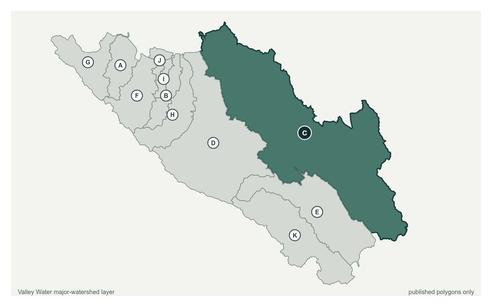
Coyote Creek runs the length of the valley floor, from the Diablo Range above Gilroy through east San Jose to the Bay at Alviso. It is the creek that flooded in February 2017.
28 stream gauges · 14 rain gauges · 2 reservoirs · drains to San Francisco Bay
- Stream gauge
- Rain gauge
- Reservoir
- San Francisquito
- Adobe
- Permanente
- Sunnyvale West
- Sunnyvale East
- Calabazas
- San Tomas
- Guadalupe River
- Coyote
- Uvas
- Llagas
Reservoirs Above This Watershed
Water released or spilled from these reservoirs arrives at the gauges below.
| Reservoir | Storage | Elevation | Spills at |
|---|---|---|---|
| Anderson Reservoir | 3,508 acre-feet | 489.3 ft | 625 ft |
| Coyote Reservoir | 9,840 acre-feet | 753.4 ft | 777.2 ft |
Stream Gauges, Upstream to Bay
Each creek is drawn top to bottom in the order the water runs. The bar beside each gauge is filled to its captured stage on that gauge's own local scale; the dashed rules across it are the flood thresholds Valley Water publishes for that location.
Coyote Creek
10 gauges, ordered south to north down the creek
Coyote Creek above Coyote Reservoir (USGS)
3.29 ft · 0 cfs · no published thresholdCoyote Creek below Coyote Reservoir (USGS)
4.60 ft · 6.1 cfs · no published thresholdCoyote Creek below Anderson Reservoir
3.73 ft · 3.87 cfs · no published thresholdCoyote Creek at Madrone (USGS)
2.03 ft · 12 cfs · 3.97 ft below threshold 1Coyote Creek above Metcalf Road
5.91 ft · 0.6 cfs · no published thresholdCoyote Creek below Coyote Perc Pond
0.00 ft · 0 cfs · no published threshold- 2.77 ft · 0 cfs · no published threshold
- 1.11 ft · 0 cfs · 6.89 ft below threshold 1
- 3.61 ft · 1.73 cfs · 21.39 ft below threshold 1
- 4.99 ft · 9.53 cfs · 9.51 ft below threshold 1
Upper Penitencia Creek
3 gauges, ordered south to north down the creek
Upper Penitencia Creek below Educational Park Drive
3.43 ft · 0 cfs · no published thresholdUpper Penitencia Creek at Piedmont Rd
4.24 ft · 0 cfs · 1.76 ft below threshold 1Upper Penitencia Creek at Dorel Dr
6.93 ft · 0.02 cfs · no published threshold
Berryessa Creek
2 gauges, ordered south to north down the creek
Berryessa Creek at Old Piedmont Road
9.90 ft · 0 cfs · 1.10 ft below threshold 1Berryessa Creek above Calaveras Blvd
3.97 ft · 102 cfs · 9.03 ft below threshold 1
Other Gauges Here
- Artesian Slough 5.11 ft
- Coyote Ck below Coyote Ranch Rd -1.90 ft
- Coyote Percolation Pond Level 1.71 ft
- Fisher Ck at Monterey Rd 1.26 ft
- Fisher Creek at Laguna Ave (Not Real-Time) 0.29 ft
- Las Animas Creek above Anderson Reservoir 2.46 ft
- Lower Penitencia Creek at Machado Ave 1.08 ft
- Lower Silver Creek at San Antonio Rd 0.92 ft
- Ogier Downstream Coyote Creek 8.92 ft
- Packwood Creek at Jackson Ranch 0.53 ft
- Thompson Creek at Quimby Rd 1.62 ft
- Upper Penitencia Creek Diversion to Mabury Recharge Pond 0.00 ft
- Upper Silver Creek at Yerba Buena Rd 1.01 ft
Rain Gauges Here
| Gauge | Last hour | Last 24 hours | Season |
|---|---|---|---|
| Biel Ranch | 0.00 in | 0.00 in | 18.03 in |
| Coe Park | 0.00 in | 0.00 in | 29.76 in |
| Coit Ranch | 0.00 in | 0.00 in | 21.10 in |
| Coyote Reservoir | 0.00 in | 0.00 in | 19.29 in |
| Curtner Ranch | 0.00 in | 0.00 in | 17.09 in |
| Haskins Ranch | 0.00 in | 0.00 in | 22.09 in |
| Leroy Anderson Dam | 0.00 in | 0.00 in | 18.07 in |
| Mt Hamilton | 0.00 in | 0.00 in | 26.77 in |
| Shanti Ashrama | 0.00 in | 0.00 in | 18.82 in |
| Penitencia WTP | 0.00 in | 0.00 in | 16.26 in |
| UTC | 0.00 in | 0.00 in | 17.09 in |
| Cow Ridge | 0.00 in | 0.00 in | 24.72 in |
| City of San Jose | 0.00 in | 0.00 in | 14.88 in |
| Evergreen | 0.00 in | 0.00 in | 13.39 in |