Trail
Auto Tour
Much of the Seward Highway follows the historic trail, and north of Anchorage the Glenn Highway and Knik-Goose Bay Road reach the old Knik crossing; at the far end, the first 35 miles of the Nome-Council Highway are the trail itself.
Road 1 of 4
The Seward Highway
Seward to Anchorage
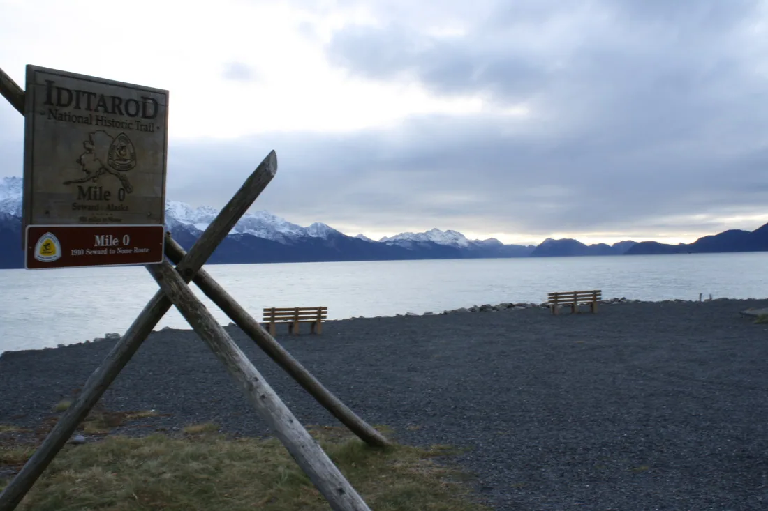
Considered to be one of the best scenic byways in the United States, the Seward Highway extends 125 miles from Seward to Anchorage along the Kenai Peninsula and Turnagain Arm. When following the Seward Highway, you are actually following much of the historic Iditarod Trail. Road signs direct drivers to numerous trailheads and campsites located just off the highway.
-
Mile0of the trail
Seward
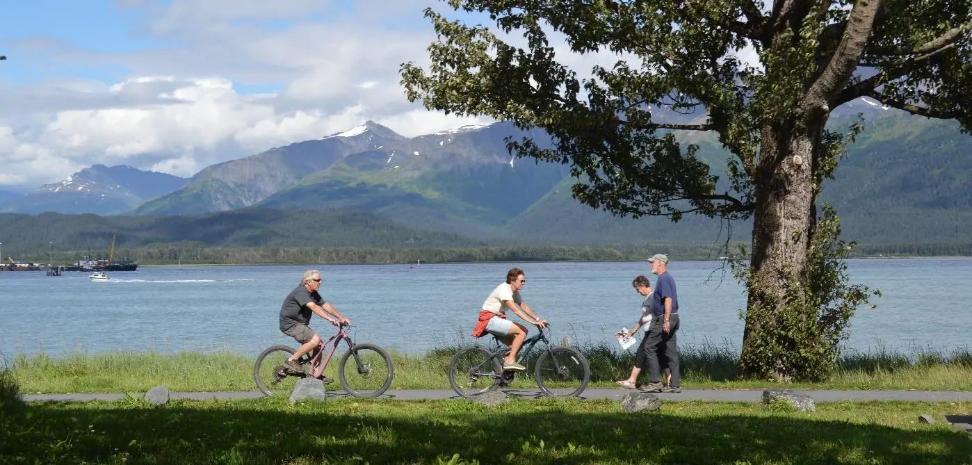
Look for the tripod and historic Iditarod Trail monument located along the shoreline of Resurrection Bay next to the Alaska SeaLife Center. This is the southernmost terminus for the historic Iditarod Trail.
-
Mile32.5Seward Highway
Johnson Pass Trail
Trailheads at miles 32.5 and 64, near Moose Pass
This 23-mile trail is part of the historic Iditarod Trail system. It is one of many commemorative Iditarod Trail segments in the Chugach National Forest. Popular with mountain bikers and hikers, this trail offers spectacular scenery with hemlock forests, wildflowers, and sweeping vistas.
-
Girdwood
Off the highway on the Alyeska Highway
Today, the town hosts some of the most easily accessed and historically intact segments of the Iditarod Trail. Wide, paved bike paths parallel the Alyeska Highway in the lower valley, while moss-shrouded rainforest sections start at trailheads from mile 1.6 of Crow Creek Road.
-
Mile96.1Seward Highway
Bird to Gird Trail
Trailhead at the Bird Point rest stop
First cut by trail builders in 1908 seeking to avoid the avalanche prone Crow Pass Trail, today’s route is a wide 13-mile, bike-friendly asphalt trail. There are frequent turnouts, numerous information displays, and great opportunities for wildlife viewing along this portion of the trail.
-
Anchorage
The Alaska Public Lands Information Center, Fourth Avenue
This interagency visitor center on Fourth Avenue can provide details on Iditarod Trail-related recreation described in this guide, as well as other opportunities throughout Alaska.
Road 2 of 4
The Glenn Highway
Anchorage to the Knik River crossing
-
Mile10Eagle River Road
Eagle River Nature Center
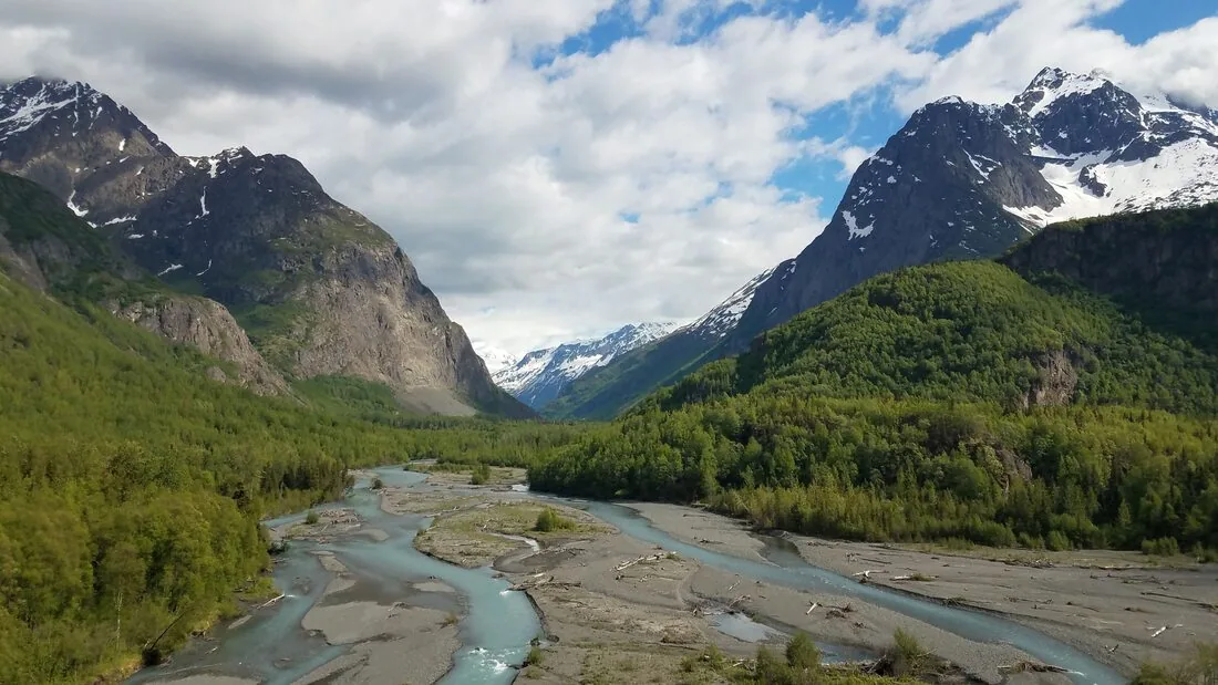
The nonprofit Eagle River Nature Center provides nature studies for adults and children, nine miles of hiking trails—including a portion of the historic Iditarod Trail—and overnight camping (by reservation) at a public use cabin and three yurts. Located at mile 10 on Eagle River Road, the site is open year round.
-
Eklutna Historic Park
On Eklutna Village Road in Chugiak
This Dena’ina Athabaskan village site, established in 1650, was a winter Knik River crossing site for the historic Iditarod Trail. A museum, historic Russian Orthodox church from the 1840s, and colorfully decorated graveyard ‘spirit houses’ provide a window into the past. Open to the public from May 15 through September 15.
-
Mile30Reflections Lake exit
Reflections Lake
Excellent waterfowl viewing and stunning Chugach mountain scenery can be found at the over-the-Knik River ice crossing site of the old Iditarod Trail. A flat, one-mile gravel trail winds around Reflections Lake leading to a 35-foot tall viewing tower on the northwest side of the lake that offers hidden views into this unique intertidal wetland.
Road 3 of 4
Knik-Goose Bay Road
Wasilla to Knik
-
Mile2.2Knik-Goose Bay Road
Iditarod Trail Sled Dog Race Headquarters
A large log building houses a museum with memorabilia, displays, and photographs dating back to the first runs of the Iditarod Trail Sled Dog Race in 1973. A public shelter cabin replica is located on site with artifacts and information associated with the historic uses of the Iditarod Trail. The site is open year round and dog sled rides are offered May to September.
-
Mile13.9Knik-Goose Bay Road
Knik Museum and Sled Dog Mushers Hall of Fame
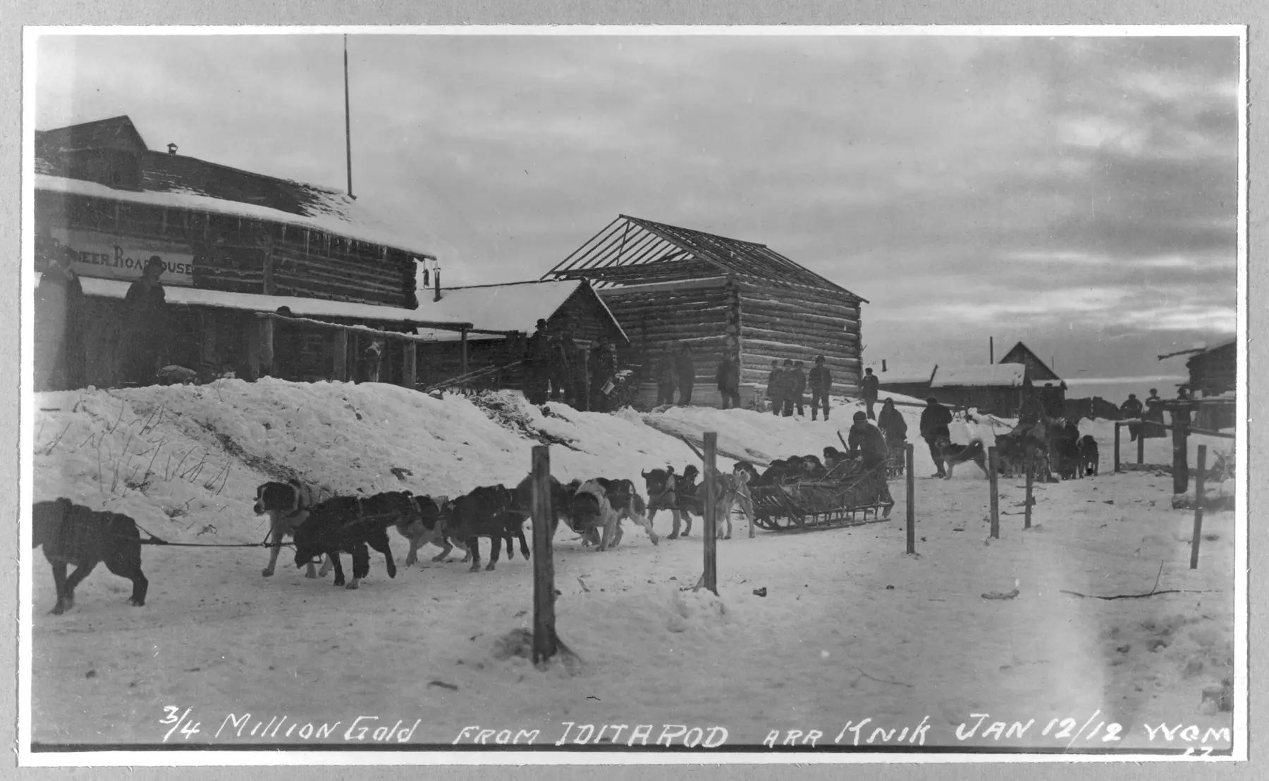
Located on the main route of the historic Iditarod Trail where it passed through the gold rush era town of Knik, the museum building was previously used as a pool hall and roadhouse. The first floor contains artifacts and photographs from the historic Knik townsite, while the second floor is home to the Sled Dog Mushers Hall of Fame.
Road 4 of 4
The Nome-Council Highway
Nome to the Solomon River
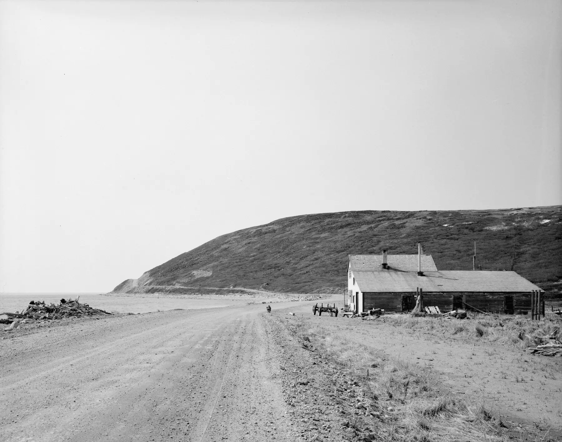
Drive or bike a scenic 35-mile section of the historic Iditarod Trail starting in Nome and heading east along the coast of Norton Sound. The gravel road passes Cape Nome and parallels Safety Sound to the Solomon River. In the winter, the road is unplowed and becomes the Iditarod Trail; look for trail marking tripods. Great birdwatching in summer.
-
Nome
The beaches east of town
Recreational panning is allowed on the beaches east of town to the Fort Davis Roadhouse. Dress to get wet!
-
Safety Sound
The Safety Sound Bridge
Drive out from Nome on the Council Highway to the Safety Sound Bridge, and walk the Trail on the beach of the Alaska Maritime National Wildlife Refuge.
-
35miles east of Nome
The Last Train to Nowhere
At Solomon
A rich gold strike 50 miles inland from the town of Solomon (on the Iditarod Trail) encouraged entrepreneurs to build a railroad over the tundra in 1903. A huge Norton Sound storm in 1913 washed out the tracks, stranding the engines where they can still be seen today.
Take the Visitor Guide With You
The Iditarod National Historic Trail Visitor Guide maps each of these roads with its trailheads, visitor centers and public use cabins.
Download the Visitor Guide