
Trail
Trail Maps
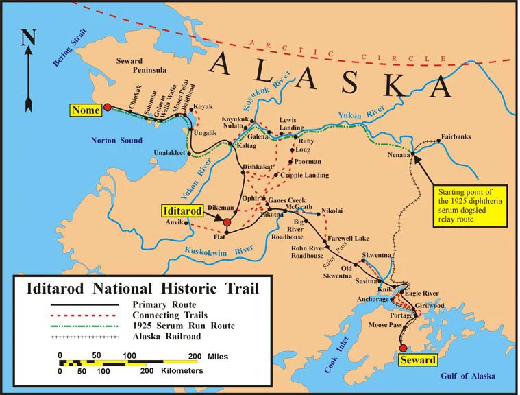
The whole trail system on one map, Seward to Nome, with the primary route, the connecting trails and the 1925 serum run.
The Iditarod National Historic Trail

Maps in the Visitor Guide
Page 4 of the Iditarod National Historic Trail Visitor Guide maps the whole trail system. Each part of the trail has its own pages after that.
- Iditarod Trail System MapPage 4
- Kenai MountainsPage 9
- Turnagain ArmPage 10
- Anchorage AreaPage 12
- Wasilla AreaPage 13
- McGrath and UnalakleetPage 18
- NomePage 19
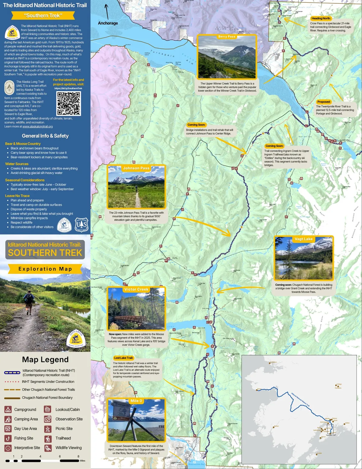
Southern Trek Exploration Map
This Exploration Map showcases newly completed and scheduled upcoming work on the Iditarod National Historic Trail in Chugach National Forest. The Iditarod Trail south of Anchorage, aka the "Southern Trek," is rapidly progressing towards completion, meaning there will be a continuous* footpath from Eagle River to Seward, approximately 120 miles of trail (*or nearly continuous). Be among the first to conquer each new mile of trail as it opens! The 17"x27" map is available for free at several stores and visitor centers along the trail, or order it here and have it shipped for just $3.00 shipping & handling fee. Produced through a partnership with the Iditarod Historic Trail Alliance, Alaska Trails, US Forest Service, and Bureau of Land Management. See you on the trail!
$3.00