Reading 2.56 ft and 0 cfs. That is 12.94 feet below the first flood threshold.
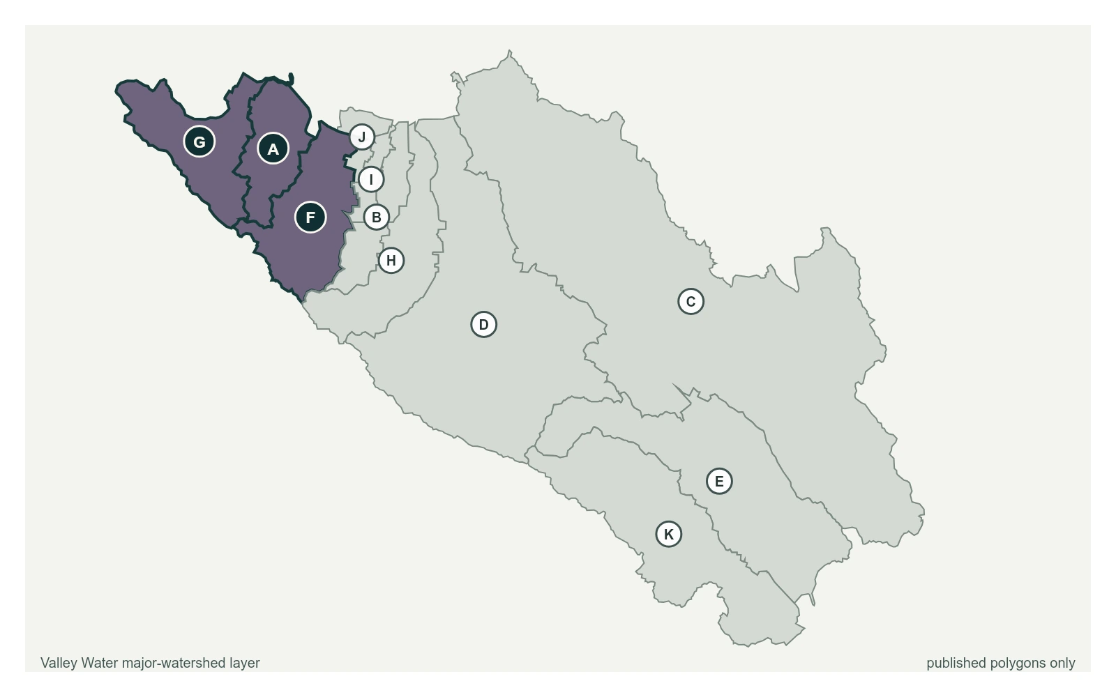
Stevens Creek above CA-85 near Central Ave at 37.3952, -122.0690, exactly as positioned in Valley Water's sensor feed. Valley Water publishes San Francisquito, Adobe, Permanente as a major watersheds here. The eleven published boundaries do not line up exactly with the five watershed groupings used here, and not every named creek has one.
Stream gauge
2.56 ft
Captured July 28, 2026 at 4:30 PM PT
Sensor ID 5035
37.3952, -122.0690
Included in Valley Water's flood watch
Reporting
What Floods at Each Level
These descriptions are Valley Water's own, quoted exactly as published for this gauge.
Threshold 1 · 15.5 ft(3,900 cfs)
12.94 ft above the current reading
Significant flows. Check Evelyn, Middlefield, Moffett, & US-101 for possible blockages. Flooding may begin on east bank between US-101 and Moffett Blvd.
Valley Water, threshold 1 description for Stevens Creek above CA-85 near Central Ave
Threshold 2 · 16.5 ft(4,400 cfs)
13.94 ft above the current reading
Overflow at Moffett Blvd returning back to Creek. Creek overtops Evelyn Ave and Central Expwy moving westward.
Valley Water, threshold 2 description for Stevens Creek above CA-85 near Central Ave
Threshold 3 · 18 ft(5,500 cfs)
15.44 ft above the current reading
Flooding continues at above locations. Flooding near Moffett flows across US-101 flooding adjacent streets and buildings.
Valley Water, threshold 3 description for Stevens Creek above CA-85 near Central Ave
Threshold 4 · 19.5 ft(6,600 cfs)
16.94 ft above the current reading
Flooding begins on both west and east banks near West Valley Elementary School.
Valley Water, threshold 4 description for Stevens Creek above CA-85 near Central Ave
Places This Gauge Covers
Streets and landmarks named in the threshold descriptions above.