
Maps and water data
Maps & Data
Maps of DEWR's projects and of the Compact's appendices, and the water data DEWR and its partners publish.
By river and creek
Projects on the Reservation
Boundary and highways: U.S. Census Bureau. Rivers, lakes and places: U.S. Geological Survey. Data retrieved October 26, 2026.
Jocko River
North Fork Jocko and the Tabor Feeder Canal
Crow Creek and Lower Crow Reservoir
Mission Valley reservoirs and canals
Water Resources and Data
- CSKT Water DataSnow, surface water and groundwater data
- Water Rights Query SystemMontana DNRC's water rights search
- Flathead Reservation Water Management BoardWater rights administration on the Reservation
Project Maps and Drawings
- Bison Range Reach phase mapThe restored channel over the 1962 aerial photograph
- Jocko Valley Canal-to-Pipeline Conversion: project mapPhases 1 to 6 of the canal-to-pipe conversion, each in its own color, as of July 1, 2025.
- Crow Pump Diversion Reconstruction: design drawingIsometric view: the spillway, sluice gate, fishway, wetwell intake and pump building foundation.
- Pablo 31A Chute Replacement: design drawingThe buried pipeline that replaces the 31A concrete chute, from the top gate to the impact basin.
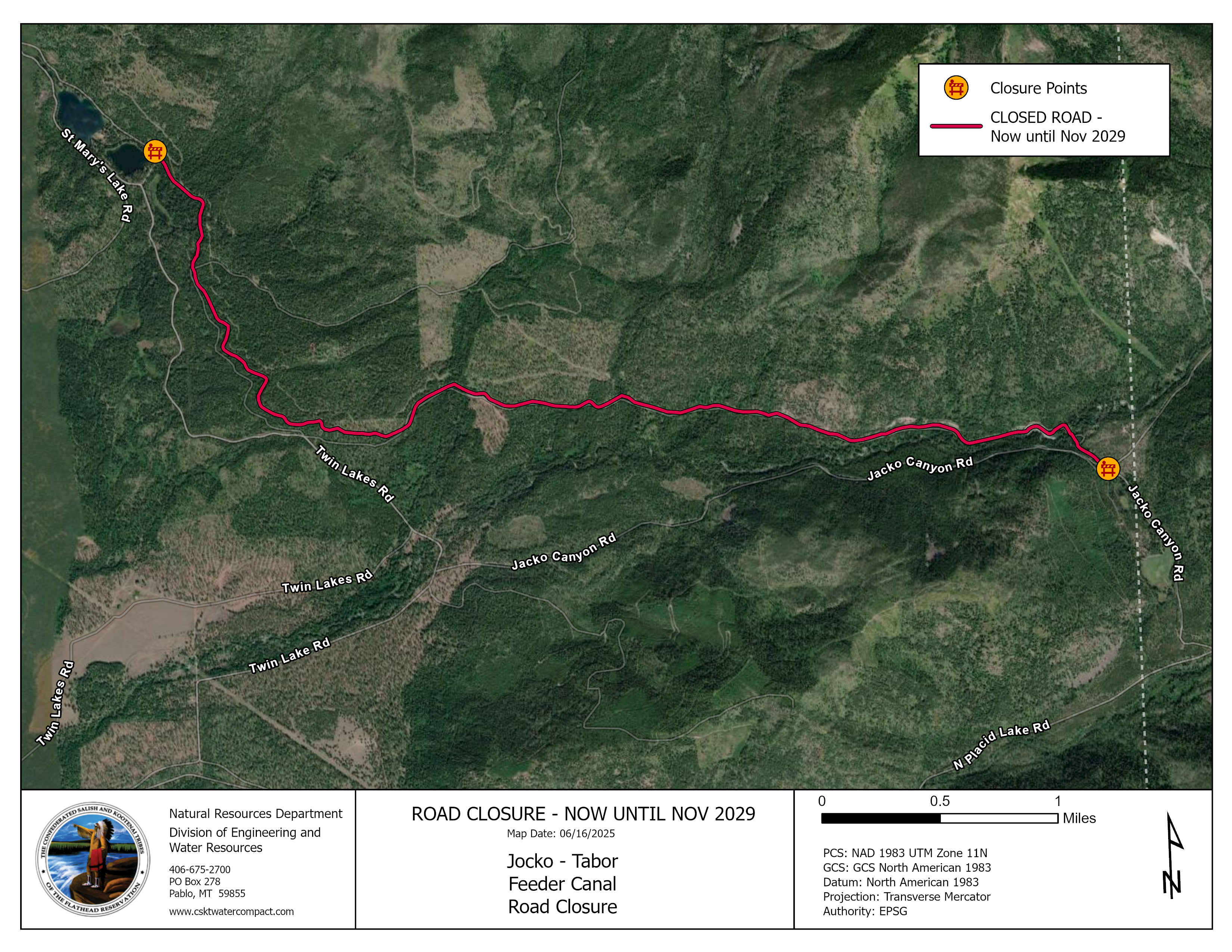
- Tabor Feeder Canal road closure map, now until November 2029PNG, 7.0 MB
Compact Maps
- Appendix 1: Hydrologic Basin MapsPDF, 4.2 MB, 14 pages
- Appendix 2: FIIP Influence Area MapPDF, 987 KB, 1 page
- Appendix 6: Map of Non-FIIP Historic Irrigated Acres Lands Eligible for RegistrationPDF, 510 KB, 2 pages
ArcGIS StoryMaps
- Jocko Pipelines StoryMapJocko Valley Canal-to-Pipeline Conversion
- Jocko K Diversion StoryMapJocko K Diversion
- Milltown Water Right: Naạycčstm StoryMapWater Rights Program