Sources + photo credits

Follow each fact to its keeper.

This is an independent, unofficial field guide. It does not speak for the Township or Chamber. It also does not speak for Fishtown Preservation, the park, the Conservancy, the library, or the museum. Facts that can change were checked July 13, 2026. Follow the direct links to learn what is true today.

Authority ledger

Who is responsible for what

Leland Township / Leelanau County
Use this source for government notices, contacts, meetings, and services. It also covers permits, voting, zoning, sewer, and Township-owned parks. Township page · Parks and recreation
Leland Chamber of Commerce
Use this source to get around and find local places. It covers the business list, events, beaches, and parks. It is a Chamber source, not a government source. Chamber home · Live events calendar
Fishtown Preservation
Use this source for Fishtown property and care. It explains the working waterfront, shanties, docks, and fish tugs. What is Fishtown? · Fish tugs
National Park Service
Use this source for Manitou Island access, closures, facilities, and park rules. It owns the key 2026 building notice. Manitou Island access
Manitou Island Transit
Use the operator’s own ferry status. It says there are no trips during the 2026 season. Operator notice
Leelanau Conservancy
Use this source for nature area access and care. It also posts site conditions and the current Whaleback closure. Whaleback Natural Area
Leland Township Public Library
Use this source for library hours, programs, books, spaces, and services. Library website
Leelanau Historical Society & Museum
Use this source for museum visits, archives, and exhibits. It also leads to history research and original records. Visit information · Archives
U.S. Census Bureau
This is the Leland census-designated-place record. It gives a 2020 population of 410. That number is not the Township population. 2020 Michigan CDP table
Wikipedia
Use this page to get your bearings and find sources. Do not use it alone for current access or other facts that guide a choice. Leland, Michigan

Six real views of the place

Photography and licenses

Local copies were made smaller for faster pages. Each creator keeps the copyright and license unless the work is public domain.
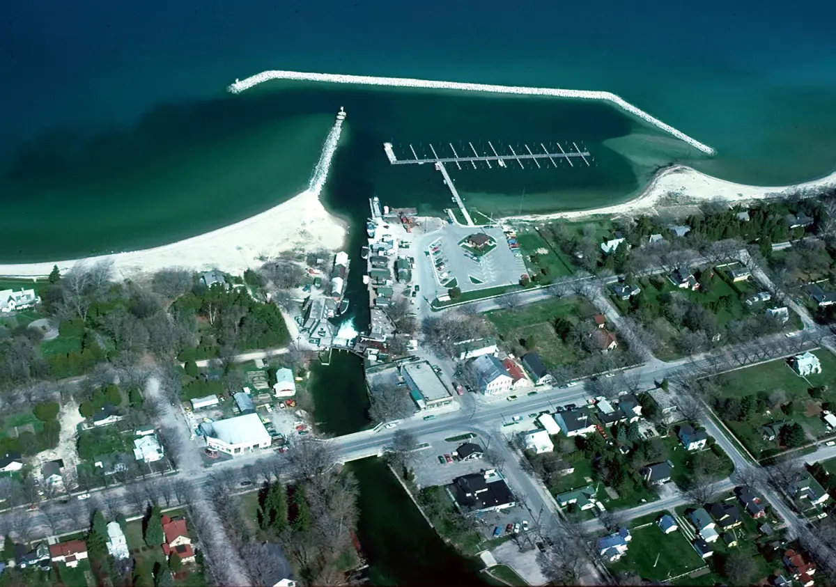
Aerial view of Leland’s river, harbor, and two-water geography
Leland Michigan aerial view
U.S. Army Corps of Engineers · Public Domain · source record and original
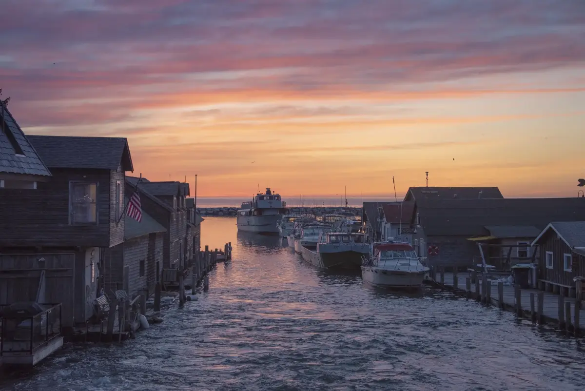
Fishtown buildings and harbor water in late-day light
Fishtown at sunset
Richard Hurd · CC BY 2.0 · source record and original
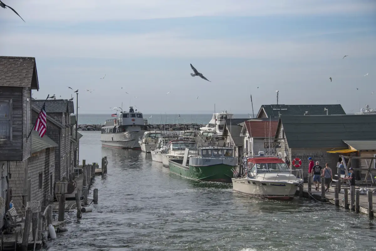
Buildings and boats on the working Fishtown waterfront
Fishtown on Lake Michigan along M-22
Richard Hurd · CC BY 2.0 · source record and original
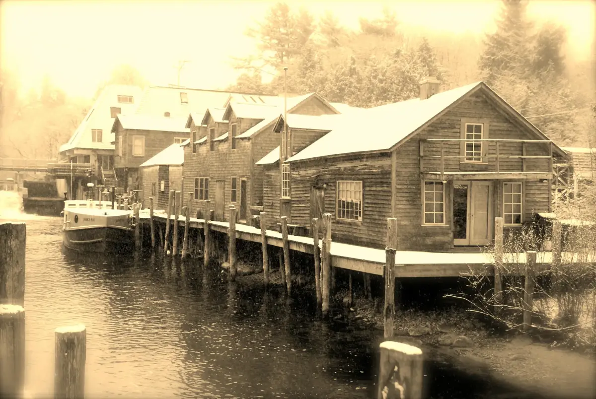
Leland River, waterfront buildings, and snow in winter
Leland River
John Levanen · CC BY-SA 2.0 · source record and original
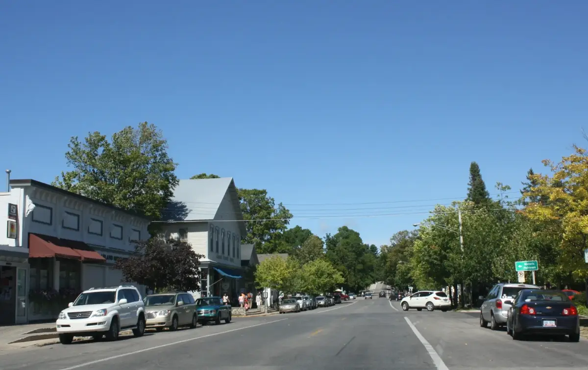
Street view of downtown Leland along M-22
Leland Michigan Downtown M-22
Royalbroil · CC BY-SA 3.0 · source record and original
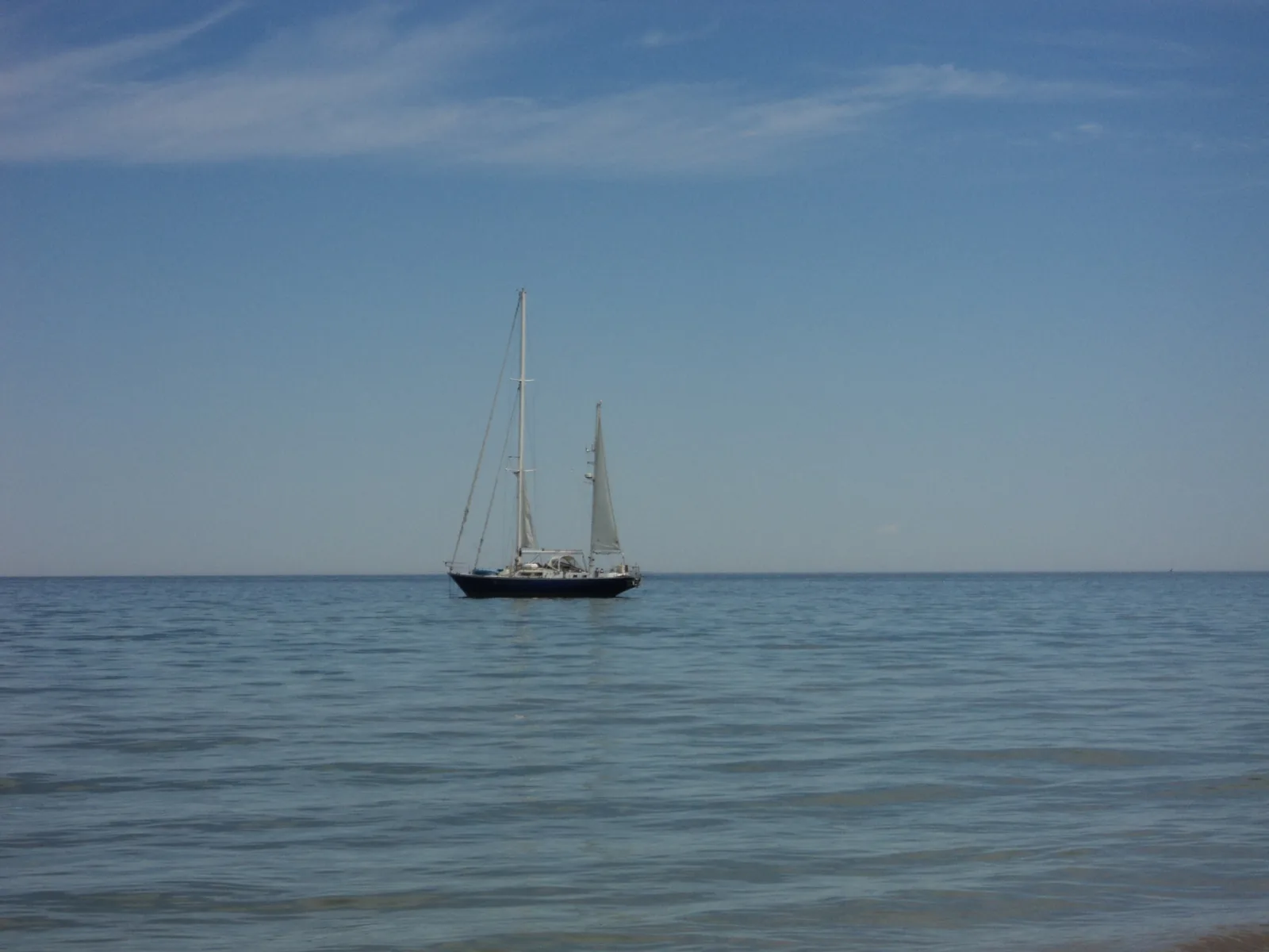
Sailboat on Lake Michigan seen from Leland’s public beach
Sailboat on Lake Michigan from Leland Public Beach
Jaspermaz · CC BY-SA 3.0 · source record and original
How this field guide works

Dates stay attached to changeable facts.

Closures, ferry access, events, hours, parking, and business details can change. This site names the group behind each fact that could shape a plan. It shows when the fact was checked. Then it links out instead of acting like a static page has live data.

Sources may conflict. When they do, the place owner or operator controls the current status. That is why the National Park Service’s 2026 island notice takes the lead. The Conservancy’s Whaleback notice also takes the lead over old visitor copy.

Source Serif 4 and Funnel Sans are self-hosted under the SIL Open Font License 1.1.