
Unified Development Code
Article 2, Creation of Zoning Districts and Official Map
As Adopted
The text on this page is the City’s chapter as posted. An ordinance passed since may not be set into it yet.
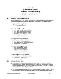
Creation of Zoning Districts
By the official adoption of this UDC by the Governing Body of the City of Edgerton, and upon publication of the adopting ordinance, the following zoning districts are hereby created.
A.Agricultural Zoning Districts
1.A-G, Agricultural District
B.Residential Zoning Districts
1.R-1, Single Family Residence District
2.R-2, Two Family Residence District
3.R-3, Multi Family Residence District
4.MHP, Manufactured Homes District
5.Reserved for Future District
C.Commercial Zoning Districts
1.C-D, Downtown Commercial District
2.C-1, General Commercial District
3.C-2, Heavy Service Commercial District
4.Reserved for Future District
D.Industrial Zoning Districts
1.B-P, Business Park District
2.L-P, Logistics Park District
3.I-G, General Industrial District
4.I-H, Heavy Industrial District
E.Planned Development Districts
1.PUD, Planed Unit Development District
2.Reserved for Future District
Official Zoning Map
A.An official zoning map delineating the location of all zones and districts in the City of Edgerton is hereby adopted as a part of this UDC. The official zoning map of Edgerton shall become effective upon the approval of the Governing Body of the City of Edgerton and the publication of the adopting ordinance.
B.The zoning maps, together with everything shown and all amendments, shall be a part of this regulation as set forth and described herein. If for any reason the location of the zoning district boundary line is not readily determinable from the official zoning map, the Zoning Administrator in accordance with the following provisions shall determine the location of the zoning district boundary line. Where more than one of the following provisions are applicable in any given situation, the first enumerated applicable provision shall prevail over all other provisions.
1.Where a Zoning District boundary line is located with reference to a fixture, monument, or natural feature; the location of such fixture, monument, or natural feature shall control;
2.Where a Zoning District boundary line is given a position within or abutting a highway, road, street, or alley right-of-way which does not appear to be located within any Zoning District, the Zoning District boundary line shall be deemed to be in the center of such highway, road, street, or alley right-of-way;
3.Where a Zoning District boundary line is shown as closely (and approximately) following subdivision plat lot lines, municipal boundary or county boundary lines, such line or municipal or county boundary lines shall control;
4.Where a Zoning District boundary line is shown by a specific dimension, such specific dimension shall control;
5.Where a Zoning District boundary line is shown by reference to property ownership, the location of the Zoning District boundary line shall be determined by scaling from the County Appraiser's maps;
6.In all other circumstances, the location of the Zoning District boundary line shall be determined by scaling from the Zoning District maps.
Every Article
Unified Development Code- Article 1Authority, Adoption, Application of Regulations12 sections
- Article 2Creation of Zoning Districts and Official Map2 sections
- Article 3Agricultural and Residence Zoning Districts6 sections
- Article 4Commercial Zoning Districts6 sections
- Article 5Industrial Zoning Districts4 sections
- Article 6Planned Unit Development6 sections
- Article 7Conditional Uses2 sections
- Article 8Administrative Authorities, Duties and Procedures7 sections
- Article 9Land Use Determination Procedures7 sections
- Article 10Site Plans and Design Standards4 sections
- Article 12Signs12 sections
- Article 13Subdivision Approval Procedures8 sections
- Article 14Improvements and Standards of Design16 sections
- Article 15Definitions3 sections
- Article 16Parking and Loading Regulations4 sections