Design study · Independent place guide · Michigan
Follow one river from the inland lake to Lake Michigan
A field guide to Leland built as a crossing rather than a menu: North Lake Leelanau, the river, the dam, the working Fishtown waterfront, the harbor, and out into Lake Michigan — in that order, because that is the order the place is in.
Independent concept, built without an RFP. Current conditions were checked July 13, 2026; this is not an official Leland Township, Chamber, or Fishtown Preservation website.
- Place website design
- Source-dated content
- Search or Ask
- Open-license photography
- Progressive interaction
Leland, Michigan — open the working site
Case study overview
The problem
A small place with a big reputation is described by many organizations at once. In Leland, the Township owns public notices, the Chamber owns visitor listings, Fishtown Preservation owns the working-waterfront record, the National Park Service owns Manitou access, and the Leelanau Conservancy owns natural-area status. A visitor does not know or care about that division, so they either bounce between five sites or land on a tourism page that flattens the whole thing into a postcard and quietly goes stale.
The approach
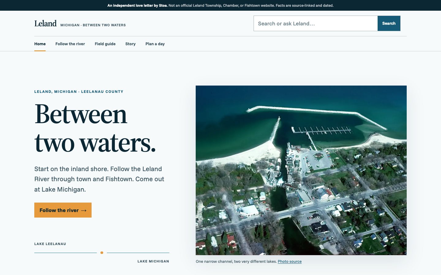
The site is organized by the geography instead of by the organizations: an east-to-west crossing that a first-time visitor can understand in one view. Follow the River is the signature interaction — a progressive, keyboard-accessible journey down the channel, with the base state a plain ordered list so it works without JavaScript. Authority stays explicit rather than absorbed: each fact links back to whoever actually owns it. Every current condition carries the date it was checked, so the page ages honestly instead of pretending to be live. The visual world is a calm Great Lakes field atlas — Source Serif, fresh-water blue, spruce, and one working-harbor orange — over rights-cleared documentary photography, with a federal aerial establishing the two-water geography.
The result
Nine routes covering a field guide, a day planner, and a one-box Search or Ask surface, built entirely from open-license and public-domain imagery. Conditions were verified on a stated date and labelled as such — which is the difference between a guide that stays useful and one that misleads someone about a boat launch in a year's time.
Have something similar in mind?
Need a civic tool with this shape?
Stoa designs and ships resident-facing tools, internal workflows, and public service interfaces that stay fast, legible, and accessible from day one.