
Montgomery County, Maryland
Our County
At first glance, the health of Montgomery County, MD is among the most highly ranked in the United States. However, health of our population is not uniform throughout the County.
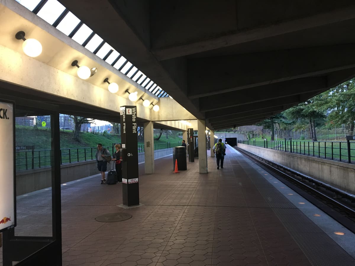
76 years Life expectancy in White Flint
92 years Life expectancy in Bethesda
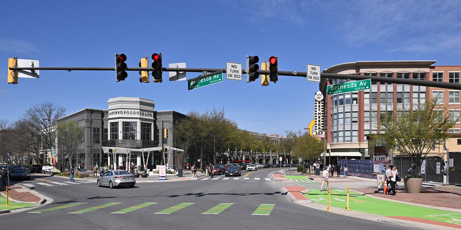
For instance, someone born in White Flint can expect to live 76 years. 5 miles away in Bethesda, life expectancy increases to 92 years.
Uneven Opportunities, 2018
The county, tract by tract
Opens the map at full size.
-
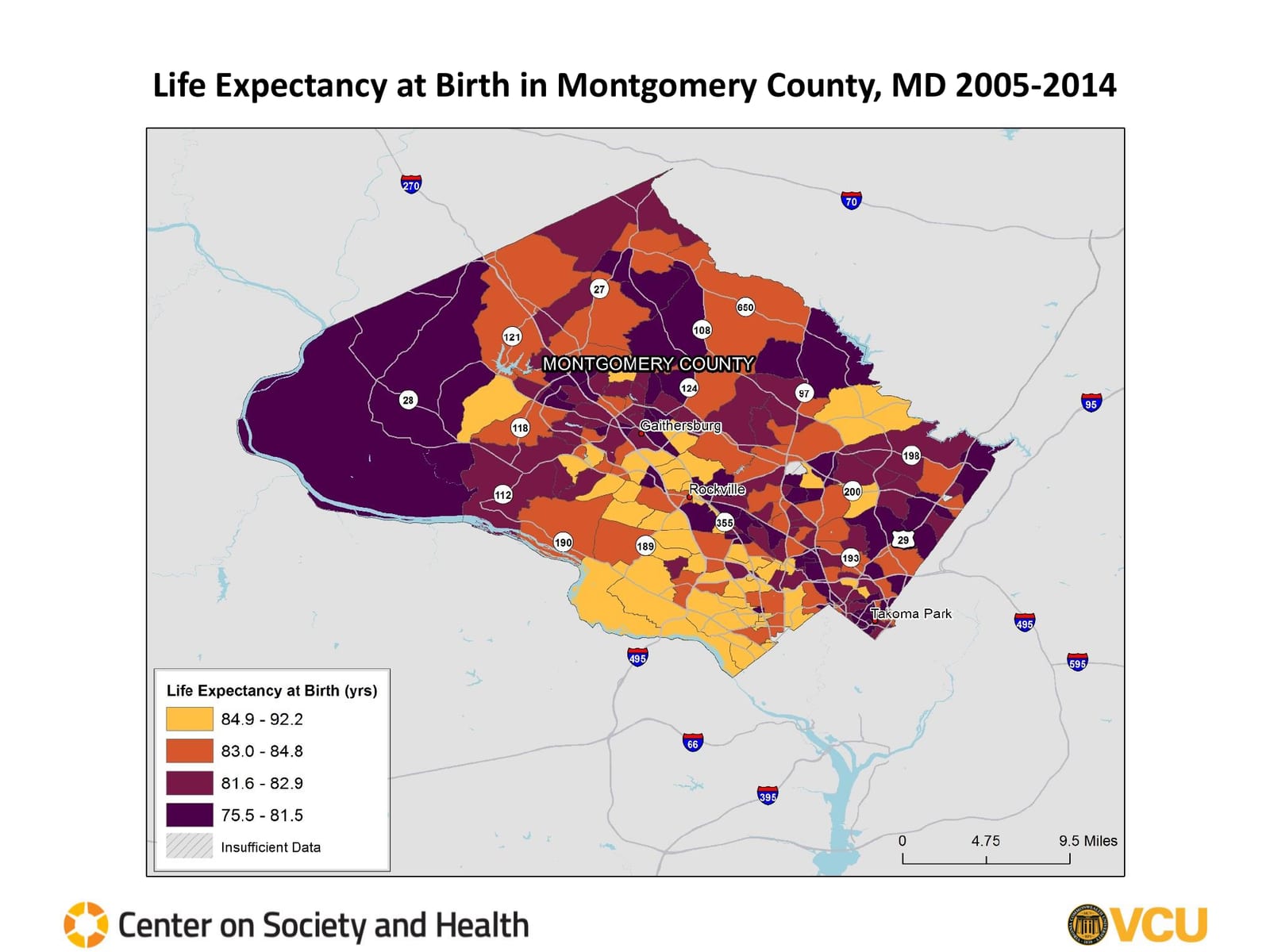
Life Expectancy at Birth 2005 to 2014 The longest lives, 84.9 to 92.2 years, cluster in the southwest around Bethesda and Potomac and in pockets near Rockville and Olney; the shortest, 75.5 to 81.5 years, cover the western farmland and run up the county's east side and through tracts near Gaithersburg, Rockville, and Takoma Park. -

Healthy Places Index Scores The highest scores sit in the southwest between the Potomac and Rockville; the lowest run along the east side from Route 29 to Takoma Park, across the western farmland, and in tracts around Gaithersburg. -
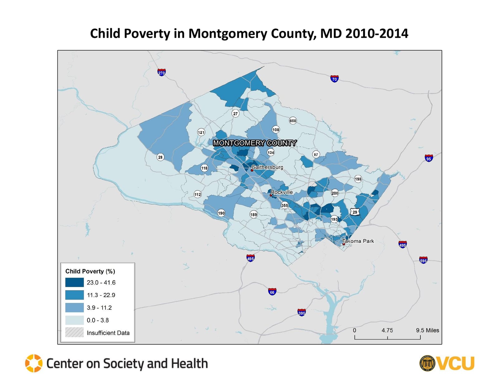
Child Poverty 2010 to 2014 The highest rates, 23.0 to 41.6 percent, fall in tracts around Gaithersburg, along Route 355 through Rockville, and on the east side near Wheaton, White Oak, Silver Spring, and Takoma Park; the southwest and the western farmland are lowest. -
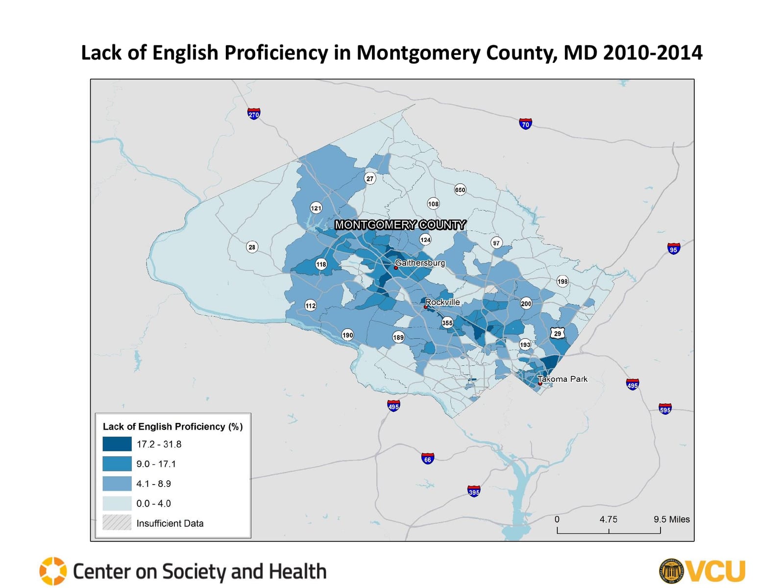
Lack of English Proficiency 2010 to 2014 The highest shares run from Germantown and Gaithersburg down Route 355 and across the east side from Wheaton to Takoma Park; the southwest and the upper county are lowest. -
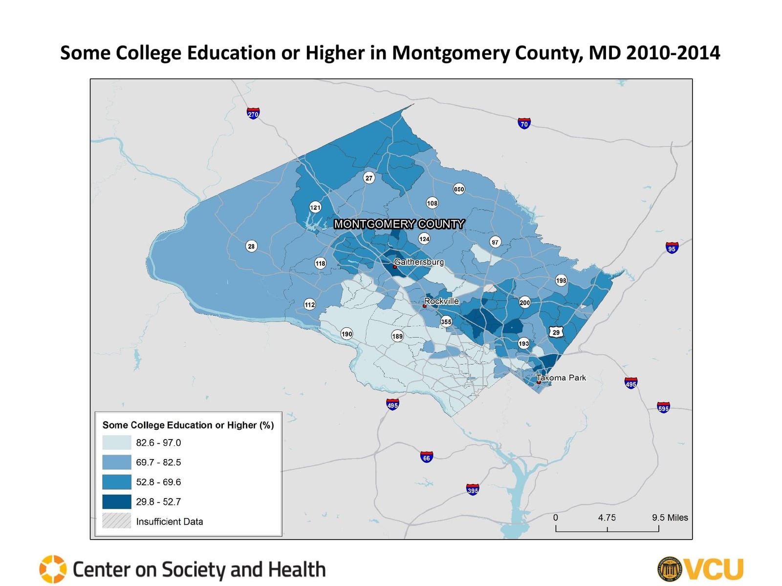
Some College Education or Higher 2010 to 2014 The lowest shares, 29.8 to 52.7 percent, fall on the east side around Wheaton, Silver Spring, and Takoma Park and in tracts near Gaithersburg; the southwest is highest. -
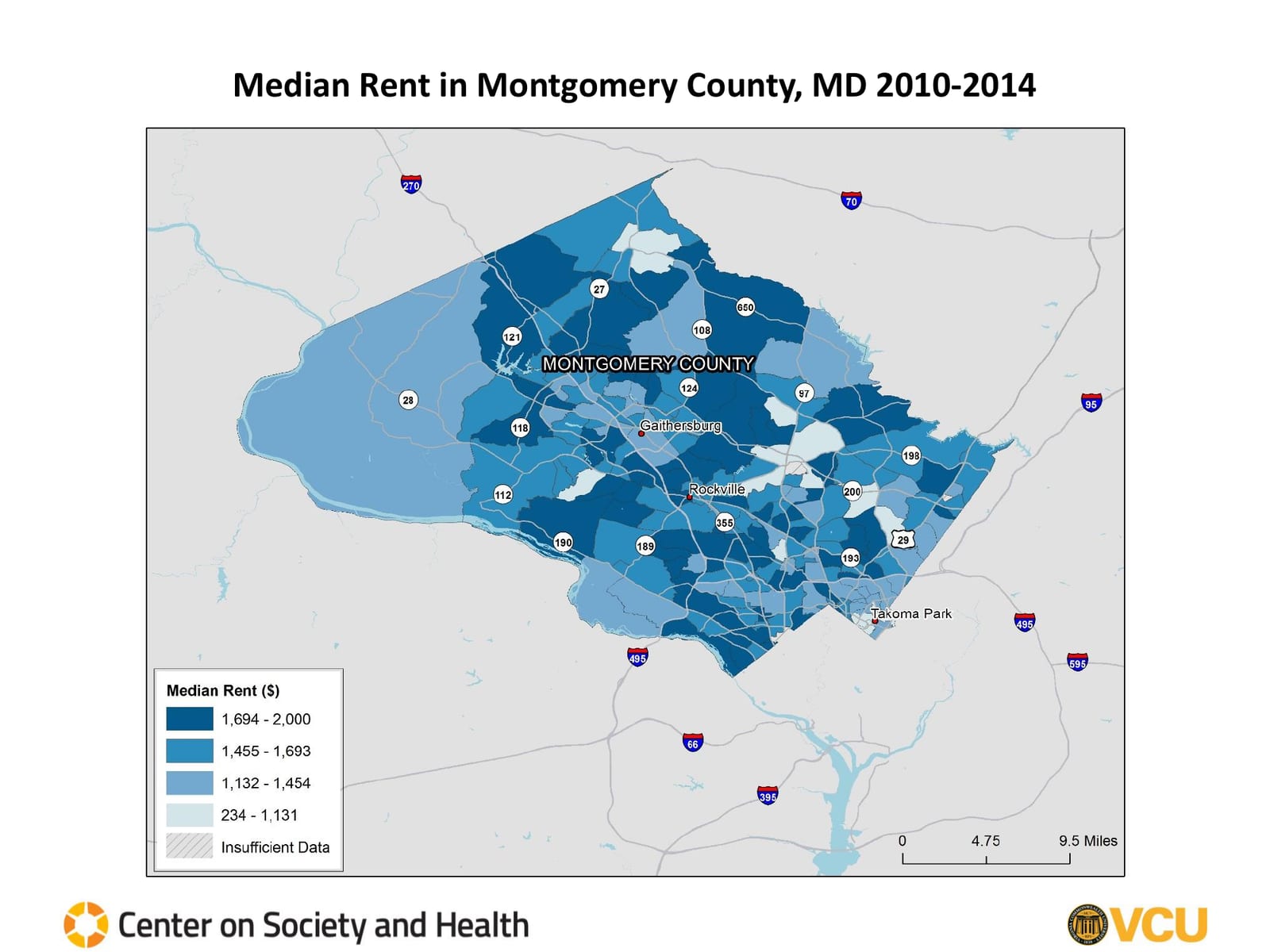
Median Rent 2010 to 2014 The highest rents, $1,694 to $2,000, cover much of the center and south of the county; the lowest scatter through the east side and the upper county. -

Older Age of Housing 2010 to 2014 The oldest housing stock sits inside the Beltway around Silver Spring, Takoma Park, and Bethesda, with pockets in the far northwest. -
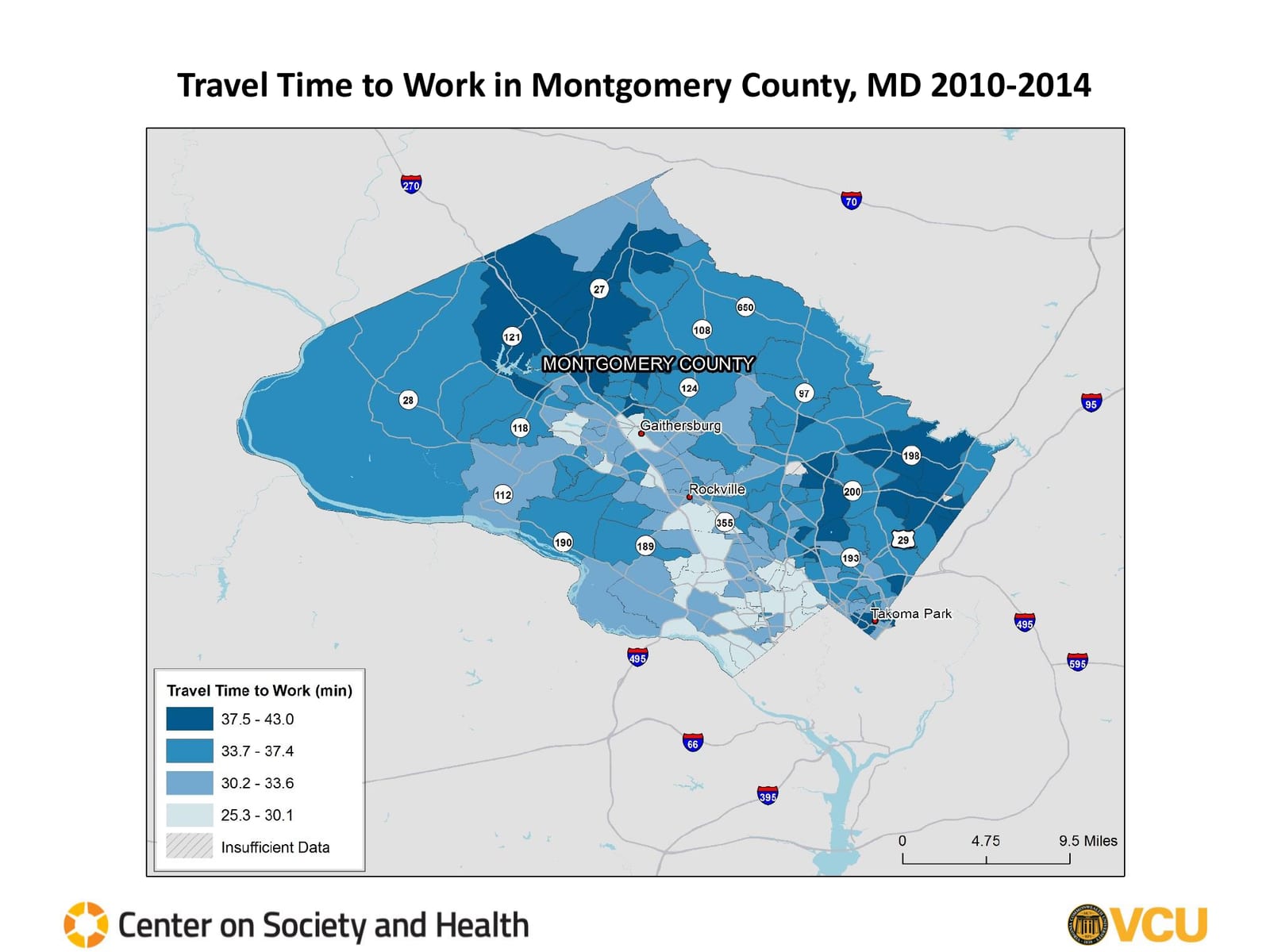
Travel Time to Work 2010 to 2014 The longest commutes, 37.5 to 43.0 minutes, come from the upper county around Damascus and from the east side along Route 29; the shortest are near Rockville and Bethesda. -
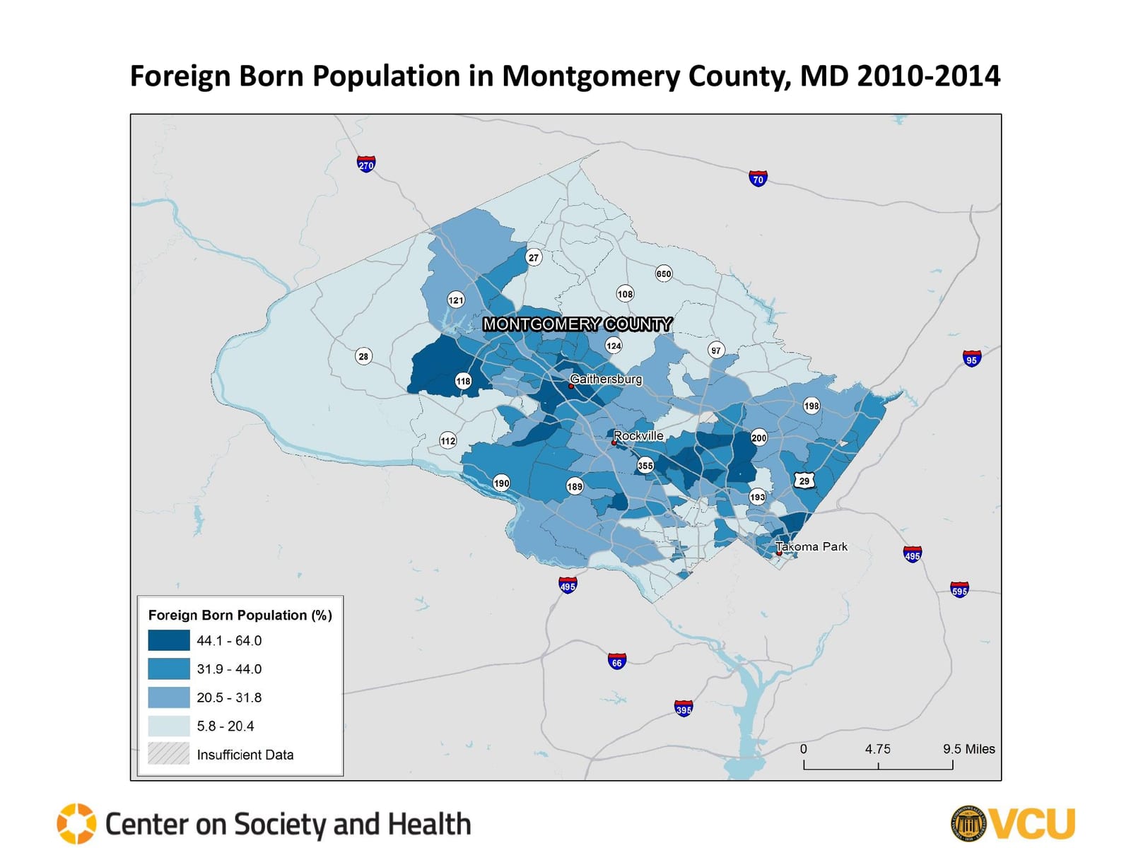
Foreign Born Population 2010 to 2014 The highest shares, 44.1 to 64.0 percent, fall around Gaithersburg and Germantown, along Route 355, and across the east side from Wheaton to Takoma Park; the west and north are lowest. -
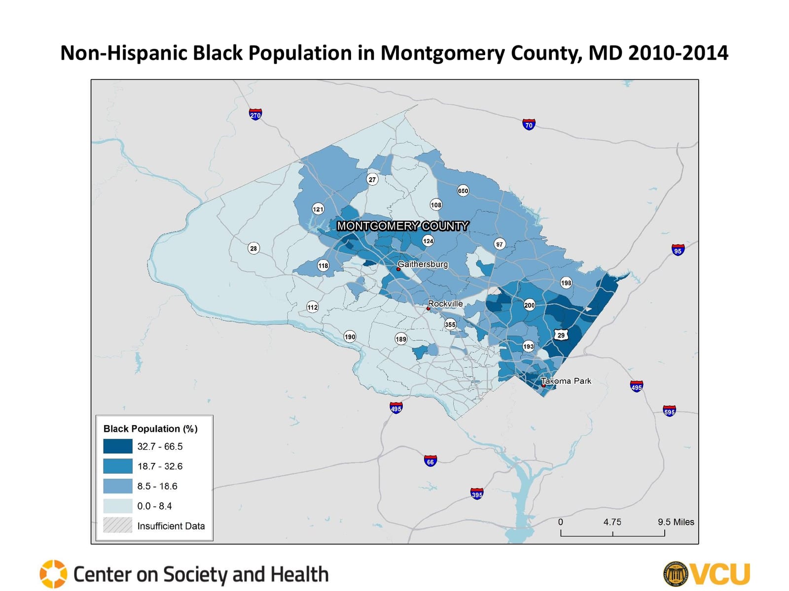
Non-Hispanic Black Population 2010 to 2014 The highest shares, 32.7 to 66.5 percent, run along the east side near Route 29 from Burtonsville to Silver Spring and in tracts around Germantown and Gaithersburg; the southwest and west are lowest.
Maps: VCU Center on Society and Health
The study
Uneven Opportunities
Produced in 2018 by the Virginia Commonwealth University (VCU) Center on Society and Health for the Metropolitan Washington Council of Governments (COG) Health Officials Committee, the study examines the health of the community at the census tract level, focusing on life expectancy and the factors that shape health.
This report was made possible by the support of the Healthcare Initiative Foundation, Kaiser Permanente, Northern Virginia Health Foundation, and Potomac Health Foundation.
In 2020, COG released a compendium report, Health Equity: How Opportunities for Health are Shaped by Race and Ethnicity.
Across the map
Where partners work

Silver SpringAyuda's office since 2019, and Warrior Canine Connection's Silver Spring Vet Center program, an FY26 grantPhoto: Farragutful, CC BY-SA 4.0 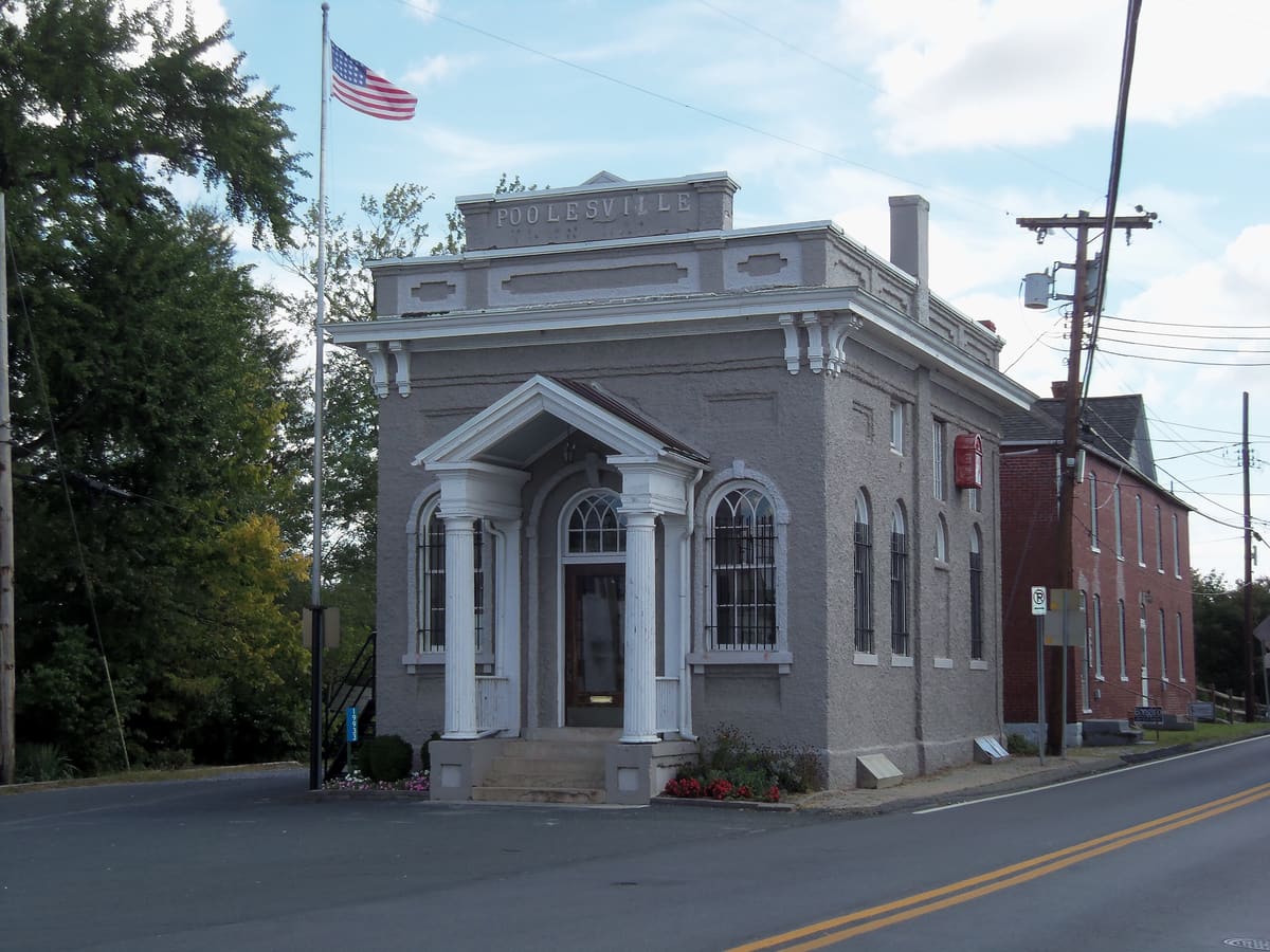
PoolesvilleWhere American Diversity Group and WUMCO Help held the first Poolesville Health Day, with a mobile dental clinicPhoto: Farragutful, CC BY-SA 3.0 
GermantownHIF's office and Sheppard Pratt's Community Wellness Hub share a suite at 12850 Middlebrook RoadPhoto: Carol M. Highsmith (Public domain) 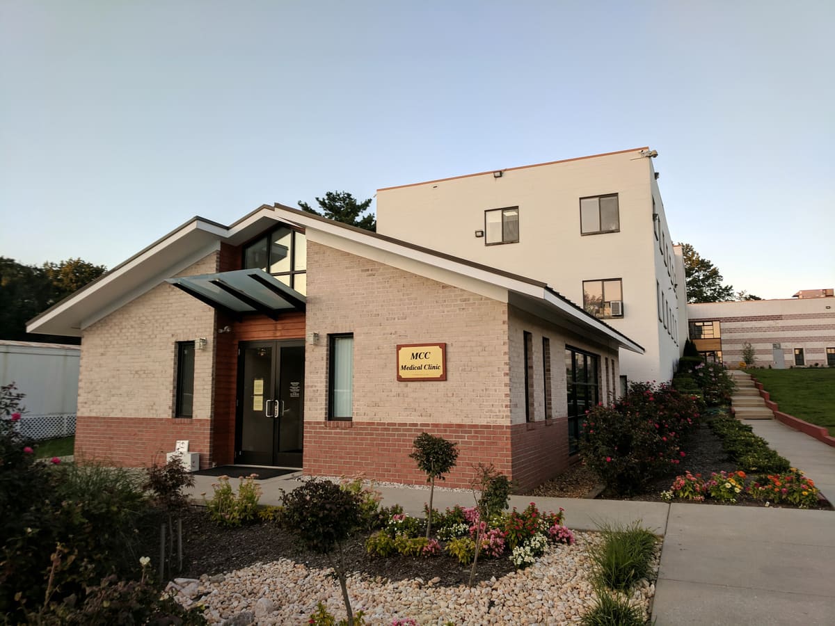
ColesvilleMuslim Community Center, an FY26 Spring partner for its dental programPhoto: Bohemian Baltimore, CC BY-SA 4.0