
Planning Agenda item 6C
Master Plan Discussion
Planning Commission, Thursday, April 16, 2026
Download these 19 pages, 1.8 MB Whole packet, 132 pages, 116.6 MB
Page 114
Text of page 114
Memorandum To: Date: From: RE:
City of Saugatuck Planning Commission April 10, 2026 David M. Jirousek, AICP Master Plan UpdateCharacter Analysis Progress Report and Exercise
Overview As part of the ongoing Master Plan process, the project team has initiated a community character analysis to supplement findings from public input and the existing land use review. This analysis is intended to better understand the unique qualities of the City and its neighborhoods in ways that a traditional existing land use map alone cannot capture. Rather than serving as a simple inventory of land uses, the analysis evaluates the physical and functional characteristics that define districts, neighborhoods, and corridors, including development scale, block and lot patterns, street and sidewalk networks, pathways, parking, building types, and land use relationships. This approach is helping the Planning Commission more clearly identify areas to preserve, enhance, or thoughtfully transform, and will provide a stronger foundation for future land use recommendations and zoning policy decisions. Ultimately, the character analysis is intended to ensure that future growth and development align with Saugatuck’s established character and community context. To better understand the City’s physical form and development patterns, the community has been divided into character areas. These areas represent distinct parts of the City that share common patterns in land use, development intensity, built form, and environmental context. This analysis serves several purposes: §
Classifies areas based on common characteristics, including land use, zoning, density, intensity, infrastructure, and utilities, and helps to define a sense of place.
Establishes a clear and simplified framework for future growth and land use planning.
Provides justification for future land use recommendations and distinctions between different parts of the City.
Each character area is evaluated using the following components: §
Buildings: Predominant building types, setbacks, architectural character, and general form.
Land Use: Primary and supporting uses within the area.
Scale: Building height, massing, and overall development intensity.
Blocks and Streets: Block patterns, street layout (grid, curvilinear, etc.), and connectivity.
Horizon Community Planning - PO Box 68647 - Grand Rapids, MI 49516 – www.horizon-planning.com
Page 115
Text of page 115
City of Saugatuck April 10, 2026 §
Streetscape: Sidewalks, street trees, lighting, and pedestrian environment.
Public Space: Parks, plazas, waterfront access, and civic spaces.
Parking: On-street and off-street parking patterns and visibility.
Walkability: Distance from downtown and ease of pedestrian travel.
Intent The Planning Commission is encouraged to review this character area framework and provide input to further refine and define what distinguishes each area. In particular, consideration should be given to whether these areas accurately represent the unique parts of the City or if additional distinctions, subareas, or refinements are warranted. Commissioners are also encouraged to suggest alternative names or descriptors that better capture the character, identity, and function of each area. While this framework establishes an initial structure, it should be viewed as a working draft document intended to solicit feedback and discussion. This exercise should be approached independently of existing zoning designations, with a fresh perspective focused on the physical, functional, and experiential qualities that define neighborhoods and districts. The intent is to identify what makes areas similar or different based on real-world characteristics rather than regulatory boundaries. This type of analysis also provides an opportunity to consider the unique opportunities, needs, concerns, and priorities associated with each planning area. By evaluating areas based on their existing character and conditions, the City can better identify where preservation is appropriate, where enhancements may be needed, and where change or reinvestment may be supported. This helps inform more thoughtful and context-sensitive planning decisions moving forward. It is also important to note that delineating character area boundaries does not directly establish future land use or zoning. This analysis reflects existing conditions and serves as a foundation for understanding the City today. Future land use planning will build upon this work by identifying how areas should be preserved, enhanced, or transformed over time.
Page 2
Page 116
Text of page 116
City of Saugatuck April 10, 2026
Planning Areas The City has been organized into three primary planning areas, each containing multiple distinct character areas. This structure is intended to provide a clear, manageable framework for understanding and evaluating the City from a planning perspective. By grouping character areas within broader planning areas, the analysis can focus on both larger geographic patterns and the finer-grained distinctions between neighborhoods, districts, and corridors. §
Central City o
Central Downtown Activity Center
Downtown Waterfront Commercial
Downtown Neighborhood Mixed-Use
Transitional Residential
Central City Residential
East Side Neighborhoods o
Traditional Neighborhood Residential
North Riverfront Residential
South Riverfront Mixed Residential
North Marina/Harbor Services Area
South Hillside Residential
Suburban/Rural Fringe Residential
Coastal Dunes and Peninsula o
West Riverfront Residential
Coastal Dune Residential
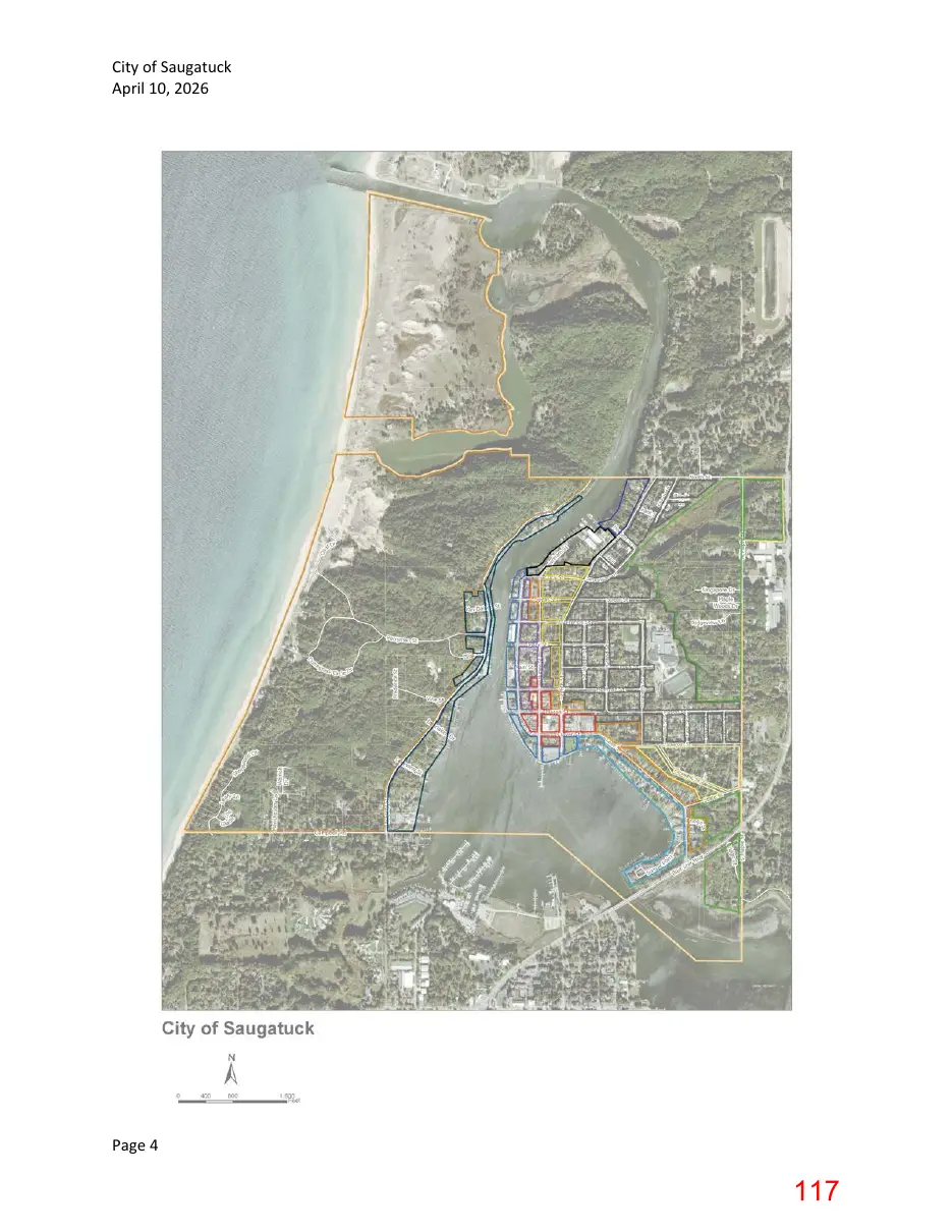
The planning areas reflect natural divisions within the community, shaped by geography, waterfront features, transportation patterns, and the overall arrangement of development. This approach allows for a more organized and practical assessment of existing conditions, ensuring that major portions of the City can be evaluated cohesively while still recognizing the unique characteristics that define smaller areas within each planning area. Please note that these areas have not been formally mapped, but preliminary exhibits are included over the following pages.
Page 3
Page 117
Text of page 117
City of Saugatuck April 10, 2026
Page 4
Page 118
Text of page 118
City of Saugatuck April 10, 2026
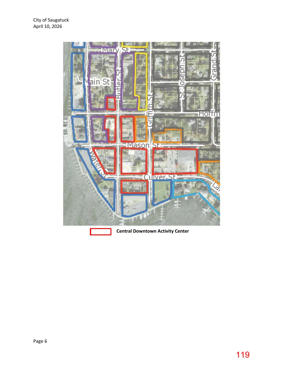
Planning Area One: Central City This area represents the heart of Saugatuck and contains the highest concentration of commercial activity, tourism destinations, civic uses, and walkable neighborhoods. It is defined by a compact development pattern, strong pedestrian orientation, and direct access to the waterfront. Central Downtown Activity Center The Central Downtown Activity Center represents the historic and functional core of the City and serves as its primary center of activity. It is characterized by a cohesive pattern of traditional downtown buildings that define a continuous street edge and support an active, pedestrian-oriented environment. A mix of commercial, civic, and entertainment uses contributes to a vibrant atmosphere. This area serves as the focal point for daily activities, tourism, and community gatherings. Butler and Culver Streets serve as the focal points of the character area. The area is characterized by a cohesive pattern of oneto two-story traditional downtown buildings, many of which are contributing resources within the Historic District, forming a largely continuous “street wall” of buildings from Culver Street to Hoffman Street. In this area, buildings are commonly attached or detached with minimal separations, reinforcing a highly active, pedestrian-oriented environment. However, while the area is predominantly defined by attached storefronts or buildings drawn closer to the right-of-way, the presence of house-scale detached buildings contributes to an eclectic, varied character. This Central Downtown Activity Center is supported by wide sidewalks that extend from building facades to the curb, mature street trees, and streetscape elements such as bike racks, garbage receptacles, and clearly marked crosswalks. §
Buildings: Traditional historic storefronts drawn close to the street; attached buildings or those with minimal setbacks, with some house-scale detached buildings interspersed
Land Use: Retail, offices, restaurants, taverns, entertainment, services, and civic uses
Scale: 1–2 story buildings, occasionally 2.5; compact and continuous at a higher intensity
Blocks and Streets: Traditional street grid with strong connectivity
Streetscape: Wide sidewalks, wayfinding signage, outdoor dining areas, street trees, bike racks, planter boxes, public art, benches, hatched crosswalks, standard street lighting (some decorative), and overhead powerlines
Public Space: Civic spaces, City Hall
Parking: On-street parking on both sides of the streets and two public parking lots with 122 spaces
Walkability: 0-5 minute walk throughout the Central Downtown Activity Center with a mostly complete network of sidewalks
Page 5
Page 119
Text of page 119
City of Saugatuck April 10, 2026
Central Downtown Activity Center
Page 6
Page 120
Text of page 120
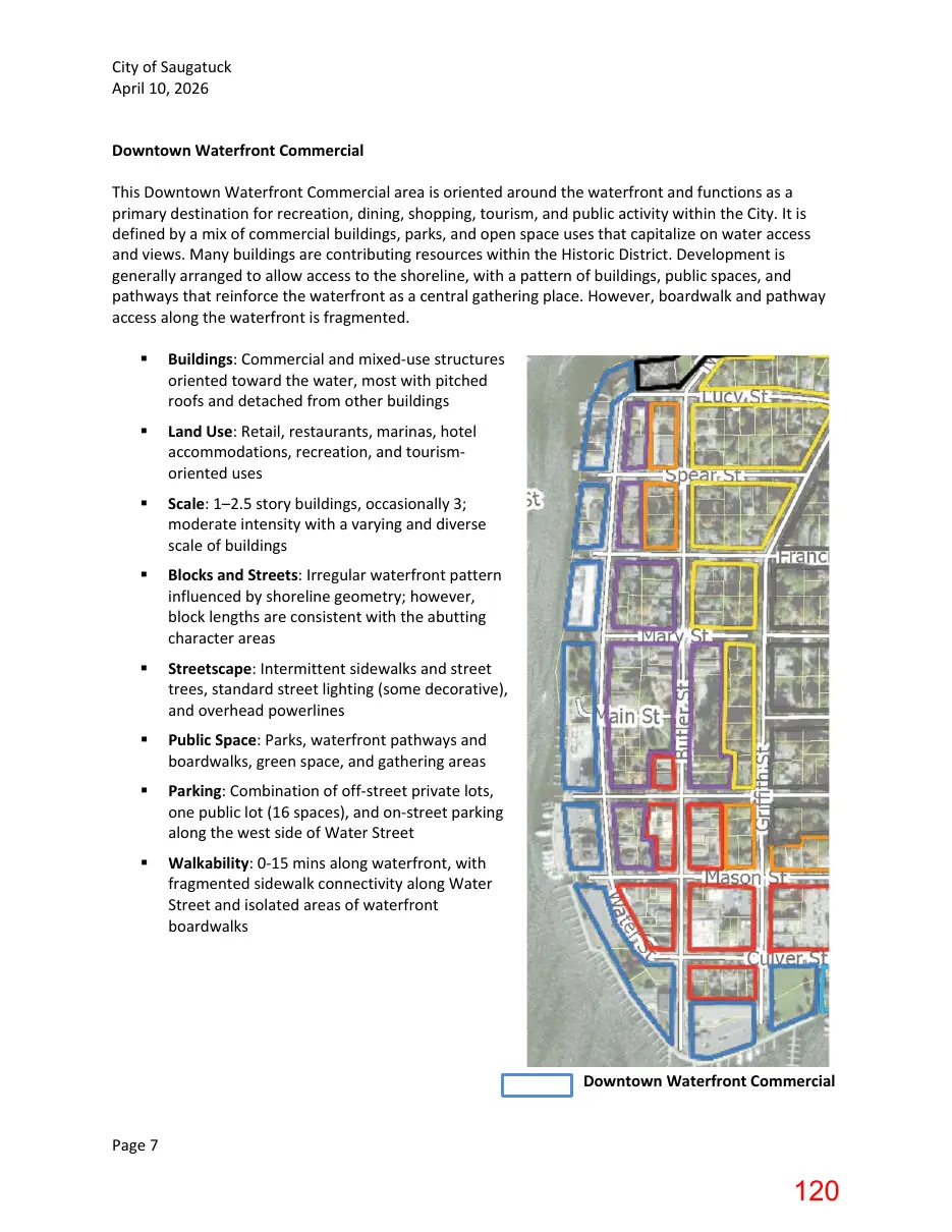
City of Saugatuck April 10, 2026 Downtown Waterfront Commercial This Downtown Waterfront Commercial area is oriented around the waterfront and functions as a primary destination for recreation, dining, shopping, tourism, and public activity within the City. It is defined by a mix of commercial buildings, parks, and open space uses that capitalize on water access and views. Many buildings are contributing resources within the Historic District. Development is generally arranged to allow access to the shoreline, with a pattern of buildings, public spaces, and pathways that reinforce the waterfront as a central gathering place. However, boardwalk and pathway access along the waterfront is fragmented. §
Buildings: Commercial and mixed-use structures oriented toward the water, most with pitched roofs and detached from other buildings
Land Use: Retail, restaurants, marinas, hotel accommodations, recreation, and tourismoriented uses
Scale: 1–2.5 story buildings, occasionally 3; moderate intensity with a varying and diverse scale of buildings
Blocks and Streets: Irregular waterfront pattern influenced by shoreline geometry; however, block lengths are consistent with the abutting character areas
Streetscape: Intermittent sidewalks and street trees, standard street lighting (some decorative), and overhead powerlines
Public Space: Parks, waterfront pathways and boardwalks, green space, and gathering areas
Parking: Combination of off-street private lots, one public lot (16 spaces), and on-street parking along the west side of Water Street
Walkability: 0-15 mins along waterfront, with fragmented sidewalk connectivity along Water Street and isolated areas of waterfront boardwalks
Downtown Waterfront Commercial Page 7
Page 121
Text of page 121
City of Saugatuck April 10, 2026
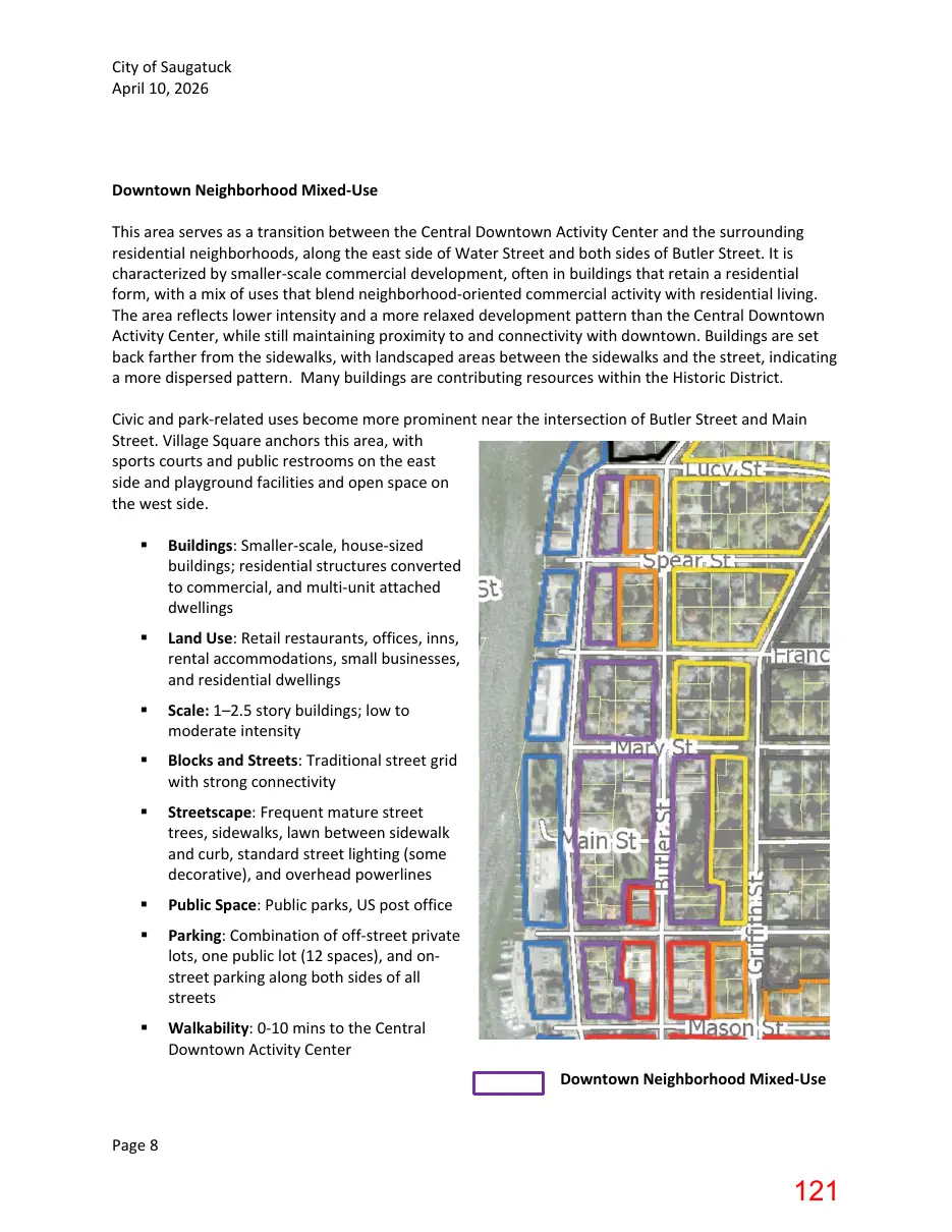
Downtown Neighborhood Mixed-Use This area serves as a transition between the Central Downtown Activity Center and the surrounding residential neighborhoods, along the east side of Water Street and both sides of Butler Street. It is characterized by smaller-scale commercial development, often in buildings that retain a residential form, with a mix of uses that blend neighborhood-oriented commercial activity with residential living. The area reflects lower intensity and a more relaxed development pattern than the Central Downtown Activity Center, while still maintaining proximity to and connectivity with downtown. Buildings are set back farther from the sidewalks, with landscaped areas between the sidewalks and the street, indicating a more dispersed pattern. Many buildings are contributing resources within the Historic District. Civic and park-related uses become more prominent near the intersection of Butler Street and Main Street. Village Square anchors this area, with sports courts and public restrooms on the east side and playground facilities and open space on the west side. §
Buildings: Smaller-scale, house-sized buildings; residential structures converted to commercial, and multi-unit attached dwellings
Land Use: Retail restaurants, offices, inns, rental accommodations, small businesses, and residential dwellings
Scale: 1–2.5 story buildings; low to moderate intensity
Blocks and Streets: Traditional street grid with strong connectivity
Streetscape: Frequent mature street trees, sidewalks, lawn between sidewalk and curb, standard street lighting (some decorative), and overhead powerlines
Public Space: Public parks, US post office
Parking: Combination of off-street private lots, one public lot (12 spaces), and onstreet parking along both sides of all streets
Walkability: 0-10 mins to the Central Downtown Activity Center Downtown Neighborhood Mixed-Use
Page 8
Page 122
Text of page 122
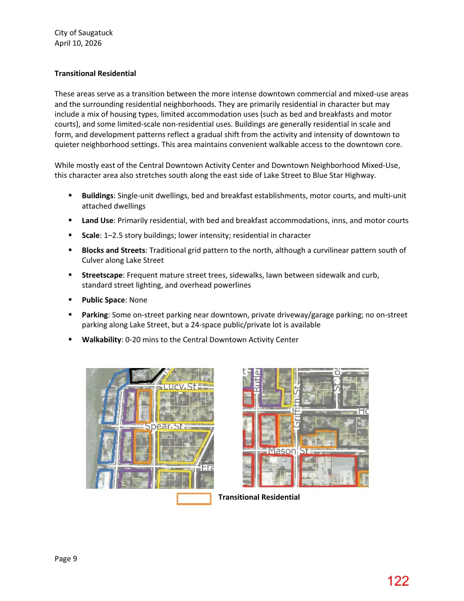
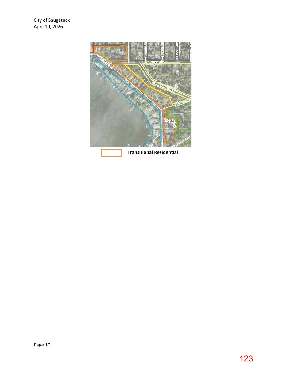
City of Saugatuck April 10, 2026 Transitional Residential These areas serve as a transition between the more intense downtown commercial and mixed-use areas and the surrounding residential neighborhoods. They are primarily residential in character but may include a mix of housing types, limited accommodation uses (such as bed and breakfasts and motor courts), and some limited-scale non-residential uses. Buildings are generally residential in scale and form, and development patterns reflect a gradual shift from the activity and intensity of downtown to quieter neighborhood settings. This area maintains convenient walkable access to the downtown core. While mostly east of the Central Downtown Activity Center and Downtown Neighborhood Mixed-Use, this character area also stretches south along the east side of Lake Street to Blue Star Highway. §
Buildings: Single-unit dwellings, bed and breakfast establishments, motor courts, and multi-unit attached dwellings
Land Use: Primarily residential, with bed and breakfast accommodations, inns, and motor courts
Scale: 1–2.5 story buildings; lower intensity; residential in character
Blocks and Streets: Traditional grid pattern to the north, although a curvilinear pattern south of Culver along Lake Street
Streetscape: Frequent mature street trees, sidewalks, lawn between sidewalk and curb, standard street lighting, and overhead powerlines
Public Space: None
Parking: Some on-street parking near downtown, private driveway/garage parking; no on-street parking along Lake Street, but a 24-space public/private lot is available
Walkability: 0-20 mins to the Central Downtown Activity Center
Transitional Residential
Page 9
Page 123
Text of page 123
City of Saugatuck April 10, 2026
Transitional Residential
Page 10
Page 124
Text of page 124
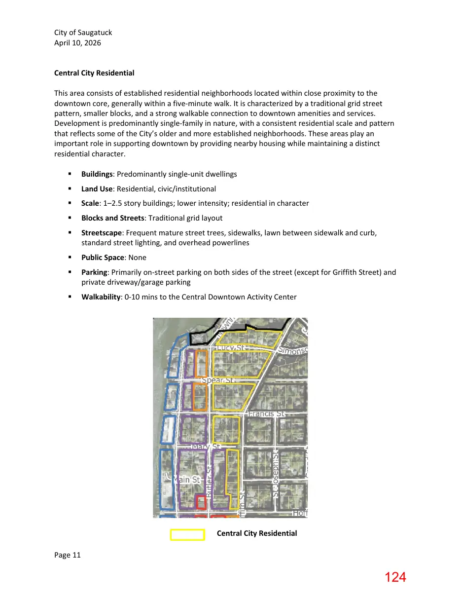
City of Saugatuck April 10, 2026 Central City Residential This area consists of established residential neighborhoods located within close proximity to the downtown core, generally within a five-minute walk. It is characterized by a traditional grid street pattern, smaller blocks, and a strong walkable connection to downtown amenities and services. Development is predominantly single-family in nature, with a consistent residential scale and pattern that reflects some of the City’s older and more established neighborhoods. These areas play an important role in supporting downtown by providing nearby housing while maintaining a distinct residential character. §
Buildings: Predominantly single-unit dwellings
Land Use: Residential, civic/institutional
Scale: 1–2.5 story buildings; lower intensity; residential in character
Blocks and Streets: Traditional grid layout
Streetscape: Frequent mature street trees, sidewalks, lawn between sidewalk and curb, standard street lighting, and overhead powerlines
Public Space: None
Parking: Primarily on-street parking on both sides of the street (except for Griffith Street) and private driveway/garage parking
Walkability: 0-10 mins to the Central Downtown Activity Center
Central City Residential Page 11
Page 125
Text of page 125
City of Saugatuck April 10, 2026
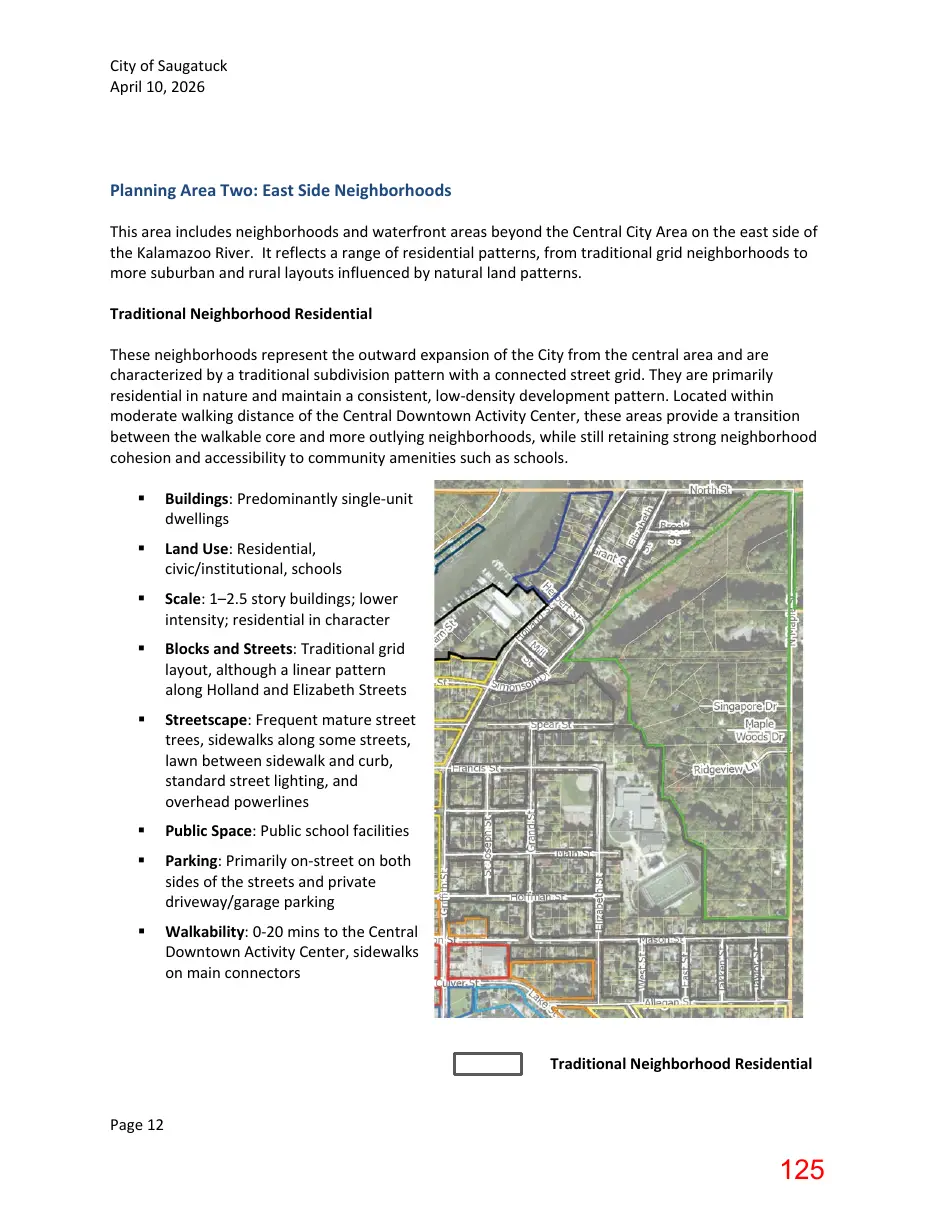
Planning Area Two: East Side Neighborhoods This area includes neighborhoods and waterfront areas beyond the Central City Area on the east side of the Kalamazoo River. It reflects a range of residential patterns, from traditional grid neighborhoods to more suburban and rural layouts influenced by natural land patterns. Traditional Neighborhood Residential These neighborhoods represent the outward expansion of the City from the central area and are characterized by a traditional subdivision pattern with a connected street grid. They are primarily residential in nature and maintain a consistent, low-density development pattern. Located within moderate walking distance of the Central Downtown Activity Center, these areas provide a transition between the walkable core and more outlying neighborhoods, while still retaining strong neighborhood cohesion and accessibility to community amenities such as schools. §
Buildings: Predominantly single-unit dwellings
Land Use: Residential, civic/institutional, schools
Scale: 1–2.5 story buildings; lower intensity; residential in character
Blocks and Streets: Traditional grid layout, although a linear pattern along Holland and Elizabeth Streets
Streetscape: Frequent mature street trees, sidewalks along some streets, lawn between sidewalk and curb, standard street lighting, and overhead powerlines
Public Space: Public school facilities
Parking: Primarily on-street on both sides of the streets and private driveway/garage parking
Walkability: 0-20 mins to the Central Downtown Activity Center, sidewalks on main connectors
Traditional Neighborhood Residential Page 12
Page 126
Text of page 126
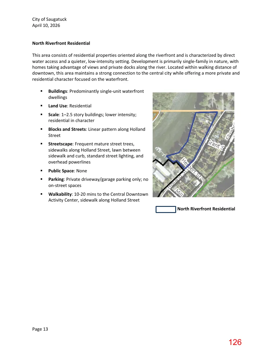
City of Saugatuck April 10, 2026 North Riverfront Residential This area consists of residential properties oriented along the riverfront and is characterized by direct water access and a quieter, low-intensity setting. Development is primarily single-family in nature, with homes taking advantage of views and private docks along the river. Located within walking distance of downtown, this area maintains a strong connection to the central city while offering a more private and residential character focused on the waterfront. §
Buildings: Predominantly single-unit waterfront dwellings
Land Use: Residential
Scale: 1–2.5 story buildings; lower intensity; residential in character
Blocks and Streets: Linear pattern along Holland Street
Streetscape: Frequent mature street trees, sidewalks along Holland Street, lawn between sidewalk and curb, standard street lighting, and overhead powerlines
Public Space: None
Parking: Private driveway/garage parking only; no on-street spaces
Walkability: 10-20 mins to the Central Downtown Activity Center, sidewalk along Holland Street North Riverfront Residential
Page 13
Page 127
Text of page 127
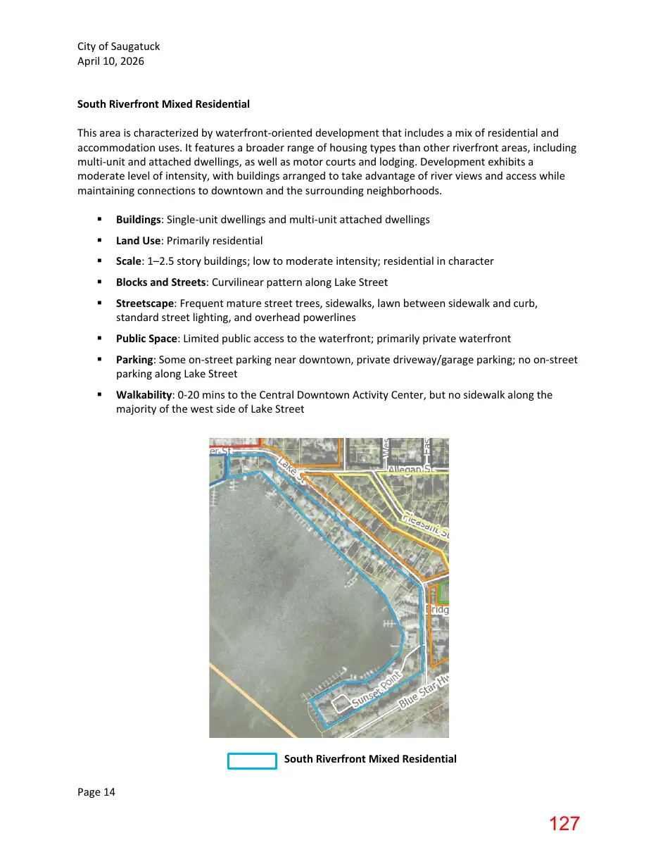
City of Saugatuck April 10, 2026 South Riverfront Mixed Residential This area is characterized by waterfront-oriented development that includes a mix of residential and accommodation uses. It features a broader range of housing types than other riverfront areas, including multi-unit and attached dwellings, as well as motor courts and lodging. Development exhibits a moderate level of intensity, with buildings arranged to take advantage of river views and access while maintaining connections to downtown and the surrounding neighborhoods. §
Buildings: Single-unit dwellings and multi-unit attached dwellings
Land Use: Primarily residential
Scale: 1–2.5 story buildings; low to moderate intensity; residential in character
Blocks and Streets: Curvilinear pattern along Lake Street
Streetscape: Frequent mature street trees, sidewalks, lawn between sidewalk and curb, standard street lighting, and overhead powerlines
Public Space: Limited public access to the waterfront; primarily private waterfront
Parking: Some on-street parking near downtown, private driveway/garage parking; no on-street parking along Lake Street
Walkability: 0-20 mins to the Central Downtown Activity Center, but no sidewalk along the majority of the west side of Lake Street
South Riverfront Mixed Residential Page 14
Page 128
Text of page 128
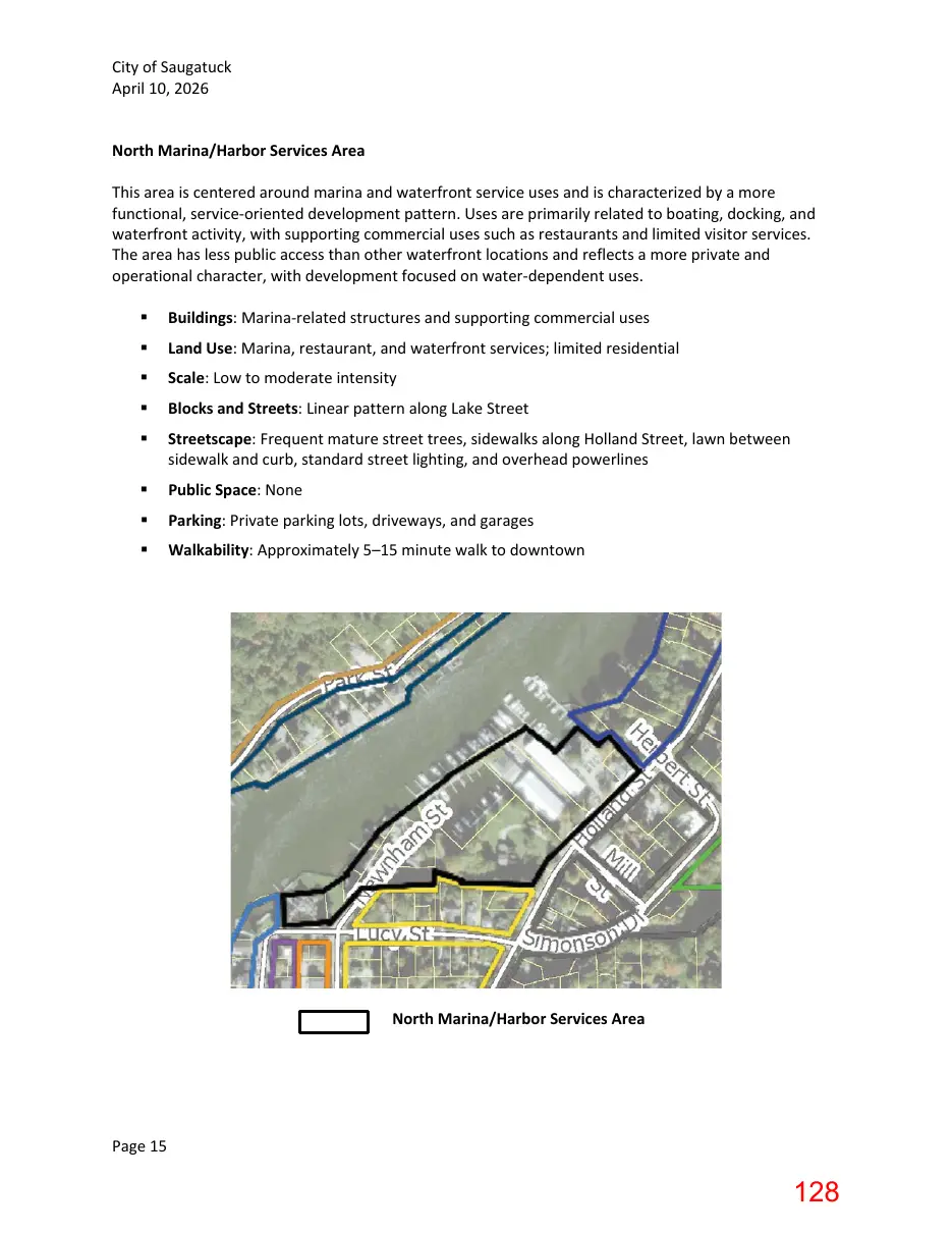
City of Saugatuck April 10, 2026 North Marina/Harbor Services Area This area is centered around marina and waterfront service uses and is characterized by a more functional, service-oriented development pattern. Uses are primarily related to boating, docking, and waterfront activity, with supporting commercial uses such as restaurants and limited visitor services. The area has less public access than other waterfront locations and reflects a more private and operational character, with development focused on water-dependent uses. §
Buildings: Marina-related structures and supporting commercial uses
Land Use: Marina, restaurant, and waterfront services; limited residential
Scale: Low to moderate intensity
Blocks and Streets: Linear pattern along Lake Street
Streetscape: Frequent mature street trees, sidewalks along Holland Street, lawn between sidewalk and curb, standard street lighting, and overhead powerlines
Public Space: None
Parking: Private parking lots, driveways, and garages
Walkability: Approximately 5–15 minute walk to downtown
North Marina/Harbor Services Area
Page 15
Page 129
Text of page 129
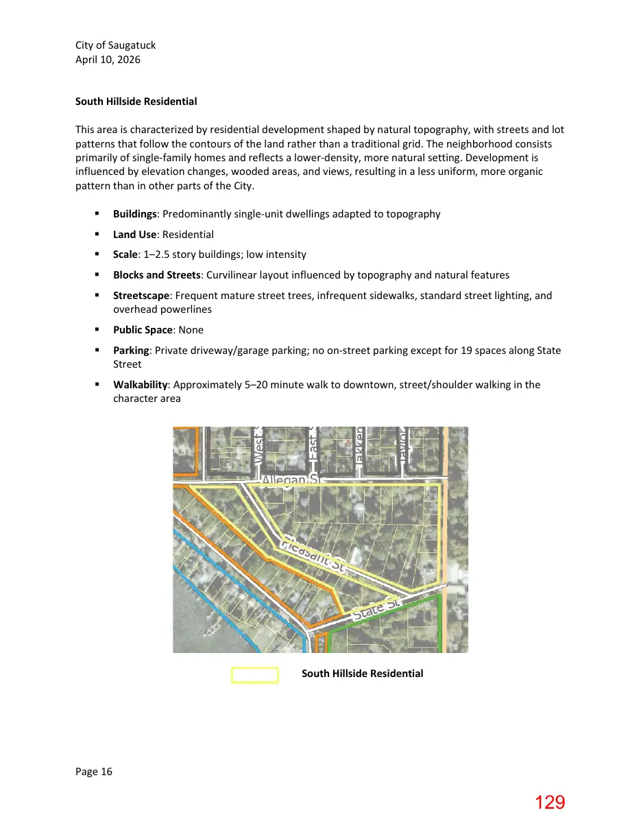
City of Saugatuck April 10, 2026 South Hillside Residential This area is characterized by residential development shaped by natural topography, with streets and lot patterns that follow the contours of the land rather than a traditional grid. The neighborhood consists primarily of single-family homes and reflects a lower-density, more natural setting. Development is influenced by elevation changes, wooded areas, and views, resulting in a less uniform, more organic pattern than in other parts of the City. §
Buildings: Predominantly single-unit dwellings adapted to topography
Land Use: Residential
Scale: 1–2.5 story buildings; low intensity
Blocks and Streets: Curvilinear layout influenced by topography and natural features
Streetscape: Frequent mature street trees, infrequent sidewalks, standard street lighting, and overhead powerlines
Public Space: None
Parking: Private driveway/garage parking; no on-street parking except for 19 spaces along State Street
Walkability: Approximately 5–20 minute walk to downtown, street/shoulder walking in the character area
South Hillside Residential
Page 16
Page 130
Text of page 130
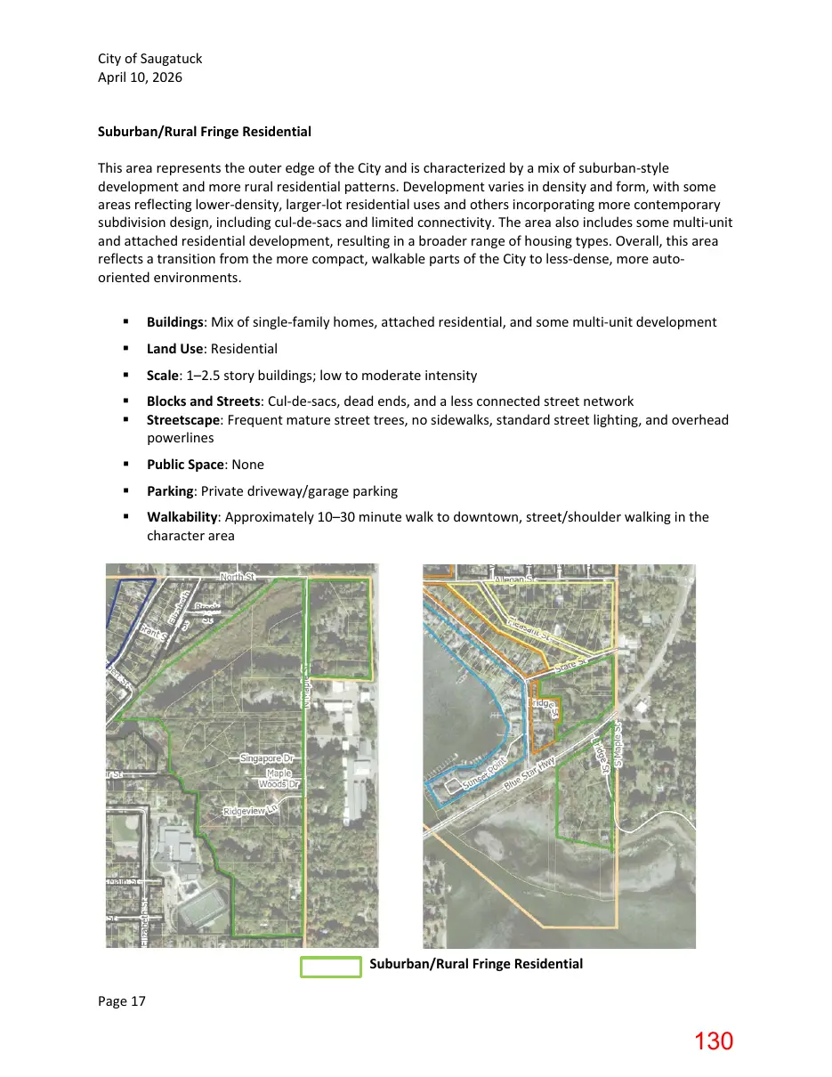
City of Saugatuck April 10, 2026 Suburban/Rural Fringe Residential This area represents the outer edge of the City and is characterized by a mix of suburban-style development and more rural residential patterns. Development varies in density and form, with some areas reflecting lower-density, larger-lot residential uses and others incorporating more contemporary subdivision design, including cul-de-sacs and limited connectivity. The area also includes some multi-unit and attached residential development, resulting in a broader range of housing types. Overall, this area reflects a transition from the more compact, walkable parts of the City to less-dense, more autooriented environments. §
Buildings: Mix of single-family homes, attached residential, and some multi-unit development
Land Use: Residential
Scale: 1–2.5 story buildings; low to moderate intensity
Blocks and Streets: Cul-de-sacs, dead ends, and a less connected street network Streetscape: Frequent mature street trees, no sidewalks, standard street lighting, and overhead powerlines
Public Space: None
Parking: Private driveway/garage parking
Walkability: Approximately 10–30 minute walk to downtown, street/shoulder walking in the character area
Suburban/Rural Fringe Residential Page 17
Page 131
Text of page 131
City of Saugatuck April 10, 2026
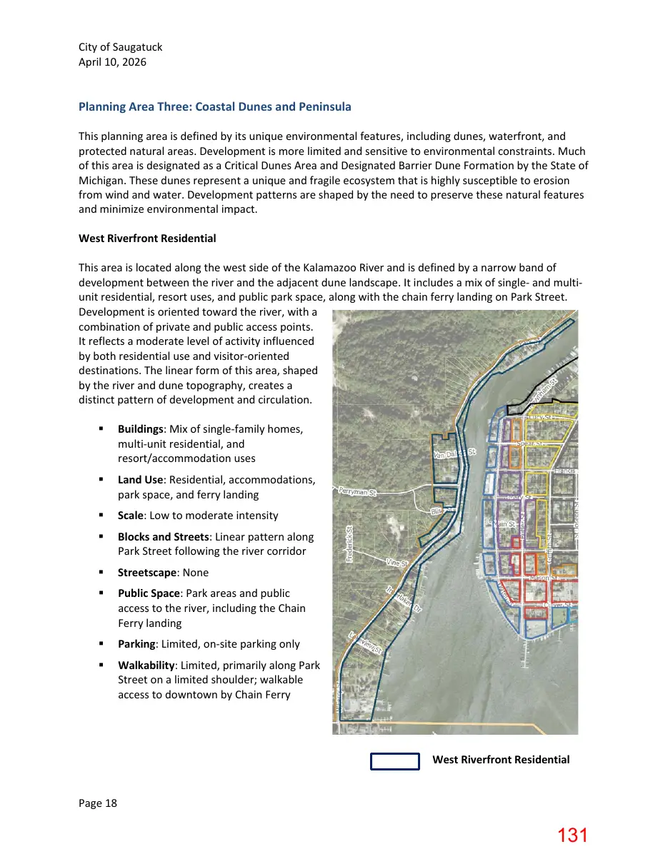
Planning Area Three: Coastal Dunes and Peninsula This planning area is defined by its unique environmental features, including dunes, waterfront, and protected natural areas. Development is more limited and sensitive to environmental constraints. Much of this area is designated as a Critical Dunes Area and Designated Barrier Dune Formation by the State of Michigan. These dunes represent a unique and fragile ecosystem that is highly susceptible to erosion from wind and water. Development patterns are shaped by the need to preserve these natural features and minimize environmental impact. West Riverfront Residential This area is located along the west side of the Kalamazoo River and is defined by a narrow band of development between the river and the adjacent dune landscape. It includes a mix of singleand multiunit residential, resort uses, and public park space, along with the chain ferry landing on Park Street. Development is oriented toward the river, with a combination of private and public access points. It reflects a moderate level of activity influenced by both residential use and visitor-oriented destinations. The linear form of this area, shaped by the river and dune topography, creates a distinct pattern of development and circulation. §
Buildings: Mix of single-family homes, multi-unit residential, and resort/accommodation uses
Land Use: Residential, accommodations, park space, and ferry landing
Scale: Low to moderate intensity
Blocks and Streets: Linear pattern along Park Street following the river corridor
Streetscape: None
Public Space: Park areas and public access to the river, including the Chain Ferry landing
Parking: Limited, on-site parking only
Walkability: Limited, primarily along Park Street on a limited shoulder; walkable access to downtown by Chain Ferry
West Riverfront Residential Page 18
Page 132
Text of page 132
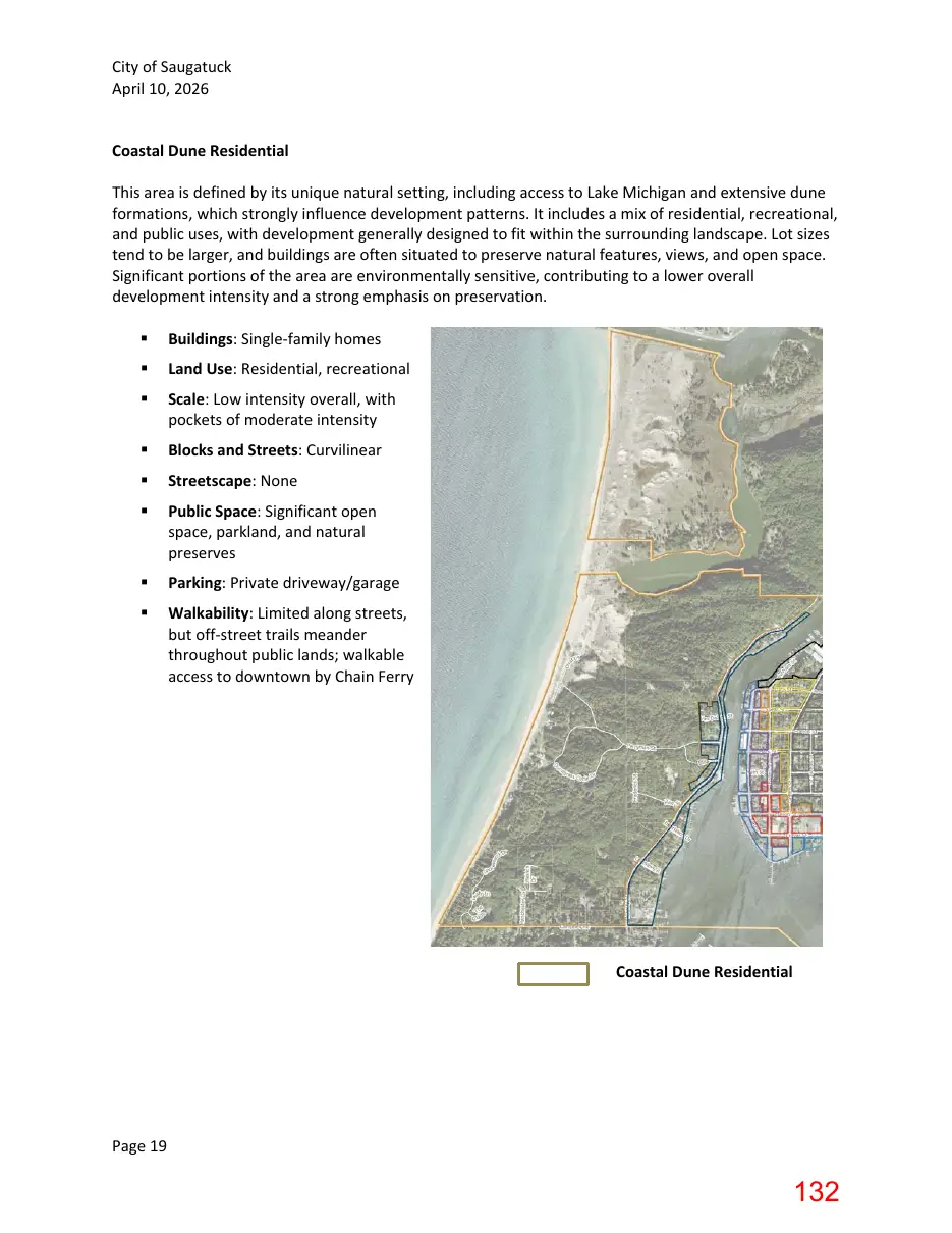
City of Saugatuck April 10, 2026 Coastal Dune Residential This area is defined by its unique natural setting, including access to Lake Michigan and extensive dune formations, which strongly influence development patterns. It includes a mix of residential, recreational, and public uses, with development generally designed to fit within the surrounding landscape. Lot sizes tend to be larger, and buildings are often situated to preserve natural features, views, and open space. Significant portions of the area are environmentally sensitive, contributing to a lower overall development intensity and a strong emphasis on preservation. §
Buildings: Single-family homes
Land Use: Residential, recreational
Scale: Low intensity overall, with pockets of moderate intensity
Blocks and Streets: Curvilinear
Streetscape: None
Public Space: Significant open space, parkland, and natural preserves
Parking: Private driveway/garage
Walkability: Limited along streets, but off-street trails meander throughout public lands; walkable access to downtown by Chain Ferry
Coastal Dune Residential
Page 19