
Planning Agenda item 5A
142 Butler, Site Plan Review
Planning Commission, Thursday, September 18, 2025
Download these 22 pages, 11.4 MB Whole packet, 190 pages, 63.8 MB
Page 8
Text of page 8
MEMORANDUM City of Saugatuck Planning Commission Memo Date: Request: Address: Parcel: Lot Size: Complete: City Staff:
September 12, 2025 Site Plan Review 142 Butler Street 03-57-300-176-00 1,980 square feet Conditionally Grayson Moore
Meeting Date: Applicant: Project Name: Plan Date: Zoning District: Recommendation: Consultant:
September 18, 2025 Teresa Hendricks Lucia’s Imports July 28, 2025 City Center C-1 Deny or Postpone David M. Jirousek, AICP
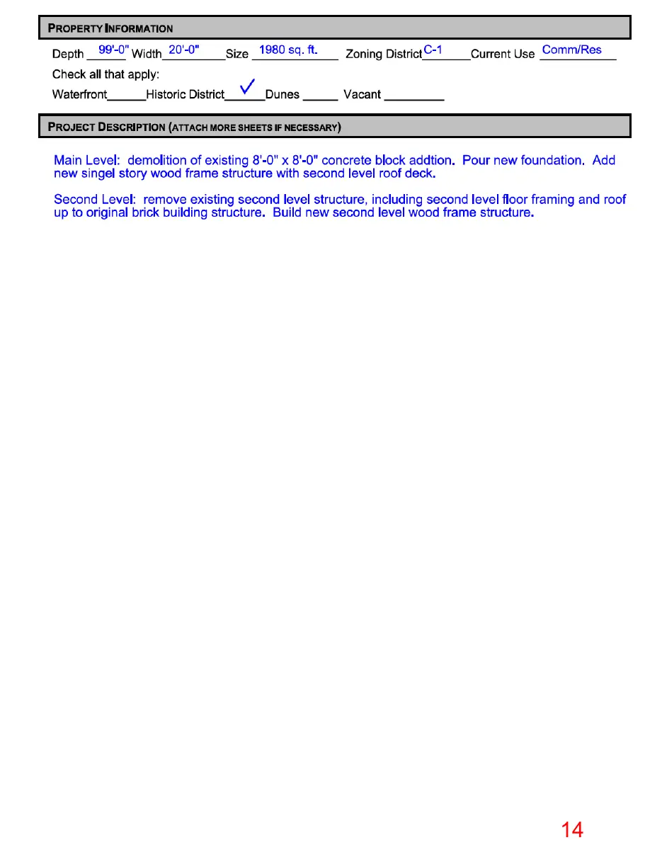
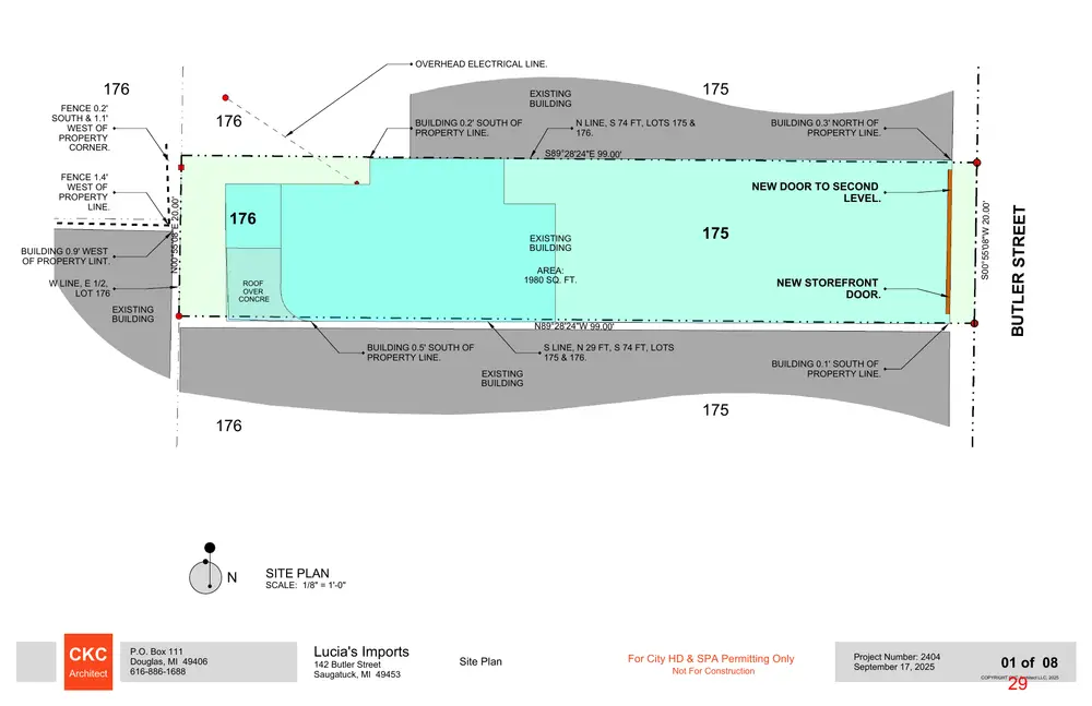
Overview The applicant proposes revisions to the east storefront elevation, demolition of the firstand second-floor rear portions of the building, reconstruction of the first-floor rear addition, and construction of a second-floor bedroom addition and roof deck. This memo provides a compliance review related to all applicable zoning standards and requirements, including Section 154.025 C1 City Center Commercial District and Section 154.060 Site Plan Review. Background 2024 Historic District Commission and Administrative Review: In late 2024, the Historic District Commission approved a comprehensive façade renovation for the existing commercial building. The previous proposal featured a first-floor entry on the left and a second-floor unit entry to the right, with a projecting storefront window display area situated between them. This was also approved administratively as a site plan amendment. 2025 Historic District Commission Review: As part of the recent Historic District Commission and Planning Commission applications, the projecting storefront window plan was revised to be flush with the front wall of the building. The Historic District Commission denied the street facing window change, so the 2024 approval remains effective.
102 Butler Street P.O. Box 86 Saugatuck, MI 49453 Phone: 269-857-2603 Website: www.saugatuckcity.com
Page 9
Text of page 9
City of Saugatuck Planning Commission 142 Butler September 12, 2025 Page 2
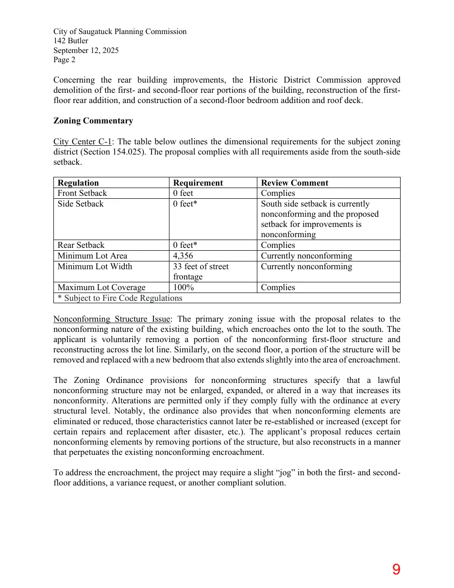
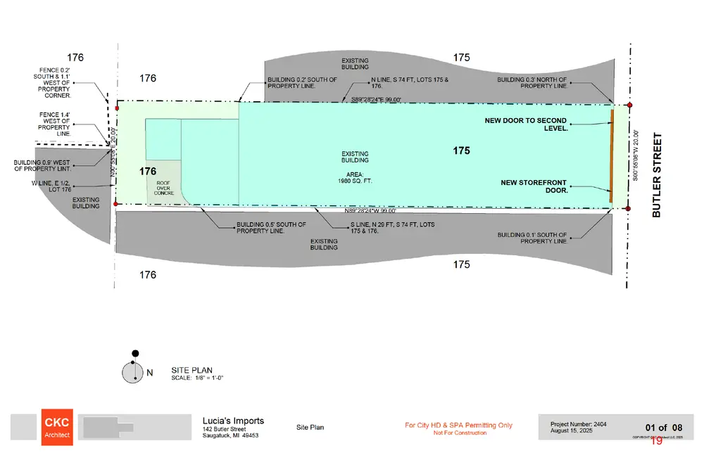
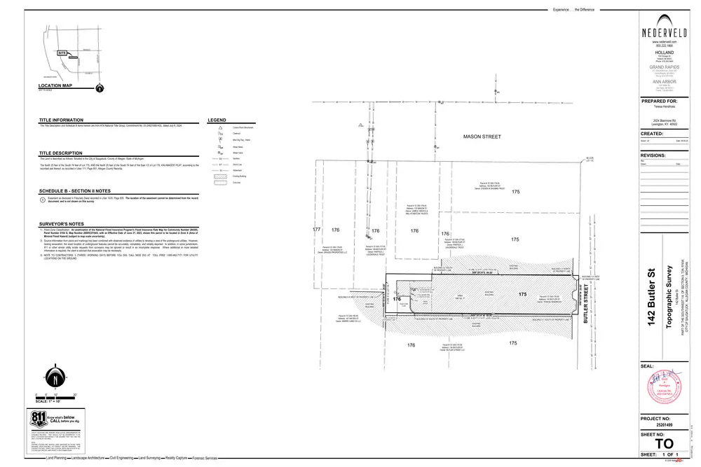
Concerning the rear building improvements, the Historic District Commission approved demolition of the firstand second-floor rear portions of the building, reconstruction of the firstfloor rear addition, and construction of a second-floor bedroom addition and roof deck. Zoning Commentary City Center C-1: The table below outlines the dimensional requirements for the subject zoning district (Section 154.025). The proposal complies with all requirements aside from the south-side setback. Regulation Front Setback Side Setback
Rear Setback Minimum Lot Area Minimum Lot Width
Requirement 0 feet 0 feet*
0 feet* 4,356 33 feet of street frontage Maximum Lot Coverage 100% * Subject to Fire Code Regulations
Review Comment Complies South side setback is currently nonconforming and the proposed setback for improvements is nonconforming Complies Currently nonconforming Currently nonconforming Complies
Nonconforming Structure Issue: The primary zoning issue with the proposal relates to the nonconforming nature of the existing building, which encroaches onto the lot to the south. The applicant is voluntarily removing a portion of the nonconforming first-floor structure and reconstructing across the lot line. Similarly, on the second floor, a portion of the structure will be removed and replaced with a new bedroom that also extends slightly into the area of encroachment. The Zoning Ordinance provisions for nonconforming structures specify that a lawful nonconforming structure may not be enlarged, expanded, or altered in a way that increases its nonconformity. Alterations are permitted only if they comply fully with the ordinance at every structural level. Notably, the ordinance also provides that when nonconforming elements are eliminated or reduced, those characteristics cannot later be re-established or increased (except for certain repairs and replacement after disaster, etc.). The applicant’s proposal reduces certain nonconforming elements by removing portions of the structure, but also reconstructs in a manner that perpetuates the existing nonconforming encroachment. To address the encroachment, the project may require a slight “jog” in both the firstand secondfloor additions, a variance request, or another compliant solution.
Page 10
Text of page 10
City of Saugatuck Planning Commission 142 Butler September 12, 2025 Page 3
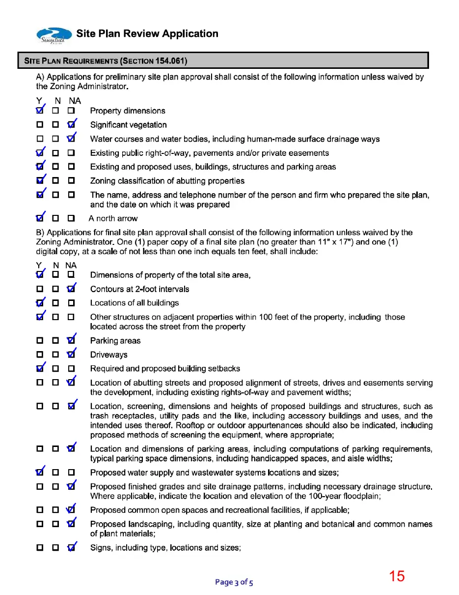
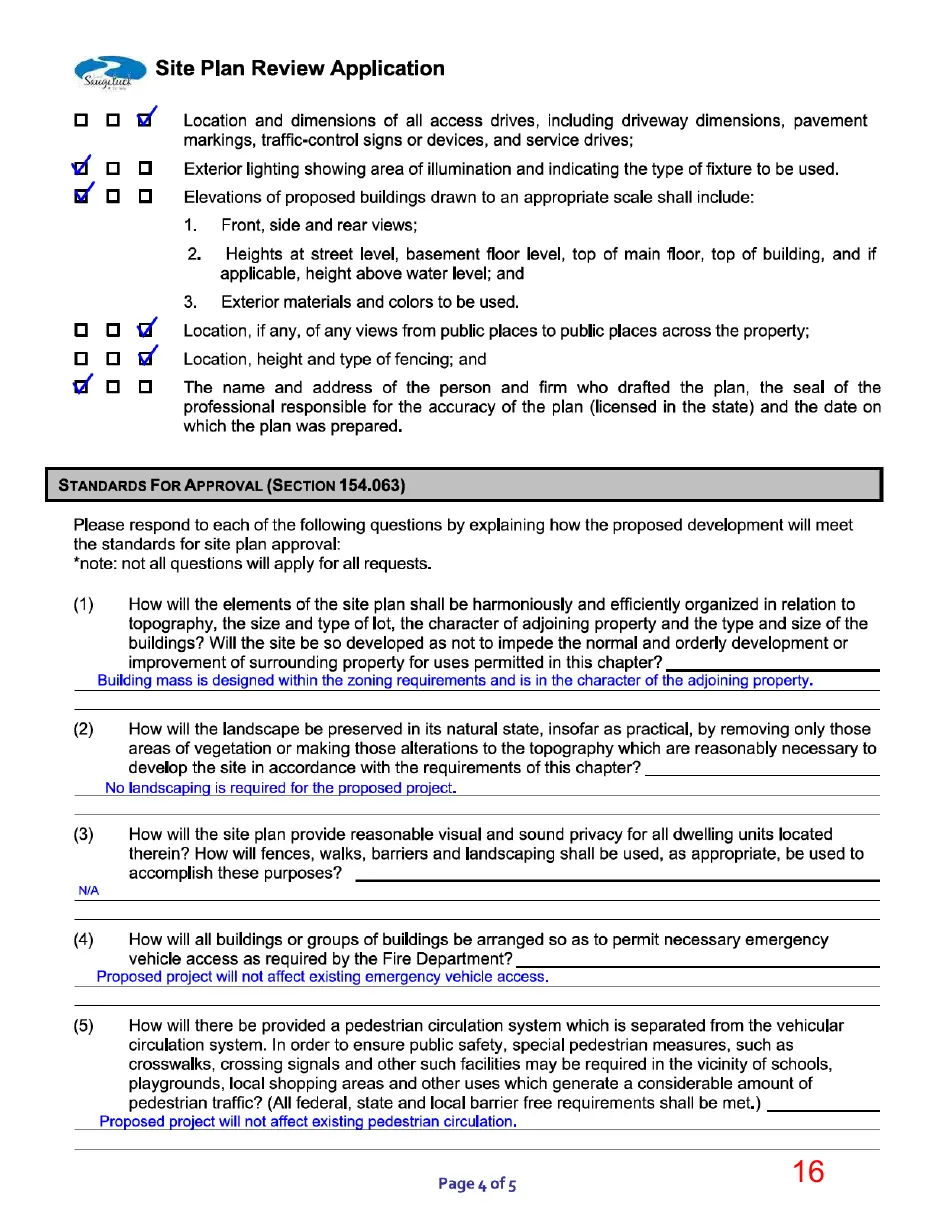
Site Plan Standards of Approval Applications: The submittal is sufficiently complete for review in accordance with Section 154.061, except that the applicant should provide information concerning any new exterior lighting and the location of trash receptacles. Standards for Formal Site Plan Approval: The following standards for site plan review and approval apply to the project per Section 154.063. Comments related to each standard are provided for consideration by the Planning Commission. A. All elements of the site plan shall be harmoniously and efficiently organized in relation to topography, the size and type of lot, the character of adjoining property and the type and size of the buildings. The site will be so developed as not to impede the normal and orderly development or improvement of surrounding property for uses permitted in this chapter. Comment: The overall design includes logical and appropriate rear additions for rebuilt storage space and expanded second-floor living space. However, the nonconforming south side setback remains the primary concern related to compliance. B. The landscape shall be preserved in its natural state, insofar as practical, by removing only those areas of vegetation or making those alterations to the topography which are reasonably necessary to develop the site in accordance with the requirements of this chapter. Comment: There will be no additional site disturbance, as all work is proposed within the existing building footprint. Existing natural features will remain unchanged, with no alterations to the topography. C. The site plan shall provide reasonable visual and sound privacy for all dwelling units located therein. Fences, walks, barriers and landscaping shall be used, as appropriate, to accomplish these purposes. Comment: The rear deck area of the upper residential unit is reasonably private, and no additional screening measures are recommended. D. All buildings or groups of buildings shall be arranged so as to permit necessary emergency vehicle access as required by the Fire Department. Comment: Approval of the site plan amendment is contingent upon approval of the Fire Department. E. There shall be provided a pedestrian circulation system which is separated from the vehicular circulation system. In order to ensure public safety, special pedestrian measures, such as crosswalks, crossing signals and other such facilities may be required in the vicinity of schools,
Page 11
Text of page 11
City of Saugatuck Planning Commission 142 Butler September 12, 2025 Page 4
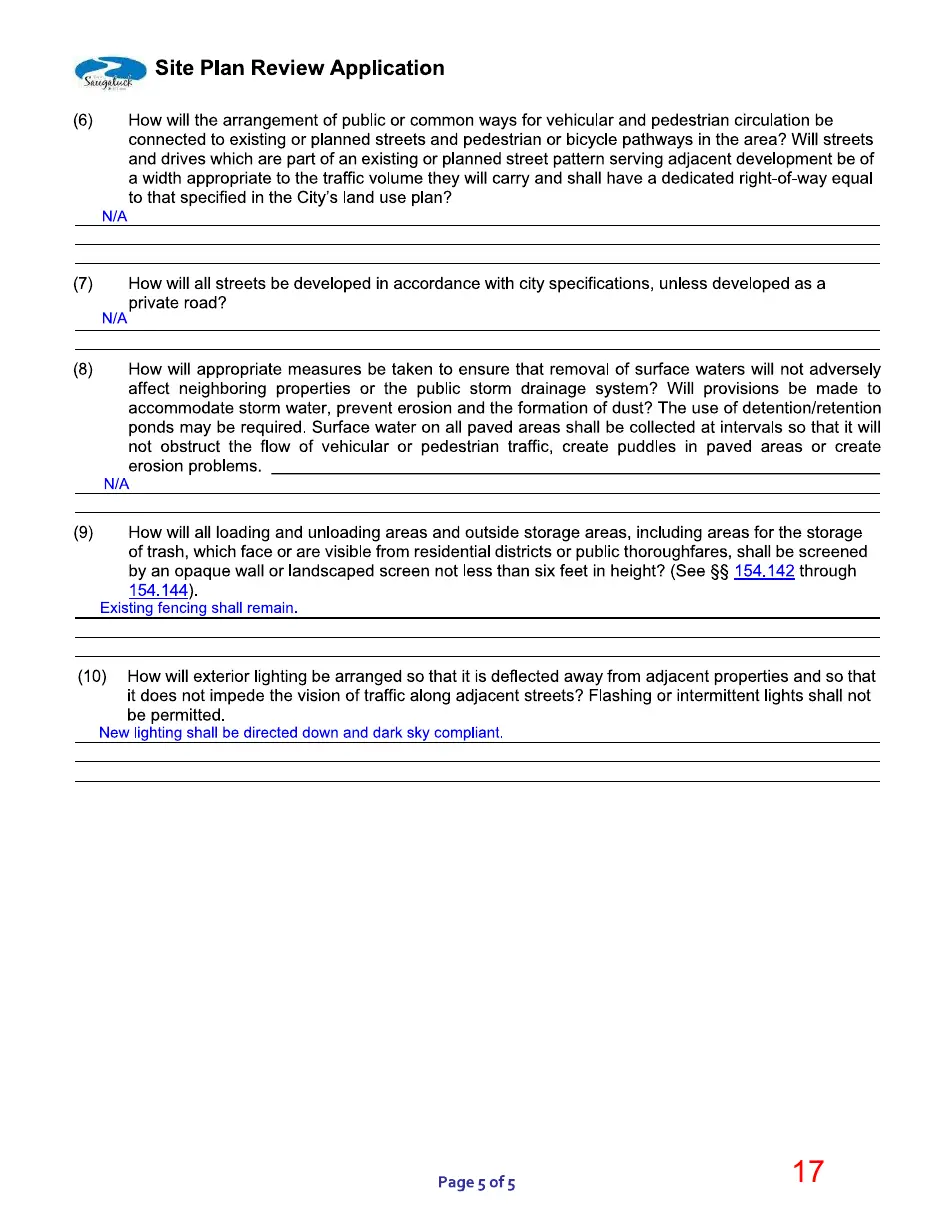
playgrounds, local shopping areas and other uses which generate a considerable amount of pedestrian traffic. All federal, state, and local barrier free requirements shall be met. Comment: This standard is not applicable. The proposed improvements have no impact on the overall pedestrian circulation system. F. The arrangement of public or common ways for vehicular and pedestrian circulation shall be connected to existing or planned streets and pedestrian or bicycle pathways in the area. Streets and drives which are part of an existing or planned street pattern serving adjacent development shall be of a width appropriate to the traffic volume they will carry and shall have a dedicated right-of-way equal to that specified in the City’s land use plan. Comment: No changes to public or common ways for vehicle or pedestrian access are proposed. G. All streets shall be developed in accordance with city specifications, unless developed as a private road. Comment: This standard is not applicable, as streets are not proposed. H. Appropriate measures shall be taken to ensure that removal of surface waters will not adversely affect neighboring properties or the public storm drainage system. Provisions shall be made to accommodate storm water, prevent erosion and the formation of dust. The use of detention/retention ponds may be required. Surface water on all paved areas shall be collected at intervals so that it will not obstruct the flow of vehicular or pedestrian traffic, create puddles in paved areas or create erosion problems. Comment: The City’s engineering consultant has provided comments regarding water, sewer, and stormwater issues. All comments must be addressed by the applicant. I. All loading and unloading areas and outside storage areas, including areas for the storage of trash, which face or are visible from residential districts or public thoroughfares, shall be screened by an opaque wall or landscaped screen not less than six feet in height. (See §§ 154.142 through 154.144). Comment: The applicant should provide information regarding current and proposed methods for storing trash bins. J. Exterior lighting shall be arranged so that it is deflected away from adjacent properties and so that it does not impede the vision of traffic along adjacent streets. Flashing or intermittent lights shall not be permitted. Comment: Lighting details were not provided.
Page 12
Text of page 12
City of Saugatuck Planning Commission 142 Butler September 12, 2025 Page 5
K. In approving the site plan, the Planning Commission may recommend that a bond or other financial guarantee of ample sum be furnished by the developer to ensure compliance for such requirements as drives, walks, utilities, parking, landscaping and the like (see § 154.173). Comment: A financial guarantee is not recommended. Recommendation It is our opinion that the application should be denied as presented due to the south side setback compliance issue. Alternatively, consideration could be postponed to a future meeting if the applicant plans to redesign the improvements to comply with the south side setback. The applicant should also address the engineering comments and provide lighting specifics and trash bin storage information. Fire Department approval is also necessary.
Page 13
This page is a scanned image with no text layer. The PDF of these pages has it at full resolution.
Page 14
This page is a scanned image with no text layer. The PDF of these pages has it at full resolution.
Page 15
This page is a scanned image with no text layer. The PDF of these pages has it at full resolution.
Page 16
This page is a scanned image with no text layer. The PDF of these pages has it at full resolution.
Page 17
This page is a scanned image with no text layer. The PDF of these pages has it at full resolution.
Page 18
This page is a scanned image with no text layer. The PDF of these pages has it at full resolution.
Page 19
This page is a scanned image with no text layer. The PDF of these pages has it at full resolution.
Page 20
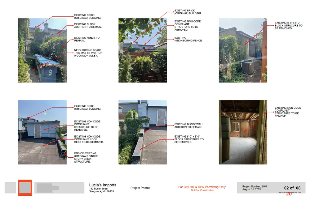
This page is a scanned image with no text layer. The PDF of these pages has it at full resolution.
Page 21
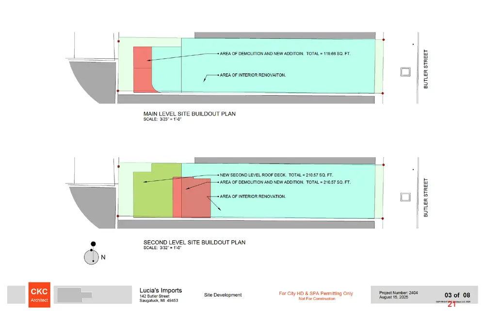
This page is a scanned image with no text layer. The PDF of these pages has it at full resolution.
Page 22
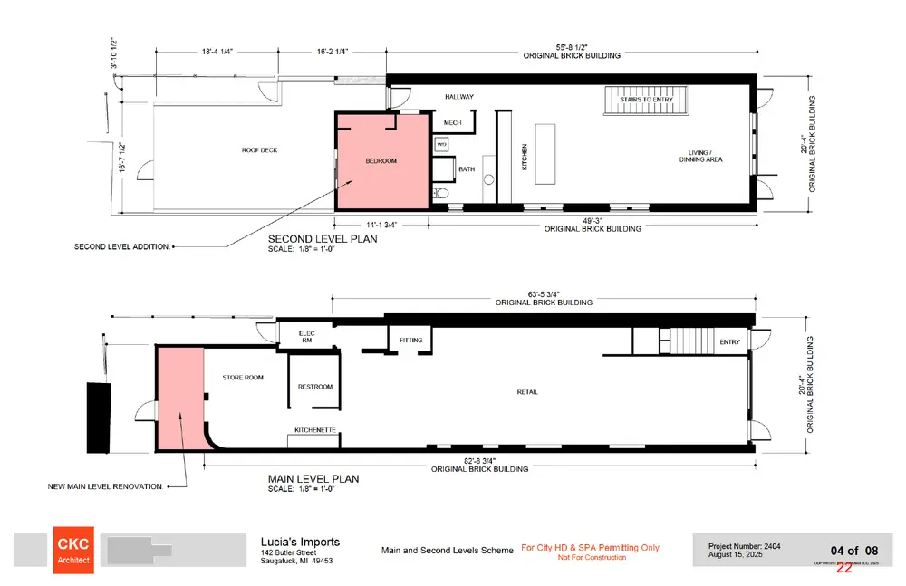
This page is a scanned image with no text layer. The PDF of these pages has it at full resolution.
Page 23
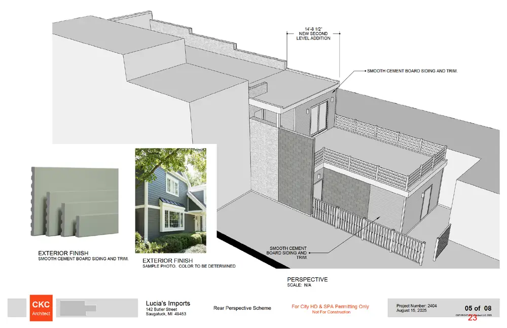
This page is a scanned image with no text layer. The PDF of these pages has it at full resolution.
Page 24
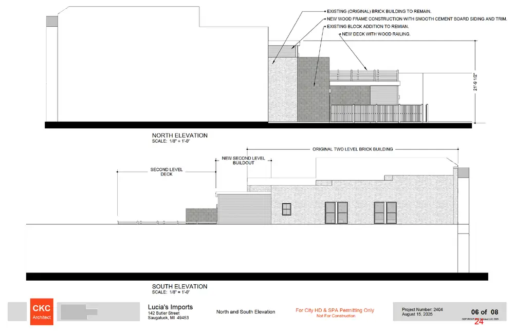
This page is a scanned image with no text layer. The PDF of these pages has it at full resolution.
Page 25
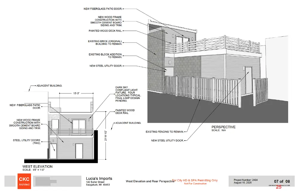
This page is a scanned image with no text layer. The PDF of these pages has it at full resolution.
Page 26
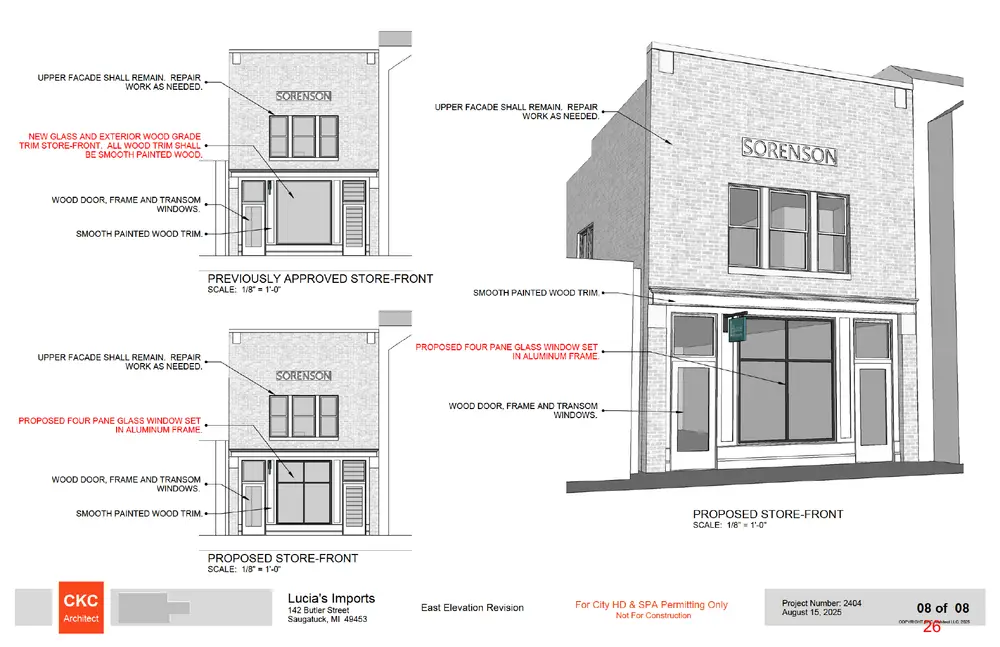
This page is a scanned image with no text layer. The PDF of these pages has it at full resolution.
Page 27
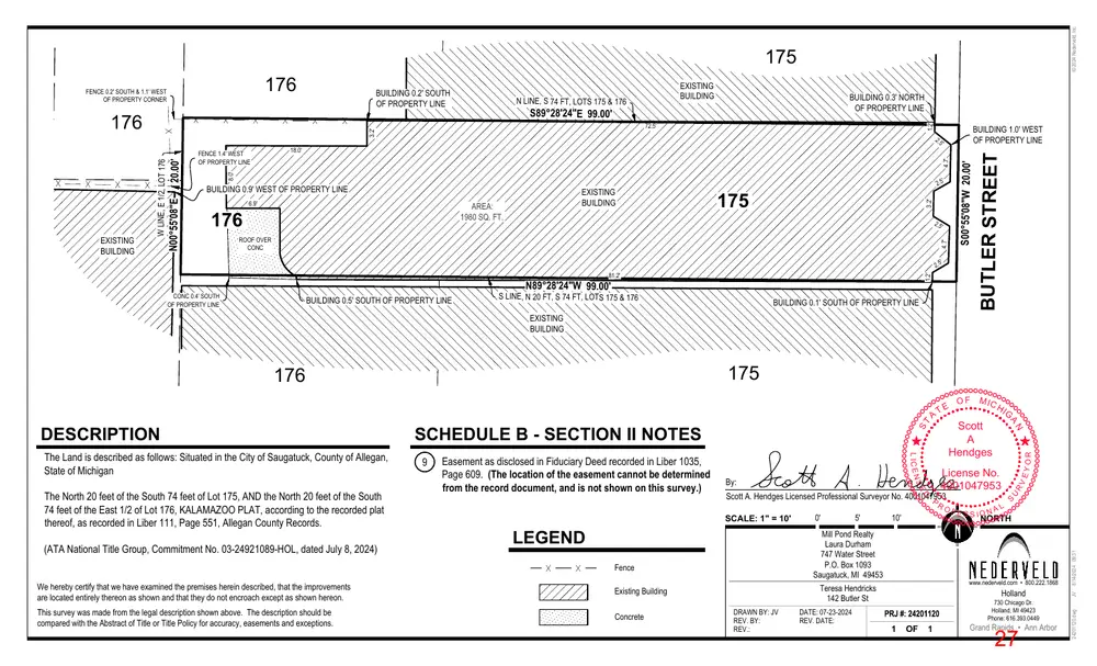
Text of page 27
© 2024 Nederveld, Inc.
175 N LINE, S 74 FT, LOTS 175 & 176 72.5'
2.5
AREA: 1980 SQ. FT.
3.2'
6.9'
EXISTING BUILDING
2.5 ' 4.7'
ROOF OVER CONC
1.2'
2.5 81.2'
N89°28'24"W 99.00' CONC 0.4' SOUTH OF PROPERTY LINE
BUILDING 0.5' SOUTH OF PROPERTY LINE
S LINE, N 20 FT, S 74 FT, LOTS 175 & 176
BUILDING 0.1' SOUTH OF PROPERTY LINE
S00°55'08"W 20.00'
4.7'
18.0'
8.0'
20.00'
W LINE, E 1/2, LOT 176
BUILDING 1.0' WEST OF PROPERTY LINE
2.5 '
BUILDING 0.9' WEST OF PROPERTY LINE
N00°55'08"E
EXISTING BUILDING
FENCE 1.4' WEST OF PROPERTY LINE
BUILDING 0.3' NORTH OF PROPERTY LINE
S89°28'24"E 99.00'
3.2'
EXISTING BUILDING
BUTLER STREET
BUILDING 0.2' SOUTH OF PROPERTY LINE
1.2'
FENCE 0.2' SOUTH & 1.1' WEST OF PROPERTY CORNER
EXISTING BUILDING
10'
DRAWN BY: JV REV. BY: REV.:
DATE: 07-23-2024 REV. DATE:
EY O
R L
www.nederveld.com • 800.222.1868
Holland
PRJ #:24201120 1
OF
730 Chicago Dr. Holland, MI 49423 Phone: 616.393.0449
Grand Rapids • Ann Arbor
8/14/2024 09:31
NORTH
JV
Concrete
F E S S IO NA
24201120.dwg
Fence
This survey was made from the legal description shown above. The description should be compared with the Abstract of Title or Title Policy for accuracy, easements and exceptions.
Mill Pond Realty Laura Durham 747 Water Street P.O. Box 1093 Saugatuck, MI 49453 Teresa Hendricks 142 Butler St
LEGEND Existing Building
Scott A. Hendges Licensed Professional Surveyor No. 4001047953 P SCALE: 1" = 10'
RV
License No. 4001047953 RO
We hereby certify that we have examined the premises herein described, that the improvements are located entirely thereon as shown and that they do not encroach except as shown hereon.
Scott A Hendges
By:
O F M IC HI
(ATA National Title Group, Commitment No. 03-24921089-HOL, dated July 8, 2024)
Easement as disclosed in Fiduciary Deed recorded in Liber 1035, Page 609. (The location of the easement cannot be determined from the record document, and is not shown on this survey.)
SE
The North 20 feet of the South 74 feet of Lot 175, AND the North 20 feet of the South 74 feet of the East 1/2 of Lot 176, KALAMAZOO PLAT, according to the recorded plat thereof, as recorded in Liber 111, Page 551, Allegan County Records.
L IC EN
The Land is described as follows: Situated in the City of Saugatuck, County of Allegan, State of Michigan
SCHEDULE B - SECTION II NOTES
TE
DESCRIPTION
ST
Page 28
Text of page 28
Experience . . . the Difference
www.nederveld.com 800.222.1868 MASON ST
HOLLAND
T RS TE WA
BUTLER ST
GRIFFITH ST
SITE
730 Chicago Dr. Holland, MI 49423 Phone: 616.393.0449
GRAND RAPIDS 217 Grandville Ave., Suite 302 Grand Rapids, MI 49503 Phone: 616.575.5190
CULVER ST KALAMAZOO RIVER
ANN ARBOR
LOCATION MAP
3037 Miller Rd. Ann Arbor, MI 48103 Phone: 734.929.6963 W
NOT TO SCALE
PREPARED FOR:
Teresa Hendricks W
CP #500
Control Point/ Benchmark
Cleanout
Drawn: JH
Water Valve
Watermain
W W
Existing Building Concrete
W W
Easement as disclosed in Fiduciary Deed recorded in Liber 1035, Page 609. The location of the easement cannot be determined from the record document, and is not shown on this survey.
Parcel #: 57-300-178-00 Address: 133 MASON ST Owner: JAMES YAROCK & NIEL ATHERTON TRUSTS
W W
Parcel #: 57-300-178-00 Address: 152 BUTLER ST Owner: STEVEN W SHUMAN TRUST
W W
SCHEDULE B - SECTION II NOTES
Parcel #: 57-300-177-00 Address: 146 BUTLER ST Owner: PARTICK J LAUDERDALE TRUST
Parcel #: 57-300-177-00 Address: 146 BUTLER ST Owner: PARTICK J LAUDERDALE TRUST
S LINE, N 20 FT, S 74 FT, LOTS 175 & 176
BUILDING 0.1' SOUTH OF PROPERTY LINE
Parcel #: 57-300-175-00 Address: 134 BUTLER ST Owner: BUTLER STREET LLC
TE
SCALE: 1" = 10'
Know what's below. CALLbefore you dig.
RO
FE S S IO NA
9/15/2025 14:59
SHEET NO:
Civil Engineering
Land Surveying
Reality Capture
Forensic Services
SHEET:
JH
TO
NOTE: EXISTING UTILITIES AND SERVICE LINES IDENTIFIED AS "(PLAN)" WERE OBTAINED FROM AVAILABLE CITY AS-BUILT RECORD DRAWINGS. THE CONTRACTOR SHALL VERIFY THE LOCATION, DEPTH AND STATUS OF ALL UTILITIES AND SERVICE LINES PRIOR TO NEW CONNECTIONS.
Landscape Architecture
License No. 4001047953
PROJECT NO: 25201499
UTILITY LOCATIONS ARE DERIVED FROM ACTUAL MEASUREMENTS OR AVAILABLE RECORDS. THEY SHOULD NOT BE INTERPRETED TO BE EXACT LOCATIONS NOR SHOULD IT BE ASSUMED THAT THEY ARE THE ONLY UTILITIES IN THIS AREA.
Land Planning
20'
10'
Scott A Hendges
SE
O F M IC HI
ST
SEAL:
L IC EN
142 Butler St
ST
ST
EXISTING BUILDING
BUILDING 0.5' SOUTH OF PROPERTY LINE
CONC 0.4' SOUTH OF PROPERTY LINE
EY O
N89°28'24"W 99.00'
RV
1.2'
81.2'
Parcel #: 57-300-180-00 Address: 147 WATER ST Owner: MARRO LAND CO LLC
2.5
ST
2.5
ROOF OVER CONC
CRAWL SPACE
Parcel #: 57-300-176-00 Address: 142 BUTLER ST Owner: TERESA HENDRICKS
WALL
BUTLER STREET
AREA: 1980 SQ. FT.
S00°55'08"W 20.00'
4.7' 3" PVC SEWER PIPE 3.0' SOUTH OF WALL
6.9'
EXISTING BUILDING
3.2'
8.0'
2.5
WATER METER & PIPE 0.5' SOUTH OF WALL
4.7'
EXISTING BUILDING
W LINE, E 1/2, LOT 176
BUILDING 0.9' WEST OF PROPERTY LINE
N00°55'08"E
20.00'
18.0'
Topographic Survey
BUILDING 1.0' WEST OF PROPERTY LINE
2.5 '
ST
3.2'
72.5'
142 Butler St
1.2'
S89°28'24"E 99.00'
BUILDING 0.3' NORTH OF PROPERTY LINE
ST
N LINE, S 74 FT, LOTS 175 & 176
ST
EXISTING BUILDING
ST
BUILDING 0.2' SOUTH OF PROPERTY LINE
ST
3) NOTE TO CONTRACTORS: 3 (THREE) WORKING DAYS BEFORE YOU DIG, CALL MISS DIG AT TOLL FREE 1-800-482-7171 FOR UTILITY LOCATIONS ON THE GROUND.
Parcel #: 57-300-179-00 Address: 125 MASON ST Owner: DRAVES PROPERTIES LLC
ST
ST
2) Source information from plans and markings has been combined with observed evidence of utilities to develop a view of the underground utilities. However, lacking excavation, the exact location of underground features cannot be accurately, completely, and reliably depicted. In addition, in some jurisdictions, 811 or other similar utility locate requests from surveyors may be ignored or result in an incomplete response. Where additional or more detailed information is required, the client is advised that excavation may be necessary.
W W
ST
SURVEYOR'S NOTES 1) Flood Zone Classification: An examination of the National Flood Insurance Program's Flood Insurance Rate Map for Community Number 260305, Panel Number 0164 G, Map Number 26005C0164G, with an Effective Date of June 21, 2023, shows this parcel to be located in Zone X (Area of Minimal Flood Hazard) (subject to map scale uncertainty).
Date:
1 OF 1
© 2025 Nederveld, Inc.
25201499TO.dwg
The North 20 feet of the South 74 feet of Lot 175, AND the North 20 feet of the South 74 feet of the East 1/2 of Lot 176, KALAMAZOO PLAT, according to the recorded plat thereof, as recorded in Liber 111, Page 551, Allegan County Records.
Rev: Drawn:
PART OF THE SOUTHWEST 1/4 OF SECTION 9, T3N, R16W, CITY OF SAUGATUCK, ALLEGAN COUNTY, MICHIGAN
ST
Storm Line
REVISIONS:
NE COR, LOT 175
Sanitary
SS
Date: 09.04.25
Water Meter
The Land is described as follows: Situated in the City of Saugatuck, County of Allegan, State of Michigan.
CREATED:
MASON STREET
Miss Dig Flag - Water
TITLE DESCRIPTION
2024 Blairmore Rd Lexington, KY 40502
The Title Description and Schedule B items hereon are from ATA National Title Group, Commitment No. 03-24921089-HOL, dated July 8, 2024.
LEGEND
TITLE INFORMATION
Page 29
Text of page 29
OVERHEAD ELECTRICAL LINE.
EXISTING BUILDING
FENCE 0.2' SOUTH & 1.1' WEST OF PROPERTY CORNER.
BUILDING 0.2' SOUTH OF PROPERTY LINE.
N LINE, S 74 FT, LOTS 175 & 176.
BUILDING 0.3' NORTH OF PROPERTY LINE.
BUILDING 0.9' WEST OF PROPERTY LINT.
NEW DOOR TO SECOND LEVEL.
EXISTING BUILDING
W LINE, E 1/2, LOT 176
AREA: 1980 SQ. FT.
ROOF OVER CONCRE
EXISTING BUILDING
NEW STOREFRONT DOOR.
N89°28'24"W 99.00' BUILDING 0.5' SOUTH OF PROPERTY LINE.
S LINE, N 29 FT, S 74 FT, LOTS 175 & 176.
BUTLER STREET
N00°55'08"E 20.00'
FENCE 1.4' WEST OF PROPERTY LINE.
S00°55'08"W 20.00'
S89°28'24"E 99.00'
BUILDING 0.1' SOUTH OF PROPERTY LINE.
EXISTING BUILDING
175 176
CKC Architect
P.O. Box 111 Douglas, MI 49406 616-886-1688
SITE PLAN SCALE: 1/8" = 1'-0"
Lucia's Imports 142 Butler Street Saugatuck, MI 49453
Site Plan
For City HD & SPA Permitting Only Not For Construction
Project Number: 2404 September 17, 2025
01 of 08
COPYRIGHT CKC Architect LLC, 2025