
Planning Agenda item 5A
150 Dunegrass Ridge, Site Plan Review
Planning Commission, Thursday, June 18, 2026
Download these 29 pages, 29.9 MB Whole packet, 79 pages, 31.7 MB
Page 8
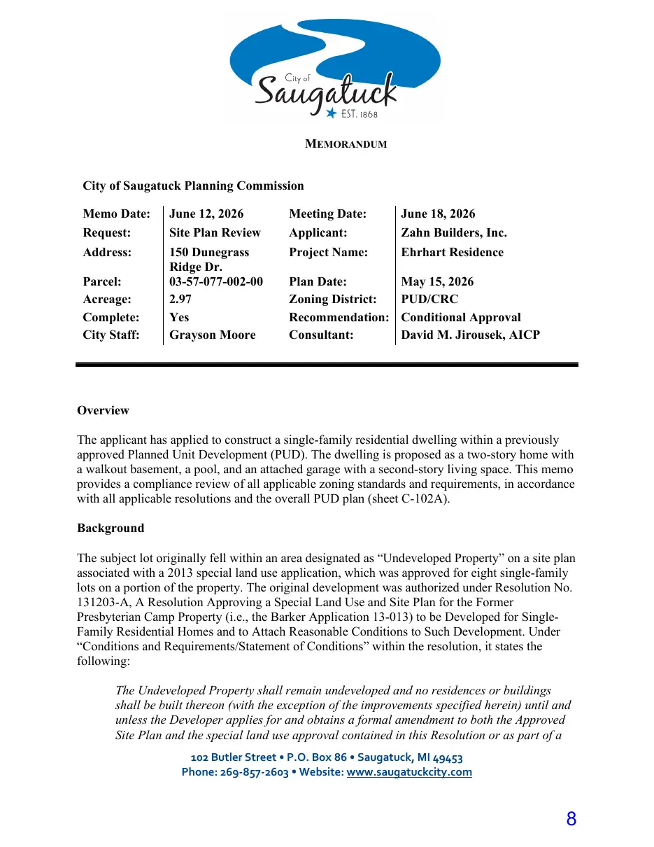
Text of page 8
MEMORANDUM City of Saugatuck Planning Commission Memo Date: Request: Address: Parcel: Acreage: Complete: City Staff:
June 12, 2026 Site Plan Review 150 Dunegrass Ridge Dr. 03-57-077-002-00 2.97 Yes Grayson Moore
Meeting Date: Applicant: Project Name:
June 18, 2026 Zahn Builders, Inc. Ehrhart Residence
Plan Date: Zoning District: Recommendation: Consultant:
May 15, 2026 PUD/CRC Conditional Approval David M. Jirousek, AICP
Overview The applicant has applied to construct a single-family residential dwelling within a previously approved Planned Unit Development (PUD). The dwelling is proposed as a two-story home with a walkout basement, a pool, and an attached garage with a second-story living space. This memo provides a compliance review of all applicable zoning standards and requirements, in accordance with all applicable resolutions and the overall PUD plan (sheet C-102A). Background The subject lot originally fell within an area designated as “Undeveloped Property” on a site plan associated with a 2013 special land use application, which was approved for eight single-family lots on a portion of the property. The original development was authorized under Resolution No. 131203-A, A Resolution Approving a Special Land Use and Site Plan for the Former Presbyterian Camp Property (i.e., the Barker Application 13-013) to be Developed for SingleFamily Residential Homes and to Attach Reasonable Conditions to Such Development. Under “Conditions and Requirements/Statement of Conditions” within the resolution, it states the following: The Undeveloped Property shall remain undeveloped and no residences or buildings shall be built thereon (with the exception of the improvements specified herein) until and unless the Developer applies for and obtains a formal amendment to both the Approved Site Plan and the special land use approval contained in this Resolution or as part of a 102 Butler Street P.O. Box 86 Saugatuck, MI 49453 Phone: 269-857-2603 Website: www.saugatuckcity.com
Page 9
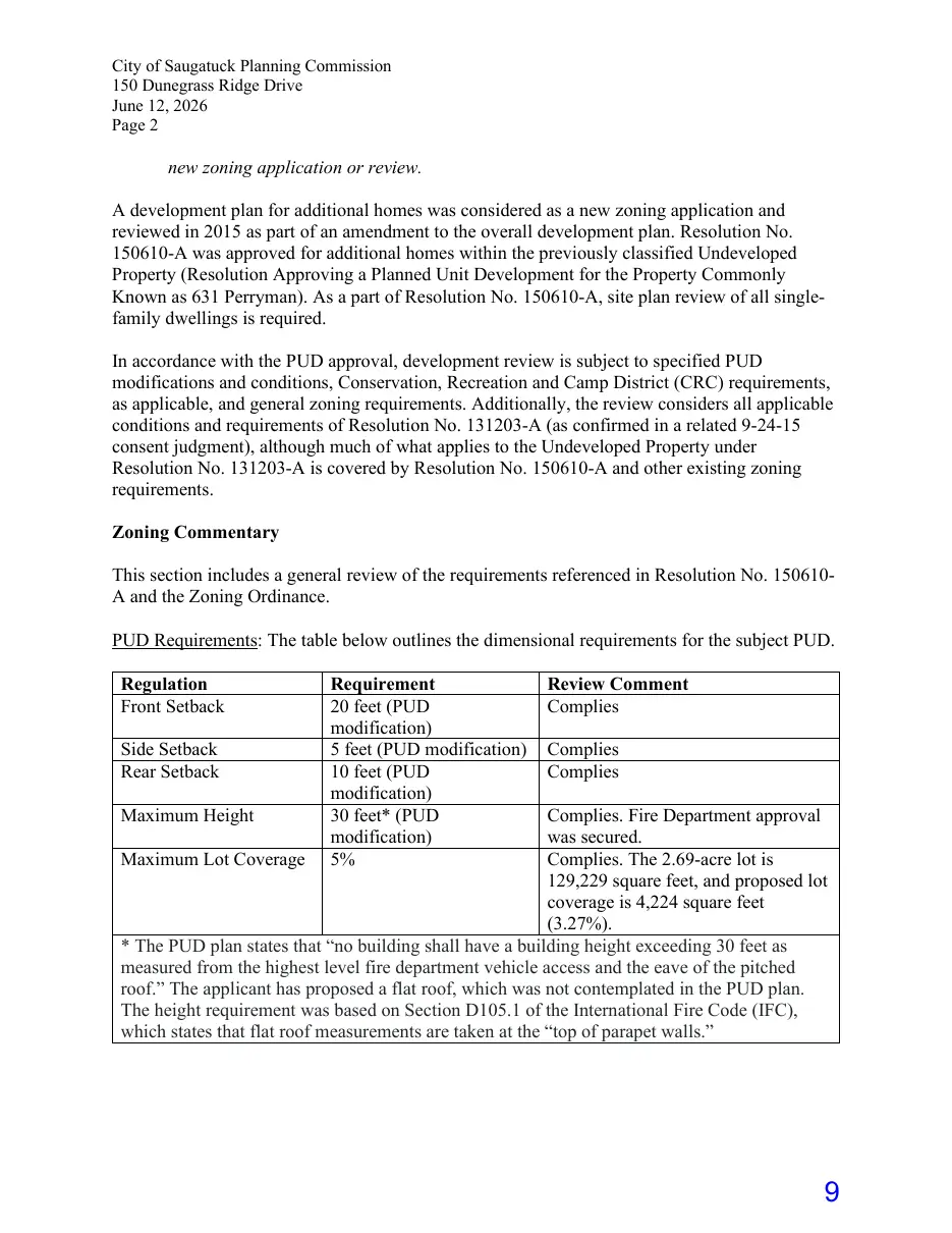
Text of page 9
City of Saugatuck Planning Commission 150 Dunegrass Ridge Drive June 12, 2026 Page 2
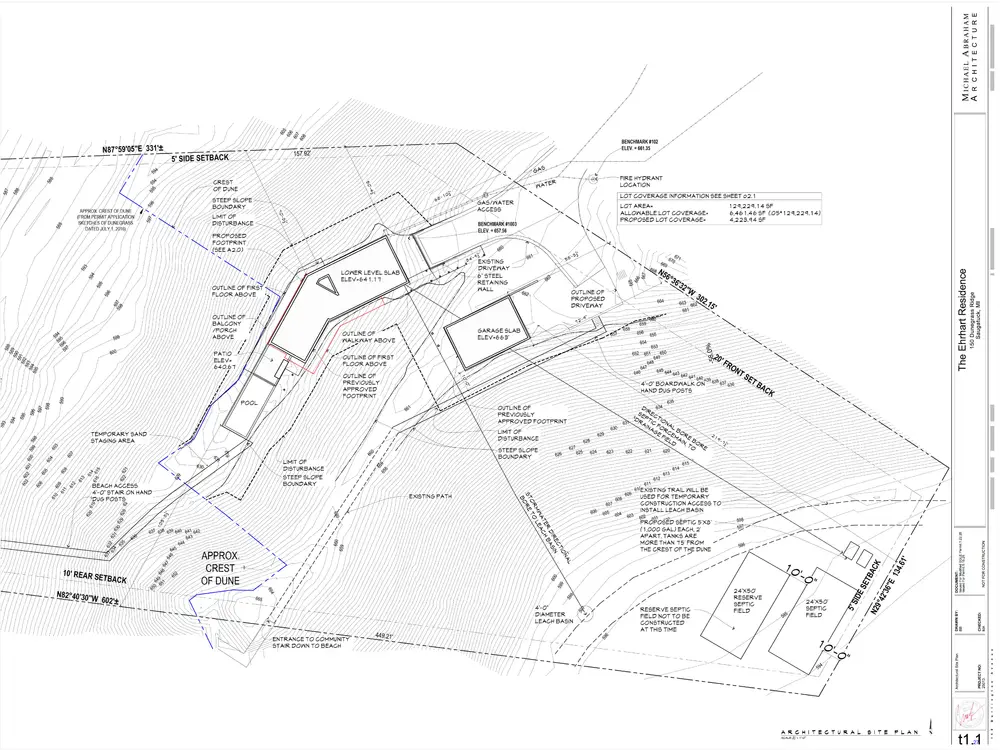
new zoning application or review. A development plan for additional homes was considered as a new zoning application and reviewed in 2015 as part of an amendment to the overall development plan. Resolution No. 150610-A was approved for additional homes within the previously classified Undeveloped Property (Resolution Approving a Planned Unit Development for the Property Commonly Known as 631 Perryman). As a part of Resolution No. 150610-A, site plan review of all singlefamily dwellings is required. In accordance with the PUD approval, development review is subject to specified PUD modifications and conditions, Conservation, Recreation and Camp District (CRC) requirements, as applicable, and general zoning requirements. Additionally, the review considers all applicable conditions and requirements of Resolution No. 131203-A (as confirmed in a related 9-24-15 consent judgment), although much of what applies to the Undeveloped Property under Resolution No. 131203-A is covered by Resolution No. 150610-A and other existing zoning requirements. Zoning Commentary This section includes a general review of the requirements referenced in Resolution No. 150610A and the Zoning Ordinance. PUD Requirements: The table below outlines the dimensional requirements for the subject PUD. Regulation Front Setback Side Setback Rear Setback Maximum Height
Requirement 20 feet (PUD modification) 5 feet (PUD modification) 10 feet (PUD modification) 30 feet* (PUD modification) 5%
Review Comment Complies Complies Complies
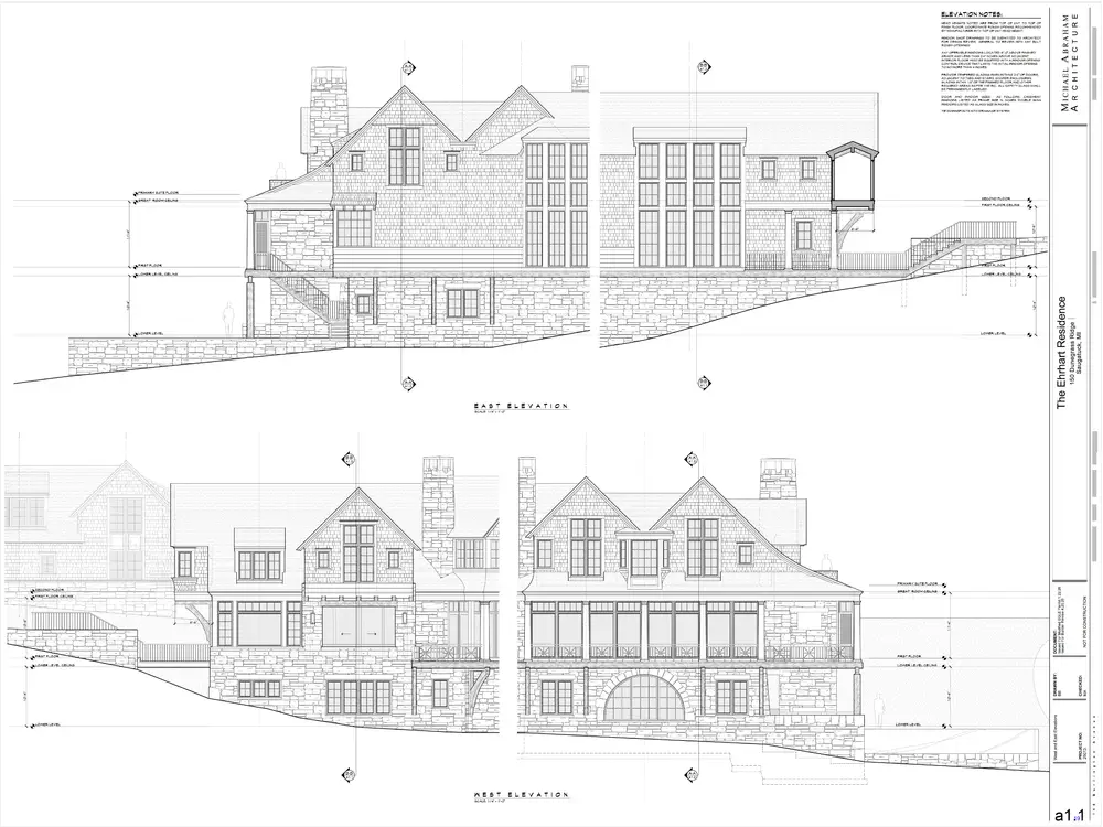
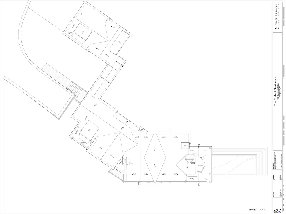
Complies. Fire Department approval was secured. Maximum Lot Coverage Complies. The 2.69-acre lot is 129,229 square feet, and proposed lot coverage is 4,224 square feet (3.27%). * The PUD plan states that “no building shall have a building height exceeding 30 feet as measured from the highest level fire department vehicle access and the eave of the pitched roof.” The applicant has proposed a flat roof, which was not contemplated in the PUD plan. The height requirement was based on Section D105.1 of the International Fire Code (IFC), which states that flat roof measurements are taken at the “top of parapet walls.”
Page 10
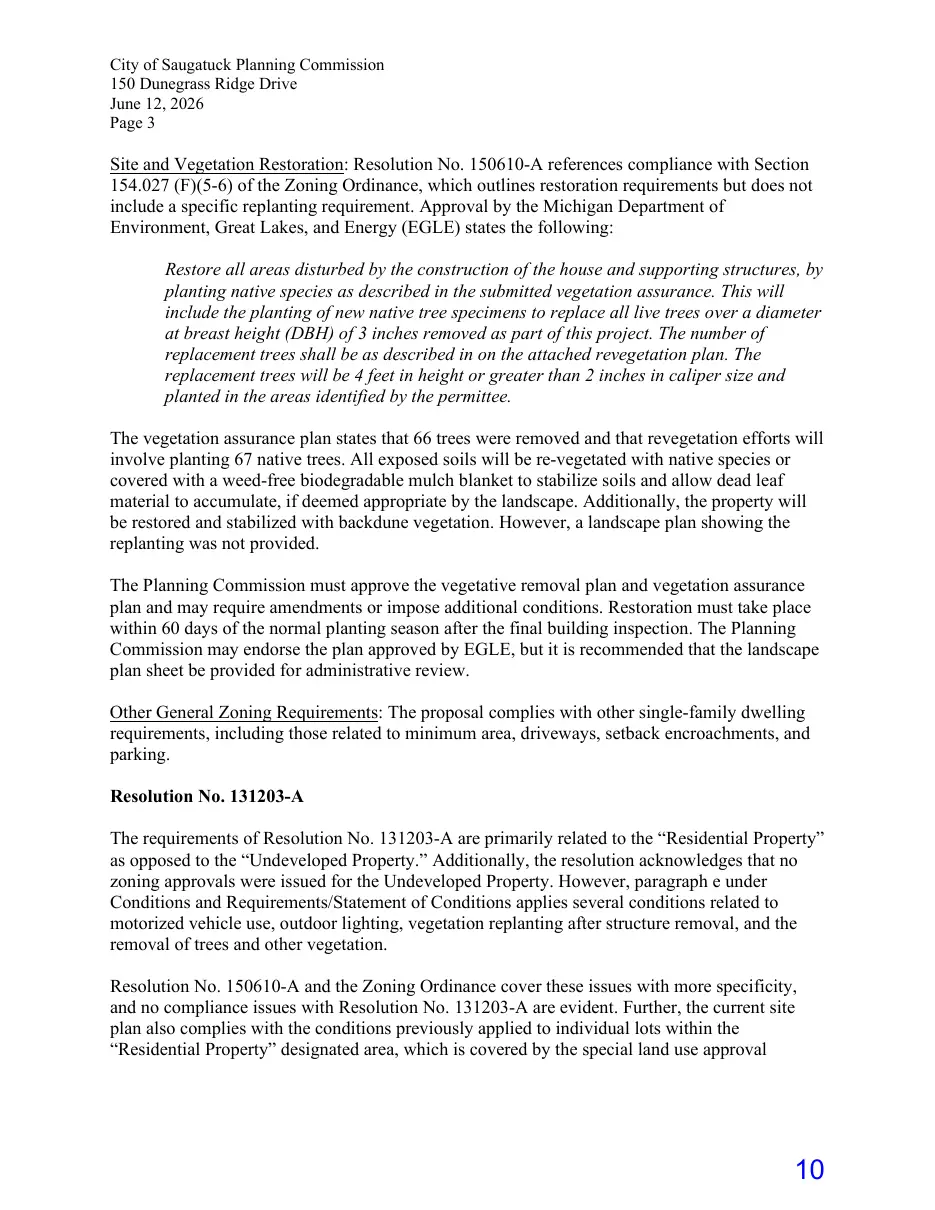
Text of page 10
City of Saugatuck Planning Commission 150 Dunegrass Ridge Drive June 12, 2026 Page 3
Site and Vegetation Restoration: Resolution No. 150610-A references compliance with Section 154.027 (F)(5-6) of the Zoning Ordinance, which outlines restoration requirements but does not include a specific replanting requirement. Approval by the Michigan Department of Environment, Great Lakes, and Energy (EGLE) states the following: Restore all areas disturbed by the construction of the house and supporting structures, by planting native species as described in the submitted vegetation assurance. This will include the planting of new native tree specimens to replace all live trees over a diameter at breast height (DBH) of 3 inches removed as part of this project. The number of replacement trees shall be as described in on the attached revegetation plan. The replacement trees will be 4 feet in height or greater than 2 inches in caliper size and planted in the areas identified by the permittee. The vegetation assurance plan states that 66 trees were removed and that revegetation efforts will involve planting 67 native trees. All exposed soils will be re-vegetated with native species or covered with a weed-free biodegradable mulch blanket to stabilize soils and allow dead leaf material to accumulate, if deemed appropriate by the landscape. Additionally, the property will be restored and stabilized with backdune vegetation. However, a landscape plan showing the replanting was not provided. The Planning Commission must approve the vegetative removal plan and vegetation assurance plan and may require amendments or impose additional conditions. Restoration must take place within 60 days of the normal planting season after the final building inspection. The Planning Commission may endorse the plan approved by EGLE, but it is recommended that the landscape plan sheet be provided for administrative review. Other General Zoning Requirements: The proposal complies with other single-family dwelling requirements, including those related to minimum area, driveways, setback encroachments, and parking. Resolution No. 131203-A The requirements of Resolution No. 131203-A are primarily related to the “Residential Property” as opposed to the “Undeveloped Property.” Additionally, the resolution acknowledges that no zoning approvals were issued for the Undeveloped Property. However, paragraph e under Conditions and Requirements/Statement of Conditions applies several conditions related to motorized vehicle use, outdoor lighting, vegetation replanting after structure removal, and the removal of trees and other vegetation. Resolution No. 150610-A and the Zoning Ordinance cover these issues with more specificity, and no compliance issues with Resolution No. 131203-A are evident. Further, the current site plan also complies with the conditions previously applied to individual lots within the “Residential Property” designated area, which is covered by the special land use approval
Page 11
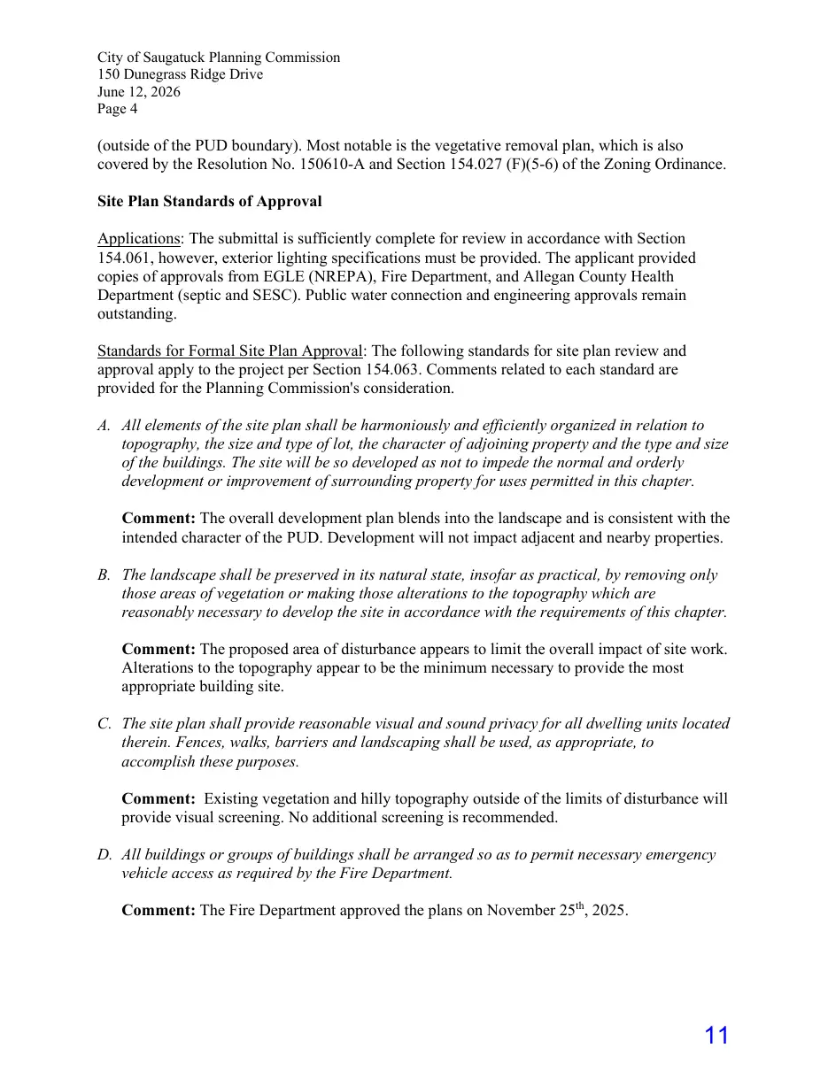
Text of page 11
City of Saugatuck Planning Commission 150 Dunegrass Ridge Drive June 12, 2026 Page 4
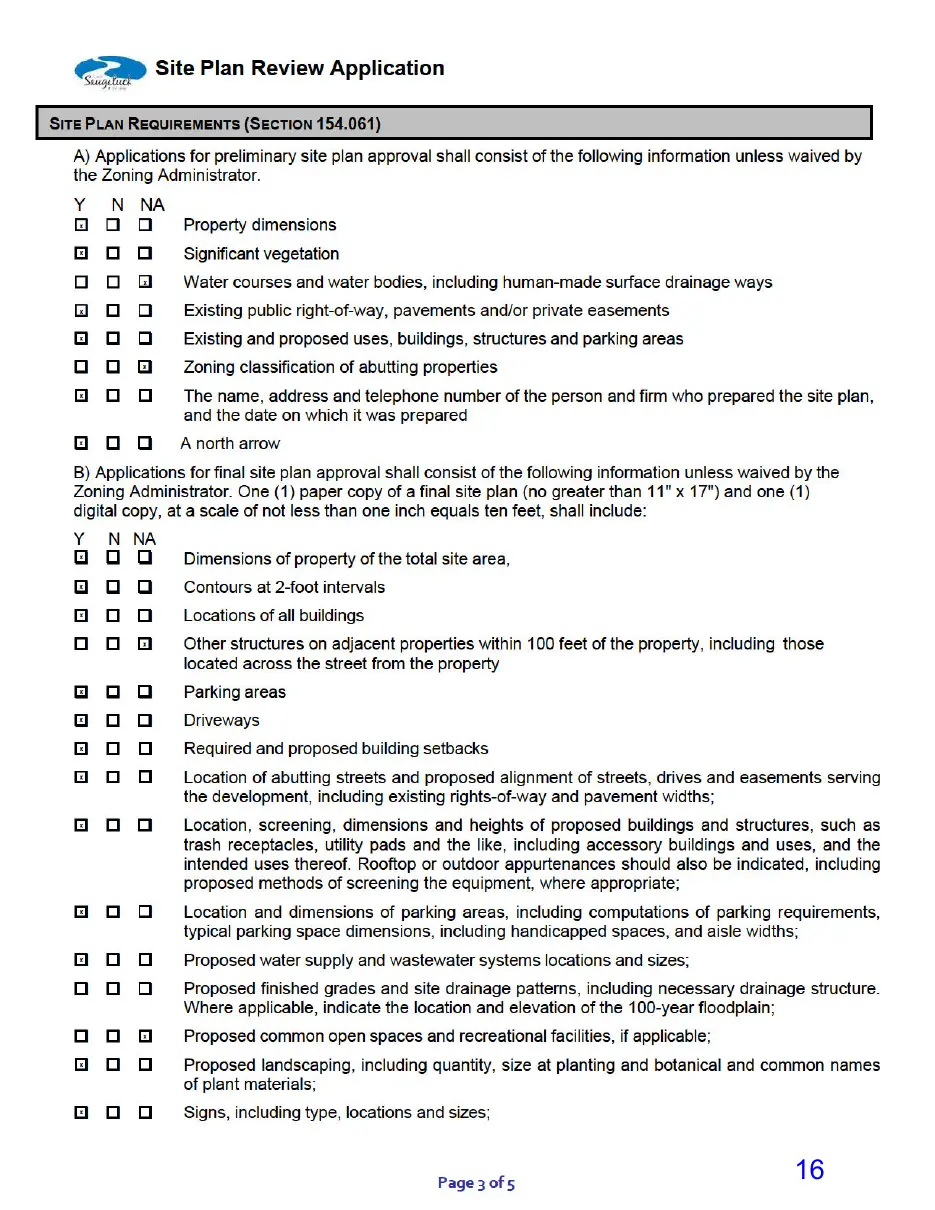
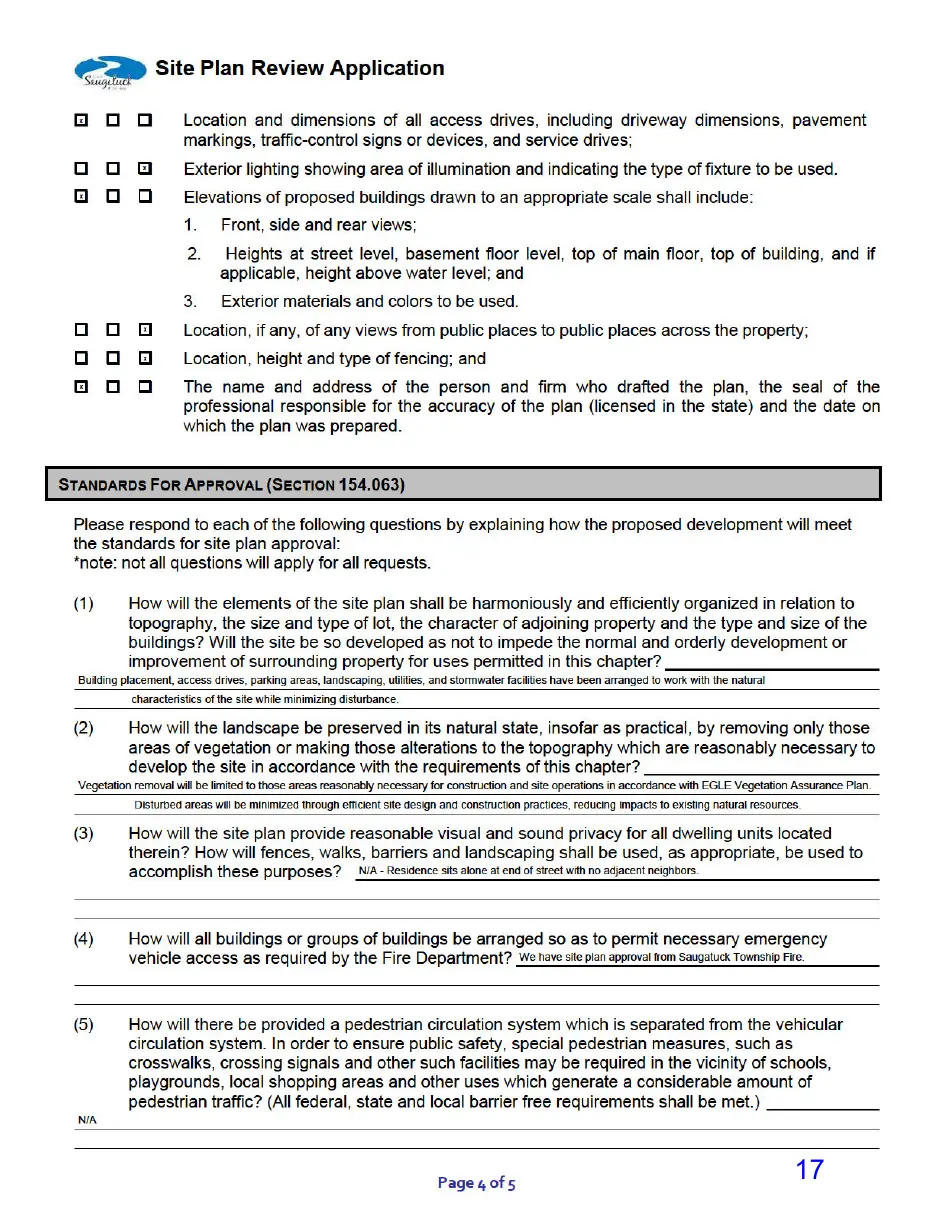
(outside of the PUD boundary). Most notable is the vegetative removal plan, which is also covered by the Resolution No. 150610-A and Section 154.027 (F)(5-6) of the Zoning Ordinance. Site Plan Standards of Approval Applications: The submittal is sufficiently complete for review in accordance with Section 154.061, however, exterior lighting specifications must be provided. The applicant provided copies of approvals from EGLE (NREPA), Fire Department, and Allegan County Health Department (septic and SESC). Public water connection and engineering approvals remain outstanding. Standards for Formal Site Plan Approval: The following standards for site plan review and approval apply to the project per Section 154.063. Comments related to each standard are provided for the Planning Commission's consideration. A. All elements of the site plan shall be harmoniously and efficiently organized in relation to topography, the size and type of lot, the character of adjoining property and the type and size of the buildings. The site will be so developed as not to impede the normal and orderly development or improvement of surrounding property for uses permitted in this chapter. Comment: The overall development plan blends into the landscape and is consistent with the intended character of the PUD. Development will not impact adjacent and nearby properties. B. The landscape shall be preserved in its natural state, insofar as practical, by removing only those areas of vegetation or making those alterations to the topography which are reasonably necessary to develop the site in accordance with the requirements of this chapter. Comment: The proposed area of disturbance appears to limit the overall impact of site work. Alterations to the topography appear to be the minimum necessary to provide the most appropriate building site. C. The site plan shall provide reasonable visual and sound privacy for all dwelling units located therein. Fences, walks, barriers and landscaping shall be used, as appropriate, to accomplish these purposes. Comment: Existing vegetation and hilly topography outside of the limits of disturbance will provide visual screening. No additional screening is recommended. D. All buildings or groups of buildings shall be arranged so as to permit necessary emergency vehicle access as required by the Fire Department. Comment: The Fire Department approved the plans on November 25th, 2025.
Page 12
Text of page 12
City of Saugatuck Planning Commission 150 Dunegrass Ridge Drive June 12, 2026 Page 5
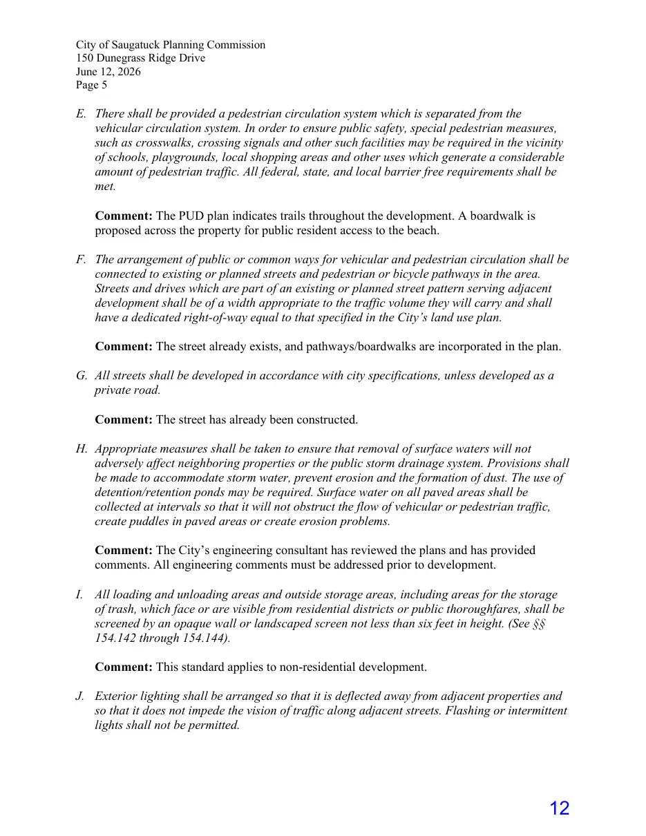
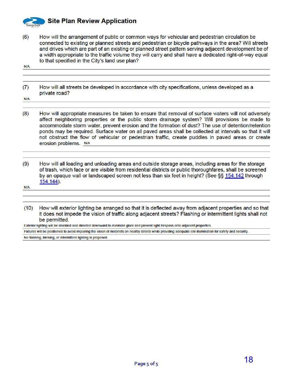
E. There shall be provided a pedestrian circulation system which is separated from the vehicular circulation system. In order to ensure public safety, special pedestrian measures, such as crosswalks, crossing signals and other such facilities may be required in the vicinity of schools, playgrounds, local shopping areas and other uses which generate a considerable amount of pedestrian traffic. All federal, state, and local barrier free requirements shall be met. Comment: The PUD plan indicates trails throughout the development. A boardwalk is proposed across the property for public resident access to the beach. F. The arrangement of public or common ways for vehicular and pedestrian circulation shall be connected to existing or planned streets and pedestrian or bicycle pathways in the area. Streets and drives which are part of an existing or planned street pattern serving adjacent development shall be of a width appropriate to the traffic volume they will carry and shall have a dedicated right-of-way equal to that specified in the City’s land use plan. Comment: The street already exists, and pathways/boardwalks are incorporated in the plan. G. All streets shall be developed in accordance with city specifications, unless developed as a private road. Comment: The street has already been constructed. H. Appropriate measures shall be taken to ensure that removal of surface waters will not adversely affect neighboring properties or the public storm drainage system. Provisions shall be made to accommodate storm water, prevent erosion and the formation of dust. The use of detention/retention ponds may be required. Surface water on all paved areas shall be collected at intervals so that it will not obstruct the flow of vehicular or pedestrian traffic, create puddles in paved areas or create erosion problems. Comment: The City’s engineering consultant has reviewed the plans and has provided comments. All engineering comments must be addressed prior to development. I. All loading and unloading areas and outside storage areas, including areas for the storage of trash, which face or are visible from residential districts or public thoroughfares, shall be screened by an opaque wall or landscaped screen not less than six feet in height. (See §§ 154.142 through 154.144). Comment: This standard applies to non-residential development. J. Exterior lighting shall be arranged so that it is deflected away from adjacent properties and so that it does not impede the vision of traffic along adjacent streets. Flashing or intermittent lights shall not be permitted.
Page 13
Text of page 13
City of Saugatuck Planning Commission 150 Dunegrass Ridge Drive June 12, 2026 Page 6
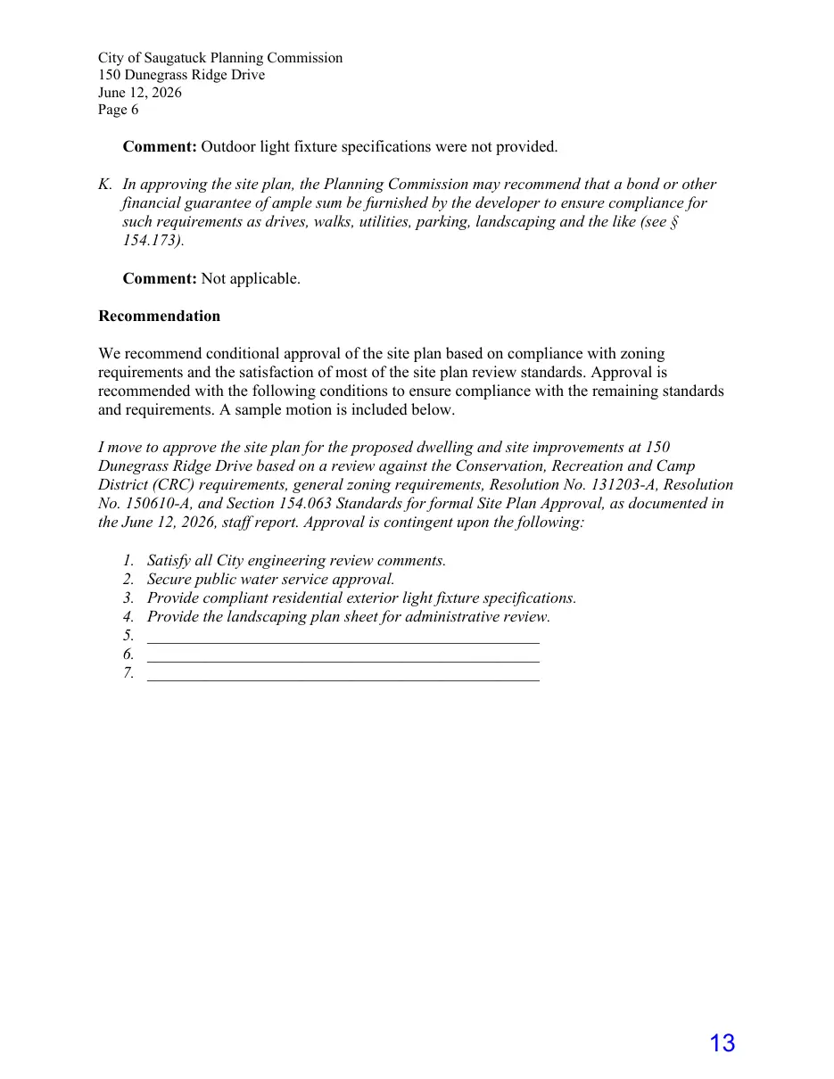
Comment: Outdoor light fixture specifications were not provided. K. In approving the site plan, the Planning Commission may recommend that a bond or other financial guarantee of ample sum be furnished by the developer to ensure compliance for such requirements as drives, walks, utilities, parking, landscaping and the like (see § 154.173). Comment: Not applicable. Recommendation We recommend conditional approval of the site plan based on compliance with zoning requirements and the satisfaction of most of the site plan review standards. Approval is recommended with the following conditions to ensure compliance with the remaining standards and requirements. A sample motion is included below. I move to approve the site plan for the proposed dwelling and site improvements at 150 Dunegrass Ridge Drive based on a review against the Conservation, Recreation and Camp District (CRC) requirements, general zoning requirements, Resolution No. 131203-A, Resolution No. 150610-A, and Section 154.063 Standards for formal Site Plan Approval, as documented in the June 12, 2026, staff report. Approval is contingent upon the following: 1. 2. 3. 4. 5. 6. 7.
Satisfy all City engineering review comments. Secure public water service approval. Provide compliant residential exterior light fixture specifications. Provide the landscaping plan sheet for administrative review. ________________________________________________ ________________________________________________ ________________________________________________
Page 14
This page is a scanned image with no text layer. The PDF of these pages has it at full resolution.
Page 15
Text of page 15
PROPERTY INFORMATION Depth
Width
Size
Zoning District
Current Use
Check all that apply: Waterfront X
Historic District
Dunes X
Vacant X
PROJECT DESCRIPTION (ATTACH MORE SHEETS IF NECESSARY)
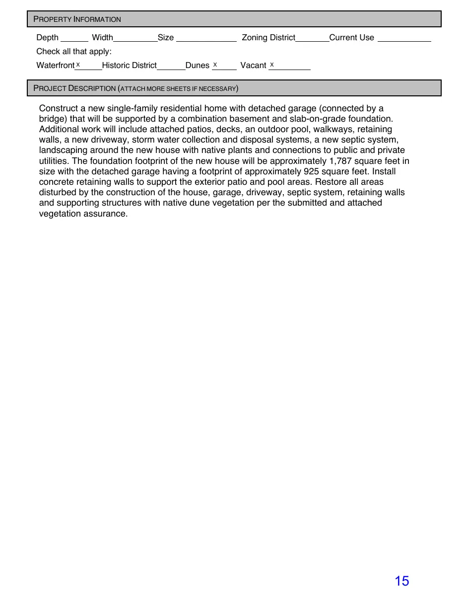
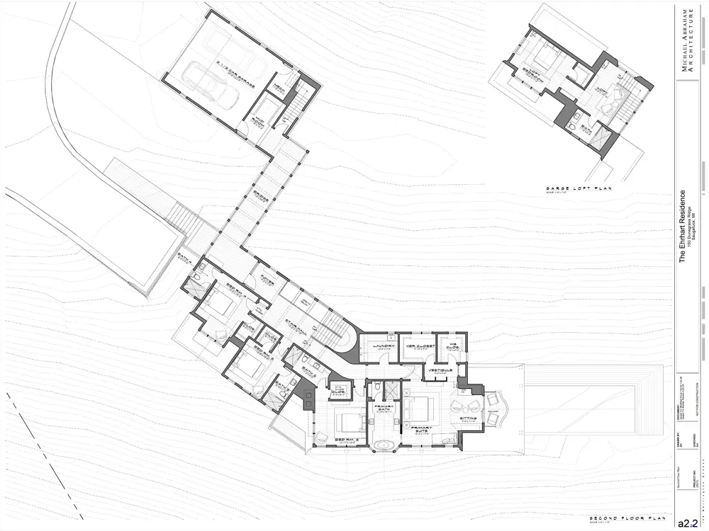
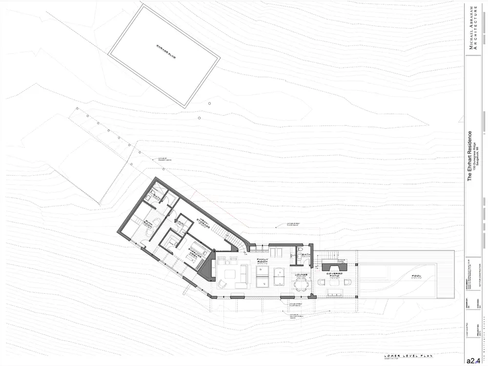
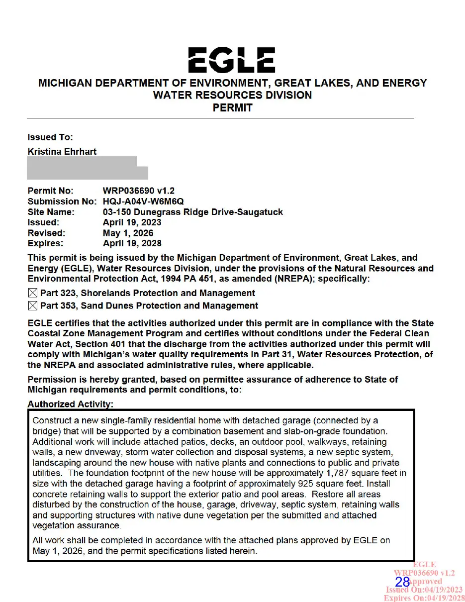
Construct a new single-family residential home with detached garage (connected by a bridge) that will be supported by a combination basement and slab-on-grade foundation. Additional work will include attached patios, decks, an outdoor pool, walkways, retaining walls, a new driveway, storm water collection and disposal systems, a new septic system, landscaping around the new house with native plants and connections to public and private utilities. The foundation footprint of the new house will be approximately 1,787 square feet in size with the detached garage having a footprint of approximately 925 square feet. Install concrete retaining walls to support the exterior patio and pool areas. Restore all areas disturbed by the construction of the house, garage, driveway, septic system, retaining walls and supporting structures with native dune vegetation per the submitted and attached vegetation assurance.
Page 16
This page is a scanned image with no text layer. The PDF of these pages has it at full resolution.
Page 17
This page is a scanned image with no text layer. The PDF of these pages has it at full resolution.
Page 18
This page is a scanned image with no text layer. The PDF of these pages has it at full resolution.
Page 19
This page is a scanned image with no text layer. The PDF of these pages has it at full resolution.
Page 20
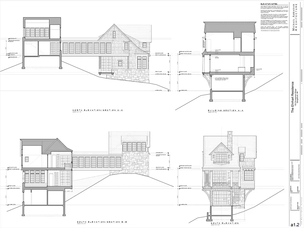
This page is a scanned image with no text layer. The PDF of these pages has it at full resolution.
Page 21
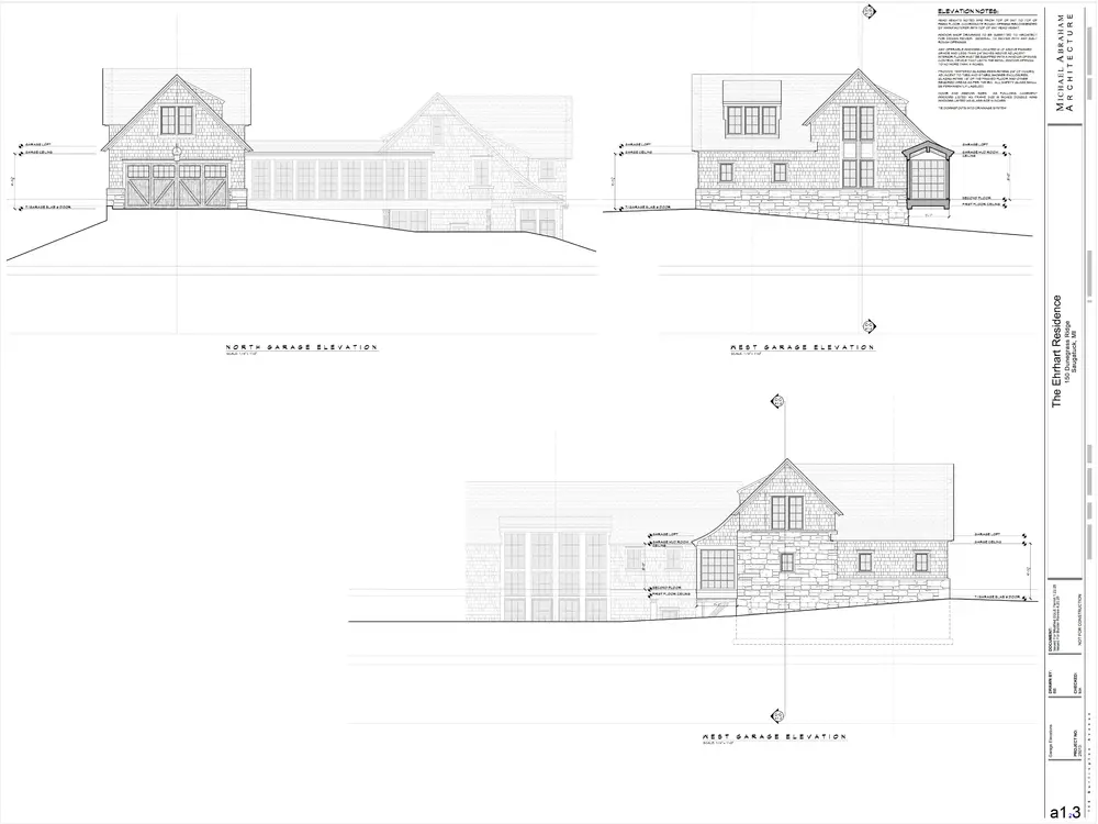
This page is a scanned image with no text layer. The PDF of these pages has it at full resolution.
Page 22
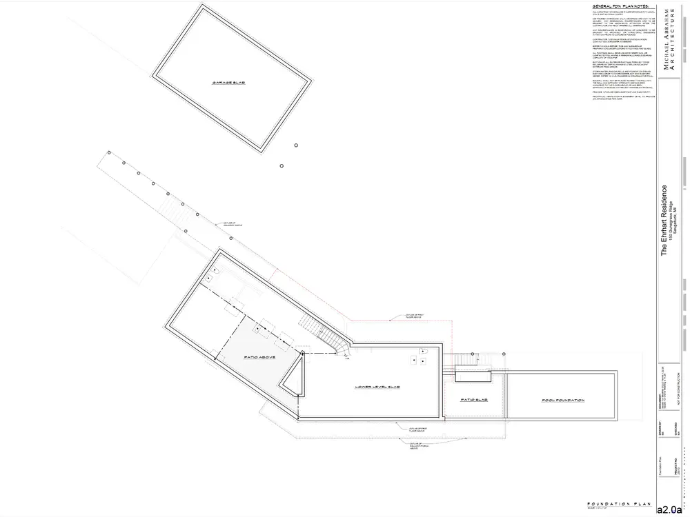
This page is a scanned image with no text layer. The PDF of these pages has it at full resolution.
Page 23
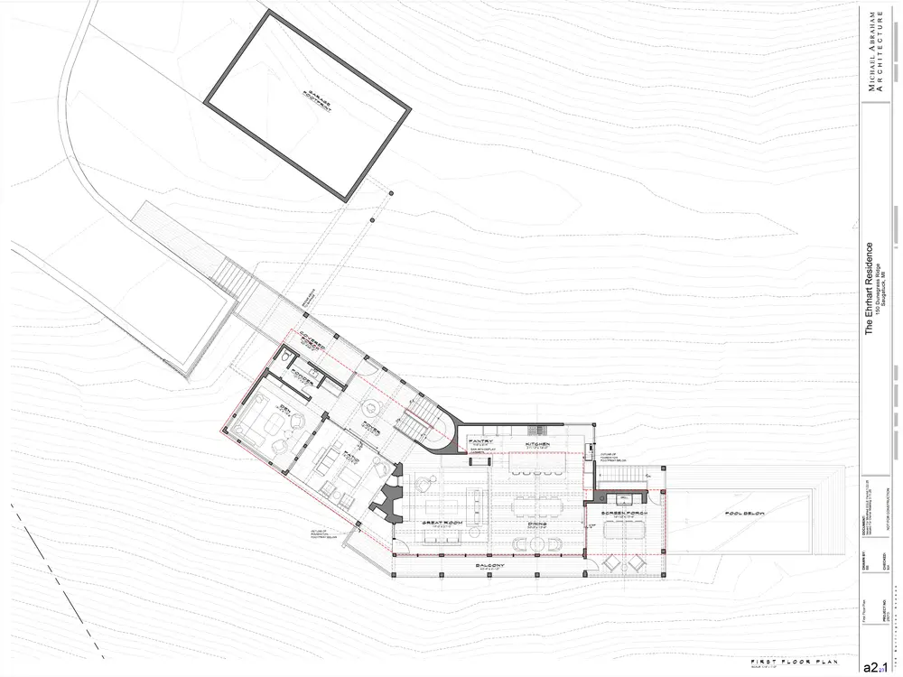
This page is a scanned image with no text layer. The PDF of these pages has it at full resolution.
Page 24
This page is a scanned image with no text layer. The PDF of these pages has it at full resolution.
Page 25
This page is a scanned image with no text layer. The PDF of these pages has it at full resolution.
Page 26
This page is a scanned image with no text layer. The PDF of these pages has it at full resolution.
Page 27
This page is a scanned image with no text layer. The PDF of these pages has it at full resolution.
Page 28
This page is a scanned image with no text layer. The PDF of these pages has it at full resolution.
Page 29
Text of page 29
Kristina Ehrhart Waterbody Affected: Property Location:
WRP036690 v1.2
Lake Michigan Allegan County, City of Saugatuck, Town/Range/Section: 03N16W08; Property Tax No: 03-57-077-002-00
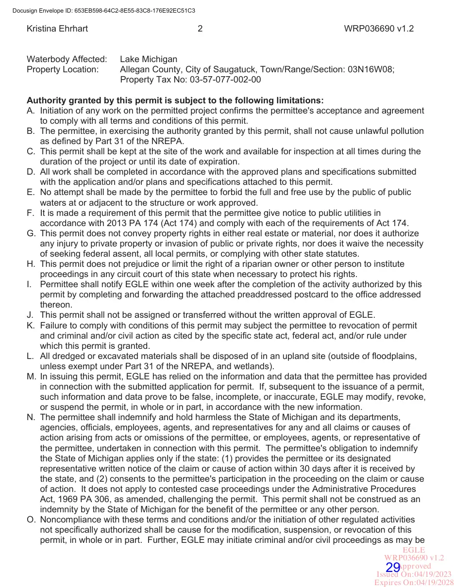
Authority granted by this permit is subject to the following limitations: A. Initiation of any work on the permitted project confirms the permittee's acceptance and agreement to comply with all terms and conditions of this permit. B. The permittee, in exercising the authority granted by this permit, shall not cause unlawful pollution as defined by Part 31 of the NREPA. C. This permit shall be kept at the site of the work and available for inspection at all times during the duration of the project or until its date of expiration. D. All work shall be completed in accordance with the approved plans and specifications submitted with the application and/or plans and specifications attached to this permit. E. No attempt shall be made by the permittee to forbid the full and free use by the public of public waters at or adjacent to the structure or work approved. F. It is made a requirement of this permit that the permittee give notice to public utilities in accordance with 2013 PA 174 (Act 174) and comply with each of the requirements of Act 174. G. This permit does not convey property rights in either real estate or material, nor does it authorize any injury to private property or invasion of public or private rights, nor does it waive the necessity of seeking federal assent, all local permits, or complying with other state statutes. H. This permit does not prejudice or limit the right of a riparian owner or other person to institute proceedings in any circuit court of this state when necessary to protect his rights. I. Permittee shall notify EGLE within one week after the completion of the activity authorized by this permit by completing and forwarding the attached preaddressed postcard to the office addressed thereon. J. This permit shall not be assigned or transferred without the written approval of EGLE. K. Failure to comply with conditions of this permit may subject the permittee to revocation of permit and criminal and/or civil action as cited by the specific state act, federal act, and/or rule under which this permit is granted. L. All dredged or excavated materials shall be disposed of in an upland site (outside of floodplains, unless exempt under Part 31 of the NREPA, and wetlands). M. In issuing this permit, EGLE has relied on the information and data that the permittee has provided in connection with the submitted application for permit. If, subsequent to the issuance of a permit, such information and data prove to be false, incomplete, or inaccurate, EGLE may modify, revoke, or suspend the permit, in whole or in part, in accordance with the new information. N. The permittee shall indemnify and hold harmless the State of Michigan and its departments, agencies, officials, employees, agents, and representatives for any and all claims or causes of action arising from acts or omissions of the permittee, or employees, agents, or representative of the permittee, undertaken in connection with this permit. The permittee's obligation to indemnify the State of Michigan applies only if the state: (1) provides the permittee or its designated representative written notice of the claim or cause of action within 30 days after it is received by the state, and (2) consents to the permittee's participation in the proceeding on the claim or cause of action. It does not apply to contested case proceedings under the Administrative Procedures Act, 1969 PA 306, as amended, challenging the permit. This permit shall not be construed as an indemnity by the State of Michigan for the benefit of the permittee or any other person. O. Noncompliance with these terms and conditions and/or the initiation of other regulated activities not specifically authorized shall be cause for the modification, suspension, or revocation of this permit, in whole or in part. Further, EGLE may initiate criminal and/or civil proceedings as may be EGLE WRP036690 v1.2 Approved Issued On:04/19/2023 Expires On:04/19/2028
Page 30
Text of page 30
Kristina Ehrhart
WRP036690 v1.2
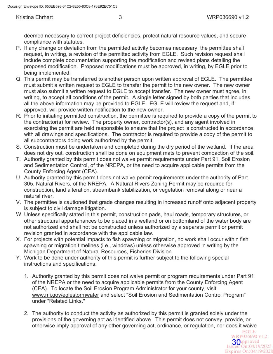
deemed necessary to correct project deficiencies, protect natural resource values, and secure compliance with statutes. P. If any change or deviation from the permitted activity becomes necessary, the permittee shall request, in writing, a revision of the permitted activity from EGLE. Such revision request shall include complete documentation supporting the modification and revised plans detailing the proposed modification. Proposed modifications must be approved, in writing, by EGLE prior to being implemented. Q. This permit may be transferred to another person upon written approval of EGLE. The permittee must submit a written request to EGLE to transfer the permit to the new owner. The new owner must also submit a written request to EGLE to accept transfer. The new owner must agree, in writing, to accept all conditions of the permit. A single letter signed by both parties that includes all the above information may be provided to EGLE. EGLE will review the request and, if approved, will provide written notification to the new owner. R. Prior to initiating permitted construction, the permittee is required to provide a copy of the permit to the contractor(s) for review. The property owner, contractor(s), and any agent involved in exercising the permit are held responsible to ensure that the project is constructed in accordance with all drawings and specifications. The contractor is required to provide a copy of the permit to all subcontractors doing work authorized by the permit. S. Construction must be undertaken and completed during the dry period of the wetland. If the area does not dry out, construction shall be done on equipment mats to prevent compaction of the soil. T. Authority granted by this permit does not waive permit requirements under Part 91, Soil Erosion and Sedimentation Control, of the NREPA, or the need to acquire applicable permits from the County Enforcing Agent (CEA). U. Authority granted by this permit does not waive permit requirements under the authority of Part 305, Natural Rivers, of the NREPA. A Natural Rivers Zoning Permit may be required for construction, land alteration, streambank stabilization, or vegetation removal along or near a natural river. V. The permittee is cautioned that grade changes resulting in increased runoff onto adjacent property is subject to civil damage litigation. W. Unless specifically stated in this permit, construction pads, haul roads, temporary structures, or other structural appurtenances to be placed in a wetland or on bottomland of the water body are not authorized and shall not be constructed unless authorized by a separate permit or permit revision granted in accordance with the applicable law. X. For projects with potential impacts to fish spawning or migration, no work shall occur within fish spawning or migration timelines (i.e., windows) unless otherwise approved in writing by the Michigan Department of Natural Resources, Fisheries Division. Y. Work to be done under authority of this permit is further subject to the following special instructions and specifications: 1. Authority granted by this permit does not waive permit or program requirements under Part 91 of the NREPA or the need to acquire applicable permits from the County Enforcing Agent (CEA). To locate the Soil Erosion Program Administrator for your county, visit www.mi.gov/eglestormwater and select "Soil Erosion and Sedimentation Control Program" under "Related Links." 2. The authority to conduct the activity as authorized by this permit is granted solely under the provisions of the governing act as identified above. This permit does not convey, provide, or otherwise imply approval of any other governing act, ordinance, or regulation, nor does it waive EGLE WRP036690 v1.2 Approved Issued On:04/19/2023 Expires On:04/19/2028
Page 31
Text of page 31
Kristina Ehrhart
WRP036690 v1.2
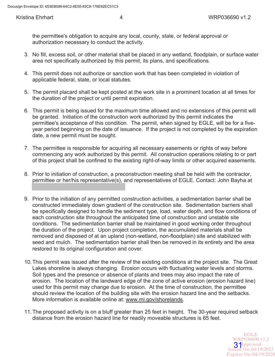
the permittee's obligation to acquire any local, county, state, or federal approval or authorization necessary to conduct the activity. 3. No fill, excess soil, or other material shall be placed in any wetland, floodplain, or surface water area not specifically authorized by this permit, its plans, and specifications. 4. This permit does not authorize or sanction work that has been completed in violation of applicable federal, state, or local statutes. 5. The permit placard shall be kept posted at the work site in a prominent location at all times for the duration of the project or until permit expiration. 6. This permit is being issued for the maximum time allowed and no extensions of this permit will be granted. Initiation of the construction work authorized by this permit indicates the permittee's acceptance of this condition. The permit, when signed by EGLE, will be for a fiveyear period beginning on the date of issuance. If the project is not completed by the expiration date, a new permit must be sought. 7. The permittee is responsible for acquiring all necessary easements or rights of way before commencing any work authorized by this permit. All construction operations relating to or part of this project shall be confined to the existing right-of-way limits or other acquired easements. 8. Prior to initiation of construction, a preconstruction meeting shall be held with the contractor, permittee or her/his representative(s), and representatives of EGLE. Contact: John Bayha at 9. Prior to the initiation of any permitted construction activities, a sedimentation barrier shall be constructed immediately down gradient of the construction site. Sedimentation barriers shall be specifically designed to handle the sediment type, load, water depth, and flow conditions of each construction site throughout the anticipated time of construction and unstable site conditions. The sedimentation barrier shall be maintained in good working order throughout the duration of the project. Upon project completion, the accumulated materials shall be removed and disposed of at an upland (non-wetland, non-floodplain) site and stabilized with seed and mulch. The sedimentation barrier shall then be removed in its entirety and the area restored to its original configuration and cover. 10. This permit was issued after the review of the existing conditions at the project site. The Great Lakes shoreline is always changing. Erosion occurs with fluctuating water levels and storms. Soil types and the presence or absence of plants and trees may also impact the rate of erosion. The location of the landward edge of the zone of active erosion (erosion hazard line) used for this permit may change due to erosion. At the time of construction, the permittee should review the location of the building site with the erosion hazard line and the setbacks. More information is available online at: www.mi.gov/shorelands. 11. The proposed activity is on a bluff greater than 25 feet in height. The 30-year required setback distance from the erosion hazard line for readily moveable structures is 65 feet. EGLE WRP036690 v1.2 Approved Issued On:04/19/2023 Expires On:04/19/2028
Page 32
Text of page 32
Kristina Ehrhart
WRP036690 v1.2
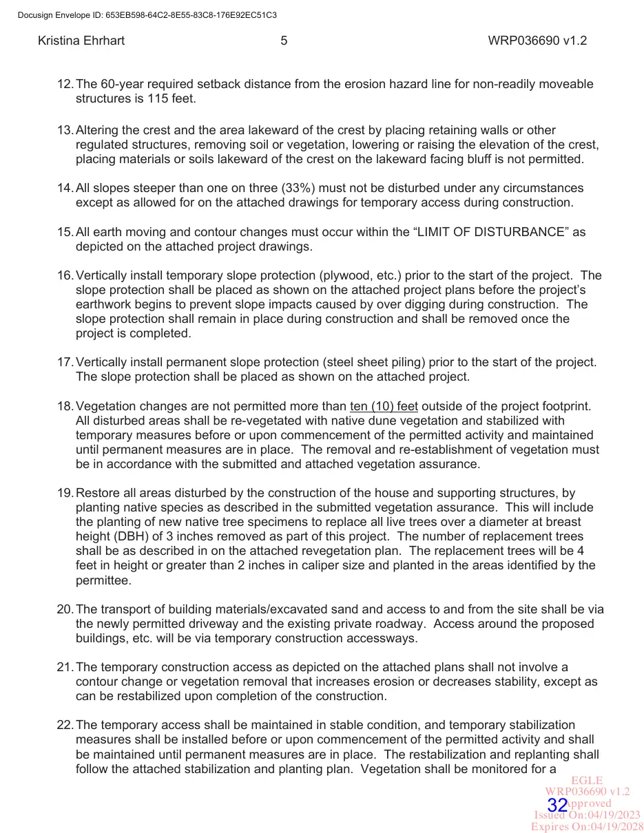
12. The 60-year required setback distance from the erosion hazard line for non-readily moveable structures is 115 feet. 13. Altering the crest and the area lakeward of the crest by placing retaining walls or other regulated structures, removing soil or vegetation, lowering or raising the elevation of the crest, placing materials or soils lakeward of the crest on the lakeward facing bluff is not permitted. 14. All slopes steeper than one on three (33%) must not be disturbed under any circumstances except as allowed for on the attached drawings for temporary access during construction. 15. All earth moving and contour changes must occur within the “LIMIT OF DISTURBANCE” as depicted on the attached project drawings. 16. Vertically install temporary slope protection (plywood, etc.) prior to the start of the project. The slope protection shall be placed as shown on the attached project plans before the project’s earthwork begins to prevent slope impacts caused by over digging during construction. The slope protection shall remain in place during construction and shall be removed once the project is completed. 17. Vertically install permanent slope protection (steel sheet piling) prior to the start of the project. The slope protection shall be placed as shown on the attached project. 18. Vegetation changes are not permitted more than ten (10) feet outside of the project footprint. All disturbed areas shall be re-vegetated with native dune vegetation and stabilized with temporary measures before or upon commencement of the permitted activity and maintained until permanent measures are in place. The removal and re-establishment of vegetation must be in accordance with the submitted and attached vegetation assurance. 19. Restore all areas disturbed by the construction of the house and supporting structures, by planting native species as described in the submitted vegetation assurance. This will include the planting of new native tree specimens to replace all live trees over a diameter at breast height (DBH) of 3 inches removed as part of this project. The number of replacement trees shall be as described in on the attached revegetation plan. The replacement trees will be 4 feet in height or greater than 2 inches in caliper size and planted in the areas identified by the permittee. 20. The transport of building materials/excavated sand and access to and from the site shall be via the newly permitted driveway and the existing private roadway. Access around the proposed buildings, etc. will be via temporary construction accessways. 21. The temporary construction access as depicted on the attached plans shall not involve a contour change or vegetation removal that increases erosion or decreases stability, except as can be restabilized upon completion of the construction. 22. The temporary access shall be maintained in stable condition, and temporary stabilization measures shall be installed before or upon commencement of the permitted activity and shall be maintained until permanent measures are in place. The restabilization and replanting shall follow the attached stabilization and planting plan. Vegetation shall be monitored for a EGLE WRP036690 v1.2 Approved Issued On:04/19/2023 Expires On:04/19/2028
Page 33
Text of page 33
Kristina Ehrhart
WRP036690 v1.2
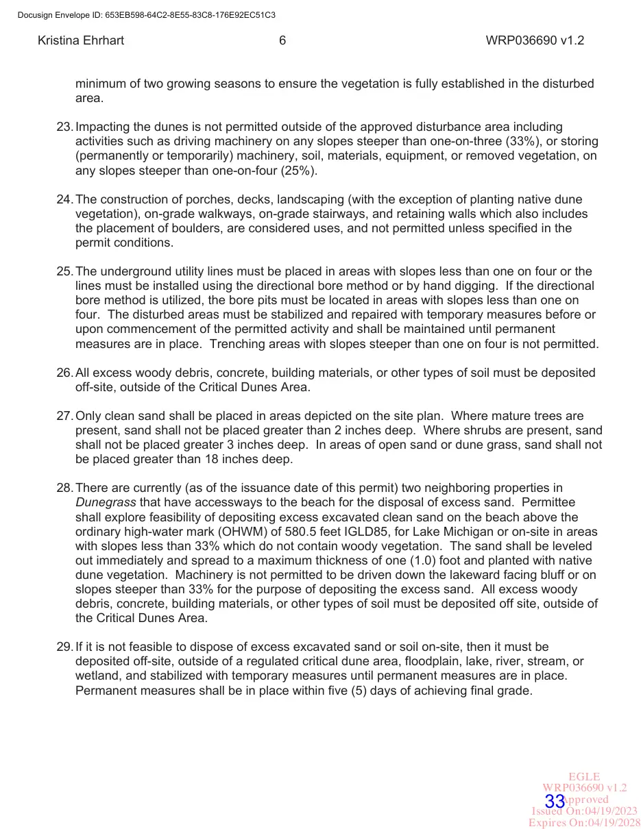
minimum of two growing seasons to ensure the vegetation is fully established in the disturbed area. 23. Impacting the dunes is not permitted outside of the approved disturbance area including activities such as driving machinery on any slopes steeper than one-on-three (33%), or storing (permanently or temporarily) machinery, soil, materials, equipment, or removed vegetation, on any slopes steeper than one-on-four (25%). 24. The construction of porches, decks, landscaping (with the exception of planting native dune vegetation), on-grade walkways, on-grade stairways, and retaining walls which also includes the placement of boulders, are considered uses, and not permitted unless specified in the permit conditions. 25. The underground utility lines must be placed in areas with slopes less than one on four or the lines must be installed using the directional bore method or by hand digging. If the directional bore method is utilized, the bore pits must be located in areas with slopes less than one on four. The disturbed areas must be stabilized and repaired with temporary measures before or upon commencement of the permitted activity and shall be maintained until permanent measures are in place. Trenching areas with slopes steeper than one on four is not permitted. 26. All excess woody debris, concrete, building materials, or other types of soil must be deposited off-site, outside of the Critical Dunes Area. 27. Only clean sand shall be placed in areas depicted on the site plan. Where mature trees are present, sand shall not be placed greater than 2 inches deep. Where shrubs are present, sand shall not be placed greater 3 inches deep. In areas of open sand or dune grass, sand shall not be placed greater than 18 inches deep. 28. There are currently (as of the issuance date of this permit) two neighboring properties in Dunegrass that have accessways to the beach for the disposal of excess sand. Permittee shall explore feasibility of depositing excess excavated clean sand on the beach above the ordinary high-water mark (OHWM) of 580.5 feet IGLD85, for Lake Michigan or on-site in areas with slopes less than 33% which do not contain woody vegetation. The sand shall be leveled out immediately and spread to a maximum thickness of one (1.0) foot and planted with native dune vegetation. Machinery is not permitted to be driven down the lakeward facing bluff or on slopes steeper than 33% for the purpose of depositing the excess sand. All excess woody debris, concrete, building materials, or other types of soil must be deposited off site, outside of the Critical Dunes Area. 29. If it is not feasible to dispose of excess excavated sand or soil on-site, then it must be deposited off-site, outside of a regulated critical dune area, floodplain, lake, river, stream, or wetland, and stabilized with temporary measures until permanent measures are in place. Permanent measures shall be in place within five (5) days of achieving final grade.
EGLE WRP036690 v1.2 Approved Issued On:04/19/2023 Expires On:04/19/2028
Page 34
This page is a scanned image with no text layer. The PDF of these pages has it at full resolution.
Page 35
Text of page 35
Docusign Envelope ID: 653EB598-64C2-8E55-83C8-176E92EC51C3
4/22/2026
Vegetation Assurance
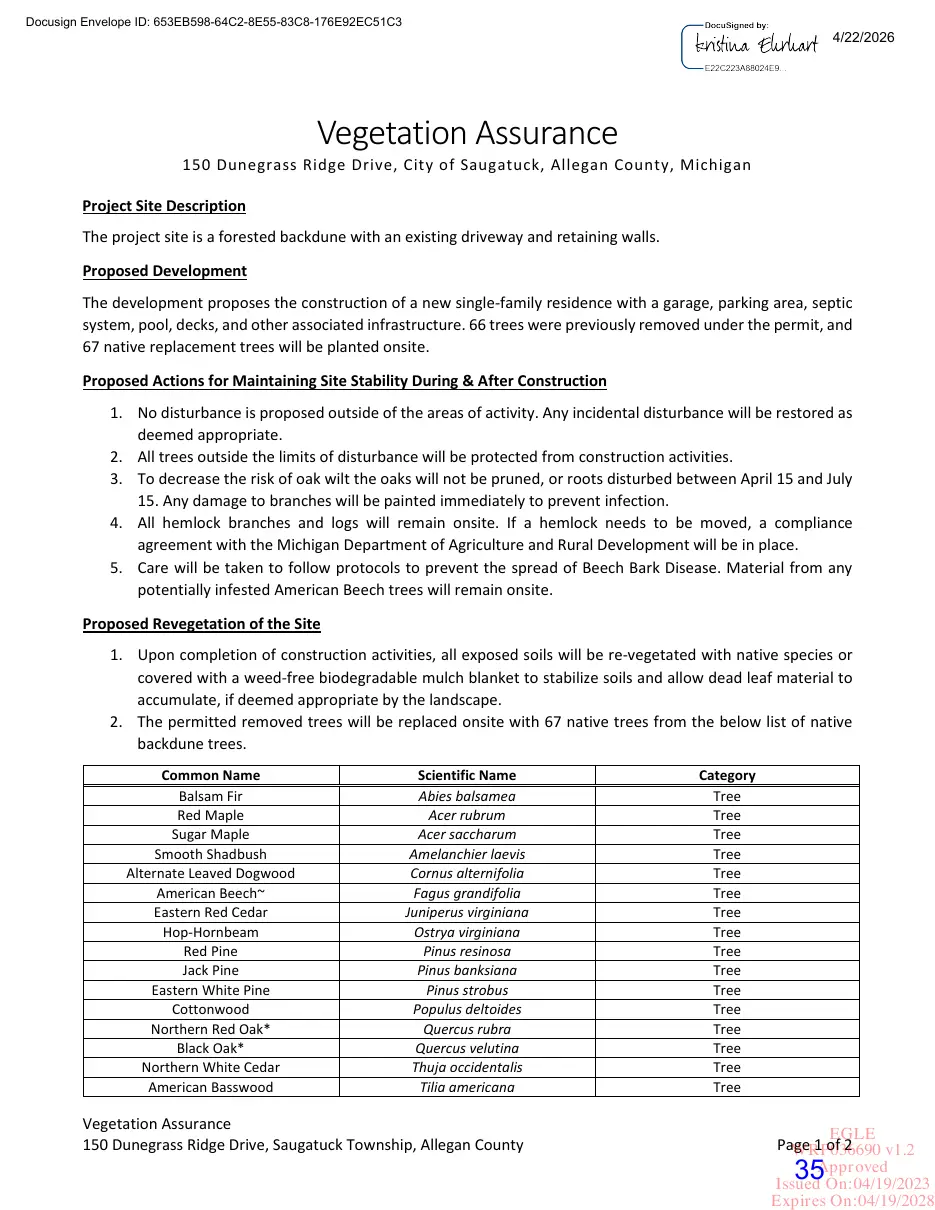
150 Dunegrass Ridge Drive, City of Saugatuck, Allegan County, Michigan Project Site Description The project site is a forested backdune with an existing driveway and retaining walls. Proposed Development The development proposes the construction of a new single-family residence with a garage, parking area, septic system, pool, decks, and other associated infrastructure. 66 trees were previously removed under the permit, and 67 native replacement trees will be planted onsite. Proposed Actions for Maintaining Site Stability During & After Construction 1. No disturbance is proposed outside of the areas of activity. Any incidental disturbance will be restored as deemed appropriate. 2. All trees outside the limits of disturbance will be protected from construction activities. 3. To decrease the risk of oak wilt the oaks will not be pruned, or roots disturbed between April 15 and July 15. Any damage to branches will be painted immediately to prevent infection. 4. All hemlock branches and logs will remain onsite. If a hemlock needs to be moved, a compliance agreement with the Michigan Department of Agriculture and Rural Development will be in place. 5. Care will be taken to follow protocols to prevent the spread of Beech Bark Disease. Material from any potentially infested American Beech trees will remain onsite. Proposed Revegetation of the Site 1. Upon completion of construction activities, all exposed soils will be re-vegetated with native species or covered with a weed-free biodegradable mulch blanket to stabilize soils and allow dead leaf material to accumulate, if deemed appropriate by the landscape. 2. The permitted removed trees will be replaced onsite with 67 native trees from the below list of native backdune trees. Common Name Balsam Fir Red Maple Sugar Maple Smooth Shadbush Alternate Leaved Dogwood American Beech~ Eastern Red Cedar Hop-Hornbeam Red Pine Jack Pine Eastern White Pine Cottonwood Northern Red Oak* Black Oak* Northern White Cedar American Basswood
Scientific Name Abies balsamea Acer rubrum Acer saccharum Amelanchier laevis Cornus alternifolia Fagus grandifolia Juniperus virginiana Ostrya virginiana Pinus resinosa Pinus banksiana Pinus strobus Populus deltoides Quercus rubra Quercus velutina Thuja occidentalis Tilia americana
Vegetation Assurance 150 Dunegrass Ridge Drive, Saugatuck Township, Allegan County
Category Tree Tree Tree Tree Tree Tree Tree Tree Tree Tree Tree Tree Tree Tree Tree Tree
EGLE Page 1 of 2 WRP036690 v1.2 Approved Issued On:04/19/2023 Expires On:04/19/2028
Page 36
Text of page 36
Docusign Envelope ID: 653EB598-64C2-8E55-83C8-176E92EC51C3
4/22/2026
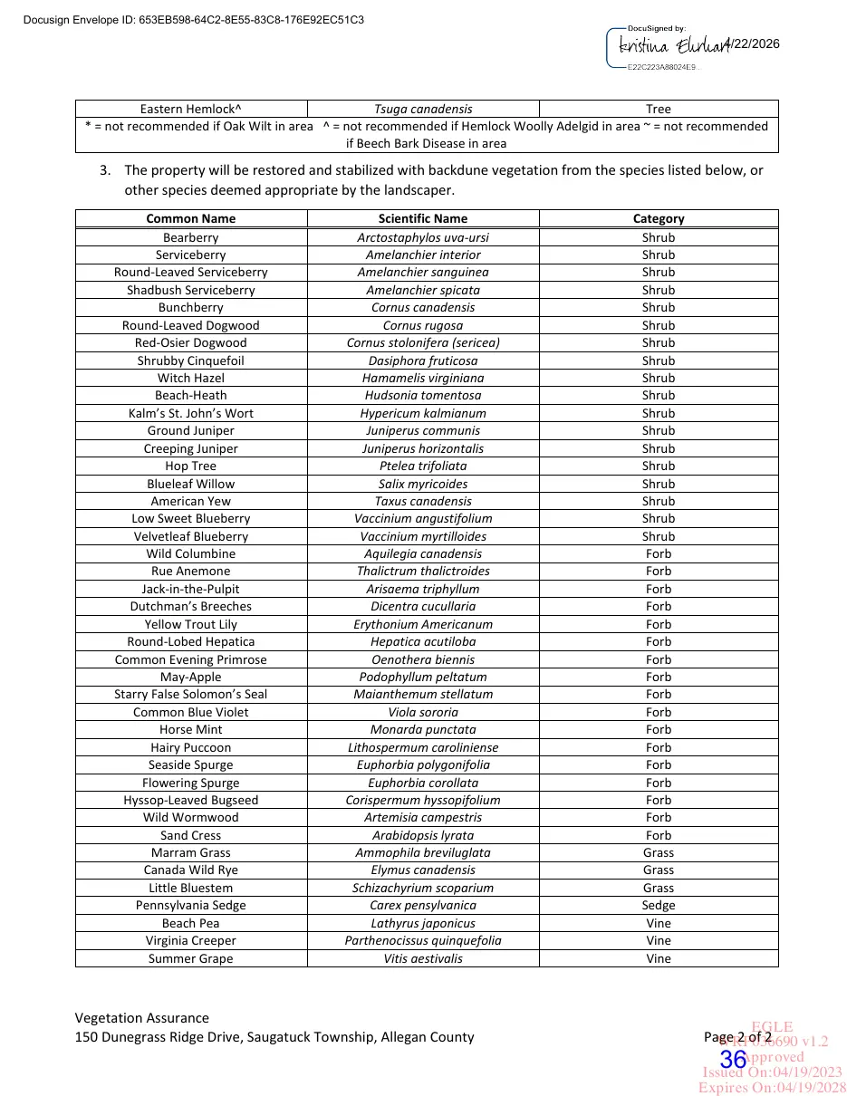
Eastern Hemlock^ Tsuga canadensis Tree * = not recommended if Oak Wilt in area ^ = not recommended if Hemlock Woolly Adelgid in area ~ = not recommended if Beech Bark Disease in area
3. The property will be restored and stabilized with backdune vegetation from the species listed below, or other species deemed appropriate by the landscaper. Common Name Bearberry Serviceberry Round-Leaved Serviceberry Shadbush Serviceberry Bunchberry Round-Leaved Dogwood Red-Osier Dogwood Shrubby Cinquefoil Witch Hazel Beach-Heath Kalm’s St. John’s Wort Ground Juniper Creeping Juniper Hop Tree Blueleaf Willow American Yew Low Sweet Blueberry Velvetleaf Blueberry Wild Columbine Rue Anemone Jack-in-the-Pulpit Dutchman’s Breeches Yellow Trout Lily Round-Lobed Hepatica Common Evening Primrose May-Apple Starry False Solomon’s Seal Common Blue Violet Horse Mint Hairy Puccoon Seaside Spurge Flowering Spurge Hyssop-Leaved Bugseed Wild Wormwood Sand Cress Marram Grass Canada Wild Rye Little Bluestem Pennsylvania Sedge Beach Pea Virginia Creeper Summer Grape
Scientific Name Arctostaphylos uva-ursi Amelanchier interior Amelanchier sanguinea Amelanchier spicata Cornus canadensis Cornus rugosa Cornus stolonifera (sericea) Dasiphora fruticosa Hamamelis virginiana Hudsonia tomentosa Hypericum kalmianum Juniperus communis Juniperus horizontalis Ptelea trifoliata Salix myricoides Taxus canadensis Vaccinium angustifolium Vaccinium myrtilloides Aquilegia canadensis Thalictrum thalictroides Arisaema triphyllum Dicentra cucullaria Erythonium Americanum Hepatica acutiloba Oenothera biennis Podophyllum peltatum Maianthemum stellatum Viola sororia Monarda punctata Lithospermum caroliniense Euphorbia polygonifolia Euphorbia corollata Corispermum hyssopifolium Artemisia campestris Arabidopsis lyrata Ammophila breviluglata Elymus canadensis Schizachyrium scoparium Carex pensylvanica Lathyrus japonicus Parthenocissus quinquefolia Vitis aestivalis
Vegetation Assurance 150 Dunegrass Ridge Drive, Saugatuck Township, Allegan County
Category Shrub Shrub Shrub Shrub Shrub Shrub Shrub Shrub Shrub Shrub Shrub Shrub Shrub Shrub Shrub Shrub Shrub Shrub Forb Forb Forb Forb Forb Forb Forb Forb Forb Forb Forb Forb Forb Forb Forb Forb Forb Grass Grass Grass Sedge Vine Vine Vine
EGLE Page 2 of 2 WRP036690 v1.2 Approved Issued On:04/19/2023 Expires On:04/19/2028