
Workshop Agenda item 6C
Saugatuck Harbor Natural Area - Invasive Species Management, Trail Assessment, and Ecological Evaluation
City Council Workshop, Wednesday, December 3, 2025
Download these 14 pages, 2.5 MB Whole packet, 40 pages, 4.8 MB
Page 12
Text of page 12
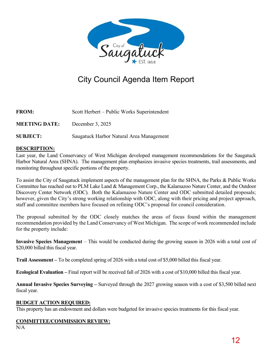
City Council Agenda Item Report
FROM:
Scott Herbert – Public Works Superintendent
MEETING DATE:
December 3, 2025
SUBJECT:
Saugatuck Harbor Natural Area Management
DESCRIPTION: Last year, the Land Conservancy of West Michigan developed management recommendations for the Saugatuck Harbor Natural Area (SHNA). The management plan emphasizes invasive species treatments, trail assessments, and monitoring throughout specific portions of the property. To assist the City of Saugatuck implement aspects of the management plan for the SHNA, the Parks & Public Works Committee has reached out to PLM Lake Land & Management Corp., the Kalamazoo Nature Center, and the Outdoor Discovery Center Network (ODC). Both the Kalamazoo Nature Center and ODC submitted detailed proposals; however, given the City’s strong working relationship with ODC, along with their pricing and project approach, staff and committee members have focused on refining ODC’s proposal for council consideration. The proposal submitted by the ODC closely matches the areas of focus found within the management recommendation provided by the Land Conservancy of West Michigan. The scope of work recommended include for the property include: Invasive Species Management – This would be conducted during the growing season in 2026 with a total cost of $20,000 billed this fiscal year. Trail Assessment – To be completed spring of 2026 with a total cost of $5,000 billed this fiscal year. Ecological Evaluation – Final report will be received fall of 2026 with a cost of $10,000 billed this fiscal year. Annual Invasive Species Surveying – Surveyed through the 2027 growing season with a cost of $3,500 billed next fiscal year. BUDGET ACTION REQUIRED: This property has an endowment and dollars were budgeted for invasive species treatments for this fiscal year. COMMITTEE/COMMISSION REVIEW: N/A
Page 13

Text of page 13
LEGAL REVIEW: N/A SAMPLE MOTION: Discussion only. Motion to approve the proposal submitted by the Outdoor Discovery Center Network in the amount of $38,500 for invasive species management, trail assessment, ecological evaluation, and invasive species survey work.
Page 14
Text of page 14
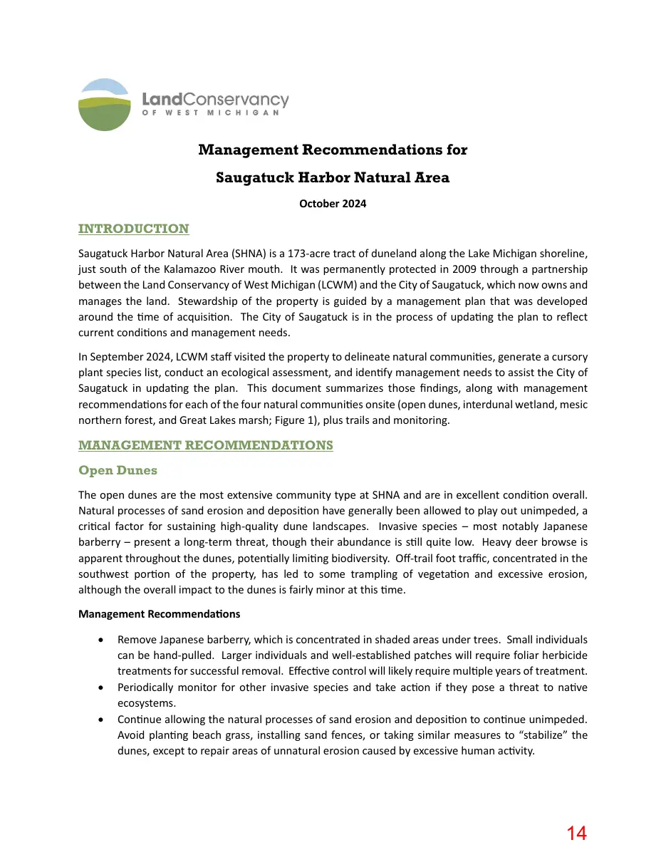
Management Recommendations for Saugatuck Harbor Natural Area October 2024
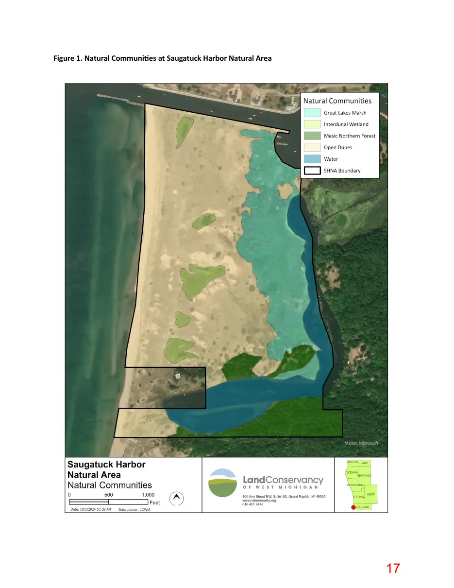
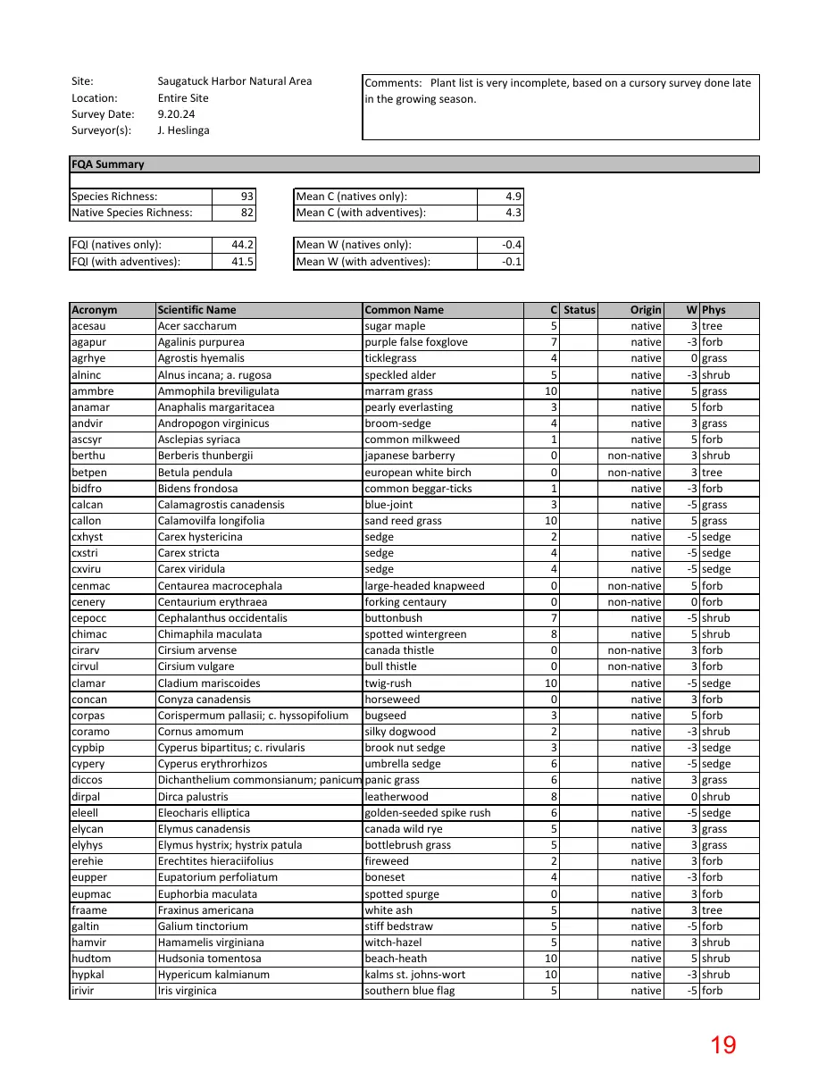
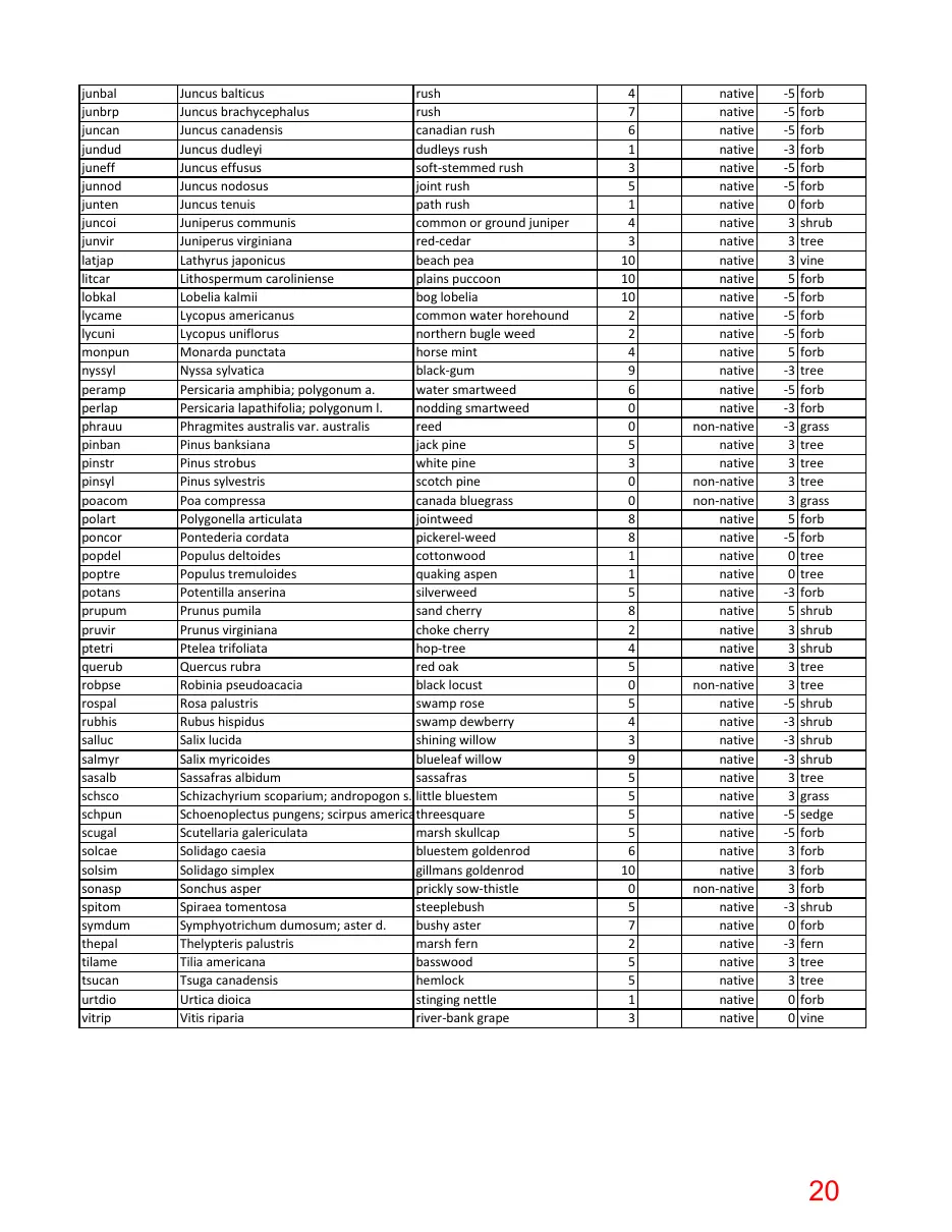
INTRODUCTION Saugatuck Harbor Natural Area (SHNA) is a 173-acre tract of duneland along the Lake Michigan shoreline, just south of the Kalamazoo River mouth. It was permanently protected in 2009 through a partnership between the Land Conservancy of West Michigan (LCWM) and the City of Saugatuck, which now owns and manages the land. Stewardship of the property is guided by a management plan that was developed around the time of acquisition. The City of Saugatuck is in the process of updating the plan to reflect current conditions and management needs. In September 2024, LCWM staff visited the property to delineate natural communities, generate a cursory plant species list, conduct an ecological assessment, and identify management needs to assist the City of Saugatuck in updating the plan. This document summarizes those findings, along with management recommendations for each of the four natural communities onsite (open dunes, interdunal wetland, mesic northern forest, and Great Lakes marsh; Figure 1), plus trails and monitoring.
MANAGEMENT RECOMMENDATIONS Open Dunes The open dunes are the most extensive community type at SHNA and are in excellent condition overall. Natural processes of sand erosion and deposition have generally been allowed to play out unimpeded, a critical factor for sustaining high-quality dune landscapes. Invasive species – most notably Japanese barberry – present a long-term threat, though their abundance is still quite low. Heavy deer browse is apparent throughout the dunes, potentially limiting biodiversity. Off-trail foot traffic, concentrated in the southwest portion of the property, has led to some trampling of vegetation and excessive erosion, although the overall impact to the dunes is fairly minor at this time. Management Recommendations •
Remove Japanese barberry, which is concentrated in shaded areas under trees. Small individuals can be hand-pulled. Larger individuals and well-established patches will require foliar herbicide treatments for successful removal. Effective control will likely require multiple years of treatment. Periodically monitor for other invasive species and take action if they pose a threat to native ecosystems. Continue allowing the natural processes of sand erosion and deposition to continue unimpeded. Avoid planting beach grass, installing sand fences, or taking similar measures to “stabilize” the dunes, except to repair areas of unnatural erosion caused by excessive human activity.
Page 15
Text of page 15
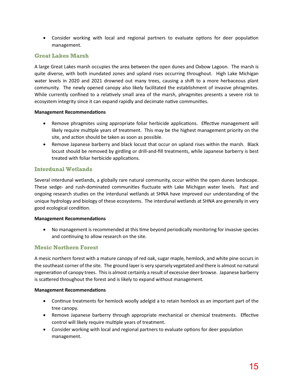
Consider working with local and regional partners to evaluate options for deer population management.
Great Lakes Marsh A large Great Lakes marsh occupies the area between the open dunes and Oxbow Lagoon. The marsh is quite diverse, with both inundated zones and upland rises occurring throughout. High Lake Michigan water levels in 2020 and 2021 drowned out many trees, causing a shift to a more herbaceous plant community. The newly opened canopy also likely facilitated the establishment of invasive phragmites. While currently confined to a relatively small area of the marsh, phragmites presents a severe risk to ecosystem integrity since it can expand rapidly and decimate native communities. Management Recommendations •
Remove phragmites using appropriate foliar herbicide applications. Effective management will likely require multiple years of treatment. This may be the highest management priority on the site, and action should be taken as soon as possible. Remove Japanese barberry and black locust that occur on upland rises within the marsh. Black locust should be removed by girdling or drill-and-fill treatments, while Japanese barberry is best treated with foliar herbicide applications.
Interdunal Wetlands Several interdunal wetlands, a globally rare natural community, occur within the open dunes landscape. These sedgeand rush-dominated communities fluctuate with Lake Michigan water levels. Past and ongoing research studies on the interdunal wetlands at SHNA have improved our understanding of the unique hydrology and biology of these ecosystems. The interdunal wetlands at SHNA are generally in very good ecological condition. Management Recommendations •
No management is recommended at this time beyond periodically monitoring for invasive species and continuing to allow research on the site.
Mesic Northern Forest A mesic northern forest with a mature canopy of red oak, sugar maple, hemlock, and white pine occurs in the southeast corner of the site. The ground layer is very sparsely vegetated and there is almost no natural regeneration of canopy trees. This is almost certainly a result of excessive deer browse. Japanese barberry is scattered throughout the forest and is likely to expand without management. Management Recommendations • • •
Continue treatments for hemlock woolly adelgid a to retain hemlock as an important part of the tree canopy. Remove Japanese barberry through appropriate mechanical or chemical treatments. Effective control will likely require multiple years of treatment. Consider working with local and regional partners to evaluate options for deer population management.
Page 16
Text of page 16
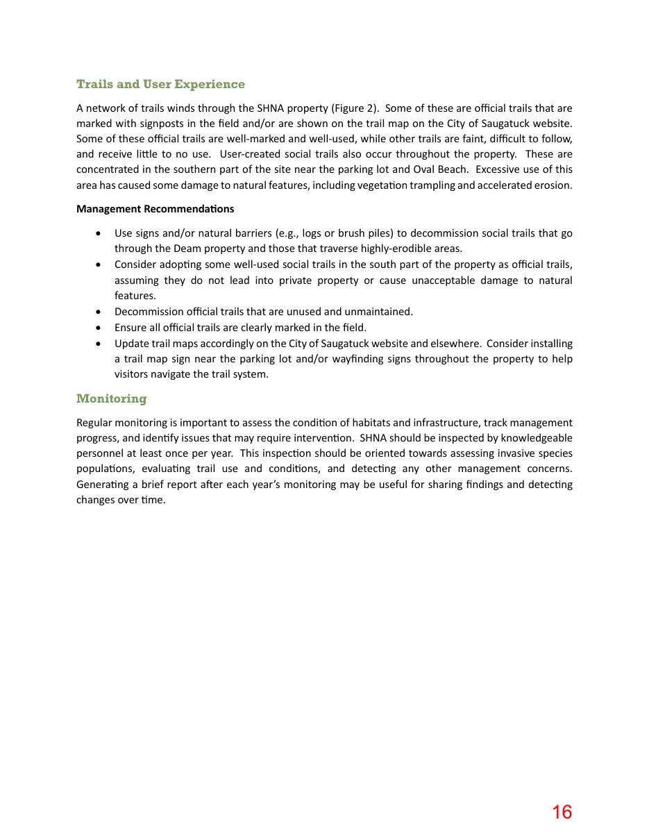
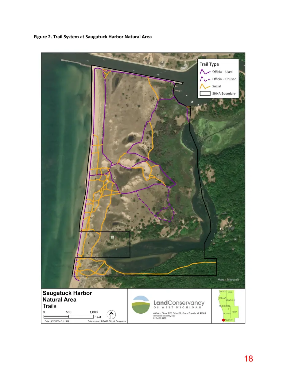
Trails and User Experience A network of trails winds through the SHNA property (Figure 2). Some of these are official trails that are marked with signposts in the field and/or are shown on the trail map on the City of Saugatuck website. Some of these official trails are well-marked and well-used, while other trails are faint, difficult to follow, and receive little to no use. User-created social trails also occur throughout the property. These are concentrated in the southern part of the site near the parking lot and Oval Beach. Excessive use of this area has caused some damage to natural features, including vegetation trampling and accelerated erosion. Management Recommendations • •
Use signs and/or natural barriers (e.g., logs or brush piles) to decommission social trails that go through the Deam property and those that traverse highly-erodible areas. Consider adopting some well-used social trails in the south part of the property as official trails, assuming they do not lead into private property or cause unacceptable damage to natural features. Decommission official trails that are unused and unmaintained. Ensure all official trails are clearly marked in the field. Update trail maps accordingly on the City of Saugatuck website and elsewhere. Consider installing a trail map sign near the parking lot and/or wayfinding signs throughout the property to help visitors navigate the trail system.
Monitoring Regular monitoring is important to assess the condition of habitats and infrastructure, track management progress, and identify issues that may require intervention. SHNA should be inspected by knowledgeable personnel at least once per year. This inspection should be oriented towards assessing invasive species populations, evaluating trail use and conditions, and detecting any other management concerns. Generating a brief report after each year’s monitoring may be useful for sharing findings and detecting changes over time.
Page 17
Text of page 17
Figure 1. Natural Communities at Saugatuck Harbor Natural Area
Page 18
Text of page 18
Figure 2. Trail System at Saugatuck Harbor Natural Area
Page 19
Text of page 19
Site: Location: Survey Date: Surveyor(s):
Saugatuck Harbor Natural Area Entire Site 9.20.24 J. Heslinga
Comments: Plant list is very incomplete, based on a cursory survey done late in the growing season.
FQA Summary Species Richness: Native Species Richness:
93 82
Mean C (natives only): Mean C (with adventives):
4.9 4.3
FQI (natives only): FQI (with adventives):
44.2 41.5
Mean W (natives only): Mean W (with adventives):
-0.4 -0.1
Acronym acesau agapur agrhye alninc ammbre anamar andvir ascsyr berthu betpen bidfro calcan callon cxhyst cxstri cxviru cenmac cenery cepocc chimac cirarv cirvul clamar concan corpas coramo cypbip cypery diccos dirpal eleell elycan elyhys erehie eupper eupmac fraame galtin hamvir hudtom hypkal irivir
Scientific Name Common Name Acer saccharum sugar maple Agalinis purpurea purple false foxglove Agrostis hyemalis ticklegrass Alnus incana; a. rugosa speckled alder Ammophila breviligulata marram grass Anaphalis margaritacea pearly everlasting Andropogon virginicus broom-sedge Asclepias syriaca common milkweed Berberis thunbergii japanese barberry Betula pendula european white birch Bidens frondosa common beggar-ticks Calamagrostis canadensis blue-joint Calamovilfa longifolia sand reed grass Carex hystericina sedge Carex stricta sedge Carex viridula sedge Centaurea macrocephala large-headed knapweed Centaurium erythraea forking centaury Cephalanthus occidentalis buttonbush Chimaphila maculata spotted wintergreen Cirsium arvense canada thistle Cirsium vulgare bull thistle Cladium mariscoides twig-rush Conyza canadensis horseweed Corispermum pallasii; c. hyssopifolium bugseed Cornus amomum silky dogwood Cyperus bipartitus; c. rivularis brook nut sedge Cyperus erythrorhizos umbrella sedge Dichanthelium commonsianum; panicum c. panic grass Dirca palustris leatherwood Eleocharis elliptica golden-seeded spike rush Elymus canadensis canada wild rye Elymus hystrix; hystrix patula bottlebrush grass Erechtites hieraciifolius fireweed Eupatorium perfoliatum boneset Euphorbia maculata spotted spurge Fraxinus americana white ash Galium tinctorium stiff bedstraw Hamamelis virginiana witch-hazel Hudsonia tomentosa beach-heath Hypericum kalmianum kalms st. johns-wort Iris virginica southern blue flag
C Status 5 7 4 5 10 3 4 1 0 0 1 3 10 2 4 4 0 0 7 8 0 0 10 0 3 2 3 6 6 8 6 5 5 2 4 0 5 5 5 10 10 5 -
Origin native native native native native native native native non-native non-native native native native native native native non-native non-native native native non-native non-native native native native native native native native native native native native native native native native native native native native native
W Phys 3 tree -3 forb 0 grass -3 shrub 5 grass 5 forb 3 grass 5 forb 3 shrub 3 tree -3 forb -5 grass 5 grass -5 sedge -5 sedge -5 sedge 5 forb 0 forb -5 shrub 5 shrub 3 forb 3 forb -5 sedge 3 forb 5 forb -3 shrub -3 sedge -5 sedge 3 grass 0 shrub -5 sedge 3 grass 3 grass 3 forb -3 forb 3 forb 3 tree -5 forb 3 shrub 5 shrub -3 shrub -5 forb
Page 20
Text of page 20
junbal junbrp juncan jundud juneff junnod junten juncoi junvir latjap litcar lobkal lycame lycuni monpun nyssyl peramp perlap phrauu pinban pinstr pinsyl poacom polart poncor popdel poptre potans prupum pruvir ptetri querub robpse rospal rubhis salluc salmyr sasalb schsco schpun scugal solcae solsim sonasp spitom symdum thepal tilame tsucan urtdio vitrip
Juncus balticus rush Juncus brachycephalus rush Juncus canadensis canadian rush Juncus dudleyi dudleys rush Juncus effusus soft-stemmed rush Juncus nodosus joint rush Juncus tenuis path rush Juniperus communis common or ground juniper Juniperus virginiana red-cedar Lathyrus japonicus beach pea Lithospermum caroliniense plains puccoon Lobelia kalmii bog lobelia Lycopus americanus common water horehound Lycopus uniflorus northern bugle weed Monarda punctata horse mint Nyssa sylvatica black-gum Persicaria amphibia; polygonum a. water smartweed Persicaria lapathifolia; polygonum l. nodding smartweed Phragmites australis var. australis reed Pinus banksiana jack pine Pinus strobus white pine Pinus sylvestris scotch pine Poa compressa canada bluegrass Polygonella articulata jointweed Pontederia cordata pickerel-weed Populus deltoides cottonwood Populus tremuloides quaking aspen Potentilla anserina silverweed Prunus pumila sand cherry Prunus virginiana choke cherry Ptelea trifoliata hop-tree Quercus rubra red oak Robinia pseudoacacia black locust Rosa palustris swamp rose Rubus hispidus swamp dewberry Salix lucida shining willow Salix myricoides blueleaf willow Sassafras albidum sassafras Schizachyrium scoparium; andropogon s. little bluestem Schoenoplectus pungens; scirpus americanus threesquare Scutellaria galericulata marsh skullcap Solidago caesia bluestem goldenrod Solidago simplex gillmans goldenrod Sonchus asper prickly sow-thistle Spiraea tomentosa steeplebush Symphyotrichum dumosum; aster d. bushy aster Thelypteris palustris marsh fern Tilia americana basswood Tsuga canadensis hemlock Urtica dioica stinging nettle Vitis riparia river-bank grape
4 7 6 1 3 5 1 4 3 10 10 10 2 2 4 9 6 0 0 5 3 0 0 8 8 1 1 5 8 2 4 5 0 5 4 3 9 5 5 5 5 6 10 0 5 7 2 5 5 1 3
native native native native native native native native native native native native native native native native native native non-native native native non-native non-native native native native native native native native native native non-native native native native native native native native native native native non-native native native native native native native native
-5 forb -5 forb -5 forb -3 forb -5 forb -5 forb 0 forb 3 shrub 3 tree 3 vine 5 forb -5 forb -5 forb -5 forb 5 forb -3 tree -5 forb -3 forb -3 grass 3 tree 3 tree 3 tree 3 grass 5 forb -5 forb 0 tree 0 tree -3 forb 5 shrub 3 shrub 3 shrub 3 tree 3 tree -5 shrub -3 shrub -3 shrub -3 shrub 3 tree 3 grass -5 sedge -5 forb 3 forb 3 forb 3 forb -3 shrub 0 forb -3 fern 3 tree 3 tree 0 forb 0 vine
Page 21
Text of page 21
PROPOSAL FOR CONSERVATION SERVICES This proposal was created for: City of Saugatuck - Saugatuck Harbor Natural Area Oval Dr, Saugatuck, MI 49453 General Background and Scope of Work: The purpose of this proposal is to address ecological improvement opportunities on the 173-acre Saugatuck Harbor Natural Area property. The property is facing substantial pressure from several invasive species, as well as unmarked trails causing damage to sensitive plant communities. To protect the sensitive habitats on the site and to ensure long-term ecological health, our team recommends the following plan in 2026 and beyond: 1. Invasive Species Management ▪ Woody invasive species: Japanese Barberry (Berberis thunbergii) and European Privet (Ligustrum vulgare) are fast-growing invasive shrubs that displace native plants in the wooded areas of the property. ▪ Smaller plants will be handpulled, while larger plants will be carefully treated with targeted foliar applications of Triclopyr herbicide in Summer of 2026. ▪ Phragmites (Phragmites australis) is a common wetland invasive that forms dense monocultures in wetland habitats; including the sensitive interdunal wetlands on the property. ▪ Carefully targeted foliar herbicide applications will be conducted with 2% Aquaneat herbicide in Fall of 2026. ▪ Spotted Knapweed (Centaurea stoebe) is a highly aggressive forb with allelopathic tendencies that quickly overtakes sandy habitats and displaces native vegetation. ▪ Hand pulling will be done in areas where off-target impacts are a concern, while foliar applications will be conducted with foliar applications in Summer of 2026. ▪ Includes procurement of all necessary permitting to apply herbicides through EGLE and MDARD. ▪ Note: Many of the observed invasive species above generally require repeated management efforts over a period of at least 5-7 years to achieve meaningful reduction or eradication. Our team will continue to monitor the population(s) annually and will provide updated pricing and management recommendations each year. The allows for adaptive management strategies based on observed changes in site conditions and treatment efficacy year-to-year. 2. Trail Assessment ▪ Conduct general survey of the entire property to outline the ideal footprint for the trail system. ▪ Deliverables will include a map of recommended trail routes, trails to be decommissioned, alternative routes to avoid impacting sensitive plant communities, and recommendations for interpretive and/or other non-permanent trail signage. ▪ The trail assessment will be conducted in Spring 2026, with a concise digital report of our recommendations provided by June 15, 2026. ▪ ODC Network’s Interpretation team is available to assist with the detailed design and production of interpretive signage upon request. 3. Ecological Evaluation ▪ In order to assess the current ecological health of the property, our team will identify each distinct natural community observed on the property and outline the following criteria for each: ▪ General ecological site description and inventory of natural features. ▪ Description of each natural community including: • Landscape context and natural processes.
INITIAL______
Page 22
Text of page 22
General inventory and distribution of native plant communities including the canopy, understory, and forb/graminoid layers (including calculation of overall floristic quality index). • Documentation of high-quality native plant species (with coefficient of conservatism rankings between 6-10). • Documentation of both observed and potential wildlife including: state threatened (T), endangered (E), and species of special concern (SC). • Documentation of invasive species, pests, and potential ecological threats. • Identification of potential ecological restoration and outdoor education opportunities. The ecological evaluation process will help create a framework of the natural communities on the property for preservation, restoration, and management to help guide future management and land-use decisions on the property. ▪ Target date for field survey: April-August 2026 Following completion of the evaluation, we will create a digital report summarizing the results. ▪ Target date for report submission: September 15, 2026
4. Annual Invasive Species Survey ▪ Conduct annual survey to provide early detection of any new invasive species or expansion of existing populations that could threaten the high-quality natural areas on the site. ▪ Deliverables will include a concise report with updated maps documenting the location(s) and spread of invasive species, as well as new concerns to look out for. ▪ Surveys will be conducted mid-summer to optimize plant identification and reports will be digitally submitted by August 15, annually. Project Timeline: • Invasive species management ongoing throughout the 2026 growing season • Trail assessment conducted in spring of 2026, report submitted by June 15, 2026 • Ecological evaluation conducted between April-August, report submitted by September 15, 2026 • Invasive species survey conducted between May-July 2027, report submitted by August 15, 2027 Project Budget: • Invasive Species Management in 2026 - $20,000 (billed in July 2026) ☐ • Trail Assessment - $5,000 (billed in June 2026) ☐ • Ecological Evaluation - $10,000 (billed in June 2026) ☐ • Annual Invasive Species Survey (starting in 2027) - $3,500 (billed in August 2027) ☐ *PLEASE CHECK THE APPROPRIATE BOXES ABOVE TO INDICATE ACCEPTED SERVICES Note: This proposal accounts for pricing of all labor, materials, and equipment necessary in order to perform the outlined work plan. If additional work is required beyond the scope of this proposal, we will provide written notification and pricing will be determined on a time and materials basis. Exclusions: This proposal does not account for: • Installation or maintenance of new trail systems. • Removal of standing dead plant material following invasive species control measures. • Replacement of damaged lawn, landscape plants, trees or shrubs as a result of nearby invasive species control measures. • Reseeding of native vegetation following invasive species control measures. We are happy to provide a quote for ongoing trail maintenance and/or replanting of native vegetation following invasive species control measures per request.
INITIAL______
Page 23

Text of page 23
Qualifications: ODC Conservation Services staff are highly qualified conservation professionals. • ODC Network, and its subsidiaries, is a fully insured 501c3 and carries an extensive liability policy to conduct habitat improvement services in Michigan • State licensed herbicide applicators with certifications in Forest Pest, Right-of-Way, and Aquatic pesticide application • Combined 25+ years experience in invasive species management • Successfully restored over 250 acres of native prairie • Successfully installed over 25 native gardens and landscape beds • Manage 2,000+ acres of high quality natural area • Experienced Michigan flora and fauna identification • Advanced wetland delineation certification • Experienced GIS professionals We appreciate the opportunity to submit this proposal. We look forward to discussing the opportunity further with you. Please do not hesitate to ask questions or clarifications. If you choose to accept this proposal, please sign and return a copy.
Tanner Bricker, Conservation Services Director ODC Network 517-398-7800
If you wish to accept this proposal, please initial each page, as well as sign and date below:
_____________________________________________________ Signature of Authorized Property Owner/Manager
_____________________________ Date
INITIAL______
Page 24
Text of page 24
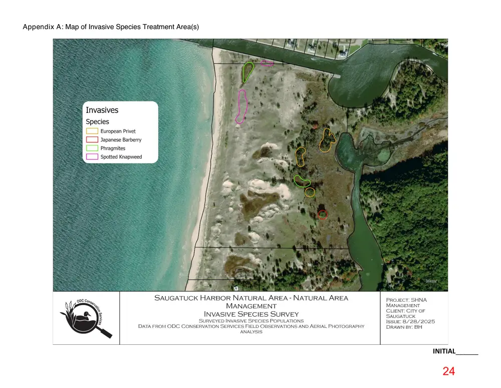
Appendix A: Map of Invasive Species Treatment Area(s)
INITIAL______
Page 25
Text of page 25
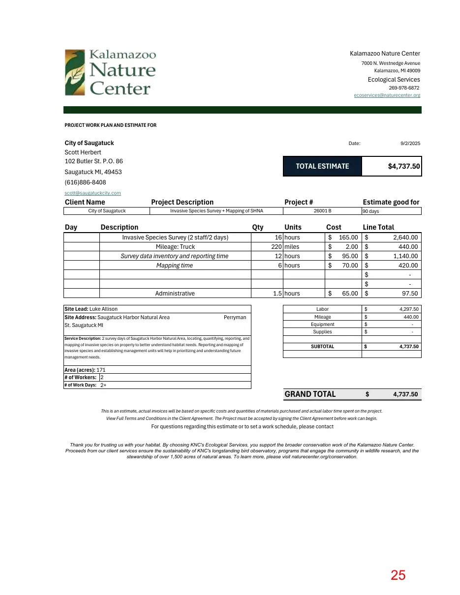
Kalamazoo Nature Center 7000 N. Westnedge Avenue Kalamazoo, MI 49009
Ecological Services 269-978-6872 ecoservices@naturecenter.org
PROJECT WORK PLAN AND ESTIMATE FOR
City of Saugatuck Scott Herbert 102 Butler St. P.O. 86
Date:
9/2/2025
TOTAL ESTIMATE
Saugatuck MI, 49453
$4,737.50
(616)886-8408 scott@saugatuckcity.com
Client Name Day
Project #
Project Description
City of Saugatuck
Invasive Species Survey + Mapping of SHNA
Description
Qty
Units 16 hours 220 miles 12 hours 6 hours
Administrative
1.5 hours Perryman
Service Description: 2 survey days of Saugatuck Harbor Natural Area, locating, quantifying, reporting, and mapping of invasive species on property to better understand habitat needs. Reporting and mapping of invasive species and establishing management units will help in prioritizing and understanding future management needs.
90 days
Cost
Invasive Species Survey (2 staff/2 days) Mileage: Truck Survey data inventory and reporting time Mapping time
Site Lead: Luke Allison Site Address: Saugatuck Harbor Natural Area St. Saugatuck MI
Area (acres): 171 # of Workers: 2 # of Work Days: 2+
Estimate good for 26001 B
Line Total
165.00 2.00 95.00 70.00
$ $ $ $ $ $ 65.00 $
2,640.00 440.00 1,140.00 420.00 97.50
Labor Mileage Equipment Supplies
4,297.50 440.00 -
SUBTOTAL
4,737.50
GRAND TOTAL
4,737.50
This is an estimate, actual invoices will be based on specific costs and quantities of materials purchased and actual labor time spent on the project. View Full Terms and Conditions in the Client Agreement. The Project must be accepted by signing the Client Agreement before work can begin.
For questions regarding this estimate or to set a work schedule, please contact Thank you for trusting us with your habitat. By choosing KNC's Ecological Services, you support the broader conservation work of the Kalamazoo Nature Center. Proceeds from our client services ensure the sustainability of KNC's longstanding bird observatory, programs that engage the community in wildlife research, and the stewardship of over 1,500 acres of natural areas. To learn more, please visit naturecenter.org/conservation.