
Planning Agenda item 5A
1165/1169 Bridge St., Major Waterfront Construction Public Hearing
Planning Commission, Tuesday, September 8, 2026
Download these 22 pages, 7.8 MB Whole packet, 70 pages, 10.4 MB
Page 6
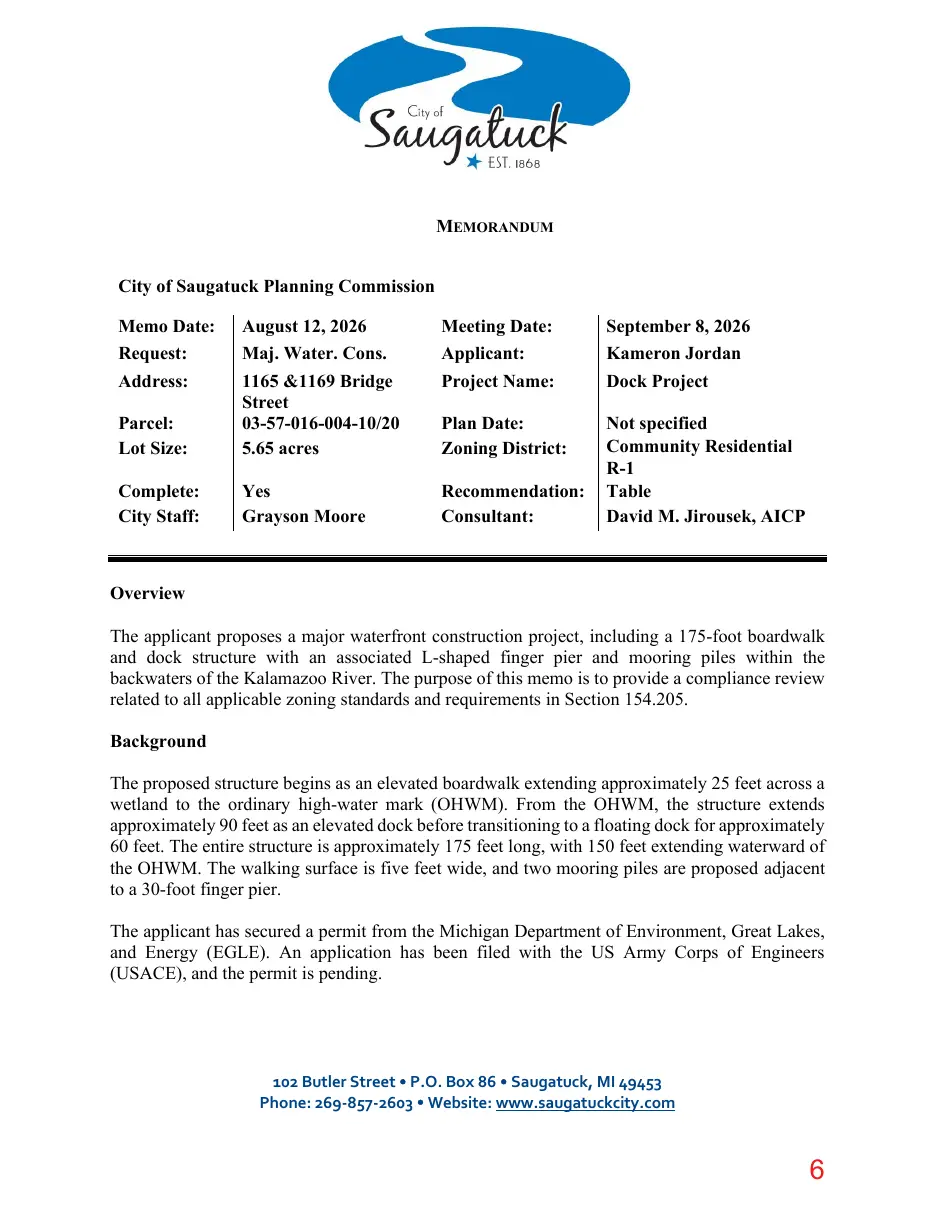
Text of page 6
MEMORANDUM City of Saugatuck Planning Commission Meeting Date: Applicant: Project Name:
September 8, 2026 Kameron Jordan Dock Project
Parcel: Lot Size:
August 12, 2026 Maj. Water. Cons. 1165 &1169 Bridge Street 03-57-016-004-10/20 5.65 acres
Plan Date: Zoning District:
Complete: City Staff:
Yes Grayson Moore
Recommendation: Consultant:
Not specified Community Residential R-1 Table David M. Jirousek, AICP
Memo Date: Request: Address:
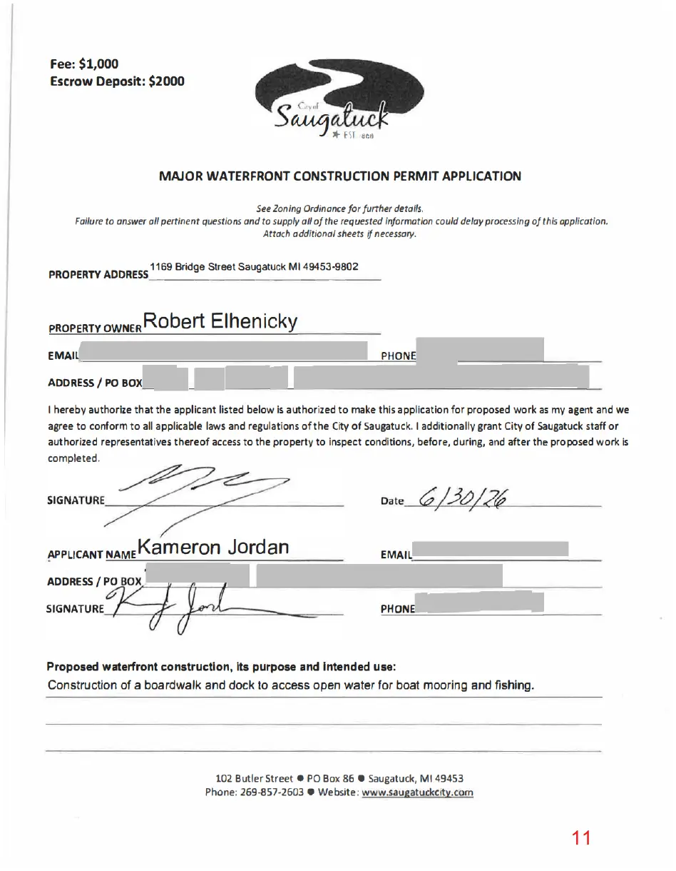
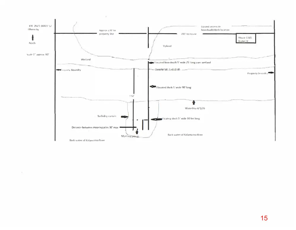
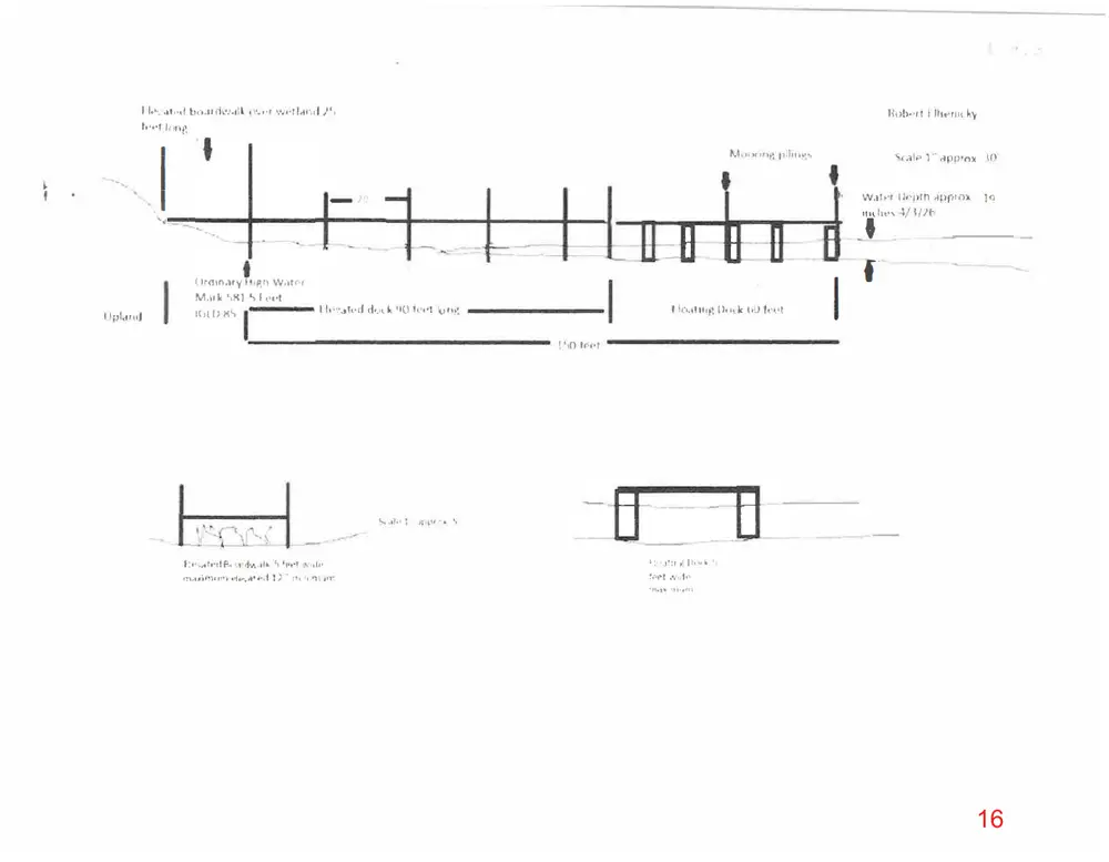
Overview The applicant proposes a major waterfront construction project, including a 175-foot boardwalk and dock structure with an associated L-shaped finger pier and mooring piles within the backwaters of the Kalamazoo River. The purpose of this memo is to provide a compliance review related to all applicable zoning standards and requirements in Section 154.205. Background The proposed structure begins as an elevated boardwalk extending approximately 25 feet across a wetland to the ordinary high-water mark (OHWM). From the OHWM, the structure extends approximately 90 feet as an elevated dock before transitioning to a floating dock for approximately 60 feet. The entire structure is approximately 175 feet long, with 150 feet extending waterward of the OHWM. The walking surface is five feet wide, and two mooring piles are proposed adjacent to a 30-foot finger pier. The applicant has secured a permit from the Michigan Department of Environment, Great Lakes, and Energy (EGLE). An application has been filed with the US Army Corps of Engineers (USACE), and the permit is pending.
102 Butler Street P.O. Box 86 Saugatuck, MI 49453 Phone: 269-857-2603 Website: www.saugatuckcity.com
Page 7
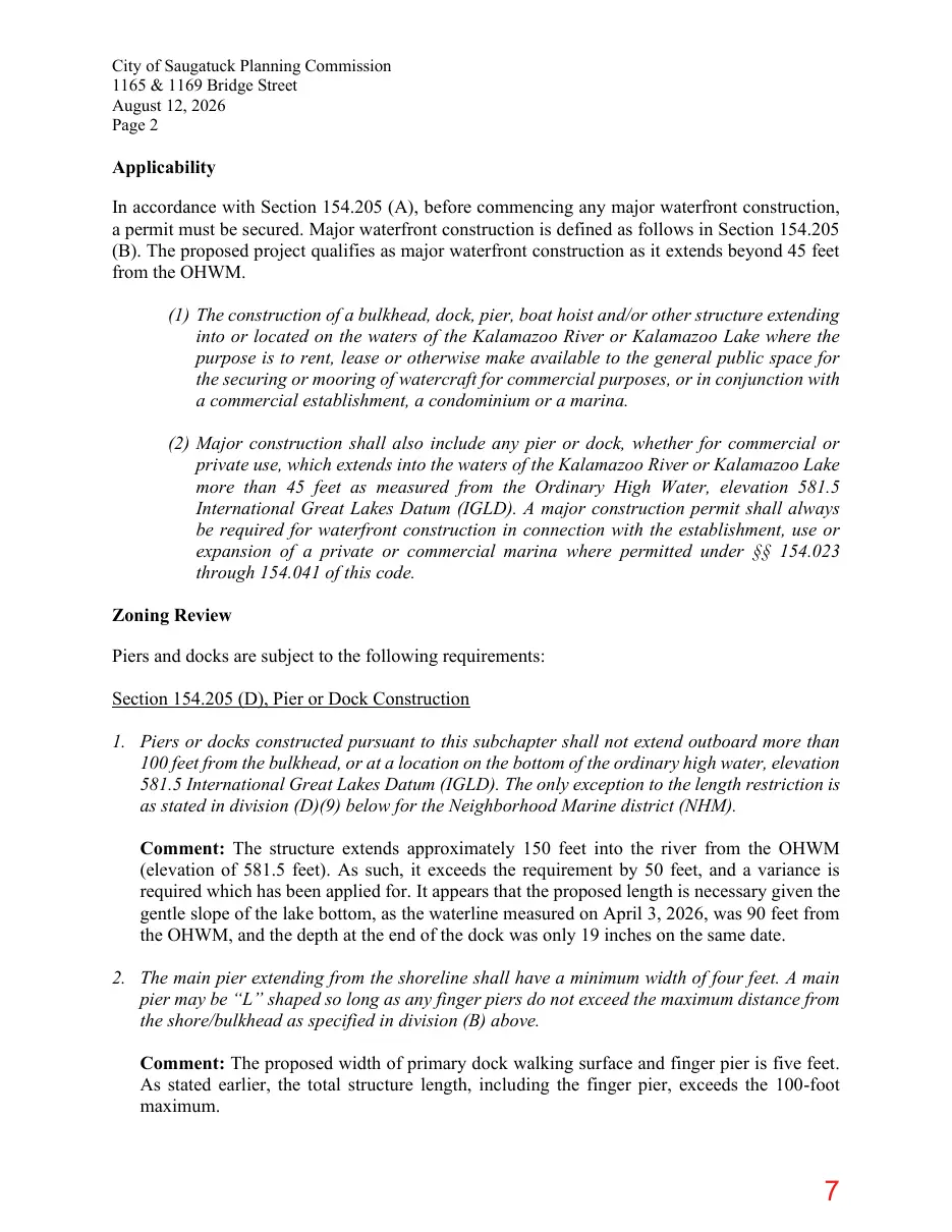
Text of page 7
City of Saugatuck Planning Commission 1165 & 1169 Bridge Street August 12, 2026 Page 2
Applicability In accordance with Section 154.205 (A), before commencing any major waterfront construction, a permit must be secured. Major waterfront construction is defined as follows in Section 154.205 (B). The proposed project qualifies as major waterfront construction as it extends beyond 45 feet from the OHWM. (1) The construction of a bulkhead, dock, pier, boat hoist and/or other structure extending into or located on the waters of the Kalamazoo River or Kalamazoo Lake where the purpose is to rent, lease or otherwise make available to the general public space for the securing or mooring of watercraft for commercial purposes, or in conjunction with a commercial establishment, a condominium or a marina. (2) Major construction shall also include any pier or dock, whether for commercial or private use, which extends into the waters of the Kalamazoo River or Kalamazoo Lake more than 45 feet as measured from the Ordinary High Water, elevation 581.5 International Great Lakes Datum (IGLD). A major construction permit shall always be required for waterfront construction in connection with the establishment, use or expansion of a private or commercial marina where permitted under §§ 154.023 through 154.041 of this code. Zoning Review Piers and docks are subject to the following requirements: Section 154.205 (D), Pier or Dock Construction 1. Piers or docks constructed pursuant to this subchapter shall not extend outboard more than 100 feet from the bulkhead, or at a location on the bottom of the ordinary high water, elevation 581.5 International Great Lakes Datum (IGLD). The only exception to the length restriction is as stated in division (D)(9) below for the Neighborhood Marine district (NHM). Comment: The structure extends approximately 150 feet into the river from the OHWM (elevation of 581.5 feet). As such, it exceeds the requirement by 50 feet, and a variance is required which has been applied for. It appears that the proposed length is necessary given the gentle slope of the lake bottom, as the waterline measured on April 3, 2026, was 90 feet from the OHWM, and the depth at the end of the dock was only 19 inches on the same date. 2. The main pier extending from the shoreline shall have a minimum width of four feet. A main pier may be “L” shaped so long as any finger piers do not exceed the maximum distance from the shore/bulkhead as specified in division (B) above. Comment: The proposed width of primary dock walking surface and finger pier is five feet. As stated earlier, the total structure length, including the finger pier, exceeds the 100-foot maximum.
Page 8
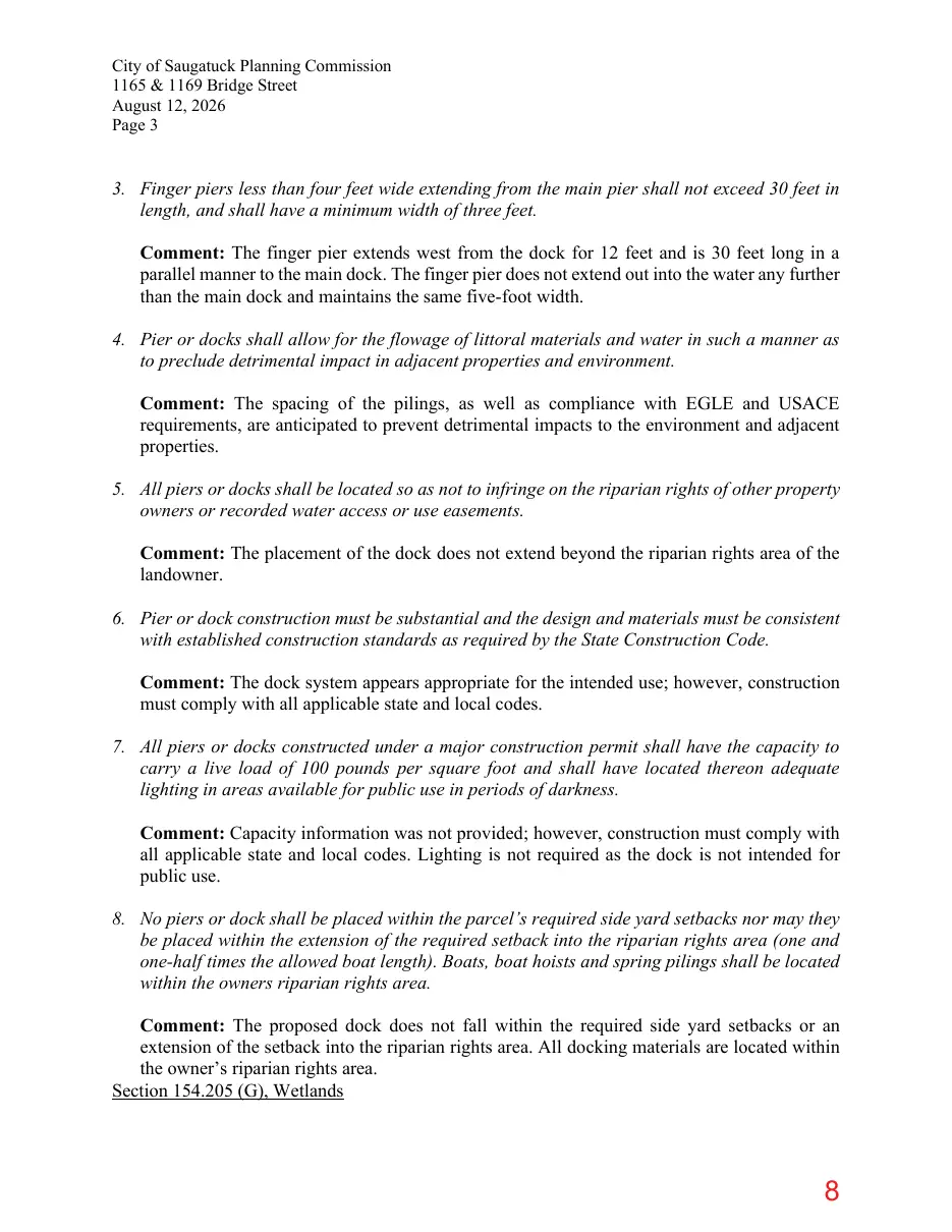
Text of page 8
City of Saugatuck Planning Commission 1165 & 1169 Bridge Street August 12, 2026 Page 3
3. Finger piers less than four feet wide extending from the main pier shall not exceed 30 feet in length, and shall have a minimum width of three feet. Comment: The finger pier extends west from the dock for 12 feet and is 30 feet long in a parallel manner to the main dock. The finger pier does not extend out into the water any further than the main dock and maintains the same five-foot width. 4. Pier or docks shall allow for the flowage of littoral materials and water in such a manner as to preclude detrimental impact in adjacent properties and environment. Comment: The spacing of the pilings, as well as compliance with EGLE and USACE requirements, are anticipated to prevent detrimental impacts to the environment and adjacent properties. 5. All piers or docks shall be located so as not to infringe on the riparian rights of other property owners or recorded water access or use easements. Comment: The placement of the dock does not extend beyond the riparian rights area of the landowner. 6. Pier or dock construction must be substantial and the design and materials must be consistent with established construction standards as required by the State Construction Code. Comment: The dock system appears appropriate for the intended use; however, construction must comply with all applicable state and local codes. 7. All piers or docks constructed under a major construction permit shall have the capacity to carry a live load of 100 pounds per square foot and shall have located thereon adequate lighting in areas available for public use in periods of darkness. Comment: Capacity information was not provided; however, construction must comply with all applicable state and local codes. Lighting is not required as the dock is not intended for public use. 8. No piers or dock shall be placed within the parcel’s required side yard setbacks nor may they be placed within the extension of the required setback into the riparian rights area (one and one-half times the allowed boat length). Boats, boat hoists and spring pilings shall be located within the owners riparian rights area. Comment: The proposed dock does not fall within the required side yard setbacks or an extension of the setback into the riparian rights area. All docking materials are located within the owner’s riparian rights area. Section 154.205 (G), Wetlands
Page 9
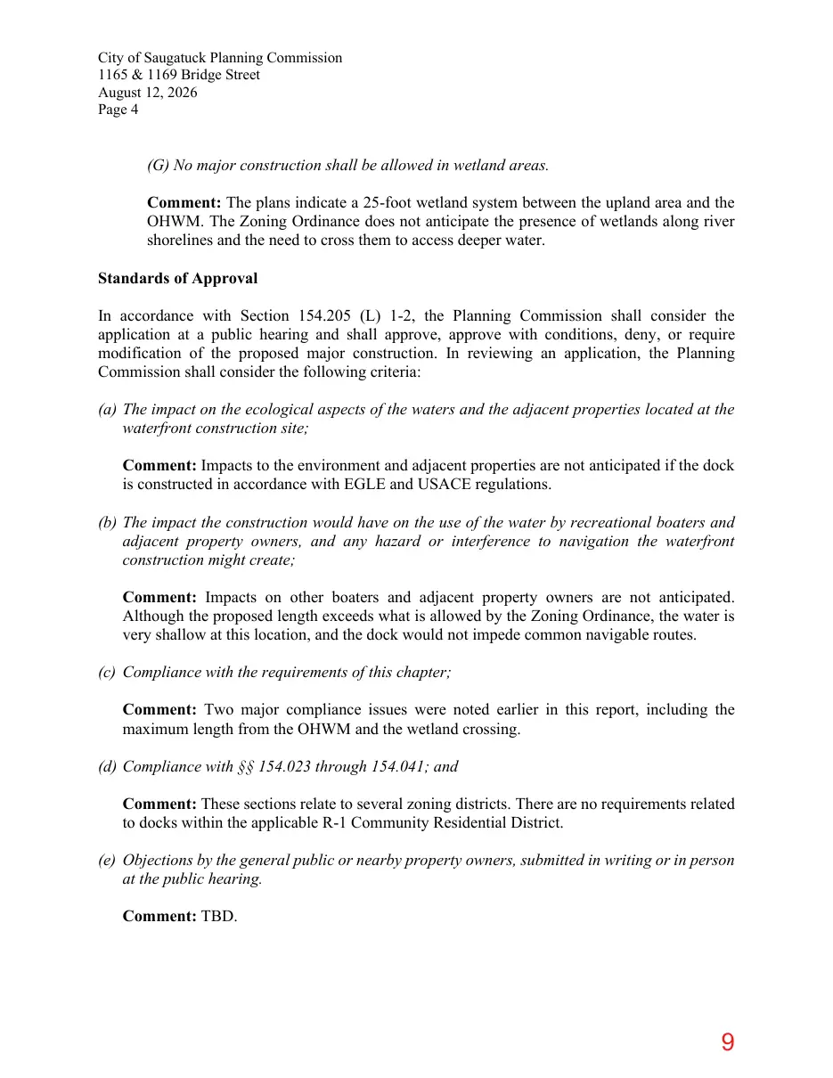
Text of page 9
City of Saugatuck Planning Commission 1165 & 1169 Bridge Street August 12, 2026 Page 4
(G) No major construction shall be allowed in wetland areas. Comment: The plans indicate a 25-foot wetland system between the upland area and the OHWM. The Zoning Ordinance does not anticipate the presence of wetlands along river shorelines and the need to cross them to access deeper water. Standards of Approval In accordance with Section 154.205 (L) 1-2, the Planning Commission shall consider the application at a public hearing and shall approve, approve with conditions, deny, or require modification of the proposed major construction. In reviewing an application, the Planning Commission shall consider the following criteria: (a) The impact on the ecological aspects of the waters and the adjacent properties located at the waterfront construction site; Comment: Impacts to the environment and adjacent properties are not anticipated if the dock is constructed in accordance with EGLE and USACE regulations. (b) The impact the construction would have on the use of the water by recreational boaters and adjacent property owners, and any hazard or interference to navigation the waterfront construction might create; Comment: Impacts on other boaters and adjacent property owners are not anticipated. Although the proposed length exceeds what is allowed by the Zoning Ordinance, the water is very shallow at this location, and the dock would not impede common navigable routes. (c) Compliance with the requirements of this chapter; Comment: Two major compliance issues were noted earlier in this report, including the maximum length from the OHWM and the wetland crossing. (d) Compliance with §§ 154.023 through 154.041; and Comment: These sections relate to several zoning districts. There are no requirements related to docks within the applicable R-1 Community Residential District. (e) Objections by the general public or nearby property owners, submitted in writing or in person at the public hearing. Comment: TBD.
Page 10
Text of page 10
City of Saugatuck Planning Commission 1165 & 1169 Bridge Street August 12, 2026 Page 5 Recommendation
The dock cannot be approved as submitted based on its proposed length, as measured from the OHWM, and because wetlands are proposed to be crossed. The Planning Commission may wish to table consideration of the project to give the applicant a chance to apply for a variance based on the compliance issues noted in this report. Sample motions are included below. I move to conditionally approve the major waterfront construction project for a 175-foot dock at 1165 and 1169 Bridge Street, provided that the approval shall not become effective unless and until the Zoning Board of Appeals granting both of the following variances: 1. A 50-foot dimensional variance from Section 154.205(D)(1) of the City’s Zoning Ordinance to allow for the construction of a 150-foot residential use dock extending waterward of the ordinary high-water mark. 2. A dimensional variance from Section 154.205(G) of the City’s Zoning Ordinance to allow for the construction of a 150-foot residential use dock extending waterward of the ordinary high-water mark that passes through areas classified as wetlands I move to table consideration of the major waterfront construction project for a 175-foot dock at 1165 and 1169 Bridge Street until the applicant applies for variances and a decision is rendered by the Zoning Board of Appeals. I move to deny the major waterfront construction project for a 175-foot dock at 1165 and 1169 Bridge Street due to a failure to comply with Sections 154.205 (D)(1) and 154.205 (G).
Page 11
This page is a scanned image with no text layer. The PDF of these pages has it at full resolution.
Page 12
Text of page 12
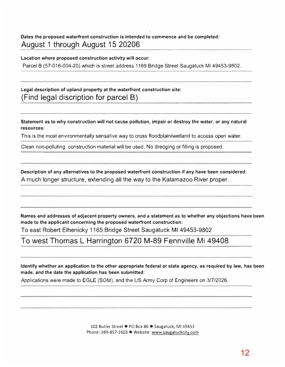
Dates the proposed waterfront construction is intended to commence and be completed:
August 1 through August 15 20206
Location where proposed construction activity will occur:
Parcel B (57-016-004-20) which is street address 1169 Bridge Street Saugatuck Mi 49453-9802.
Legal description of upland property at the waterfront construction site:
(Find legal discription for parcel B)
Statement as to why construction will not cause pollution, impair or destroy the water, or any natural resources:
This is the most environmentally sensative way to cross floodplain/wetland to access open water. Clean non-polluting construction material will be used. No dredging or filling is proposed.
Description of any alternatives to the proposed waterfront construction if any have been considered:
A much longer structure, extending all the way to the Kalamazoo River proper.
Names and addresses of adjacent property owners, and a statement as to whether any objections have been made to the applicant concerning the proposed waterfront construction:
To east Robert Elhenicky 1165 Bridge Street Saugatuck Ml 49453-9802
To west Thomas L Harrington 6720 M-89 Fennville Mi 49408 Identify whether an application to the other appropriate federal or state agency, as required by law, has been made, and the date the application has been submitted:
Applications were made to EGLE (SOM), and the US Army Corp of Engineers on 3/7/2026.
102 Butler Street• PO Box 86 • Saugatuck, Ml 49453 Phone: 269-857-2603 • Website: www.saugatuckcity.com
Page 13
Text of page 13
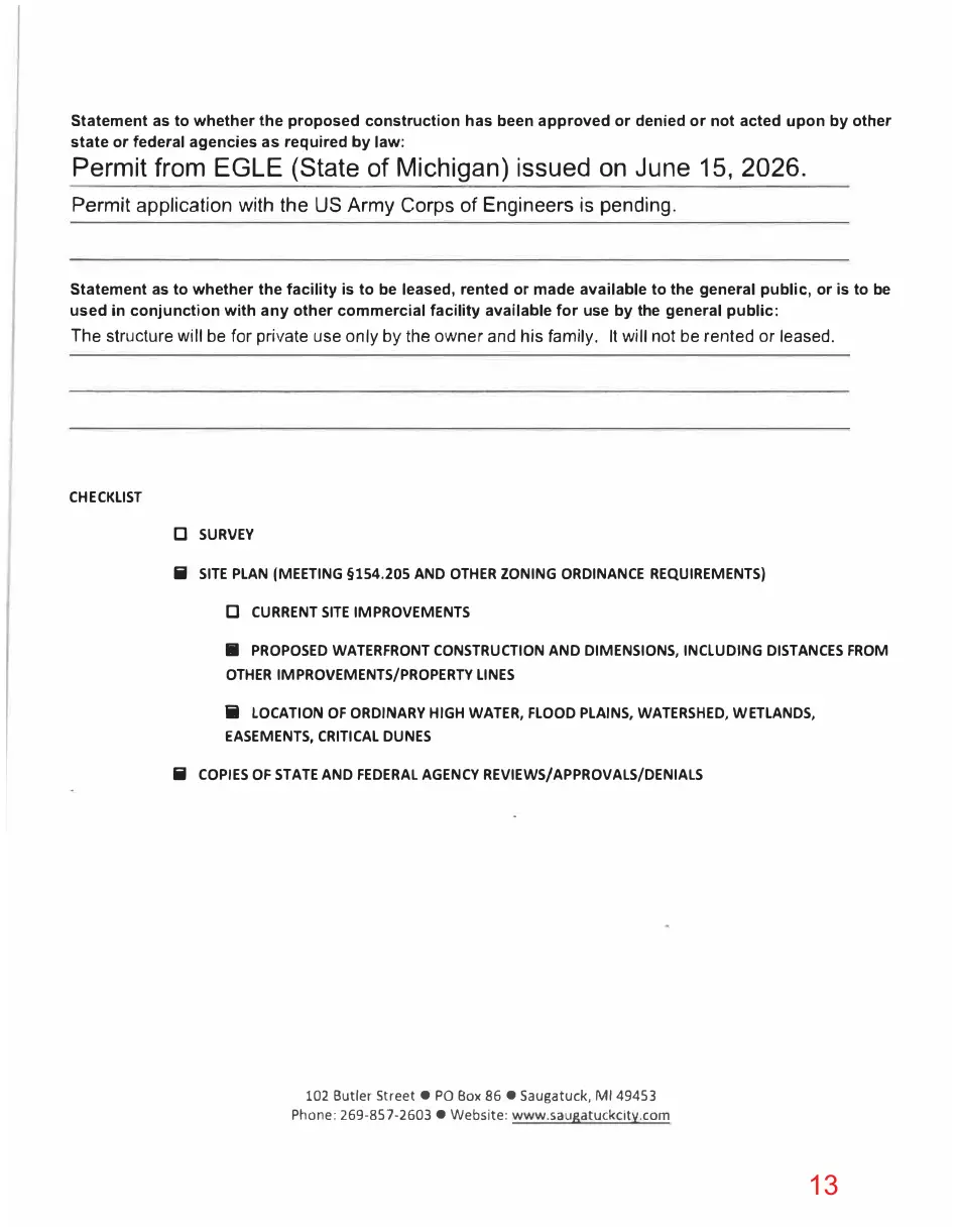
Statement as to whether the proposed construction has been approved or denied or not acted upon by other state or federal agencies as required by law:
Permit from EGLE (State of Michigan) issued on June 15, 2026.
Permit application with the US Army Corps of Engineers is pending.
Statement as to whether the facility is to be leased, rented or made available to the general public, or is to be used in conjunction with any other commercial facility available for use by the general public:
The structure will be for private use only by the owner and his family. It will not be rented or leased.
CHECKLIST
□ SURVEY Ii SITE PLAN (MEETING §154.205 AND OTHER ZONING ORDINANCE REQUIREMENTS)
□ CURRENT SITE IMPROVEMENTS Iii PROPOSED WATERFRONT CONSTRUCTION AND DIMENSIONS, INCLUDING DISTANCES FROM OTHER IMPROVEMENTS/PROPERTY LINES ii LOCATION OF ORDINARY HIGH WATER, FLOOD PLAINS, WATERSHED, W ETLANDS, EASEMENTS, CRITICAL DUNES Ii COPIES OF STATE AND FEDERAL AGENCY REVIEWS/APPROVALS/DENIALS
102 Butler Street • PO Box 86 • Saugatuck, Ml 49453 Phone: 269-857-2603 • Website: www.saugatuckclty.com
Page 14
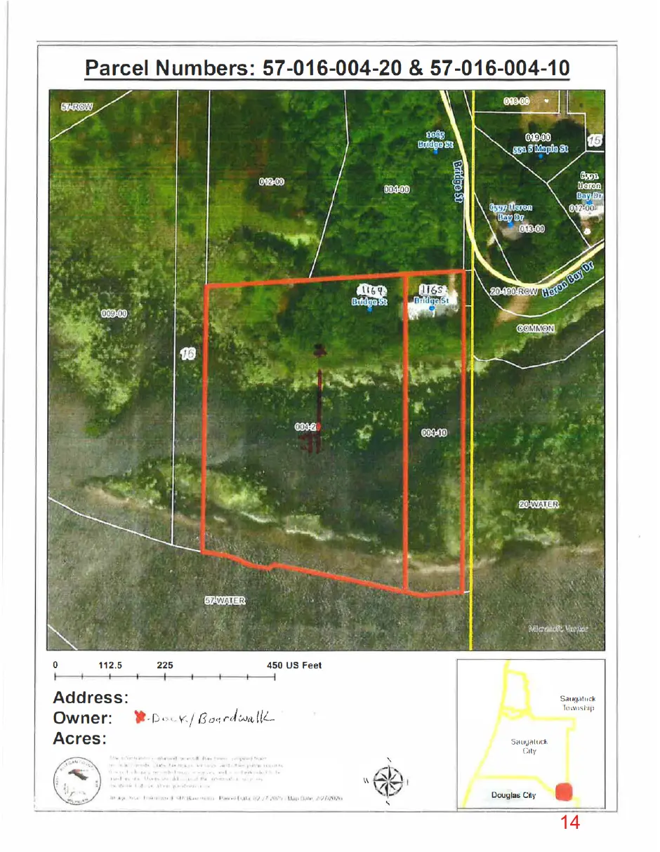
This page is a scanned image with no text layer. The PDF of these pages has it at full resolution.
Page 15
This page is a scanned image with no text layer. The PDF of these pages has it at full resolution.
Page 16
This page is a scanned image with no text layer. The PDF of these pages has it at full resolution.
Page 17
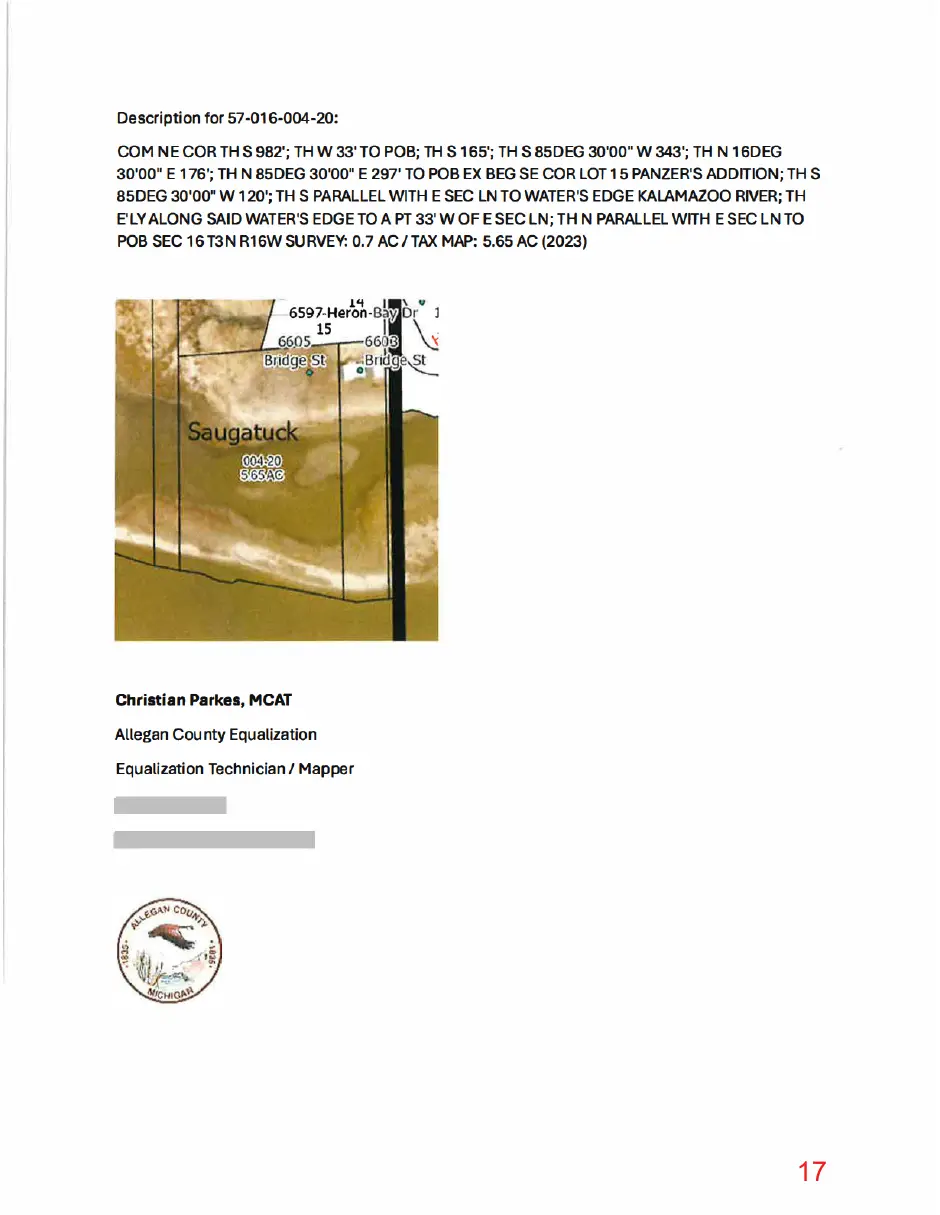
This page is a scanned image with no text layer. The PDF of these pages has it at full resolution.
Page 18
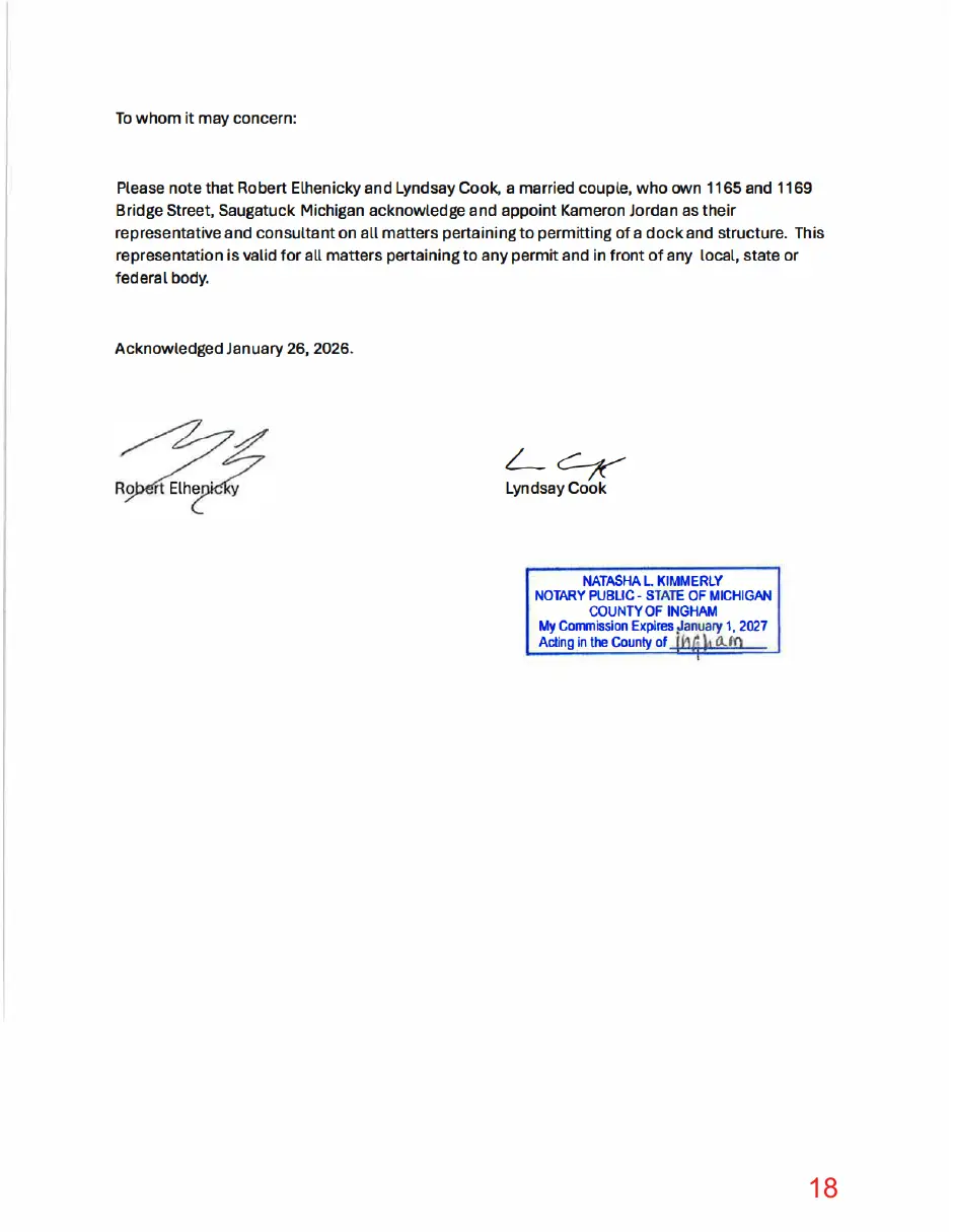
This page is a scanned image with no text layer. The PDF of these pages has it at full resolution.
Page 19
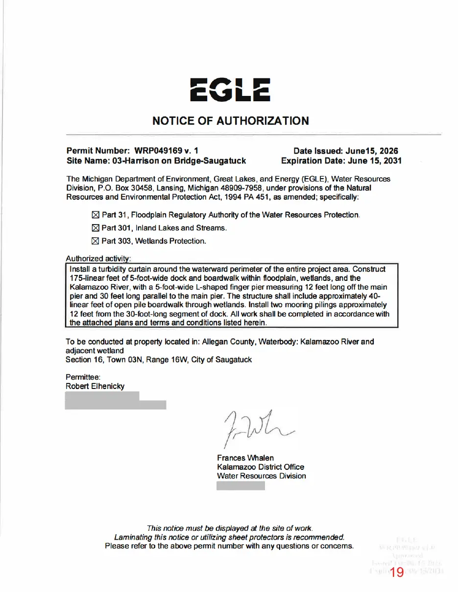
This page is a scanned image with no text layer. The PDF of these pages has it at full resolution.
Page 20
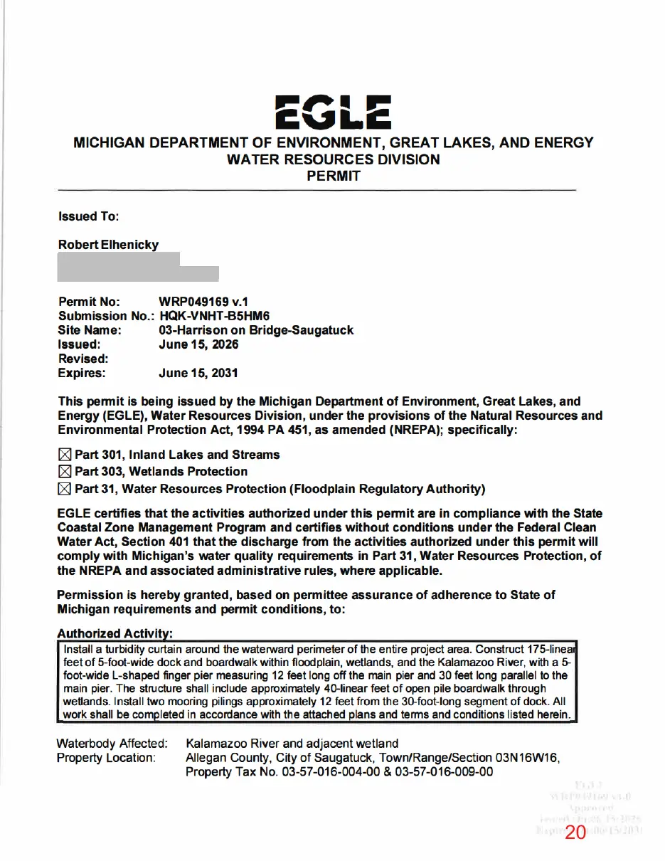
This page is a scanned image with no text layer. The PDF of these pages has it at full resolution.
Page 21
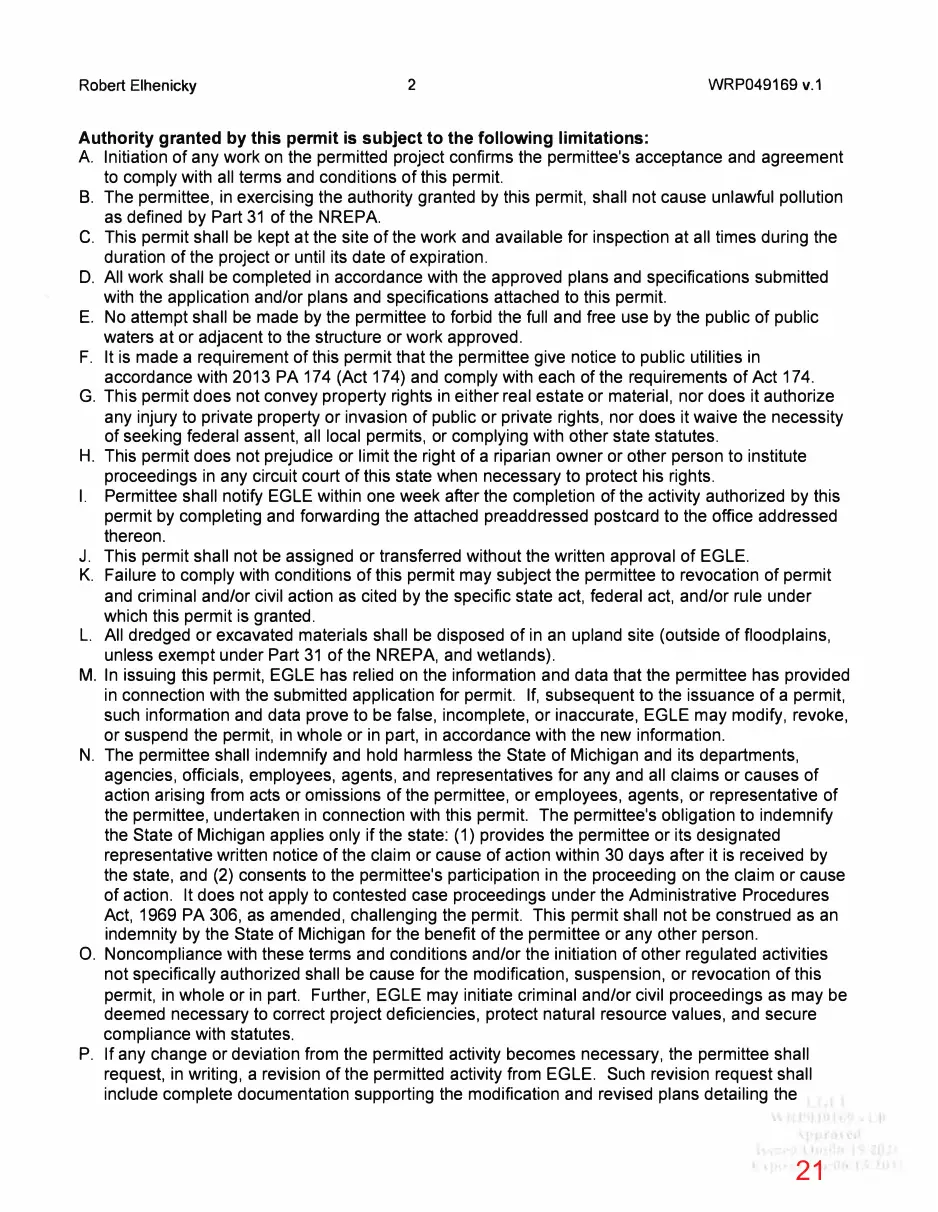
Text of page 21
Robert Elhenicky
WRP049169 v.1
Authority granted by this permit is subject to the following limitations: A Initiation of any work on the permitted project confirms the permittee's acceptance and agreement to comply with all terms and conditions of this permit. B. The permittee, in exercising the authority granted by this permit, shall not cause unlawful pollution as defined by Part 31 of the NREPA. C. This permit shall be kept at the site of the work and available for inspection at all times during the duration of the project or until its date of expiration. D. All work shall be completed in accordance with the approved plans and specifications submitted with the application and/or plans and specifications attached to this permit. E. No attempt shall be made by the permittee to forbid the full and free use by the public of public waters at or adjacent to the structure or work approved. F. It is made a requirement of this permit that the permittee give notice to public utilities in accordance with 2013 PA 174 (Act 174) and comply with each of the requirements of Act 174. G. This permit does not convey property rights in either real estate or material, nor does it authorize any injury to private property or invasion of public or private rights, nor does it waive the necessity of seeking federal assent, all local permits, or complying with other state statutes. H. This permit does not prejudice or limit the right of a riparian owner or other person to institute proceedings in any circuit court of this state when necessary to protect his rights. I. Permittee shall notify EGLE within one week after the completion of the activity authorized by this permit by completing and forwarding the attached preaddressed postcard to the office addressed thereon. J. This permit shall not be assigned or transferred without the written approval of EGLE. K. Failure to comply with conditions of this permit may subject the permittee to revocation of permit and criminal and/or civil action as cited by the specific state act, federal act, and/or rule under which this permit is granted. L. All dredged or excavated materials shall be disposed of in an upland site ( outside of floodplains, unless exempt under Part 31 of the NREPA, and wetlands). M. In issuing this permit, EGLE has relied on the information and data that the permittee has provided in connection with the submitted application for permit. If, subsequent to the issuance of a permit, such information and data prove to be false, incomplete, or inaccurate, EGLE may modify, revoke, or suspend the permit, in whole or in part, in accordance with the new information. N. The permittee shall indemnify and hold harmless the State of Michigan and its departments, agencies, officials, employees, agents, and representatives for any and all claims or causes of action arising from acts or omissions of the permittee, or employees, agents, or representative of the permittee, undertaken in connection with this permit. The permittee's obligation to indemnify the State of Michigan applies only if the state: (1) provides the permittee or its designated representative written notice of the claim or cause of action within 30 days after it is received by the state, and (2) consents to the permittee's participation in the proceeding on the claim or cause of action. It does not apply to contested case proceedings under the Administrative Procedures Act, 1969 PA 306, as amended, challenging the permit. This permit shall not be construed as an indemnity by the State of Michigan for the benefit of the permittee or any other person. 0. Noncompliance with these terms and conditions and/or the initiation of other regulated activities not specifically authorized shall be cause for the modification, suspension, or revocation of this permit, in whole or in part. Further, EGLE may initiate criminal and/or civil proceedings as may be deemed necessary to correct project deficiencies, protect natural resource values, and secure compliance with statutes. P. If any change or deviation from the permitted activity becomes necessary, the permittee shall request, in writing, a revision of the permitted activity from EGLE. Such revision request shall include complete documentation supporting the modification and revised plans detailing the
Page 22
Text of page 22
Robert Elhenicky
WRP049169 v.1
proposed modification. Proposed modifications must be approved, in writing, by EGLE prior to being implemented. Q. This permit may be transferred to another person upon written approval of EGLE. The permittee must submit a written request to EGLE to transfer the permit to the new owner. The new owner must also submit a written request to EGLE to accept transfer. The new owner must agree, in writing, to accept all conditions of the permit. A single letter signed by both parties that includes all the above information may be provided to EGLE. EGLE will review the request and, if approved, will provide written notification to the new owner. R. Prior to initiating permitted construction, the permittee is required to provide a copy of the permit to the contractor(s) for review. The property owner, contractor(s), and any agent involved in exercising the permit are held responsible to ensure that the project is constructed in accordance with all drawings and specifications. The contractor is required to provide a copy of the permit to all subcontractors doing work authorized by the permit. S. Construction must be undertaken and completed during the dry period of the wetland. If the area does not dry out, construction shall be done on equipment mats to prevent compaction of the soil. T. Authority granted by this permit does not waive permit requirements under Part 91, Soil Erosion and Sedimentation Control, of the NREPA, or the need to acquire applicable permits from the County Enforcing Agent (CEA). U. Authority granted by this permit does not waive permit requirements under the authority of Part 305, Natural Rivers, of the NREPA. A Natural Rivers Zoning Permit may be required for construction, land alteration, streambank stabilization, or vegetation removal along or near a natural river. V. The permittee is cautioned that grade changes resulting in increased runoff onto adjacent property is subject to civil damage litigation. W. Unless specifically stated in this permit, construction pads, haul roads, temporary structures, or other structural appurtenances to be placed in a wetland or on bottomland of the water body are not authorized and shall not be constructed unless authorized by a separate permit or permit revision granted in accordance with the applicable law. X. For projects with potential impacts to fish spawning or migration, no work shall occur within fish spawning or migration timelines (i.e., windows) unless otherwise approved in writing by the Michigan Department of Natural Resources, Fisheries Division. Y. Work to be done under authority of this permit is further subject to the following special instructions and specifications: 1. Authority granted by this permit does not waive permit or program requirements under Part 91 of the NREPA or the need to acquire applicable permits from the CEA. To locate the Soil Erosion Program Administrator for your county, visit https://www.michiqan.gov/egle/about/organization/water-resources/soil-erosion/sesc-overview and select "Soil Erosion and Sedimentation Control Agencies". 2. The authority to conduct the activity as authorized by this permit is granted solely under the provisions of the governing act as identified above. This permit does not convey, provide, or otherwise imply approval of any other governing act, ordinance, or regulation, nor does it waive the permittee's obligation to acquire any local, county, state, or federal approval or authorization necessary to conduct the activity. 3. No fill, excess soil, or other material shall be placed in any wetland, floodplain, or surface water area not specifically authorized by this permit, its plans, and specifications. 4. This permit does not authorize or sanction work that has been completed in violation of applicable federal, state, or local statutes.
Page 23
Text of page 23
Robert Elhenicky
WRP049169 v.1
5. The permit placard shall be kept posted at the work site in a prominent location at all times for the duration of the project or until permit expiration. 6. This permit is being issued for the maximum time allowed and no extensions of this permit will be granted. Initiation of the construction work authorized by this permit indicates the permittee's acceptance of this condition. The permit, when signed by EGLE, will be for a fiveyear period beginning on the date of issuance. If the project is not completed by the expiration date, a new permit must be sought. 7. The project is located within a community that participates in the National Flood Insurance Program (NFIP). As a participant in the NFIP, the community must comply with the Michigan Building Code (including Appendix G and listed supporting materials); the Michigan Residential Code; and Title 44 of the Code of Federal Regulations, Part 60, Criteria for Land Management and Use. The community is also responsible to ensure that its floodplain maps and studies are maintained to show changes to flood elevations and flood delineations as described in 44 CFR, Part 65, Identification and Mapping of Special Hazard Areas. 8. The design flood or 1.0% annual chance (100-year) floodplain elevation at this location on Kalamazoo River is 583.5 feet NAVD88. 9. Any other filling, grading, or construction within the 100-year floodplain will require a separate EGLE permit before starting the work. 10. All structures constructed within the floodplain or floodway shall be firmly anchored to prevent flotation or lateral movement. 11. Filling is not authorized by this permit.
12. No work or dredging within the water authorized by this permit is allowed from March 15 to June 30 and September 1 to December 15, due to critical spawning, migration, and/or recreational use periods in the Kalamazoo River, unless written approval is requested and obtained by EGLE in coordination with MDNR Fisheries Division 13. Boardwalk and dock shall be of open construction without fill, maintaining free water movement and circulation. 14. The proposed structure shall not unreasonably interfere with the navigability or boatability of the water involved or interfere with the riparian rights or use of the waters by others. 15. All pilings shall be driven in. Jetting or dredging is not authorized by this permit. 16. Prior to commencing installation of the dock, the entire lakeward perimeter of the project site shall be isolated with a turbidity curtain to prevent movement of suspended sediments. The turbidity curtain shall be installed to extend from the bed of the waterbody to a point above the existing water's surface. The turbidity curtain shall be maintained for the duration of the project and shall be left in place after completion until all disturbed sediments have settled.
Page 24
This page is a scanned image with no text layer. The PDF of these pages has it at full resolution.
Page 25
Text of page 25
Robert Elhenicky
WRP049169 v.1
THIS PERMIT MUST BE SIGNED BY THE PERMITTEE TO BE VALID. I hereby assure that I have read, am familiar with, and agree to adhere to the terms and conditions of this permit.
Permittee Signature cc:
Date
City of Saugatuck Clerk Allegan County Drain Commissioner Allegan County CEA April Champion, USAGE Kameron Jordan, Agent
Page 26
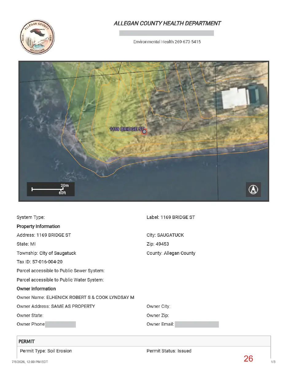
This page is a scanned image with no text layer. The PDF of these pages has it at full resolution.
Page 27
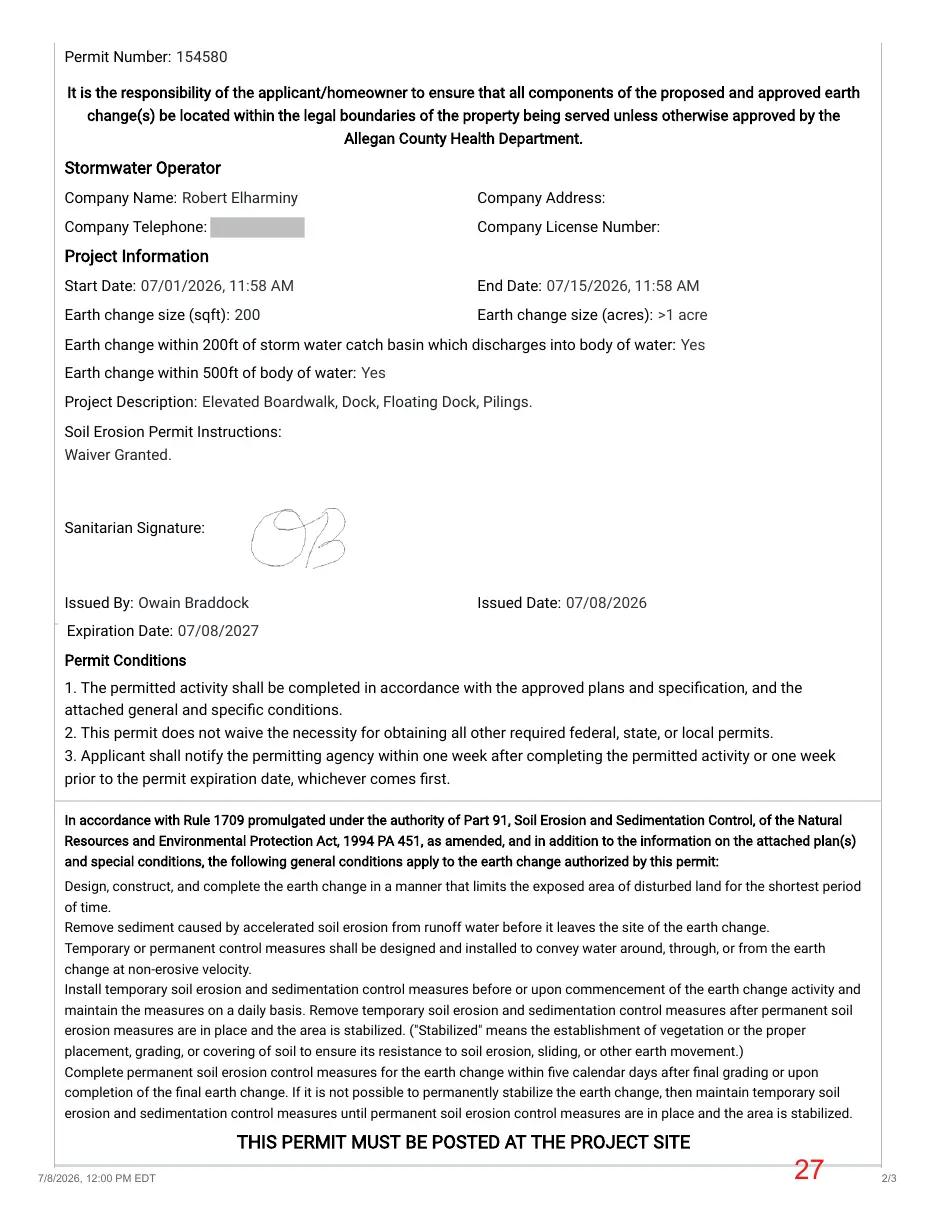
Text of page 27
Permit Number: 154580
Company Name: Robert Elharminy
Company Address:
Company Telephone:
Company License Number:
Start Date: 07/01/2026, 11:58 AM
End Date: 07/15/2026, 11:58 AM
Earth change size (sqft): 200
Earth change size (acres): >1 acre
Earth change within 200ft of storm water catch basin which discharges into body of water: Yes Earth change within 500ft of body of water: Yes Project Description: Elevated Boardwalk, Dock, Floating Dock, Pilings. Soil Erosion Permit Instructions: Waiver Granted.
Sanitarian Signature:
Issued By: Owain Braddock
Issued Date: 07/08/2026
Expiration Date: 07/08/2027 1. The permitted activity shall be completed in accordance with the approved plans and specification, and the attached general and specific conditions. 2. This permit does not waive the necessity for obtaining all other required federal, state, or local permits. 3. Applicant shall notify the permitting agency within one week after completing the permitted activity or one week prior to the permit expiration date, whichever comes first.
Design, construct, and complete the earth change in a manner that limits the exposed area of disturbed land for the shortest period of time. Remove sediment caused by accelerated soil erosion from runoff water before it leaves the site of the earth change. Temporary or permanent control measures shall be designed and installed to convey water around, through, or from the earth change at non-erosive velocity. Install temporary soil erosion and sedimentation control measures before or upon commencement of the earth change activity and maintain the measures on a daily basis. Remove temporary soil erosion and sedimentation control measures after permanent soil erosion measures are in place and the area is stabilized. ("Stabilized" means the establishment of vegetation or the proper placement, grading, or covering of soil to ensure its resistance to soil erosion, sliding, or other earth movement.) Complete permanent soil erosion control measures for the earth change within five calendar days after final grading or upon completion of the final earth change. If it is not possible to permanently stabilize the earth change, then maintain temporary soil erosion and sedimentation control measures until permanent soil erosion control measures are in place and the area is stabilized.
7/8/2026, 12:00 PM EDT
2/3