
Council Agenda item 12C
Proposal for Conservation Services at Saugatuck Harbor Natural Area
City Council, Monday, September 14, 2026
Download these 20 pages, 12.4 MB Whole packet, 139 pages, 33.7 MB
Page 88

This page is a scanned image with no text layer. The PDF of these pages has it at full resolution.
Page 89
Text of page 89
COMMITTEE/COMMISSION REVIEW: Land Conservancy of West Michigan has approved the plan & will be involved with the signage project. Parks & Public Works Committee has reviewed & recommended approval of the proposal from the ODC. LEGAL REVIEW: N/A SAMPLE MOTION: Motion to approve the ODC Network proposal for the Saugatuck Harbor Natural Area, including Trail Remediation, Habitat RestorationHybrid Approach, Signage & Wayfinding Program (Design & Fabrication), and Establishment Maintenance, in an amount not to exceed $78,300, with project costs to be reimbursed from the Saugatuck Harbor Natural Area Endowment Fund.
Page 90
This page is a scanned image with no text layer. The PDF of these pages has it at full resolution.
Page 91

Text of page 91
Project Background The ODC Conservation Services team conducted a trail assessment of parcel #’s: 57-004-008-00, 57004-010-00, and 57-004-008-10, located on Oval Dr in Saugatuck, MI. The site consists of a coastal dune and interdunal wetland complex characteristic of the Lake Michigan shoreline, supporting a mosaic of sensitive plant communities and dynamic dune processes. This assessment evaluates existing informal and established trail conditions and provides recommendations related to trail alignment, decommissioning of redundant routes, wayfinding improvements, and opportunities for interpretive signage. No construction-level design or engineering is included as part of this phase of work. Field assessment was conducted between April and May of 2026. The methodology consisted of a comprehensive pedestrian survey of accessible trail corridors across the property, with field observations documented on-site and reviewed in conjunction with available aerial imagery and GIS base layers. Key assessment priorities included: • Identification of an optimal trail footprint with emphasis on protection of sensitive ecological communities • Identification of informal, redundant, or unsustainable trails recommended for decommissioning • Recommendations for improved wayfinding and visitor circulation • Identification of key natural features suitable for interpretive signage and educational programming Executive Summary The existing trail system requires targeted modifications to reduce impacts to sensitive ecological communities while improving overall circulation, safety, and visitor experience. Based on our assessment, the system could be consolidated into a single primary loop without the need for substantial new infrastructure investments, allowing the site to function more sustainably while still accommodating public access needs and showcasing the unique ecology of the site. A refined trail alignment would help concentrate use within more resilient and established corridors, reducing fragmentation and minimizing disturbance to interdunal wetlands, open dune habitats, and adjacent upland communities. These systems support a high diversity of plant and wildlife species, many of which are sensitive to compaction, repeated off-trail disturbance, and informal path creation. By guiding users more intentionally through the landscape, the redesign would help balance ecological protection with recreational and educational access. In addition to ecological benefits, the revised layout provides an opportunity to elevate the interpretive value of the site. Key natural features including dune succession gradients, wetland transition zones, and associated native plant communities could be highlighted through strategic trail placement and potential interpretive elements. In coordination with the ecological evaluation scheduled for completion in September 2026, these improvements could support expanded educational programming, including fieldbased learning opportunities and culturally informed interpretation where applicable. Clear access definition, improved wayfinding, and reduced trail redundancy would also play a critical role in minimizing user confusion and limiting off-trail disturbance. This would help protect sensitive vegetation communities, reduce maintenance needs over time, and improve long-term resilience of the trail system. The proposed approach supports a phased, low-impact implementation strategy that can be aligned with ongoing site management goals and stakeholder input. By prioritizing consolidation and clarity over expansion, the project emphasizes ecological integrity, long-term sustainability, and a more intentional visitor experience rooted in the unique characteristics of the landscape.
Page 92
Text of page 92
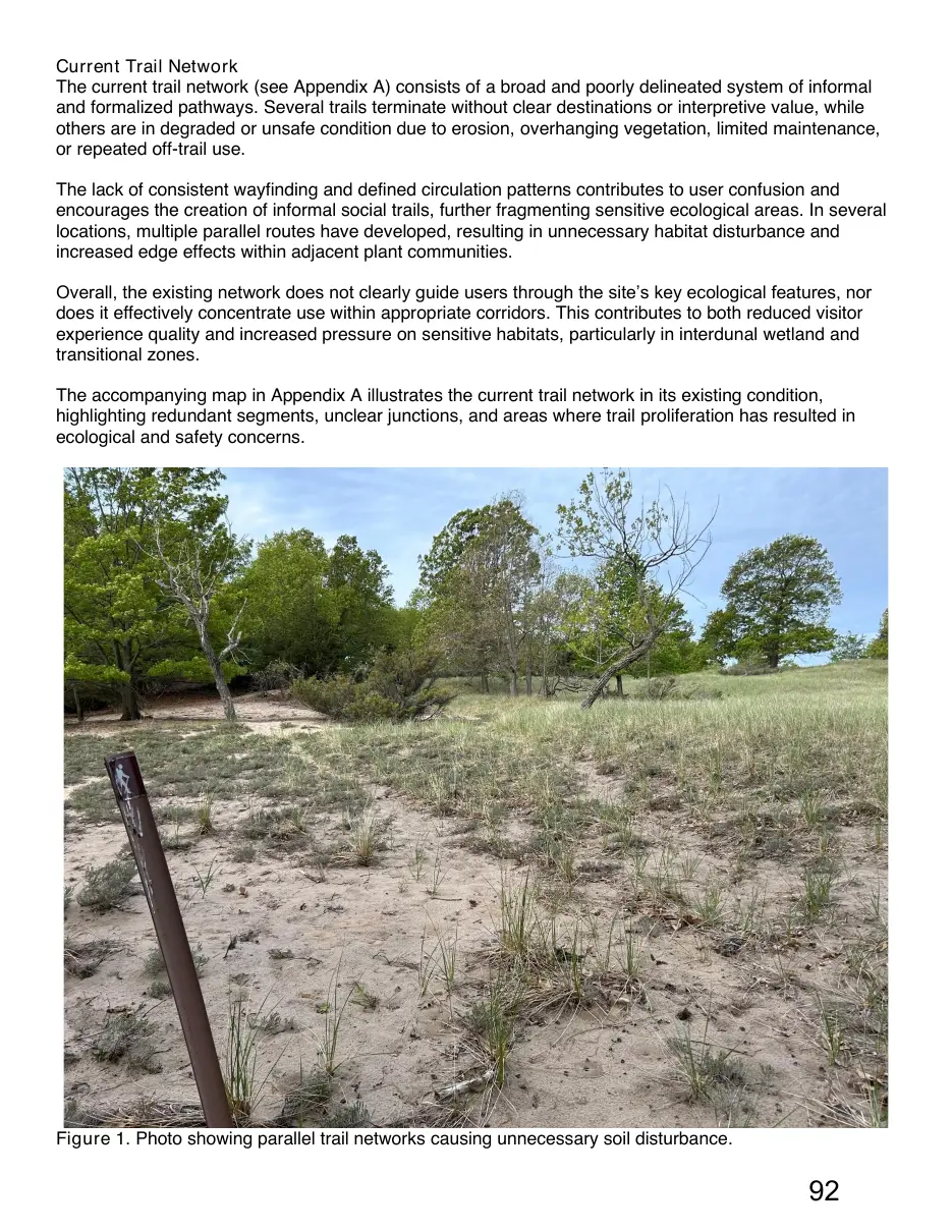
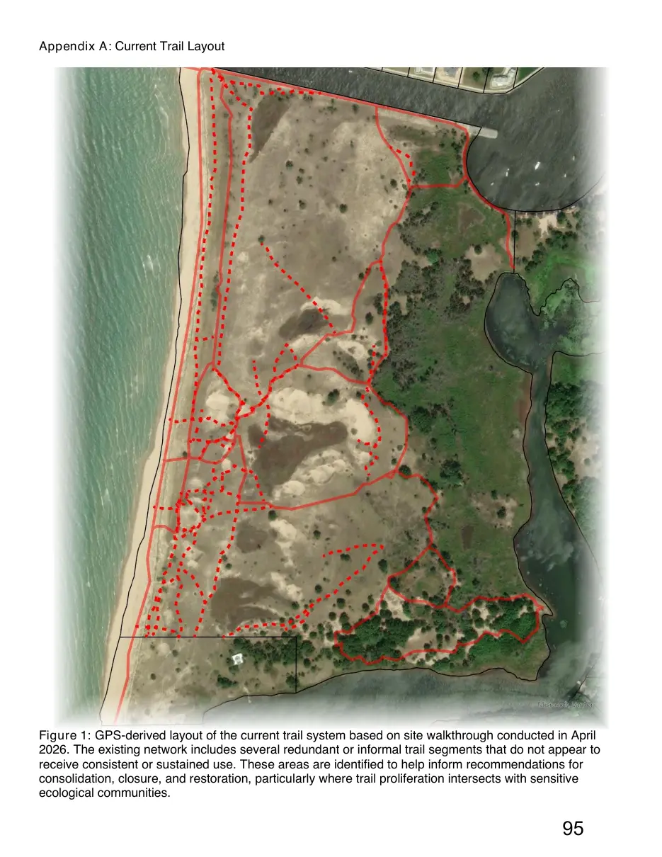
Current Trail Network The current trail network (see Appendix A) consists of a broad and poorly delineated system of informal and formalized pathways. Several trails terminate without clear destinations or interpretive value, while others are in degraded or unsafe condition due to erosion, overhanging vegetation, limited maintenance, or repeated off-trail use. The lack of consistent wayfinding and defined circulation patterns contributes to user confusion and encourages the creation of informal social trails, further fragmenting sensitive ecological areas. In several locations, multiple parallel routes have developed, resulting in unnecessary habitat disturbance and increased edge effects within adjacent plant communities. Overall, the existing network does not clearly guide users through the site’s key ecological features, nor does it effectively concentrate use within appropriate corridors. This contributes to both reduced visitor experience quality and increased pressure on sensitive habitats, particularly in interdunal wetland and transitional zones. The accompanying map in Appendix A illustrates the current trail network in its existing condition, highlighting redundant segments, unclear junctions, and areas where trail proliferation has resulted in ecological and safety concerns.
Figure 1. Photo showing parallel trail networks causing unnecessary soil disturbance.
Page 93
Text of page 93
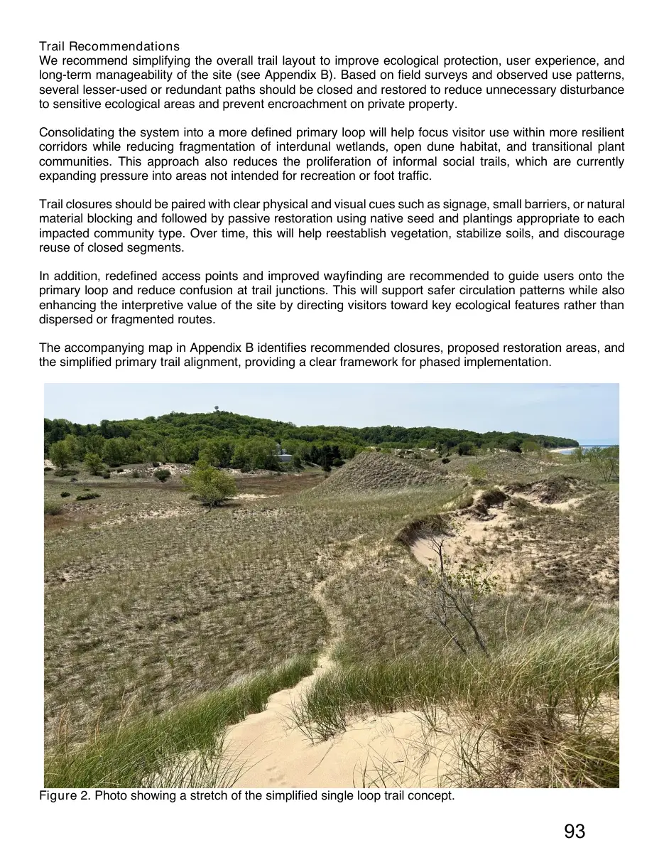
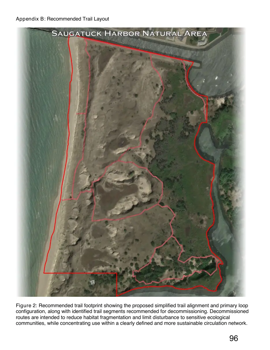
Trail Recommendations We recommend simplifying the overall trail layout to improve ecological protection, user experience, and long-term manageability of the site (see Appendix B). Based on field surveys and observed use patterns, several lesser-used or redundant paths should be closed and restored to reduce unnecessary disturbance to sensitive ecological areas and prevent encroachment on private property. Consolidating the system into a more defined primary loop will help focus visitor use within more resilient corridors while reducing fragmentation of interdunal wetlands, open dune habitat, and transitional plant communities. This approach also reduces the proliferation of informal social trails, which are currently expanding pressure into areas not intended for recreation or foot traffic. Trail closures should be paired with clear physical and visual cues such as signage, small barriers, or natural material blocking and followed by passive restoration using native seed and plantings appropriate to each impacted community type. Over time, this will help reestablish vegetation, stabilize soils, and discourage reuse of closed segments. In addition, redefined access points and improved wayfinding are recommended to guide users onto the primary loop and reduce confusion at trail junctions. This will support safer circulation patterns while also enhancing the interpretive value of the site by directing visitors toward key ecological features rather than dispersed or fragmented routes. The accompanying map in Appendix B identifies recommended closures, proposed restoration areas, and the simplified primary trail alignment, providing a clear framework for phased implementation.
Figure 2. Photo showing a stretch of the simplified single loop trail concept.
Page 94

Text of page 94
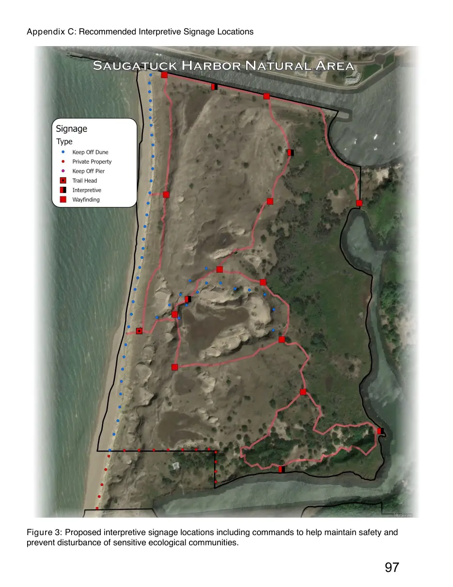
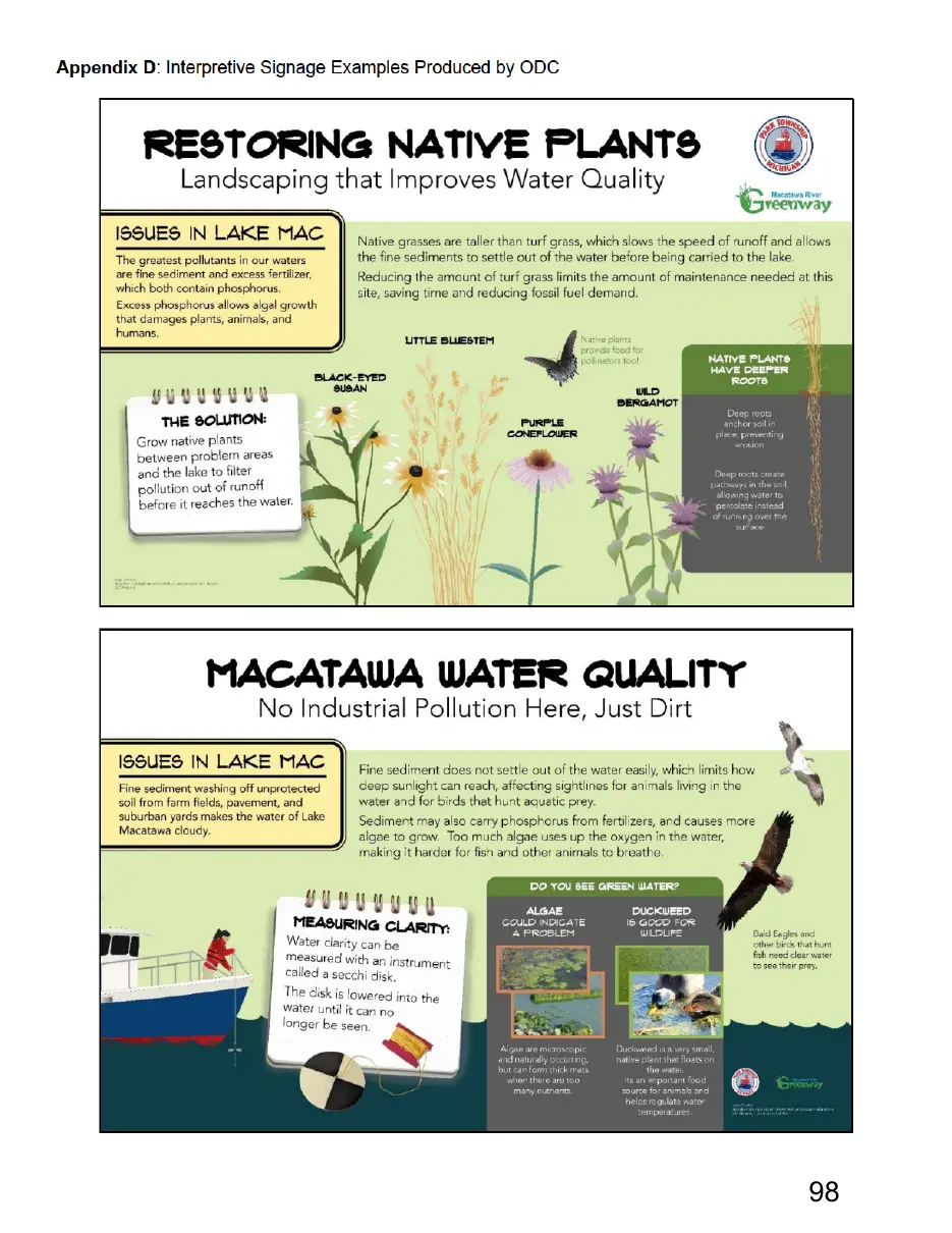
Trail Wayfinding & Interpretive Signage A clear and consistent wayfinding system is recommended to support navigation throughout the simplified trail network and to reduce the development of informal social trails. Signage should be strategically placed at key decision points, including trailheads, junctions, and transitions between major habitat types, to reinforce the primary loop and improve overall user orientation within the site (see Appendix C). Given the ecological diversity of the area, including interdunal wetland, Great Lakes marsh, and open dune systems; interpretive signage represents a strong opportunity to enhance visitor understanding of site ecology and sensitivity. These systems can be used to communicate key concepts such as hydrologic connectivity, dune dynamics, and vegetation succession, while also reinforcing the importance of staying on designated trails and not disturbing sensitive plants. While signage design and production is not included as part of this assessment, the recommended framework identifies key locations and interpretive themes where future signage would be most effective. Our team, or a qualified partner, can support subsequent phases of signage development and design if desired. Wayfinding elements should remain clear, durable, and context-sensitive, using a consistent design approach that is appropriate for a natural setting. A simple hierarchy of information is recommended, prioritizing navigation at primary junctions and more interpretive content at key ecological focal points. Interpretive messaging should focus on helping visitors understand the distinct ecological functions of the site’s major communities, including the water storage and biodiversity value of interdunal wetlands, the dynamic and disturbance-driven nature of open dunes, and the productivity and habitat complexity of Great Lakes marsh systems. The accompanying map outlined in Appendix C identifies recommended signage locations and interpretive nodes aligned with the proposed trail consolidation, providing a framework for future design and implementation.
Figure 3. Photo showing recommended placement for a trailhead kiosk to direct foot traffic off the beach and avoid the private residence. See Appendix C for relative location on the property, and F for reference images.
Page 95
Text of page 95
Appendix A: Current Trail Layout
Figure 1: GPS-derived layout of the current trail system based on site walkthrough conducted in April 2026. The existing network includes several redundant or informal trail segments that do not appear to receive consistent or sustained use. These areas are identified to help inform recommendations for consolidation, closure, and restoration, particularly where trail proliferation intersects with sensitive ecological communities.
Page 96
Text of page 96
Appendix B: Recommended Trail Layout
Figure 2: Recommended trail footprint showing the proposed simplified trail alignment and primary loop configuration, along with identified trail segments recommended for decommissioning. Decommissioned routes are intended to reduce habitat fragmentation and limit disturbance to sensitive ecological communities, while concentrating use within a clearly defined and more sustainable circulation network.
Page 97
Text of page 97
Appendix C: Recommended Interpretive Signage Locations
Figure 3: Proposed interpretive signage locations including commands to help maintain safety and prevent disturbance of sensitive ecological communities.
Page 98
This page is a scanned image with no text layer. The PDF of these pages has it at full resolution.
Page 99
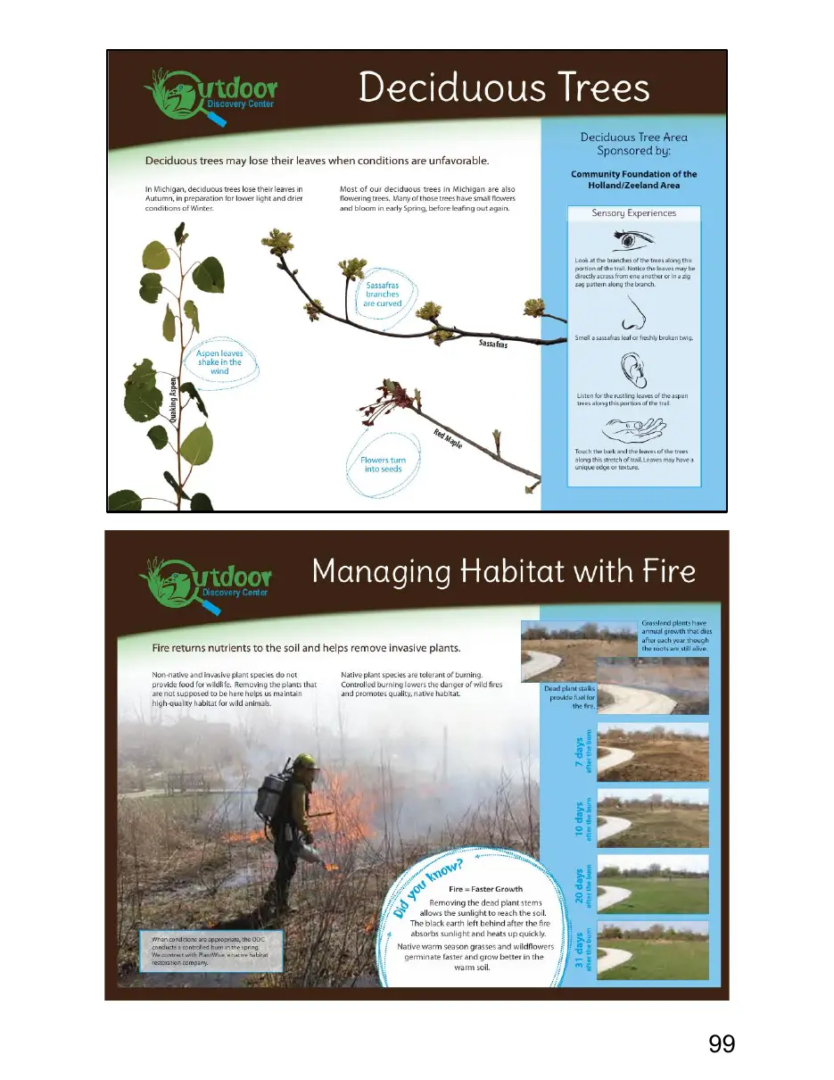
This page is a scanned image with no text layer. The PDF of these pages has it at full resolution.
Page 100
Text of page 100
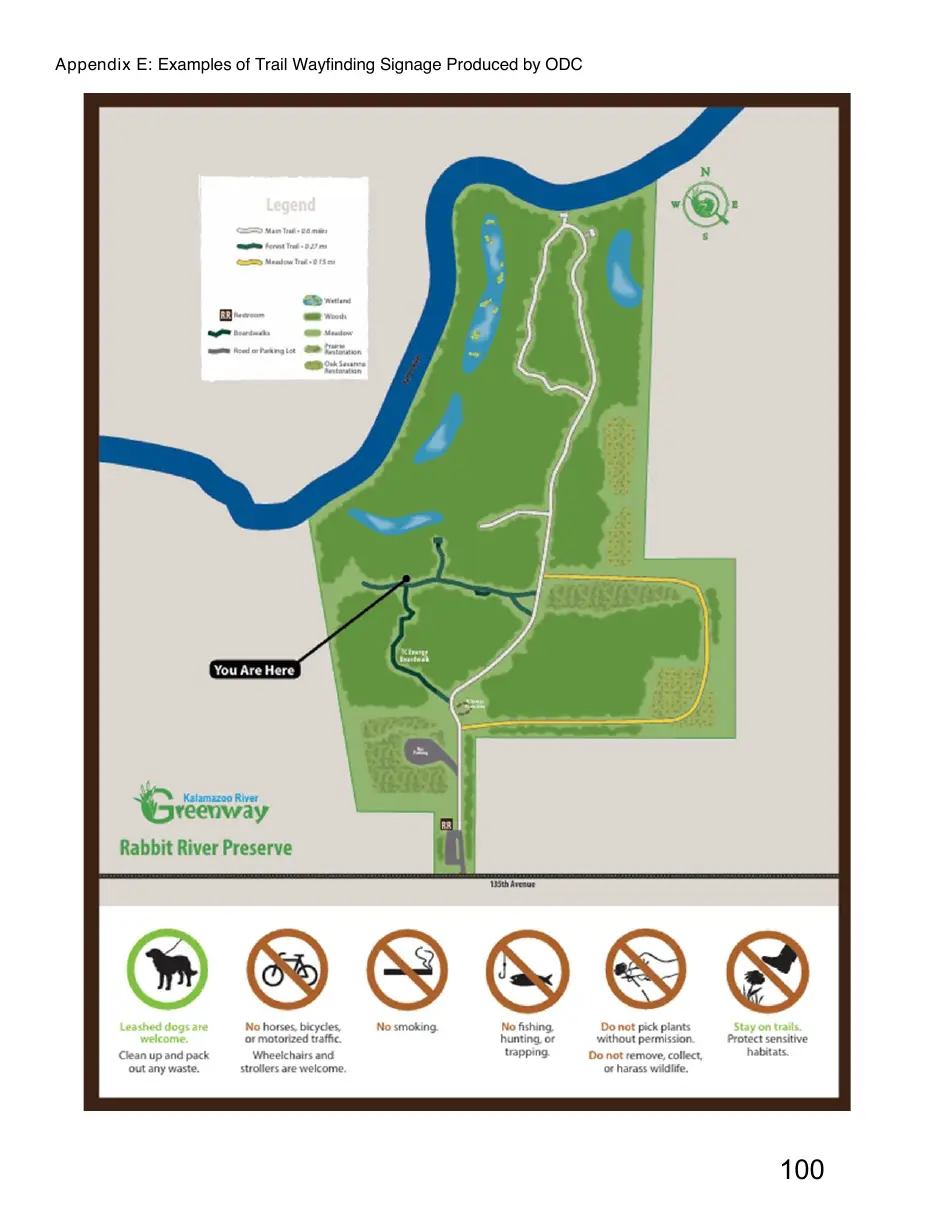
Appendix E: Examples of Trail Wayfinding Signage Produced by ODC
Page 101
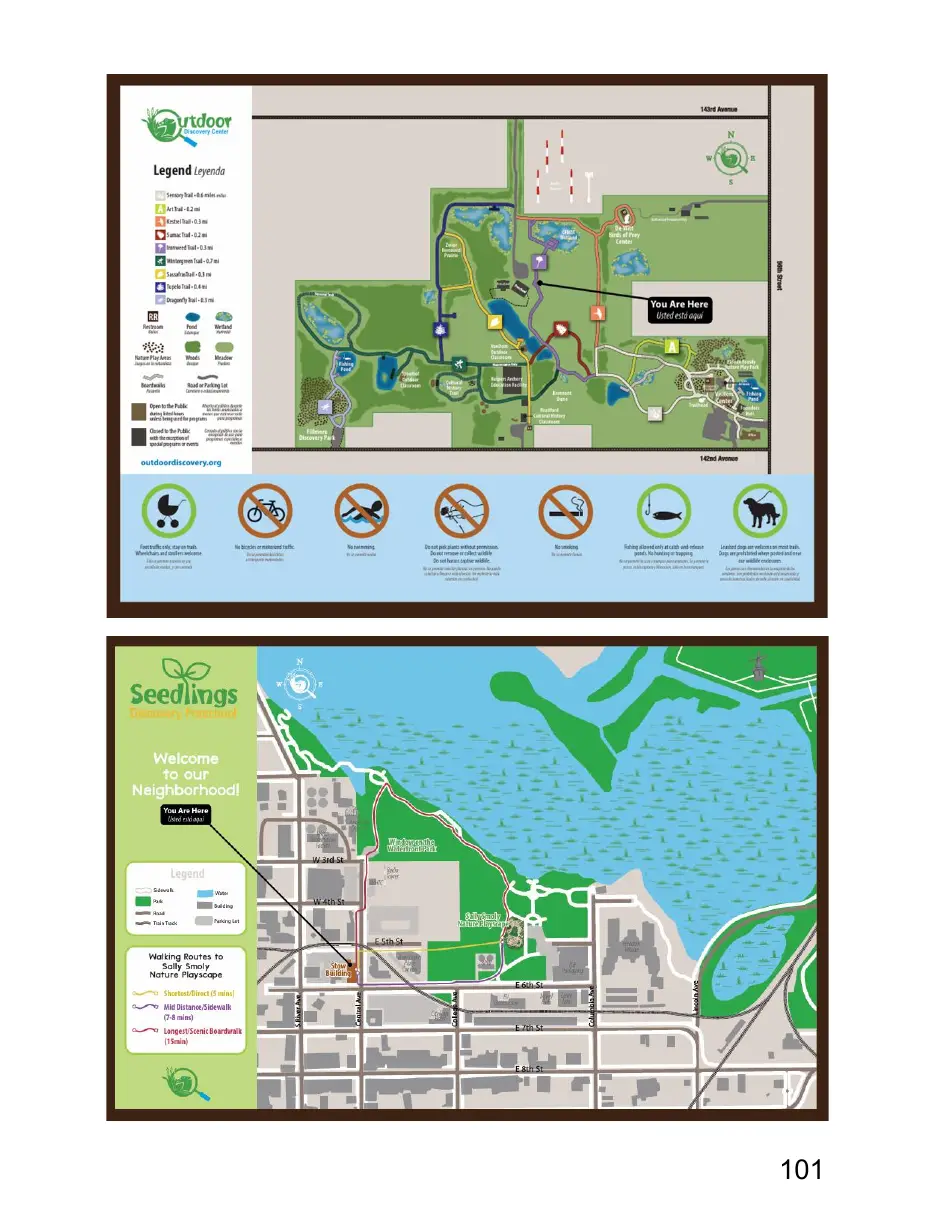
This page is a scanned image with no text layer. The PDF of these pages has it at full resolution.
Page 102
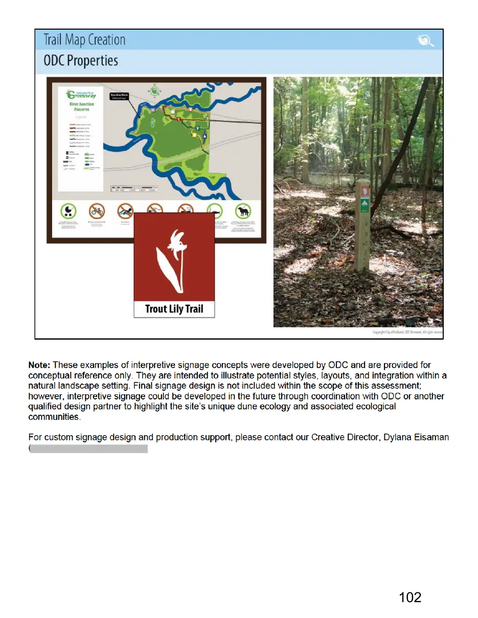
This page is a scanned image with no text layer. The PDF of these pages has it at full resolution.
Page 103
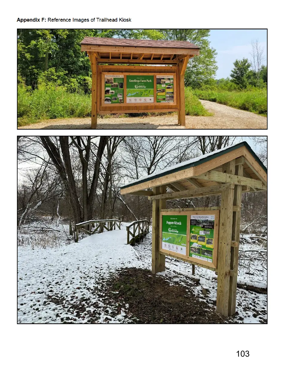
This page is a scanned image with no text layer. The PDF of these pages has it at full resolution.
Page 104
Text of page 104
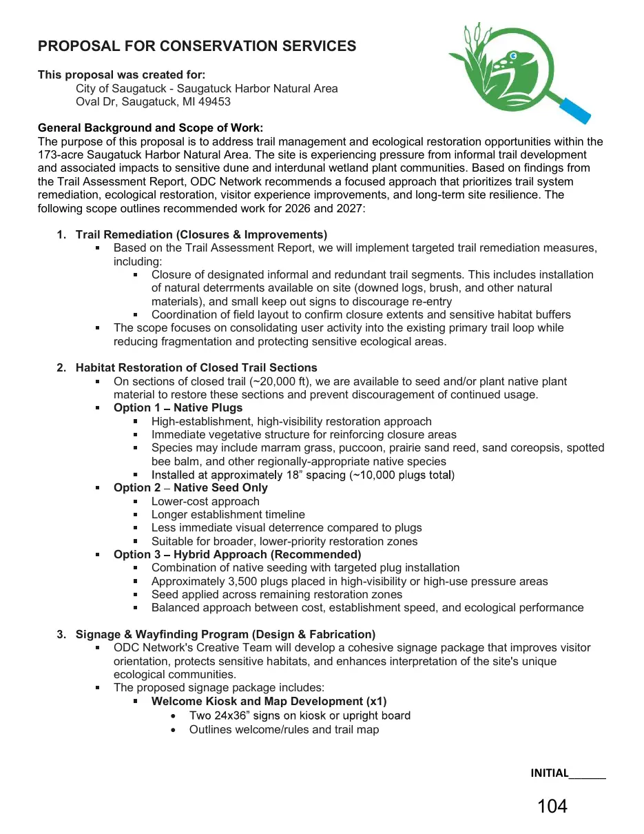
PROPOSAL FOR CONSERVATION SERVICES This proposal was created for: City of Saugatuck - Saugatuck Harbor Natural Area Oval Dr, Saugatuck, MI 49453 General Background and Scope of Work: The purpose of this proposal is to address trail management and ecological restoration opportunities within the 173-acre Saugatuck Harbor Natural Area. The site is experiencing pressure from informal trail development and associated impacts to sensitive dune and interdunal wetland plant communities. Based on findings from the Trail Assessment Report, ODC Network recommends a focused approach that prioritizes trail system remediation, ecological restoration, visitor experience improvements, and long-term site resilience. The following scope outlines recommended work for 2026 and 2027: 1. Trail Remediation (Closures & Improvements) Based on the Trail Assessment Report, we will implement targeted trail remediation measures, including: Closure of designated informal and redundant trail segments. This includes installation of natural deterrments available on site (downed logs, brush, and other natural materials), and small keep out signs to discourage re-entry Coordination of field layout to confirm closure extents and sensitive habitat buffers The scope focuses on consolidating user activity into the existing primary trail loop while reducing fragmentation and protecting sensitive ecological areas. 2. Habitat Restoration of Closed Trail Sections On sections of closed trail (~20,000 ft), we are available to seed and/or plant native plant material to restore these sections and prevent discouragement of continued usage. Option 1 Native Plugs High-establishment, high-visibility restoration approach Immediate vegetative structure for reinforcing closure areas Species may include marram grass, puccoon, prairie sand reed, sand coreopsis, spotted bee balm, and other regionally-appropriate native species Option 2 Native Seed Only Lower-cost approach Longer establishment timeline Less immediate visual deterrence compared to plugs Suitable for broader, lower-priority restoration zones Option 3 Hybrid Approach (Recommended) Combination of native seeding with targeted plug installation Approximately 3,500 plugs placed in high-visibility or high-use pressure areas Seed applied across remaining restoration zones Balanced approach between cost, establishment speed, and ecological performance 3. Signage & Wayfinding Program (Design & Fabrication) ODC Network's Creative Team will develop a cohesive signage package that improves visitor orientation, protects sensitive habitats, and enhances interpretation of the site's unique ecological communities. The proposed signage package includes: Welcome Kiosk and Map Development (x1) Outlines welcome/rules and trail map
INITIAL______
Page 105
Text of page 105
See Appendix B for example Interpretive Signs (x5) Topics for each ecological community: Open Dunes, Great Lakes Marsh, Interdunal Wetland, Mesic Northern Forest, and Native Plant Benefits See Appendix B for Example Includes rules or other policy/wayfinding information Boundary Sings (x50) Keep Off Dune, Private Property, Keep Off Pier This scope includes signage planning, interpretive content development, trail map development, graphic design, up to three (3) rounds of design and content revisions, and fabrication, procurement, and delivery of signage components. Additional revisions requested following the included three rounds, or changes to the approved scope, content, dimensions, or overall design direction, may be treated as additional work and billed separately. 4. Signage Installation (Optional Add-On) ODC Network can also provide complete field installation of all proposed signage. Installation includes: Field verification of sign locations Installation of trailhead kiosk Installation of interpretive, wayfinding, and boundary sign posts Final alignment and mounting of all sign panels 5. Establishment Maintenance (Optional Add-On) ODC Network can provide post-installation establishment support to ensure long-term success of restoration areas. This includes: First-year vegetation establishment monitoring Spot reseeding or planting adjustments as needed Invasive species spot control within restoration zones Seasonal site visits for adaptive management This scope is recommended to improve long-term restoration success and reduce reestablishment of informal trails. Project Timeline: Signage design & fabrication: ongoing between Summer 2026 Spring 2027 Trail remediation: ongoing between Fall 2026 - Summer 2027 Habitat restoration: Spring 2027 (weather and soil conditions dependent) Establishment maintenance: Ongoing throughout 2027 following installation (optional add-on) Invasive species management: Ongoing outside of this scope
INITIAL______
Page 106
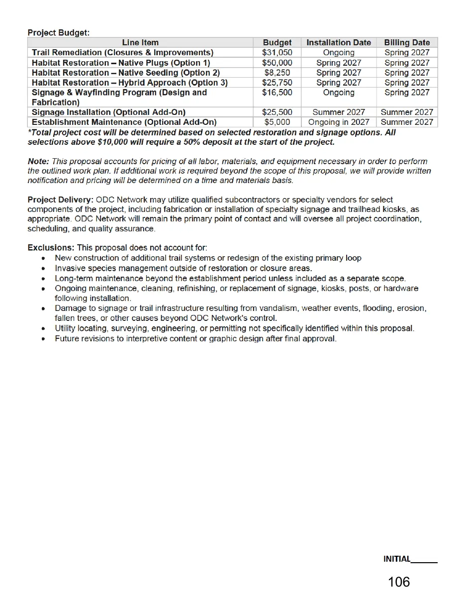
This page is a scanned image with no text layer. The PDF of these pages has it at full resolution.
Page 107

Text of page 107
Qualifications: ODC Conservation Services is staffed by highly qualified conservation professionals with extensive experience in invasive species management, habitat assessment, and ecological restoration. ODC Network (and its subsidiaries) is a fully insured 501c3 and carries an extensive liability policy to conduct habitat improvement services in Michigan. State licensed herbicide applicators with certifications in Forest Pest, Right-of-Way, and Aquatic pesticide application. Manage 2,500+ acres of natural area annually across Michigan. Successfully restored over 250 acres of native prairie habitat. Experienced consultants in invasive species management, wetland delineation, habitat assessment, and ecological restoration. Experience overseeing prescribed burns on approximately 10-100 acres of natural area annually through qualified subcontractors, including coordination, planning, and post-burn evaluation. Experience designing, installing, and maintaining native gardens/landscape beds. Proficient in identification of native and non-native Michigan flora and fauna. Experienced GIS professionals. We appreciate the opportunity to submit this proposal. We look forward to discussing the opportunity further with you. Please do not hesitate to ask questions or clarifications. If you choose to accept this proposal, please sign and return a copy.
Tanner Bricker, Conservation Services Director ODC Network
If you wish to accept this proposal, please initial each page, as well as sign and date below:
_____________________________________________________ Signature of Authorized Property Owner/Manager
_____________________________ Date
INITIAL______