
Council Agenda item 13A
Ordinance No.260526-A - To Amend the Zoning Ordinance and Zoning Map of the City of Saugatuck by Approving a Planned Unit Development Overlay and Associated Plan for 640 Water Street. (Roll Call)
City Council, Tuesday, May 26, 2026
Download these 48 pages, 60.3 MB Whole packet, 77 pages, 76.9 MB
Page 9
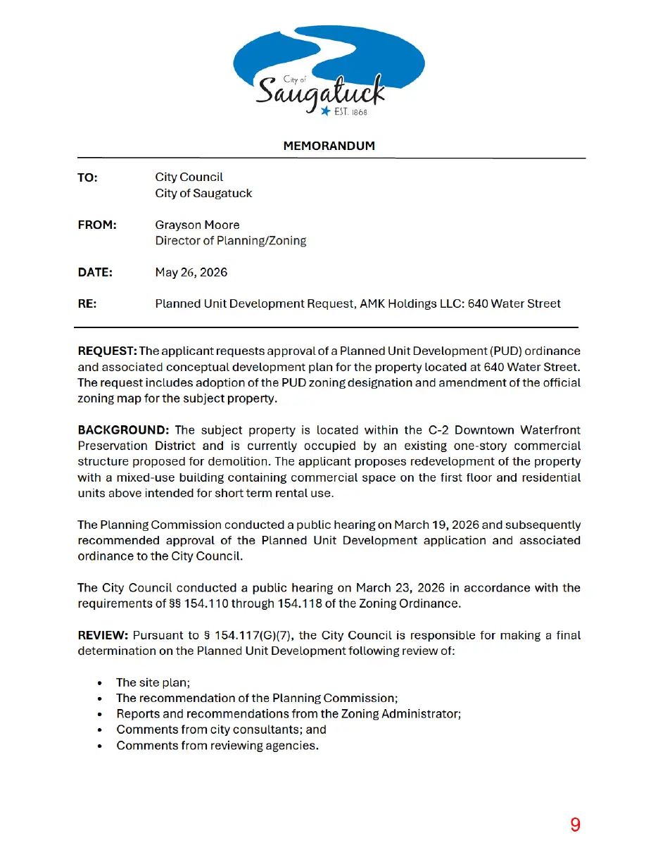
This page is a scanned image with no text layer. The PDF of these pages has it at full resolution.
Page 10
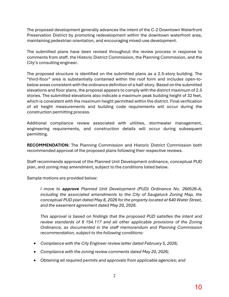
Text of page 10
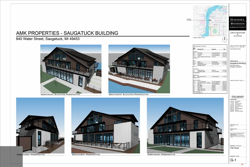
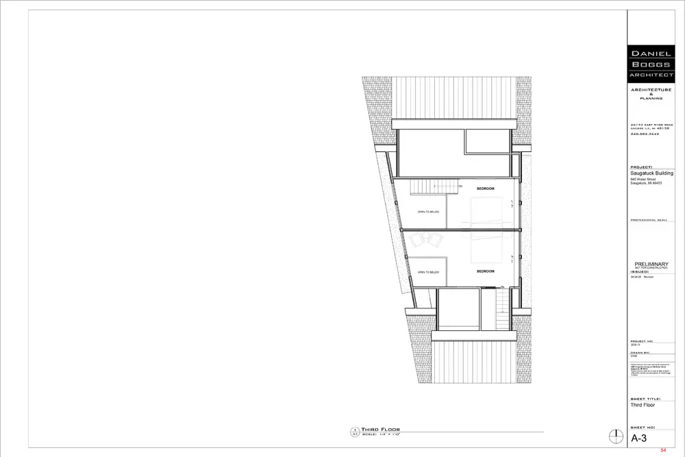
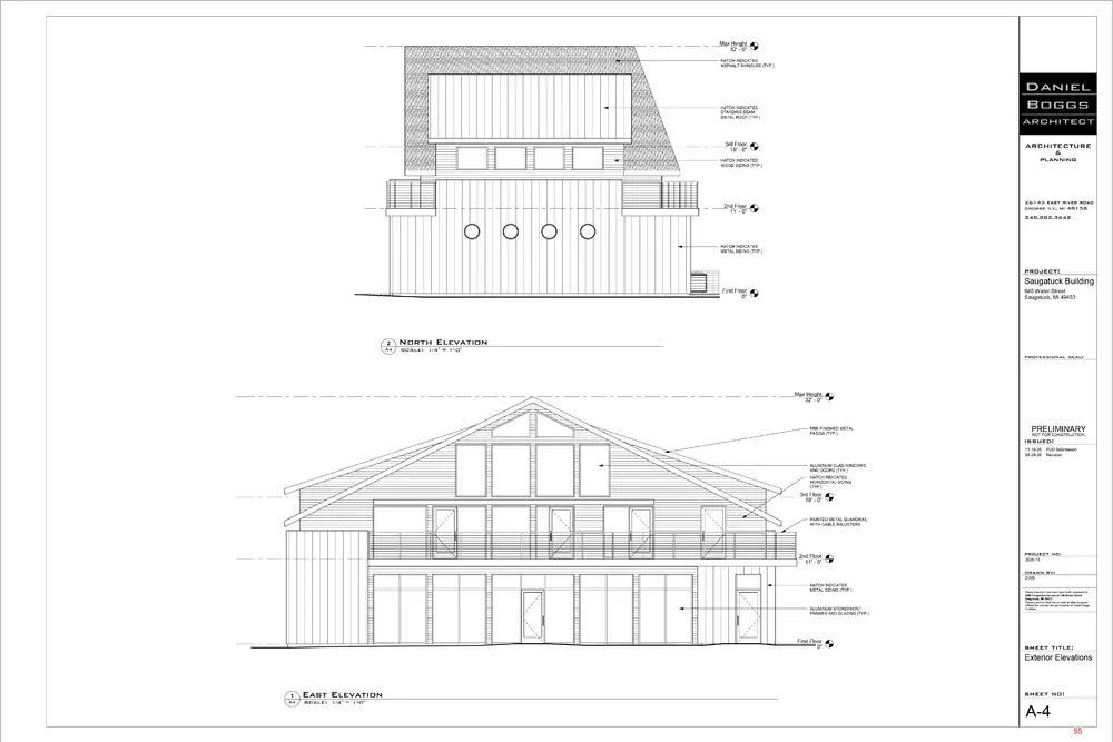
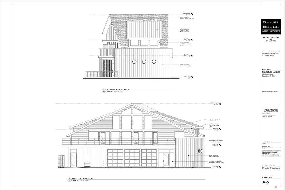
The proposed development generally advances the intent of the C-2 Downtown Waterfront Preservation District by promoting redevelopment within the downtown waterfront area, maintaining pedestrian orientation, and encouraging mixed-use development. The submitted plans have been revised throughout the review process in response to comments from staff, the Historic District Commission, the Planning Commission, and the City’s consulting engineer. The proposed structure is identified on the submitted plans as a 2.5-story building. The “third-floor” area is substantially contained within the roof form and includes open-tobelow areas consistent with the ordinance definition of a half-story. Based on the submitted elevations and floor plans, the proposal appears to comply with the district maximum of 2.5 stories. The submitted elevations also indicate a maximum peak building height of 32 feet, which is consistent with the maximum height permitted within the district. Final verification of all height measurements and building code requirements will occur during the construction permitting process. Additional compliance review associated with utilities, stormwater management, engineering requirements, and construction details will occur during subsequent permitting. RECOMMENDATION: The Planning Commission and Historic District Commission both recommended approval of the proposed plans following their respective reviews. Staff recommends approval of the Planned Unit Development ordinance, conceptual PUD plan, and zoning map amendment, subject to the conditions listed below. Sample motions are provided below: I move to approve Planned Unit Development (PUD) Ordinance No. 260526-A, including the associated amendments to the City of Saugatuck Zoning Map, the conceptual PUD plan dated May 8, 2026 for the property located at 640 Water Street, and the easement agreement dated May 20, 2026. This approval is based on findings that the proposed PUD satisfies the intent and review standards of § 154.117 and all other applicable provisions of the Zoning Ordinance, as documented in the staff memorandum and Planning Commission recommendation, subject to the following conditions: •
Compliance with the City Engineer review letter dated February 5, 2026;
Compliance with the zoning review comments dated May 20, 2026;
Obtaining all required permits and approvals from applicable agencies; and 2
Page 11
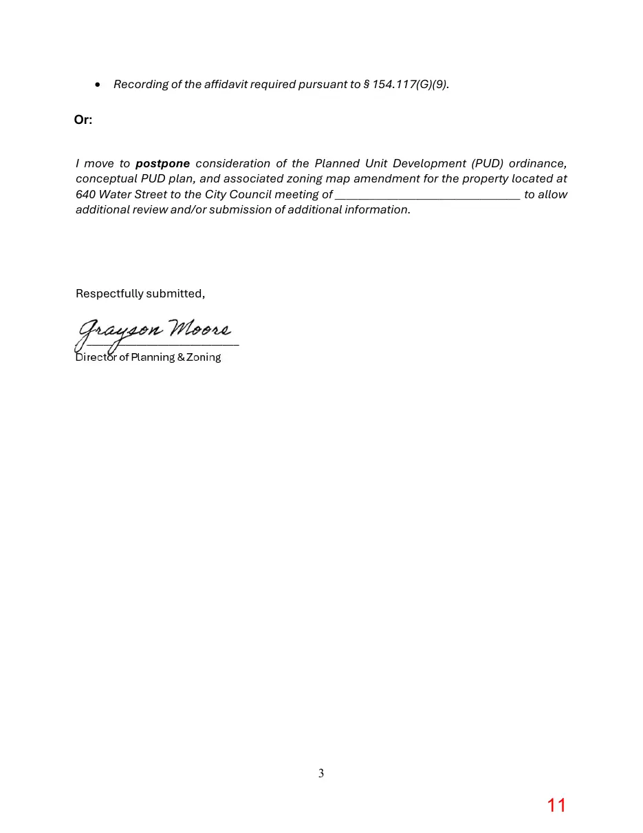
Text of page 11
Recording of the affidavit required pursuant to § 154.117(G)(9).
Or: I move to postpone consideration of the Planned Unit Development (PUD) ordinance, conceptual PUD plan, and associated zoning map amendment for the property located at 640 Water Street to the City Council meeting of ________________________________ to allow additional review and/or submission of additional information.
Respectfully submitted,
Page 12
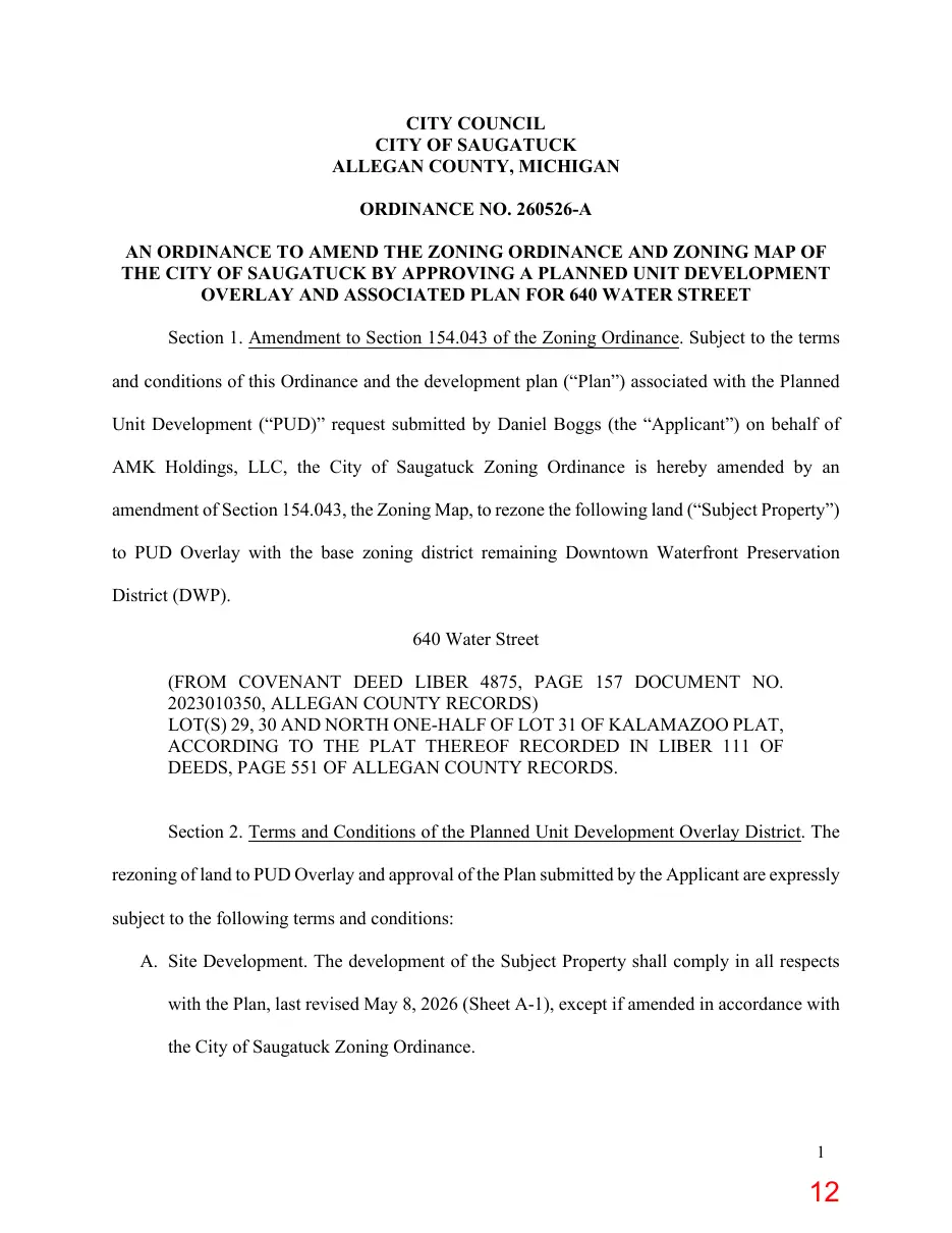
Text of page 12
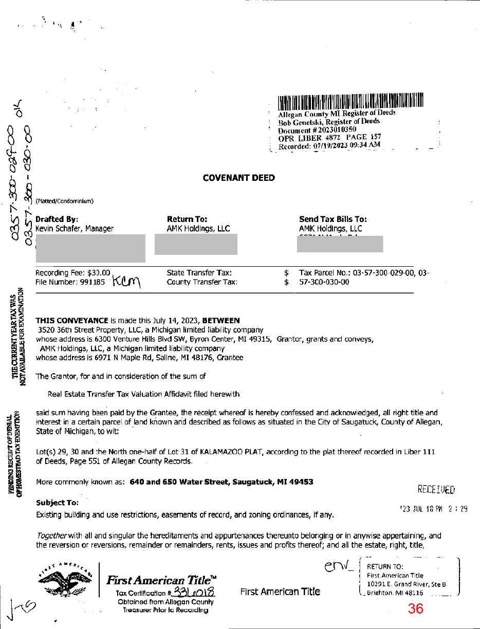
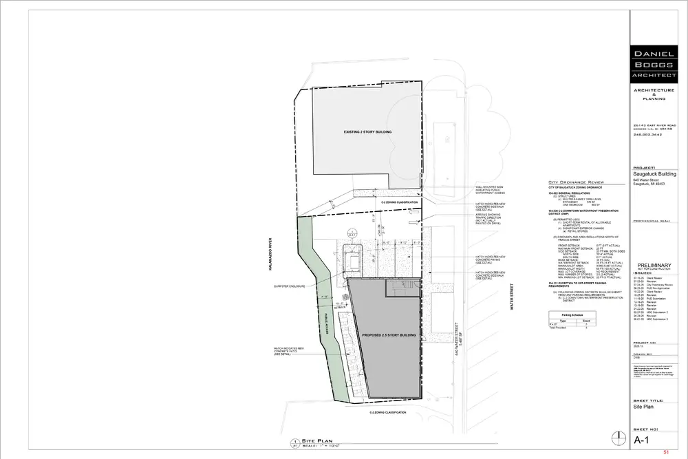
CITY COUNCIL CITY OF SAUGATUCK ALLEGAN COUNTY, MICHIGAN ORDINANCE NO. 260526-A AN ORDINANCE TO AMEND THE ZONING ORDINANCE AND ZONING MAP OF THE CITY OF SAUGATUCK BY APPROVING A PLANNED UNIT DEVELOPMENT OVERLAY AND ASSOCIATED PLAN FOR 640 WATER STREET Section 1. Amendment to Section 154.043 of the Zoning Ordinance. Subject to the terms and conditions of this Ordinance and the development plan (“Plan”) associated with the Planned Unit Development (“PUD)” request submitted by Daniel Boggs (the “Applicant”) on behalf of AMK Holdings, LLC, the City of Saugatuck Zoning Ordinance is hereby amended by an amendment of Section 154.043, the Zoning Map, to rezone the following land (“Subject Property”) to PUD Overlay with the base zoning district remaining Downtown Waterfront Preservation District (DWP). 640 Water Street (FROM COVENANT DEED LIBER 4875, PAGE 157 DOCUMENT NO. 2023010350, ALLEGAN COUNTY RECORDS) LOT(S) 29, 30 AND NORTH ONE-HALF OF LOT 31 OF KALAMAZOO PLAT, ACCORDING TO THE PLAT THEREOF RECORDED IN LIBER 111 OF DEEDS, PAGE 551 OF ALLEGAN COUNTY RECORDS. Section 2. Terms and Conditions of the Planned Unit Development Overlay District. The rezoning of land to PUD Overlay and approval of the Plan submitted by the Applicant are expressly subject to the following terms and conditions: A. Site Development. The development of the Subject Property shall comply in all respects with the Plan, last revised May 8, 2026 (Sheet A-1), except if amended in accordance with the City of Saugatuck Zoning Ordinance.
Page 13
Text of page 13
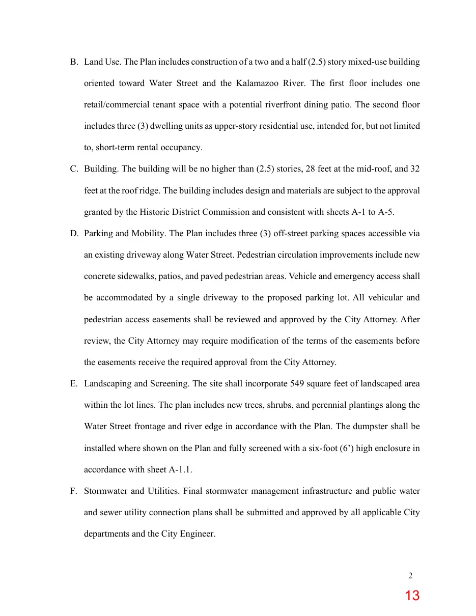
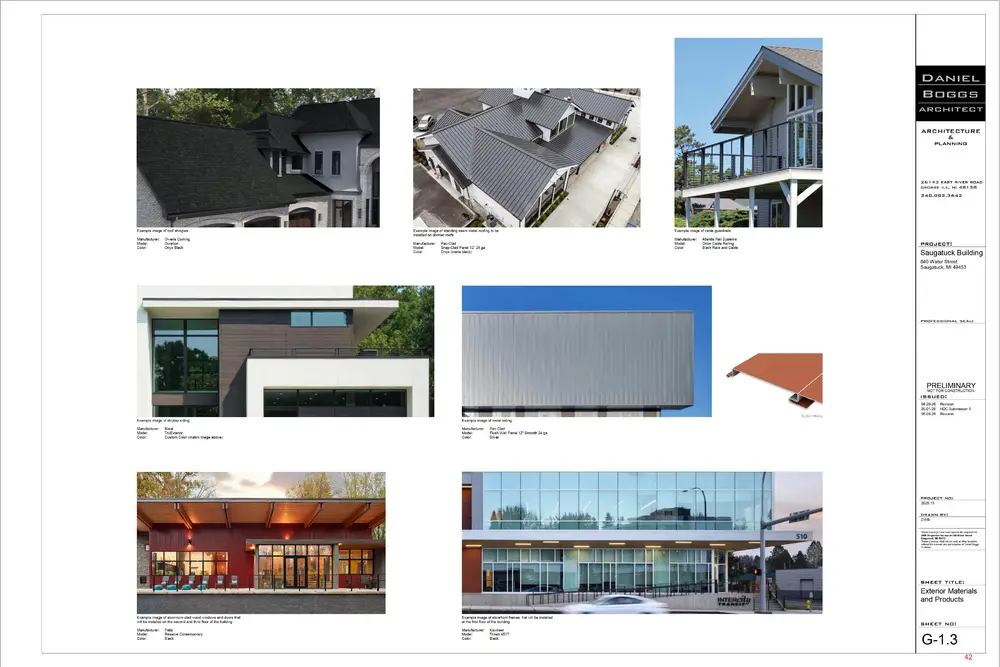
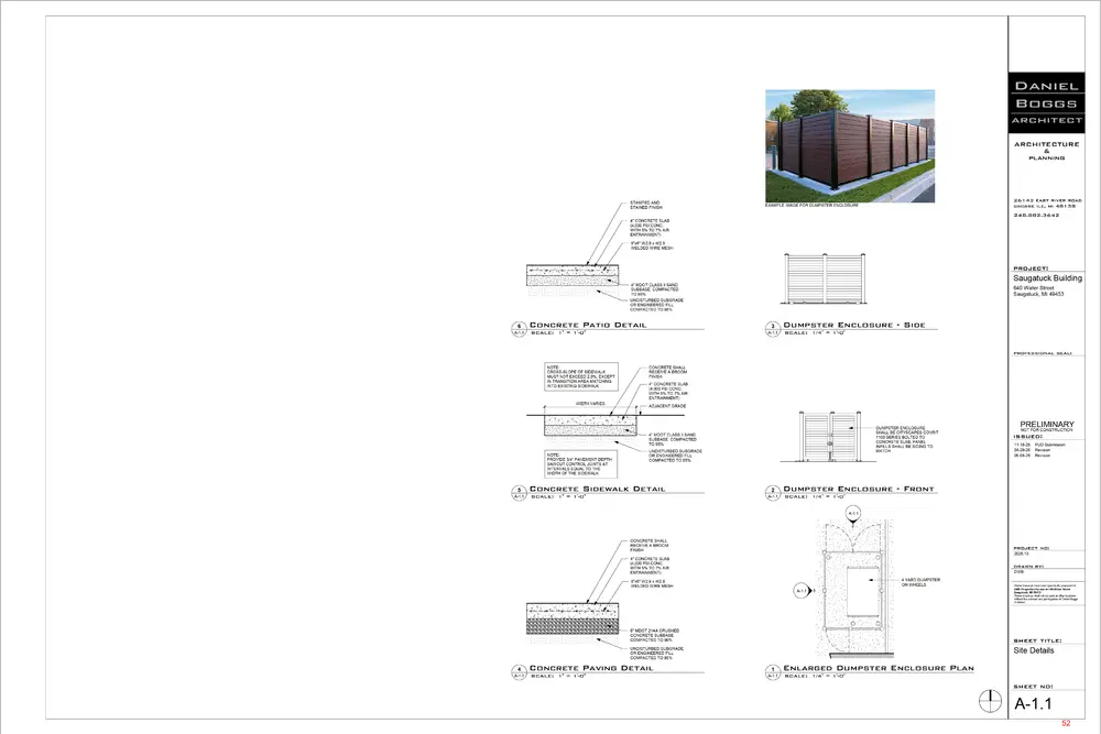
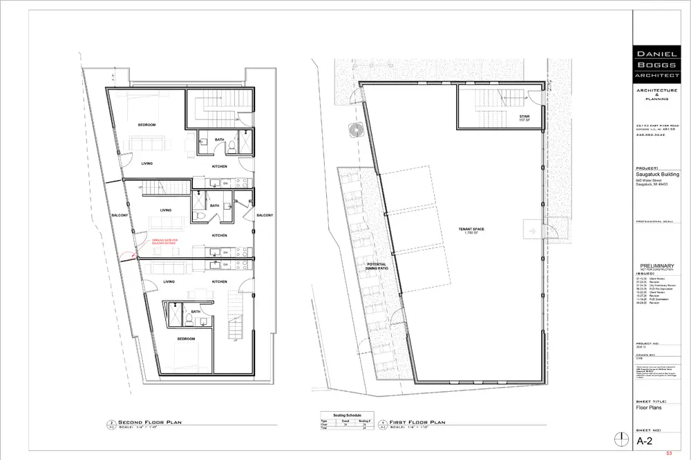
B. Land Use. The Plan includes construction of a two and a half (2.5) story mixed-use building oriented toward Water Street and the Kalamazoo River. The first floor includes one retail/commercial tenant space with a potential riverfront dining patio. The second floor includes three (3) dwelling units as upper-story residential use, intended for, but not limited to, short-term rental occupancy. C. Building. The building will be no higher than (2.5) stories, 28 feet at the mid-roof, and 32 feet at the roof ridge. The building includes design and materials are subject to the approval granted by the Historic District Commission and consistent with sheets A-1 to A-5. D. Parking and Mobility. The Plan includes three (3) off-street parking spaces accessible via an existing driveway along Water Street. Pedestrian circulation improvements include new concrete sidewalks, patios, and paved pedestrian areas. Vehicle and emergency access shall be accommodated by a single driveway to the proposed parking lot. All vehicular and pedestrian access easements shall be reviewed and approved by the City Attorney. After review, the City Attorney may require modification of the terms of the easements before the easements receive the required approval from the City Attorney. E. Landscaping and Screening. The site shall incorporate 549 square feet of landscaped area within the lot lines. The plan includes new trees, shrubs, and perennial plantings along the Water Street frontage and river edge in accordance with the Plan. The dumpster shall be installed where shown on the Plan and fully screened with a six-foot (6’) high enclosure in accordance with sheet A-1.1. F. Stormwater and Utilities. Final stormwater management infrastructure and public water and sewer utility connection plans shall be submitted and approved by all applicable City departments and the City Engineer.
Page 14
Text of page 14
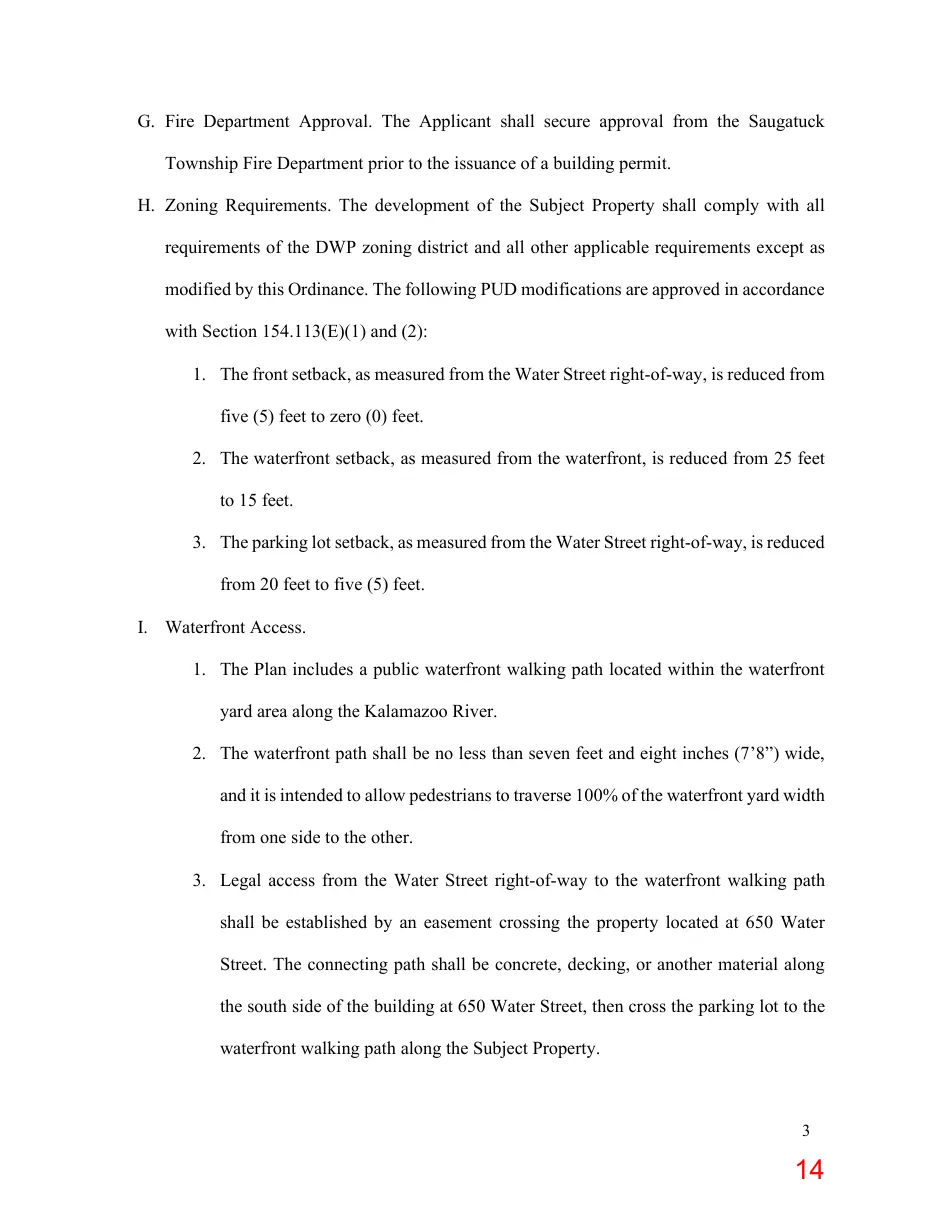
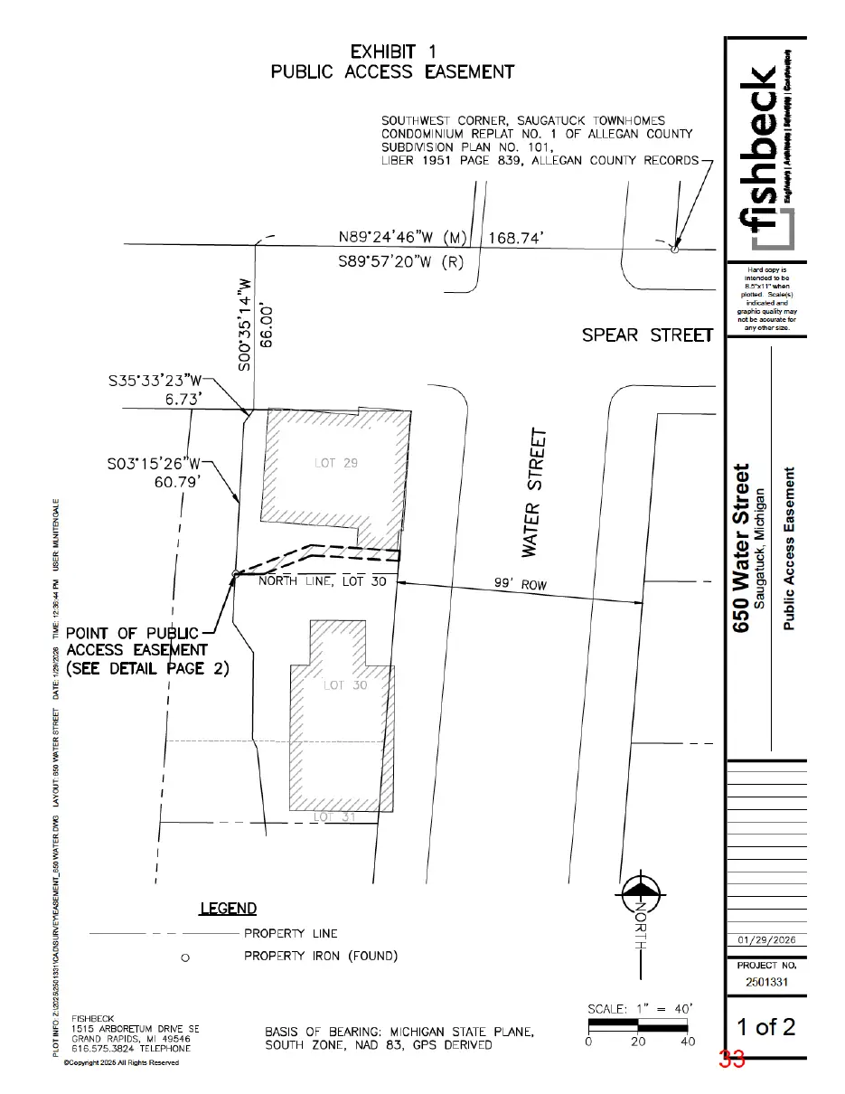
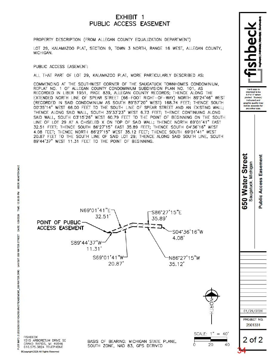
G. Fire Department Approval. The Applicant shall secure approval from the Saugatuck Township Fire Department prior to the issuance of a building permit. H. Zoning Requirements. The development of the Subject Property shall comply with all requirements of the DWP zoning district and all other applicable requirements except as modified by this Ordinance. The following PUD modifications are approved in accordance with Section 154.113(E)(1) and (2): 1. The front setback, as measured from the Water Street right-of-way, is reduced from five (5) feet to zero (0) feet. 2. The waterfront setback, as measured from the waterfront, is reduced from 25 feet to 15 feet. 3. The parking lot setback, as measured from the Water Street right-of-way, is reduced from 20 feet to five (5) feet. I. Waterfront Access. 1. The Plan includes a public waterfront walking path located within the waterfront yard area along the Kalamazoo River. 2. The waterfront path shall be no less than seven feet and eight inches (7’8”) wide, and it is intended to allow pedestrians to traverse 100% of the waterfront yard width from one side to the other. 3. Legal access from the Water Street right-of-way to the waterfront walking path shall be established by an easement crossing the property located at 650 Water Street. The connecting path shall be concrete, decking, or another material along the south side of the building at 650 Water Street, then cross the parking lot to the waterfront walking path along the Subject Property.
Page 15
Text of page 15
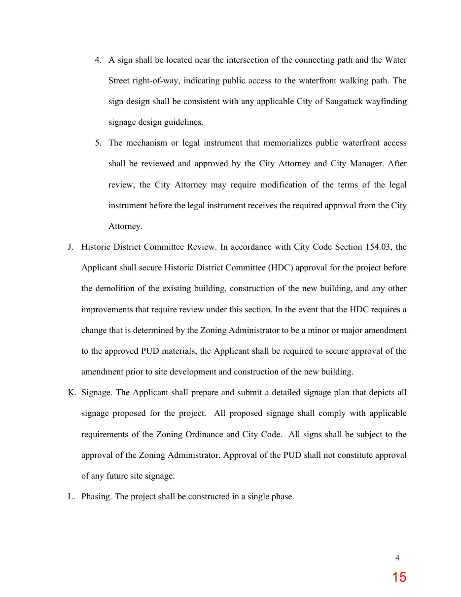
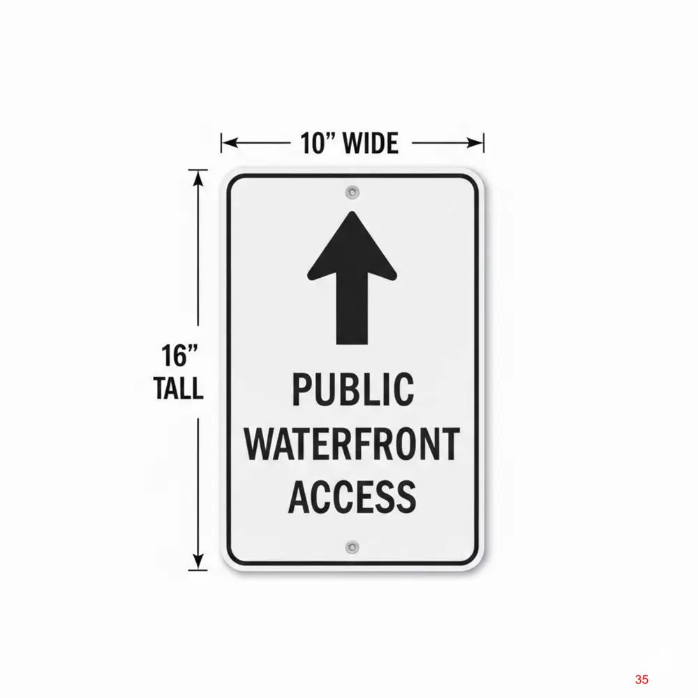
4. A sign shall be located near the intersection of the connecting path and the Water Street right-of-way, indicating public access to the waterfront walking path. The sign design shall be consistent with any applicable City of Saugatuck wayfinding signage design guidelines. 5. The mechanism or legal instrument that memorializes public waterfront access shall be reviewed and approved by the City Attorney and City Manager. After review, the City Attorney may require modification of the terms of the legal instrument before the legal instrument receives the required approval from the City Attorney. J. Historic District Committee Review. In accordance with City Code Section 154.03, the Applicant shall secure Historic District Committee (HDC) approval for the project before the demolition of the existing building, construction of the new building, and any other improvements that require review under this section. In the event that the HDC requires a change that is determined by the Zoning Administrator to be a minor or major amendment to the approved PUD materials, the Applicant shall be required to secure approval of the amendment prior to site development and construction of the new building. K. Signage. The Applicant shall prepare and submit a detailed signage plan that depicts all signage proposed for the project. All proposed signage shall comply with applicable requirements of the Zoning Ordinance and City Code. All signs shall be subject to the approval of the Zoning Administrator. Approval of the PUD shall not constitute approval of any future site signage. L. Phasing. The project shall be constructed in a single phase.
Page 16
Text of page 16
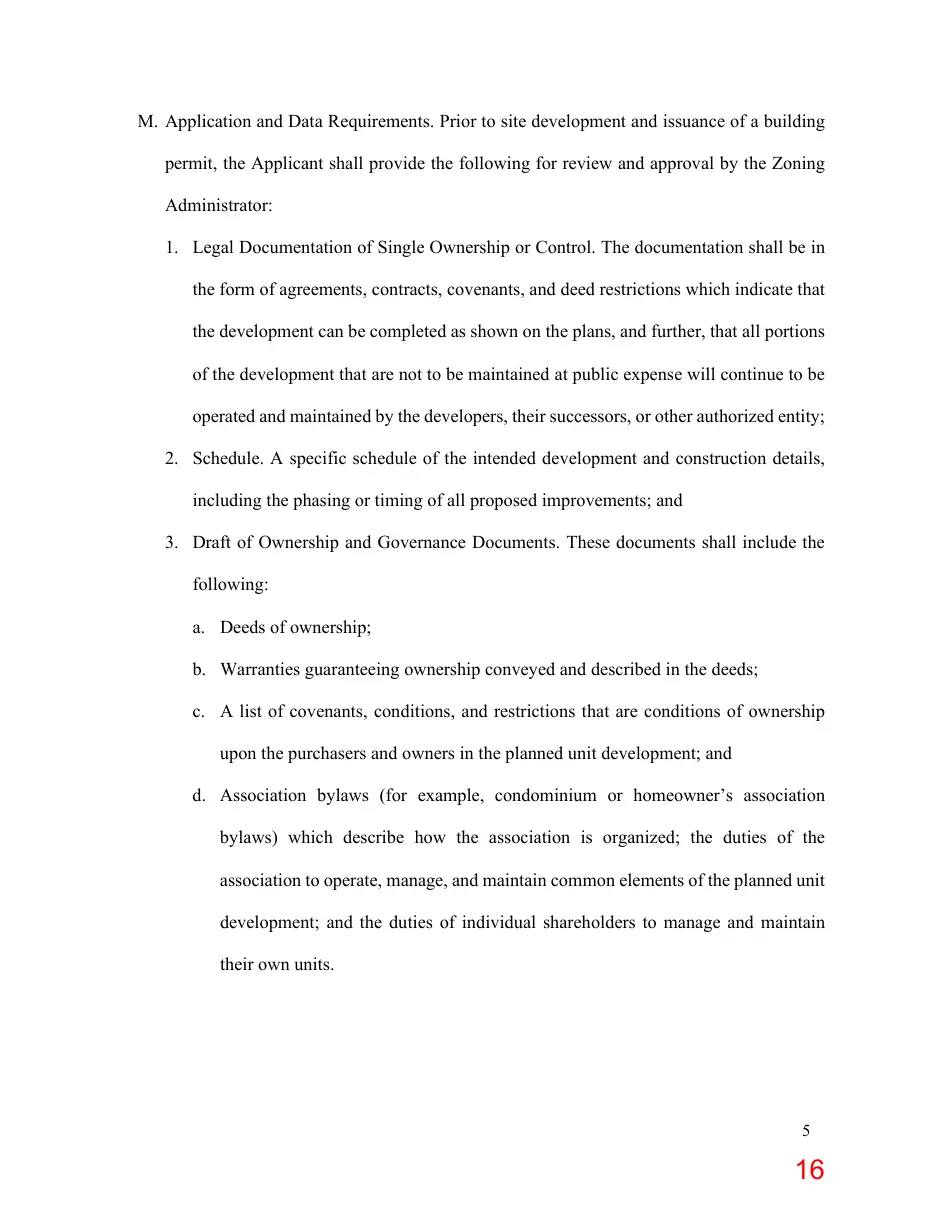
M. Application and Data Requirements. Prior to site development and issuance of a building permit, the Applicant shall provide the following for review and approval by the Zoning Administrator: 1. Legal Documentation of Single Ownership or Control. The documentation shall be in the form of agreements, contracts, covenants, and deed restrictions which indicate that the development can be completed as shown on the plans, and further, that all portions of the development that are not to be maintained at public expense will continue to be operated and maintained by the developers, their successors, or other authorized entity; 2. Schedule. A specific schedule of the intended development and construction details, including the phasing or timing of all proposed improvements; and 3. Draft of Ownership and Governance Documents. These documents shall include the following: a. Deeds of ownership; b. Warranties guaranteeing ownership conveyed and described in the deeds; c. A list of covenants, conditions, and restrictions that are conditions of ownership upon the purchasers and owners in the planned unit development; and d. Association bylaws (for example, condominium or homeowner’s association bylaws) which describe how the association is organized; the duties of the association to operate, manage, and maintain common elements of the planned unit development; and the duties of individual shareholders to manage and maintain their own units.
Page 17
Text of page 17
Section 3. Planned Unit Development Eligibility. The City Council determines that the Applicant has demonstrated that the project qualifies for PUD review and approval in accordance with Section 154.122 Eligibility: A. Recognizable and Substantial Benefit. The project delivers a recognizable community benefit by redeveloping an aging waterfront site, consistent with the C-2 DWP District's intent, and by incorporating riverfront landscaping and a public walking path. B. Minimum Area and Density. The parcel meets the minimum lot area required in the C-2 DWP District for the proposed uses, and the residential component (three upper-story dwelling units) is permitted in the district. The district does not establish a maximum density standard that the proposal would exceed. C. Availability and Capacity of Public Services. The development will be served by existing public services and infrastructure, subject to review and approval by applicable City departments and outside agencies. D. Compatibility with the Land Use Plan. The project is consistent with the City’s Comprehensive Plan policies on downtown reinvestment, compatible mixed-use development, waterfront protection, preservation of river views, and high-quality waterfront design. E. Compatibility with PUD Intent. The proposed redevelopment aligns with the intent of the PUD provisions by using design flexibility to address a constrained site while providing a higher-quality infill development that supports downtown activity and enhances the waterfront setting.
Page 18
Text of page 18
F. Economic Impact. The proposed commercial use and upper-story residential units are compatible with the downtown district and are not expected to impede surrounding properties or the continued use of nearby permitted uses. G. Unified Control of Property. The development is proposed under single ownership and control, ensuring a single responsible party to implement the project in accordance with the approved PUD Plan. H. Dedication of Utilities and Roads. No new public streets are proposed. Utility easements may be established if required during engineering review, but the project does not involve new roadway dedication. Section 4. Project Design Standards. The City Council determines that the project design standards and requirements outlined in Section 154.113 Project Design Standards have been met by the Applicant: A. Minimum Lot Area. The project is eligible for PUD review in the C-2 DWP District, which does not require a minimum acreage threshold for PUD consideration. B. Compatibility with Adjacent Uses. The building height, scale, placement, and architectural materials are generally compatible with the downtown and waterfront context. The Plan includes screening and landscaping elements intended to buffer site features, including parking and service areas. C. Permitted Uses. The proposed mix of uses (first-floor commercial/retail space and upperstory dwelling units) is allowed in the C-2 DWP District and may be authorized through the PUD approval. 7
Page 19
Text of page 19
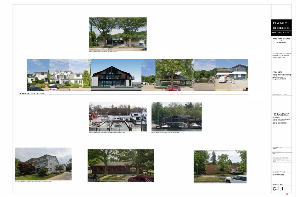
D. Application Base Regulations. The Plan was reviewed against the underlying C-2 DWP District standards and applicable site development regulations. Where deviations are proposed (including reduced front, waterfront, and parking setbacks), they are addressed through the PUD modification process. E. Regulatory Flexibility. The proposal includes requested modifications to dimensional standards (including reduced front, waterfront, and parking setbacks). The waterfront walkway component supports the flexibility provisions applicable in the C-2 DWP District by providing continuous traversable access along the waterfront yard area. F. Permitted Mix of Uses. The project’s commercial and residential components are designed to operate together and are not expected to cause nuisance impacts on surrounding properties, consistent with the district's mixed-use intent. G. Open Space Requirements. While the C-2 DWP District does not impose a maximum lot coverage standard, the Plan provides usable, accessible open area through patios, porches, and the riverfront walkway, consistent with the district’s open area requirements. H. Frontage and Access. The Subject Property fronts on Water Street and provides access using the existing shared driveway arrangement. No additional drive openings are proposed beyond the current vehicle access point. I. Utilities. Utilities are proposed to be underground where feasible and will be subject to review and approval through the City Engineer and utility service providers.
Page 20
Text of page 20
J. Privacy for Dwelling Units. Residential units are located on the second floor, with balconies and outdoor areas oriented toward the river and Water Street. The site design does not identify privacy conflicts that would prevent approval. K. Emergency Access. Emergency vehicle access is shown on the Plan and remains subject to review and approval by the Saugatuck Township Fire Department. L. Pedestrian and Vehicular Circulation. The Plan includes new sidewalks, patios, and paved areas. The waterfront pathway will be accessible to the public through an easement located at 650 Water Street. M. Minimum Spacing. The development meets applicable spacing requirements through compliance with minimum side setbacks. Separation between off-site buildings shall adhere to applicable Building Code and Fire Code requirements. N. Building Length. The proposed building length is within the maximum length standard for multiple-family buildings. O. Sensitive Natural Features. The project maintains a 15-foot waterfront setback area and does not propose removing sensitive natural features. The river edge is buffered by landscaping and a setback space, as shown on the Plan. P. Natural Vegetation Strip Along Streams. This standard is addressed through the C-2 DWP waterfront setback and proposed waterfront yard landscaping.
Page 21
Text of page 21
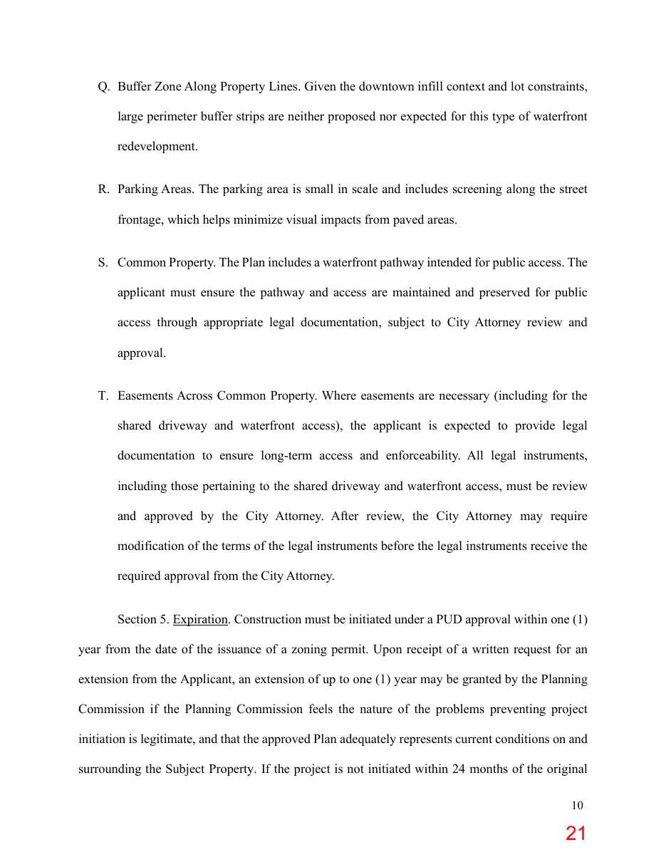
Q. Buffer Zone Along Property Lines. Given the downtown infill context and lot constraints, large perimeter buffer strips are neither proposed nor expected for this type of waterfront redevelopment. R. Parking Areas. The parking area is small in scale and includes screening along the street frontage, which helps minimize visual impacts from paved areas. S. Common Property. The Plan includes a waterfront pathway intended for public access. The applicant must ensure the pathway and access are maintained and preserved for public access through appropriate legal documentation, subject to City Attorney review and approval. T. Easements Across Common Property. Where easements are necessary (including for the shared driveway and waterfront access), the applicant is expected to provide legal documentation to ensure long-term access and enforceability. All legal instruments, including those pertaining to the shared driveway and waterfront access, must be review and approved by the City Attorney. After review, the City Attorney may require modification of the terms of the legal instruments before the legal instruments receive the required approval from the City Attorney. Section 5. Expiration. Construction must be initiated under a PUD approval within one (1) year from the date of the issuance of a zoning permit. Upon receipt of a written request for an extension from the Applicant, an extension of up to one (1) year may be granted by the Planning Commission if the Planning Commission feels the nature of the problems preventing project initiation is legitimate, and that the approved Plan adequately represents current conditions on and surrounding the Subject Property. If the project is not initiated within 24 months of the original 10
Page 22
Text of page 22
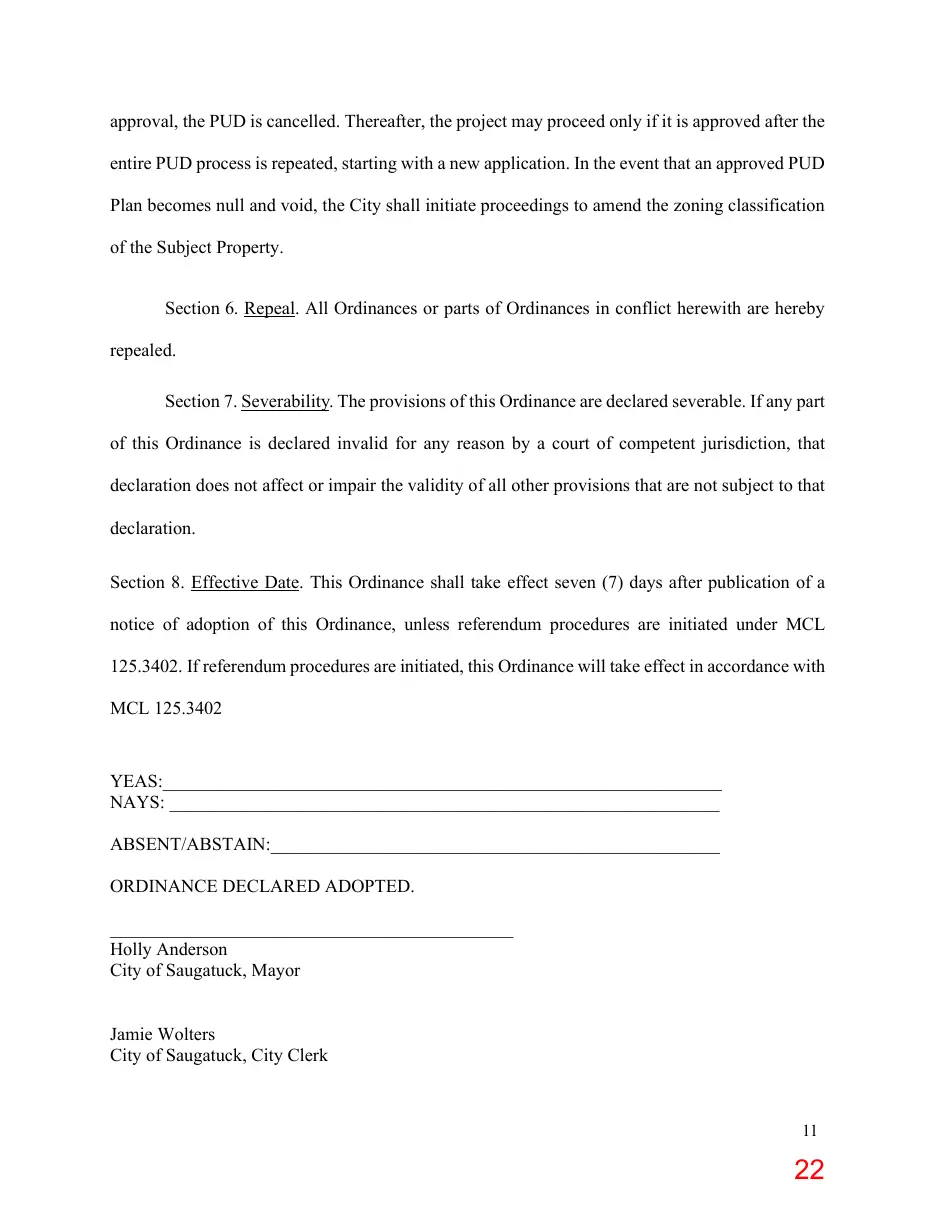
approval, the PUD is cancelled. Thereafter, the project may proceed only if it is approved after the entire PUD process is repeated, starting with a new application. In the event that an approved PUD Plan becomes null and void, the City shall initiate proceedings to amend the zoning classification of the Subject Property. Section 6. Repeal. All Ordinances or parts of Ordinances in conflict herewith are hereby repealed. Section 7. Severability. The provisions of this Ordinance are declared severable. If any part of this Ordinance is declared invalid for any reason by a court of competent jurisdiction, that declaration does not affect or impair the validity of all other provisions that are not subject to that declaration. Section 8. Effective Date. This Ordinance shall take effect seven (7) days after publication of a notice of adoption of this Ordinance, unless referendum procedures are initiated under MCL 125.3402. If referendum procedures are initiated, this Ordinance will take effect in accordance with MCL 125.3402
YEAS:_____________________________________________________________ NAYS: ____________________________________________________________ ABSENT/ABSTAIN:_________________________________________________ ORDINANCE DECLARED ADOPTED. ____________________________________________ Holly Anderson City of Saugatuck, Mayor Jamie Wolters City of Saugatuck, City Clerk
Page 23
Text of page 23
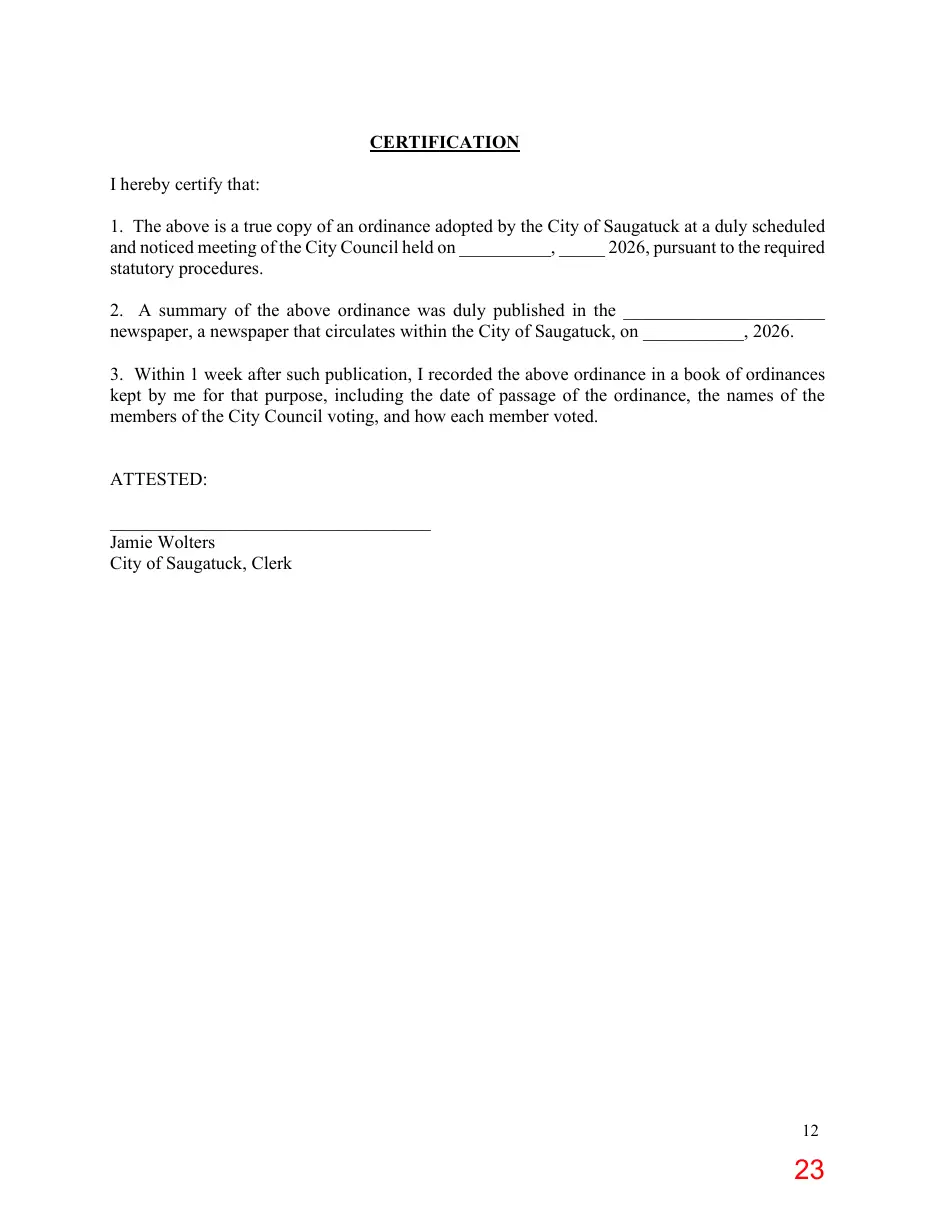
CERTIFICATION I hereby certify that: 1. The above is a true copy of an ordinance adopted by the City of Saugatuck at a duly scheduled and noticed meeting of the City Council held on __________, _____ 2026, pursuant to the required statutory procedures. 2. A summary of the above ordinance was duly published in the ______________________ newspaper, a newspaper that circulates within the City of Saugatuck, on ___________, 2026. 3. Within 1 week after such publication, I recorded the above ordinance in a book of ordinances kept by me for that purpose, including the date of passage of the ordinance, the names of the members of the City Council voting, and how each member voted. ATTESTED: ___________________________________ Jamie Wolters City of Saugatuck, Clerk
Page 24
Text of page 24
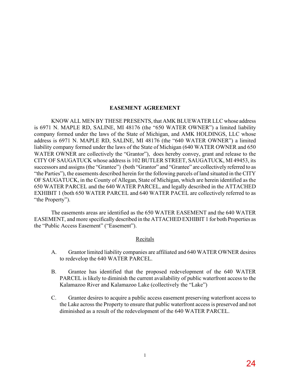
EASEMENT AGREEMENT KNOW ALL MEN BY THESE PRESENTS, that AMK BLUEWATER LLC whose address is 6971 N. MAPLE RD, SALINE, MI 48176 (the “650 WATER OWNER”) a limited liability company formed under the laws of the State of Michigan, and AMK HOLDINGS, LLC whose address is 6971 N. MAPLE RD, SALINE, MI 48176 (the “640 WATER OWNER”) a limited liability company formed under the laws of the State of Michigan (640 WATER OWNER and 650 WATER OWNER are collectively the “Grantor”), does hereby convey, grant and release to the CITY OF SAUGATUCK whose address is 102 BUTLER STREET, SAUGATUCK, MI 49453, its successors and assigns (the “Grantee”) (both “Grantor” and “Grantee” are collectively referred to as “the Parties”), the easements described herein for the following parcels of land situated in the CITY OF SAUGATUCK, in the County of Allegan, State of Michigan, which are herein identified as the 650 WATER PARCEL and the 640 WATER PARCEL, and legally described in the ATTACHED EXHIBIT 1 (both 650 WATER PARCEL and 640 WATER PACEL are collectively referred to as “the Property”). The easements areas are identified as the 650 WATER EASEMENT and the 640 WATER EASEMENT, and more specifically described in the ATTACHED EXHIBIT 1 for both Properties as the “Public Access Easement” (“Easement”). Recitals A.
Grantor limited liability companies are affiliated and 640 WATER OWNER desires to redevelop the 640 WATER PARCEL.
Grantee has identified that the proposed redevelopment of the 640 WATER PARCEL is likely to diminish the current availability of public waterfront access to the Kalamazoo River and Kalamazoo Lake (collectively the “Lake”)
Grantee desires to acquire a public access easement preserving waterfront access to the Lake across the Property to ensure that public waterfront access is preserved and not diminished as a result of the redevelopment of the 640 WATER PARCEL.
Page 25
Text of page 25
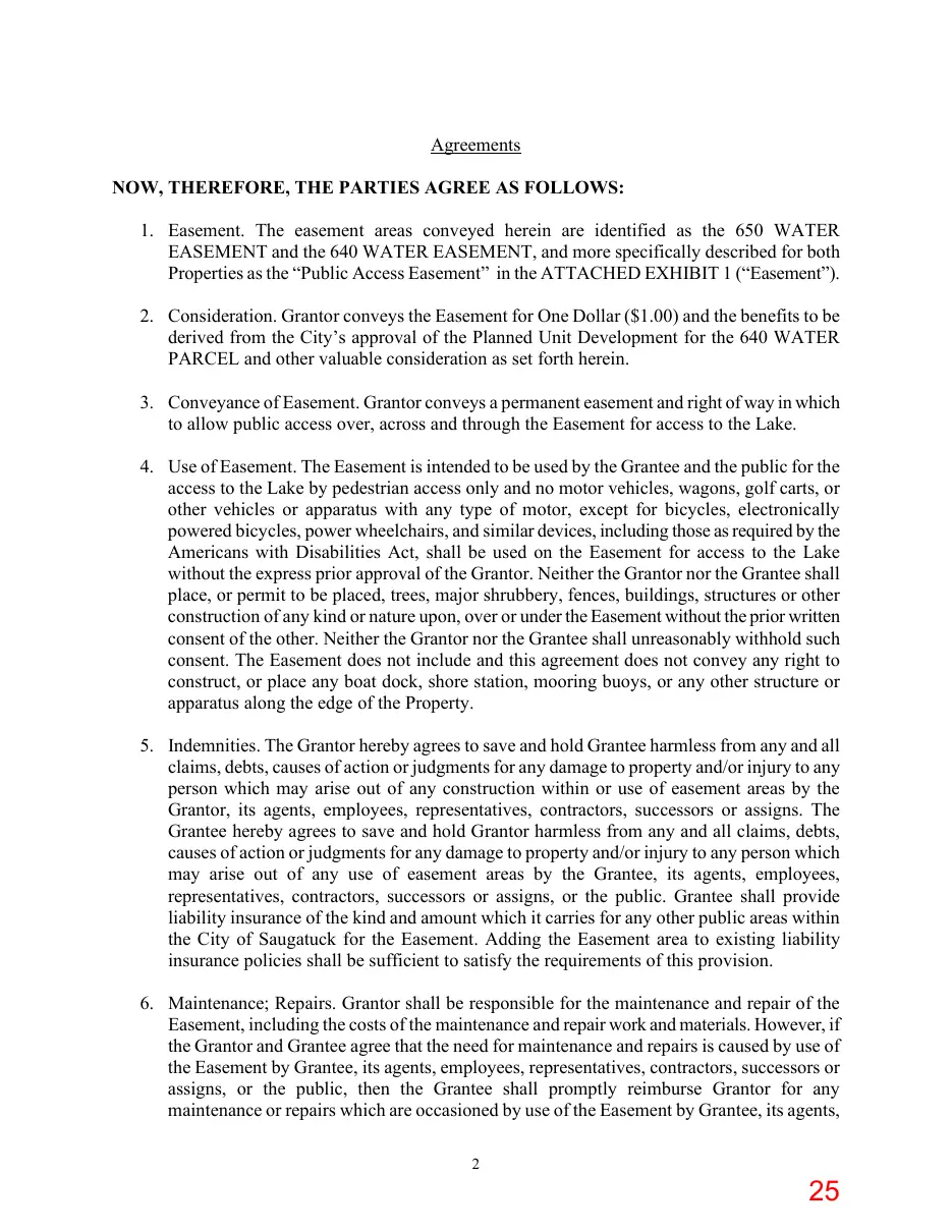
Agreements NOW, THEREFORE, THE PARTIES AGREE AS FOLLOWS: 1. Easement. The easement areas conveyed herein are identified as the 650 WATER EASEMENT and the 640 WATER EASEMENT, and more specifically described for both Properties as the “Public Access Easement” in the ATTACHED EXHIBIT 1 (“Easement”). 2. Consideration. Grantor conveys the Easement for One Dollar ($1.00) and the benefits to be derived from the City’s approval of the Planned Unit Development for the 640 WATER PARCEL and other valuable consideration as set forth herein. 3. Conveyance of Easement. Grantor conveys a permanent easement and right of way in which to allow public access over, across and through the Easement for access to the Lake. 4. Use of Easement. The Easement is intended to be used by the Grantee and the public for the access to the Lake by pedestrian access only and no motor vehicles, wagons, golf carts, or other vehicles or apparatus with any type of motor, except for bicycles, electronically powered bicycles, power wheelchairs, and similar devices, including those as required by the Americans with Disabilities Act, shall be used on the Easement for access to the Lake without the express prior approval of the Grantor. Neither the Grantor nor the Grantee shall place, or permit to be placed, trees, major shrubbery, fences, buildings, structures or other construction of any kind or nature upon, over or under the Easement without the prior written consent of the other. Neither the Grantor nor the Grantee shall unreasonably withhold such consent. The Easement does not include and this agreement does not convey any right to construct, or place any boat dock, shore station, mooring buoys, or any other structure or apparatus along the edge of the Property. 5. Indemnities. The Grantor hereby agrees to save and hold Grantee harmless from any and all claims, debts, causes of action or judgments for any damage to property and/or injury to any person which may arise out of any construction within or use of easement areas by the Grantor, its agents, employees, representatives, contractors, successors or assigns. The Grantee hereby agrees to save and hold Grantor harmless from any and all claims, debts, causes of action or judgments for any damage to property and/or injury to any person which may arise out of any use of easement areas by the Grantee, its agents, employees, representatives, contractors, successors or assigns, or the public. Grantee shall provide liability insurance of the kind and amount which it carries for any other public areas within the City of Saugatuck for the Easement. Adding the Easement area to existing liability insurance policies shall be sufficient to satisfy the requirements of this provision. 6. Maintenance; Repairs. Grantor shall be responsible for the maintenance and repair of the Easement, including the costs of the maintenance and repair work and materials. However, if the Grantor and Grantee agree that the need for maintenance and repairs is caused by use of the Easement by Grantee, its agents, employees, representatives, contractors, successors or assigns, or the public, then the Grantee shall promptly reimburse Grantor for any maintenance or repairs which are occasioned by use of the Easement by Grantee, its agents, 2
Page 26
Text of page 26
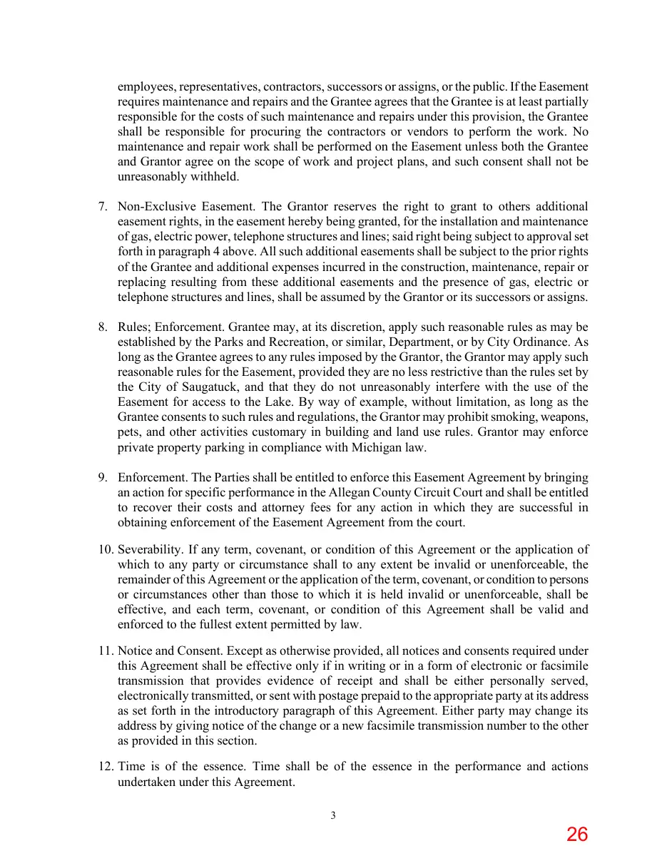
employees, representatives, contractors, successors or assigns, or the public. If the Easement requires maintenance and repairs and the Grantee agrees that the Grantee is at least partially responsible for the costs of such maintenance and repairs under this provision, the Grantee shall be responsible for procuring the contractors or vendors to perform the work. No maintenance and repair work shall be performed on the Easement unless both the Grantee and Grantor agree on the scope of work and project plans, and such consent shall not be unreasonably withheld. 7. Non-Exclusive Easement. The Grantor reserves the right to grant to others additional easement rights, in the easement hereby being granted, for the installation and maintenance of gas, electric power, telephone structures and lines; said right being subject to approval set forth in paragraph 4 above. All such additional easements shall be subject to the prior rights of the Grantee and additional expenses incurred in the construction, maintenance, repair or replacing resulting from these additional easements and the presence of gas, electric or telephone structures and lines, shall be assumed by the Grantor or its successors or assigns. 8. Rules; Enforcement. Grantee may, at its discretion, apply such reasonable rules as may be established by the Parks and Recreation, or similar, Department, or by City Ordinance. As long as the Grantee agrees to any rules imposed by the Grantor, the Grantor may apply such reasonable rules for the Easement, provided they are no less restrictive than the rules set by the City of Saugatuck, and that they do not unreasonably interfere with the use of the Easement for access to the Lake. By way of example, without limitation, as long as the Grantee consents to such rules and regulations, the Grantor may prohibit smoking, weapons, pets, and other activities customary in building and land use rules. Grantor may enforce private property parking in compliance with Michigan law. 9. Enforcement. The Parties shall be entitled to enforce this Easement Agreement by bringing an action for specific performance in the Allegan County Circuit Court and shall be entitled to recover their costs and attorney fees for any action in which they are successful in obtaining enforcement of the Easement Agreement from the court. 10. Severability. If any term, covenant, or condition of this Agreement or the application of which to any party or circumstance shall to any extent be invalid or unenforceable, the remainder of this Agreement or the application of the term, covenant, or condition to persons or circumstances other than those to which it is held invalid or unenforceable, shall be effective, and each term, covenant, or condition of this Agreement shall be valid and enforced to the fullest extent permitted by law. 11. Notice and Consent. Except as otherwise provided, all notices and consents required under this Agreement shall be effective only if in writing or in a form of electronic or facsimile transmission that provides evidence of receipt and shall be either personally served, electronically transmitted, or sent with postage prepaid to the appropriate party at its address as set forth in the introductory paragraph of this Agreement. Either party may change its address by giving notice of the change or a new facsimile transmission number to the other as provided in this section. 12. Time is of the essence. Time shall be of the essence in the performance and actions undertaken under this Agreement. 3
Page 27
Text of page 27
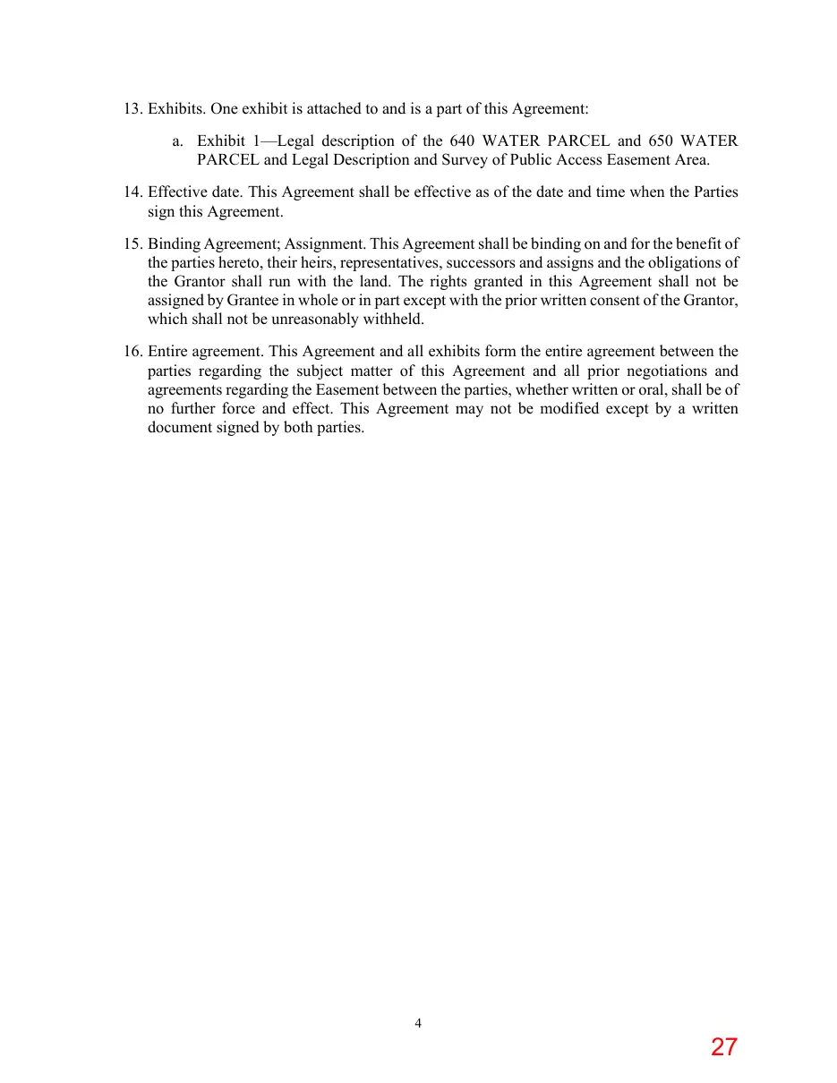
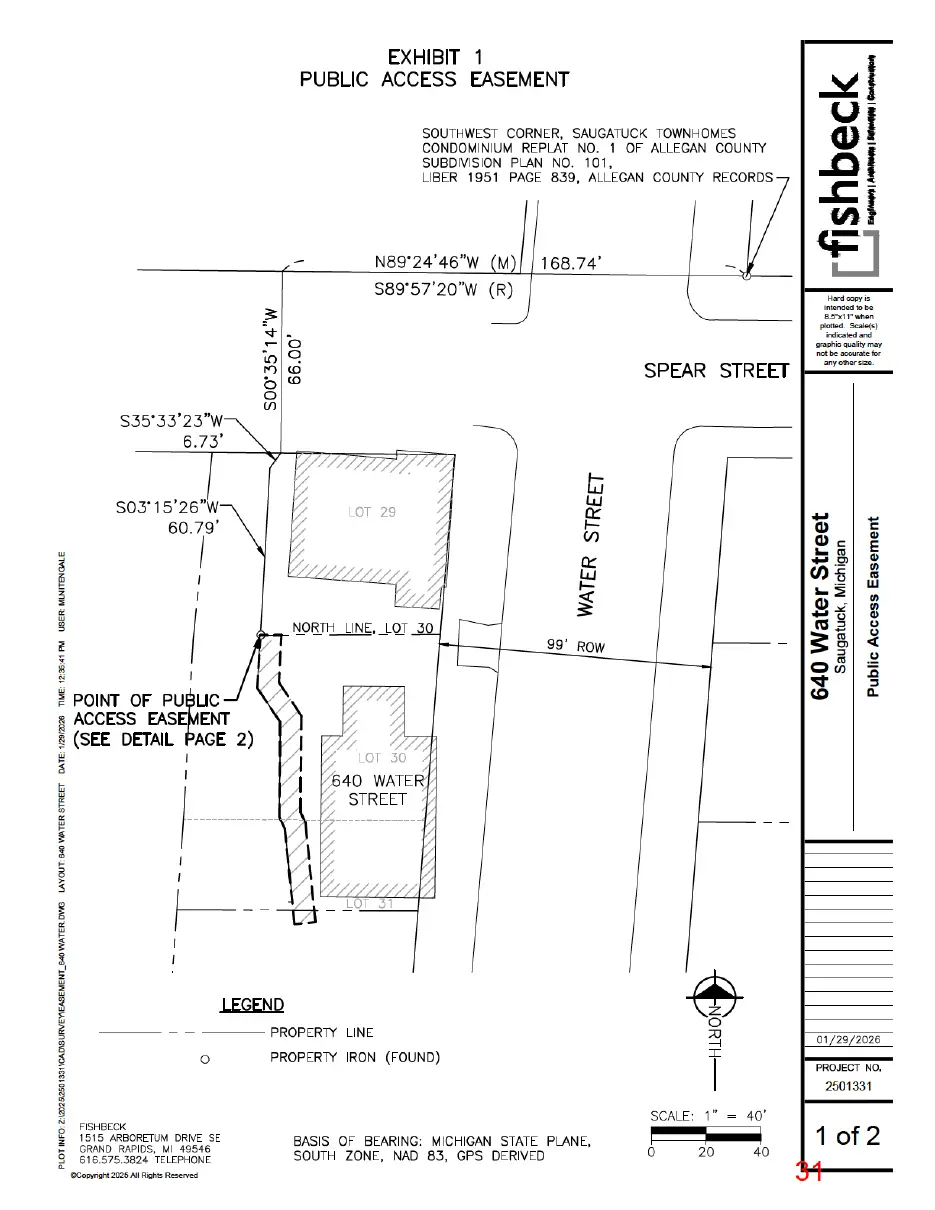
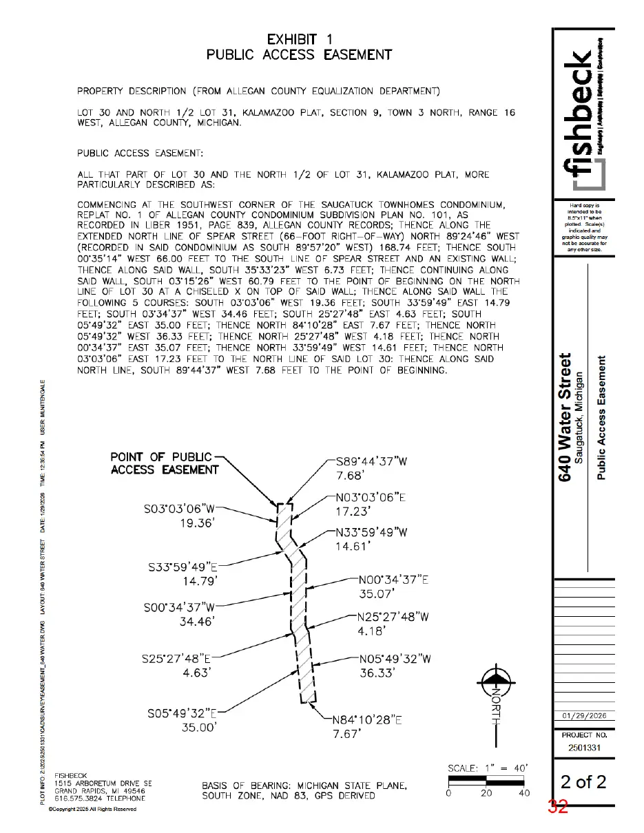
13. Exhibits. One exhibit is attached to and is a part of this Agreement: a. Exhibit 1—Legal description of the 640 WATER PARCEL and 650 WATER PARCEL and Legal Description and Survey of Public Access Easement Area. 14. Effective date. This Agreement shall be effective as of the date and time when the Parties sign this Agreement. 15. Binding Agreement; Assignment. This Agreement shall be binding on and for the benefit of the parties hereto, their heirs, representatives, successors and assigns and the obligations of the Grantor shall run with the land. The rights granted in this Agreement shall not be assigned by Grantee in whole or in part except with the prior written consent of the Grantor, which shall not be unreasonably withheld. 16. Entire agreement. This Agreement and all exhibits form the entire agreement between the parties regarding the subject matter of this Agreement and all prior negotiations and agreements regarding the Easement between the parties, whether written or oral, shall be of no further force and effect. This Agreement may not be modified except by a written document signed by both parties.
Page 28
Text of page 28
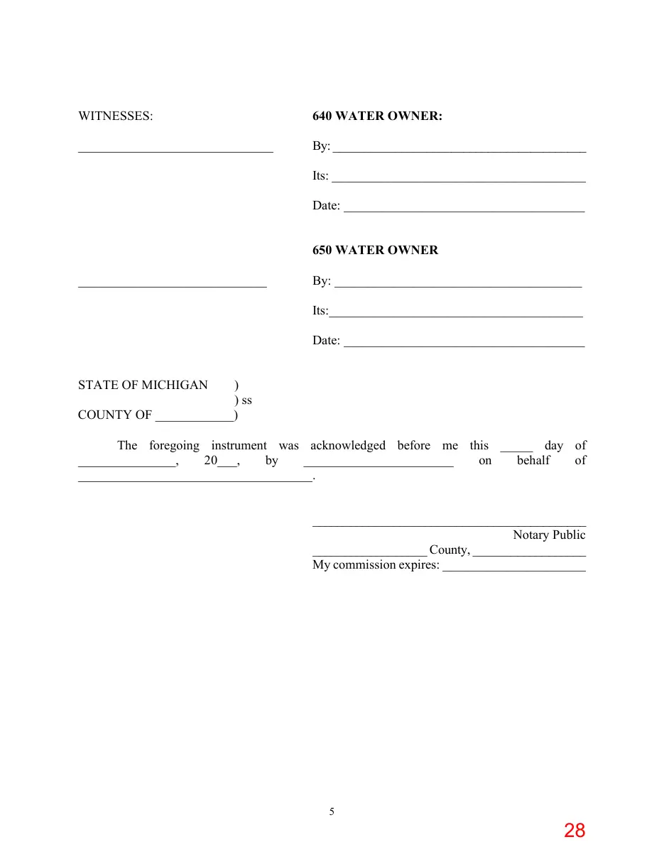
WITNESSES:
640 WATER OWNER:
______________________________
By: _________________________________________ Its: _______________________________________ Date: _____________________________________ 650 WATER OWNER
_____________________________
By: ______________________________________ Its:_______________________________________ Date: _____________________________________
STATE OF MICHIGAN
) ) ss COUNTY OF ____________) The foregoing instrument was acknowledged before me this _____ day of _______________, 20___, by _______________________ on behalf of ____________________________________. ____________________________________________ Notary Public __________________ County, __________________ My commission expires: ______________________
Page 29
Text of page 29
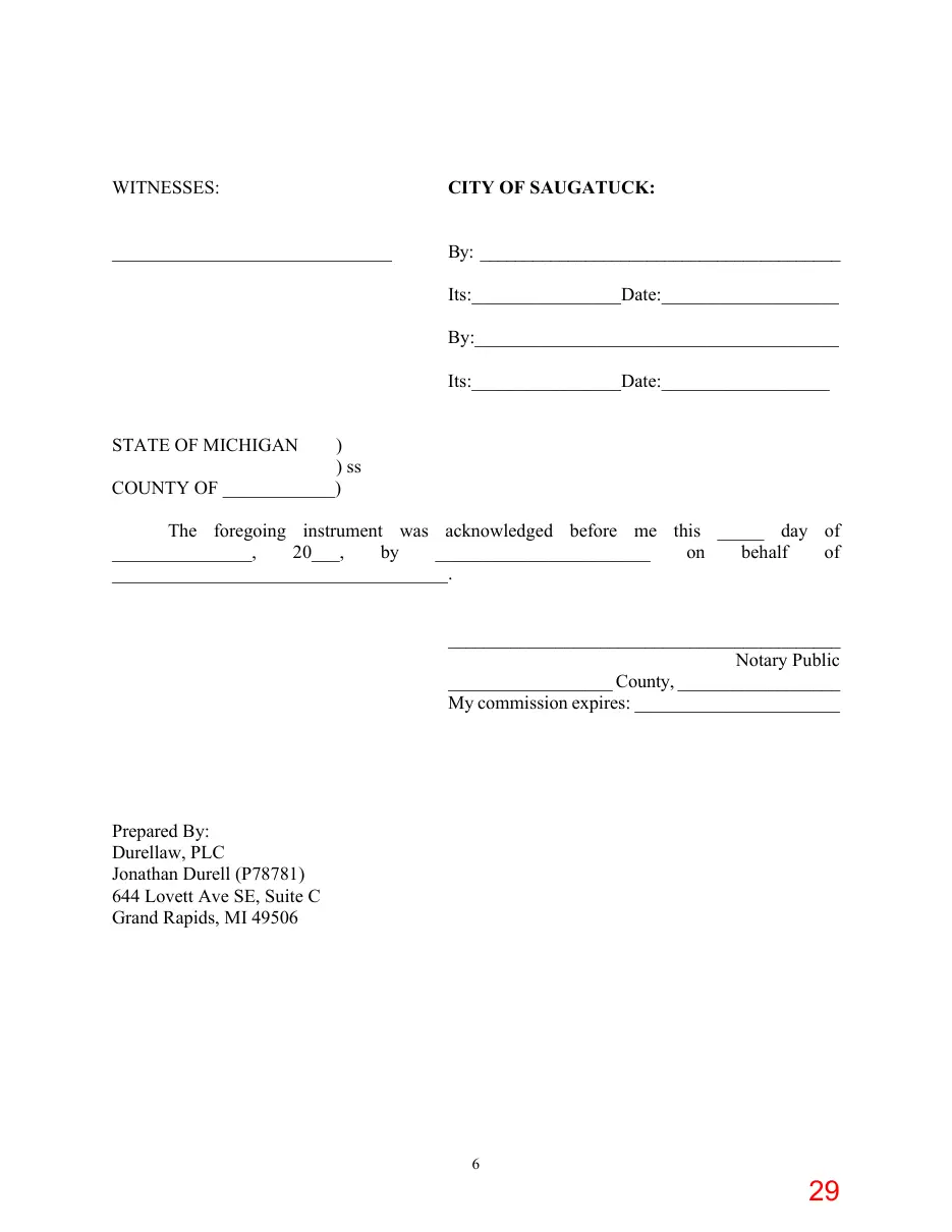
WITNESSES:
CITY OF SAUGATUCK:
______________________________
By: _________________________________________ Its:________________Date:___________________ By:_______________________________________ Its:________________Date:__________________
STATE OF MICHIGAN
) ) ss COUNTY OF ____________) The foregoing instrument was acknowledged before me this _____ day of _______________, 20___, by _______________________ on behalf of ____________________________________. ____________________________________________ Notary Public __________________ County, __________________ My commission expires: ______________________
Prepared By: Durellaw, PLC Jonathan Durell (P78781) 644 Lovett Ave SE, Suite C Grand Rapids, MI 49506
Page 30

Text of page 30
Exhibit 1 (Insert Legal Description of Property and Easement Area Exhibits)
Page 31
This page is a scanned image with no text layer. The PDF of these pages has it at full resolution.
Page 32
This page is a scanned image with no text layer. The PDF of these pages has it at full resolution.
Page 33
This page is a scanned image with no text layer. The PDF of these pages has it at full resolution.
Page 34
This page is a scanned image with no text layer. The PDF of these pages has it at full resolution.
Page 35
This page is a scanned image with no text layer. The PDF of these pages has it at full resolution.
Page 36
This page is a scanned image with no text layer. The PDF of these pages has it at full resolution.
Page 37

This page is a scanned image with no text layer. The PDF of these pages has it at full resolution.
Page 38
This page is a scanned image with no text layer. The PDF of these pages has it at full resolution.
Page 39
This page is a scanned image with no text layer. The PDF of these pages has it at full resolution.
Page 40
This page is a scanned image with no text layer. The PDF of these pages has it at full resolution.
Page 41
This page is a scanned image with no text layer. The PDF of these pages has it at full resolution.
Page 42
This page is a scanned image with no text layer. The PDF of these pages has it at full resolution.
Page 43
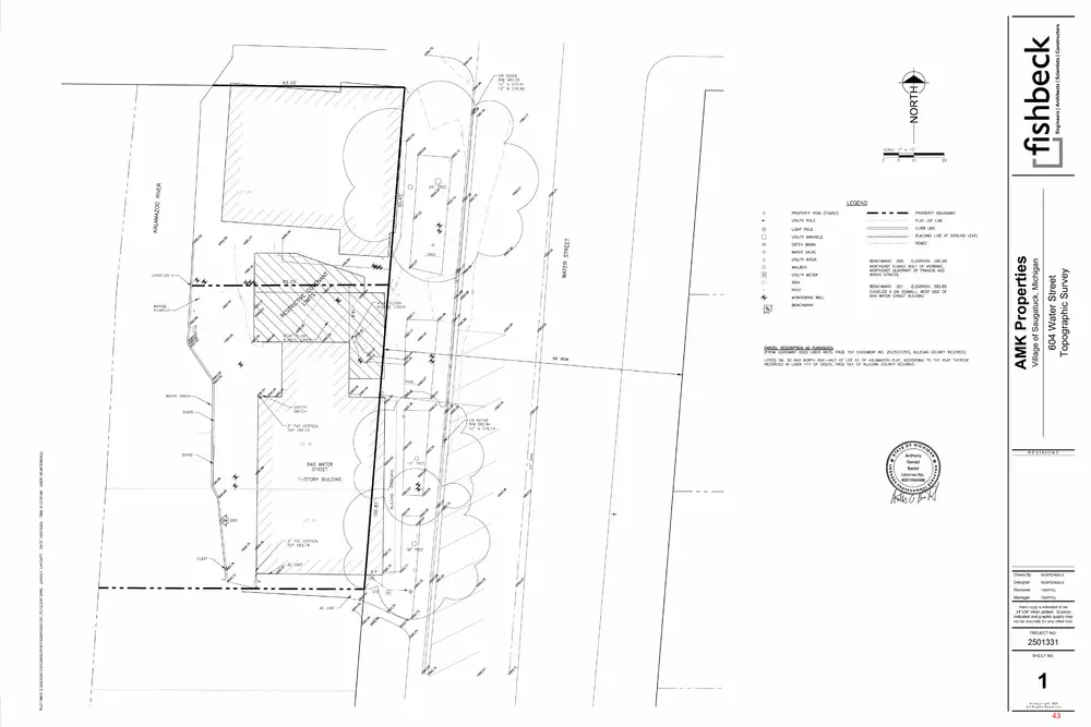
This page is a scanned image with no text layer. The PDF of these pages has it at full resolution.
Page 44
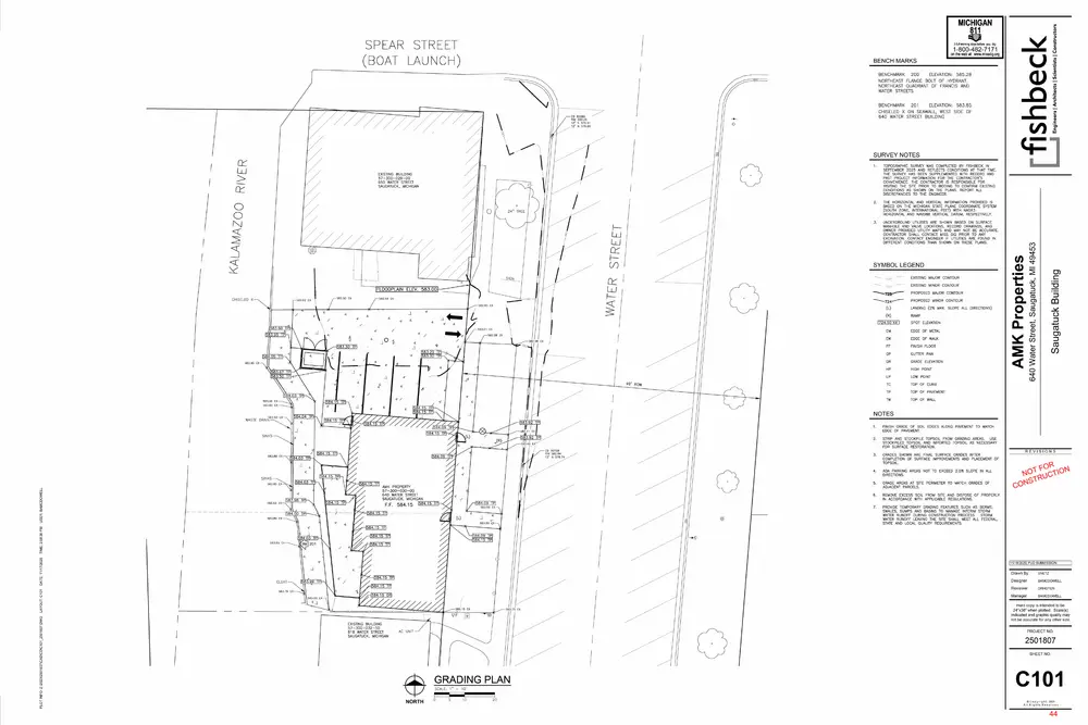
This page is a scanned image with no text layer. The PDF of these pages has it at full resolution.
Page 45
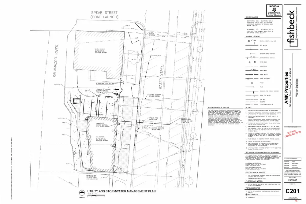
This page is a scanned image with no text layer. The PDF of these pages has it at full resolution.
Page 46
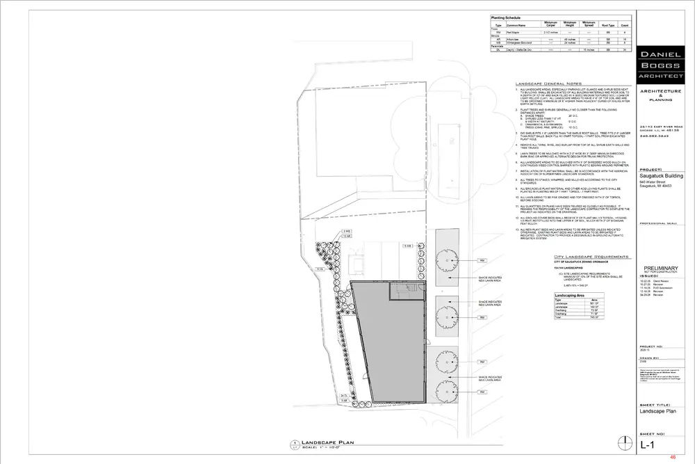
This page is a scanned image with no text layer. The PDF of these pages has it at full resolution.
Page 47
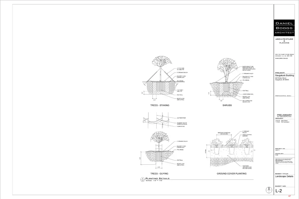
This page is a scanned image with no text layer. The PDF of these pages has it at full resolution.
Page 48
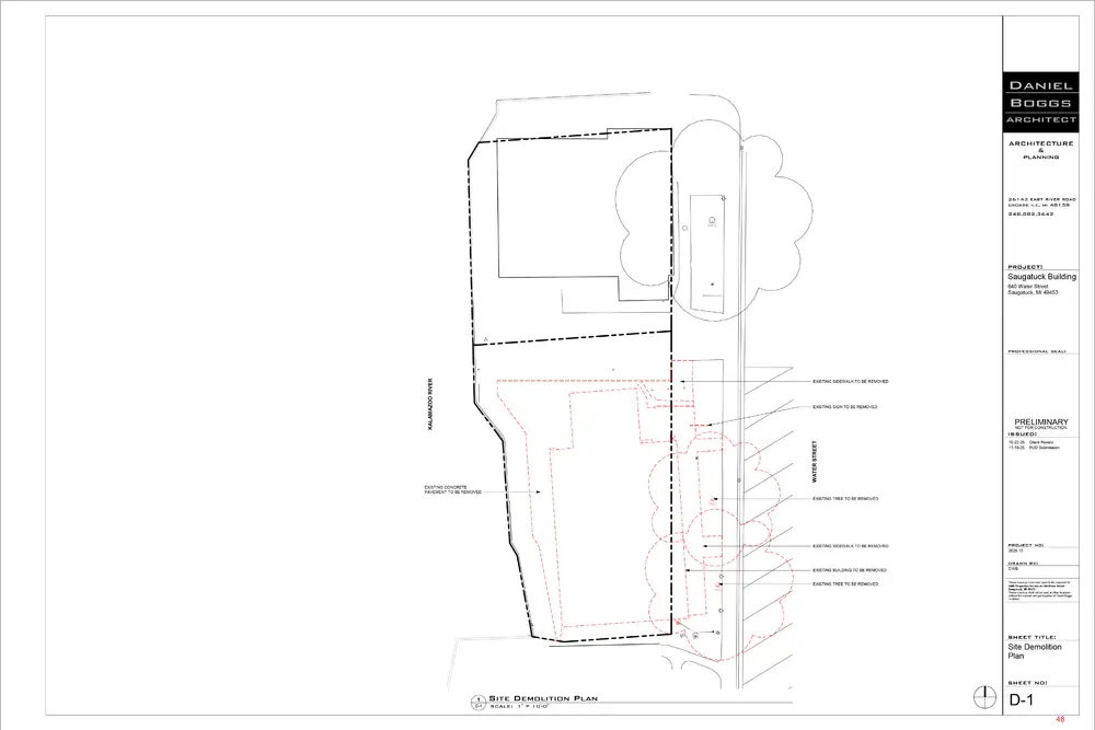
This page is a scanned image with no text layer. The PDF of these pages has it at full resolution.
Page 49
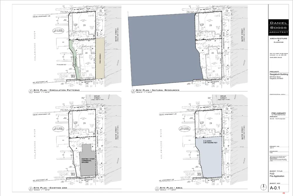
This page is a scanned image with no text layer. The PDF of these pages has it at full resolution.
Page 50
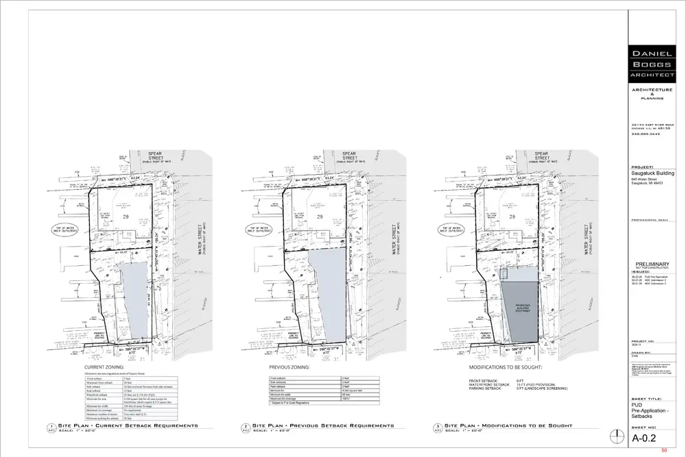
This page is a scanned image with no text layer. The PDF of these pages has it at full resolution.
Page 51
This page is a scanned image with no text layer. The PDF of these pages has it at full resolution.
Page 52
This page is a scanned image with no text layer. The PDF of these pages has it at full resolution.
Page 53
This page is a scanned image with no text layer. The PDF of these pages has it at full resolution.
Page 54
This page is a scanned image with no text layer. The PDF of these pages has it at full resolution.
Page 55
This page is a scanned image with no text layer. The PDF of these pages has it at full resolution.
Page 56
This page is a scanned image with no text layer. The PDF of these pages has it at full resolution.